Bicheno5 Map
 |
20 |
03/13/2015 9:02 a.m. |
3D terrestrial photogrammetric model |
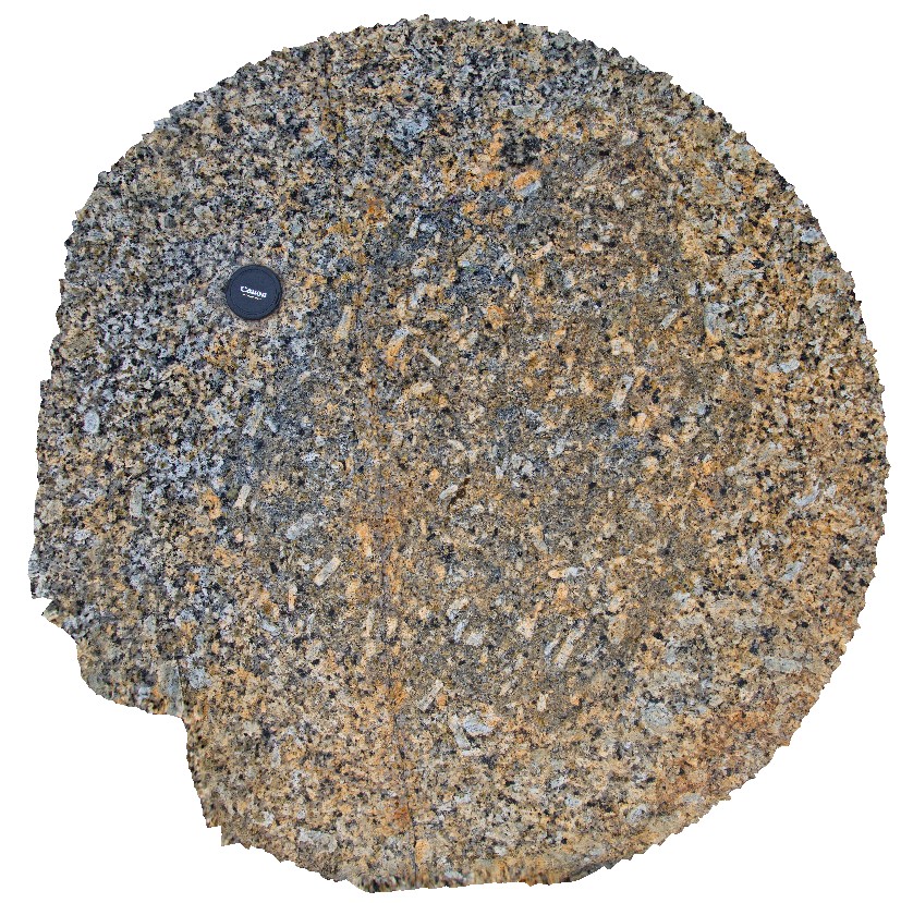
Megaphyric cognate inclusion within coarse grained porphyritic Bicheno Granite of the Boobyalla Suite. Tas. |
1.20 |
-41.86985104000 |
148.30358265000 |
1.000 |
porphyritic, granite, cognate inclusion, Phenocryst |
Granite, Granite |
HallPointFSP2 Map
 |
20 |
01/01/9999 midnight |
Full Spherical Panorama |
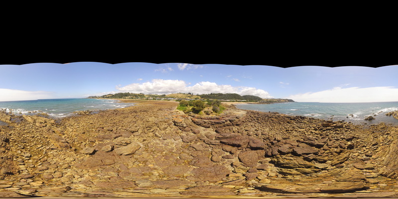
basal Ordovician unconformity with underlying folded Precambrian quartzite. Hall Point, Sulphur Creek. Tasmania. |
500.00 |
-41.09298700000 |
146.02833200000 |
1.000 |
unconformity |
quartzite, conglomerate |
Prices9 Map
 |
20 |
03/13/2015 9:13 a.m. |
3D terrestrial photogrammetric model |
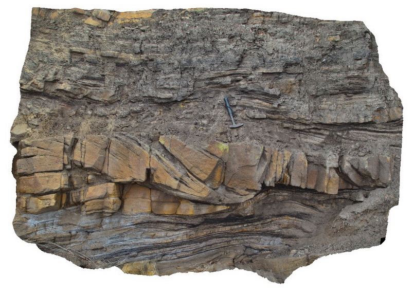
Cross bedded channel sandstone body in fine grained carbonaceous floodplain sediments. Prices Point, Tasman Peninsula, Tasmania. |
5.00 |
-43.03359100000 |
147.74572400000 |
0.500 |
channel, cross bed, fluvial, floodplain, sedimentology |
sandstone, siltstone |
Bicheno4 Map
 |
20 |
03/13/2015 9:01 a.m. |
3D terrestrial photogrammetric model |
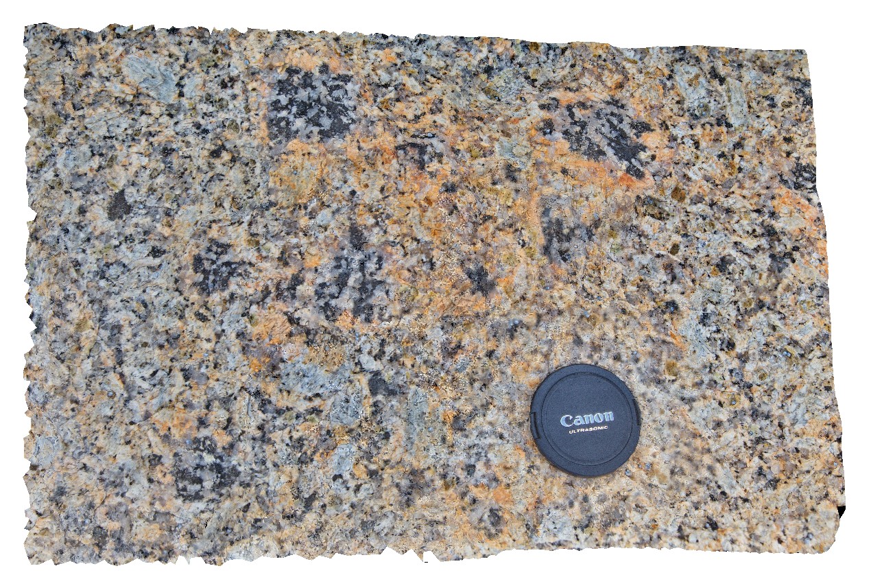
Biotite-tourmaline clots within coarse grained Bicheno Granite of the Boobyalla Suite. Tas. |
0.60 |
-41.86974704000 |
148.30375252000 |
1.000 |
deuteric, igneous, clots, granite |
Granite |
Bicheno3 Map
 |
20 |
03/13/2015 9:01 a.m. |
3D terrestrial photogrammetric model |
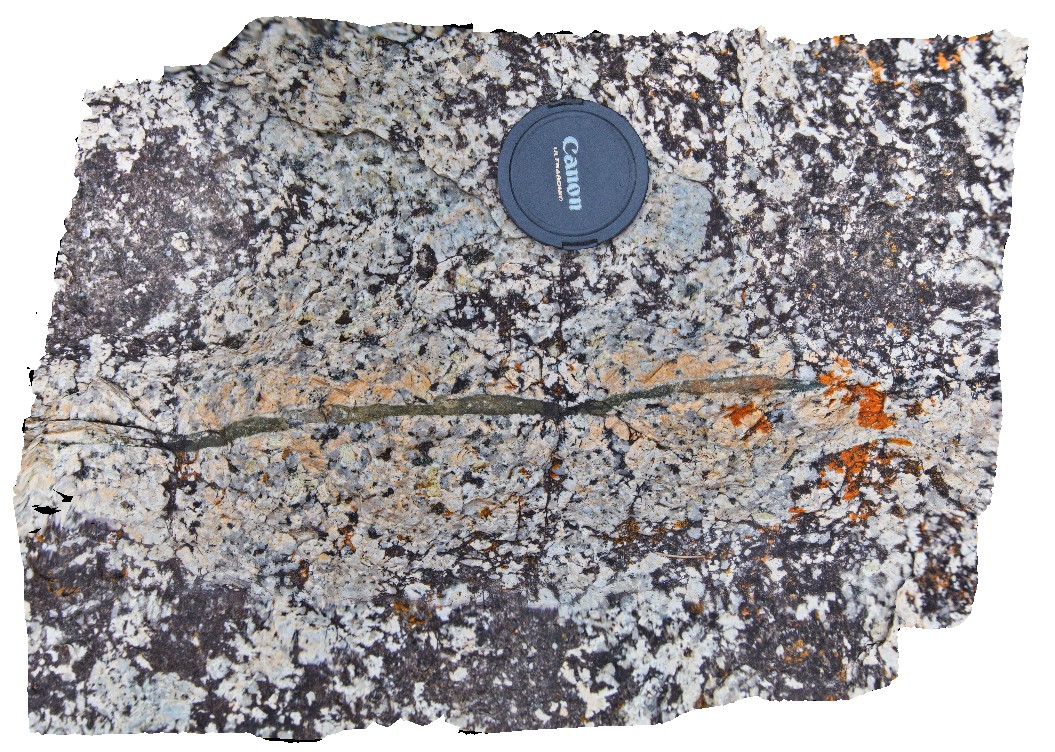
Narrow porphyritic dykelet displaying intense k-feld alteration of country rock (porphyritic Bicheno Granite of the Boobyalla Suite). Tas. |
0.50 |
-41.86979796000 |
148.30375883000 |
1.000 |
igneous, dykelet, granite, alteration, selvedge |
Granite |
Bicheno2 Map
 |
20 |
03/13/2015 9:01 a.m. |
3D terrestrial photogrammetric model |
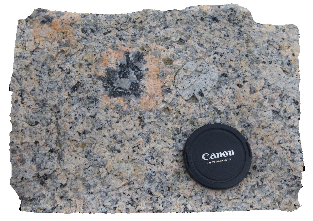
Bicheno Granite of the Boobyalla Suite displaying large plag and k-feld phenocrysts, with bt-tourm-qz alteration of the k-feld phenocrysts. Tas. |
0.35 |
-41.86983185000 |
148.30361327000 |
1.000 |
|
Granite |
Bicheno18 Map
 |
20 |
03/13/2015 9:03 a.m. |
3D terrestrial photogrammetric model |
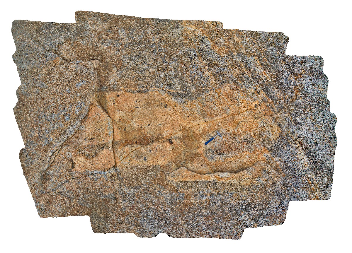
3m xenolith containing bt-tourmaline clots and within coarse grained porphyritic Bicheno Granite of the Boobyalla Suite. Assimilation of the xenolith into the melt is evident around the edges. Tas. |
4.00 |
-41.88074253000 |
148.30846867000 |
1.000 |
granite, igneous, xenolith, assimilation |
Granite |
HallPointFSP3 Map
 |
20 |
01/01/9999 midnight |
Full Spherical Panorama |
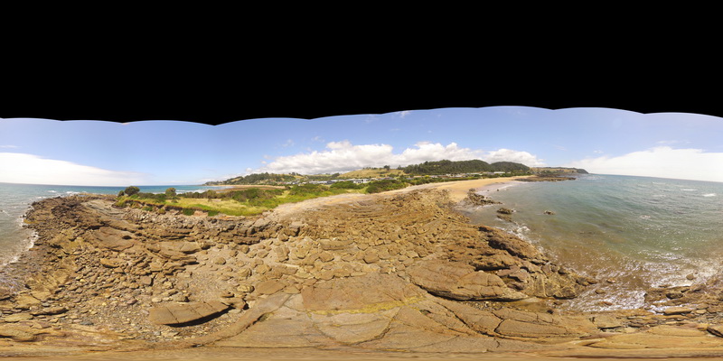
basal Ordovician unconformity with underlying folded Precambrian quartzite. Hall Point, Sulphur Creek. Tasmania. |
500.00 |
-41.09298700000 |
146.02833200000 |
1.000 |
unconformity, metasediments |
quartzite, conglomerate |
Bicheno17 Map
 |
20 |
03/13/2015 9:02 a.m. |
3D terrestrial photogrammetric model |
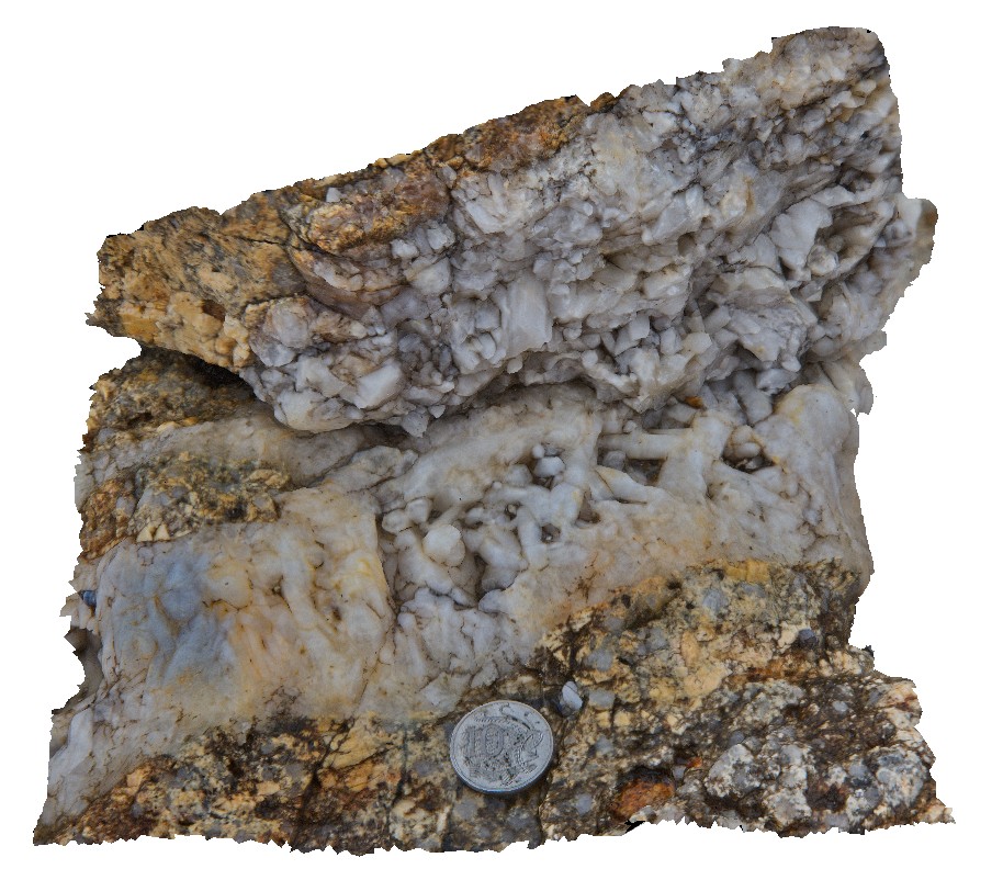
Late stage quartz veins with euhedral crystals displaying open fill texture, within porphyritic Bicheno Granite of the Boobyalla Suite. Tas. |
0.15 |
-41.88048383000 |
148.30850316000 |
1.000 |
igneous, open fill texture, vein, granite |
Granite, Quartz |
Bicheno16 Map
 |
20 |
03/13/2015 9:02 a.m. |
3D terrestrial photogrammetric model |
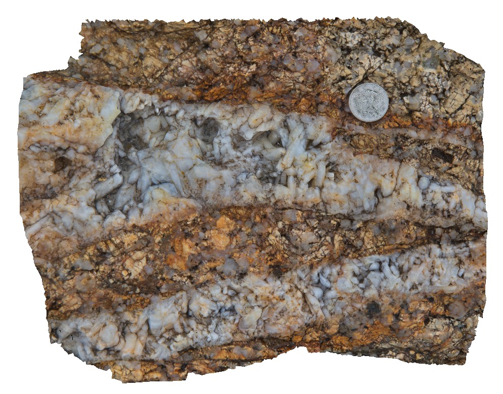
Late stage quartz veins with euhedral crystals displaying open fill texture, within porphyritic Bicheno Granite of the Boobyalla Suite. Tas. |
0.20 |
-41.88045193000 |
148.30848945000 |
1.000 |
igneous, granite, open fill texture, vein |
Granite, Quartz |
Bicheno15 Map
 |
20 |
03/13/2015 9:02 a.m. |
3D terrestrial photogrammetric model |
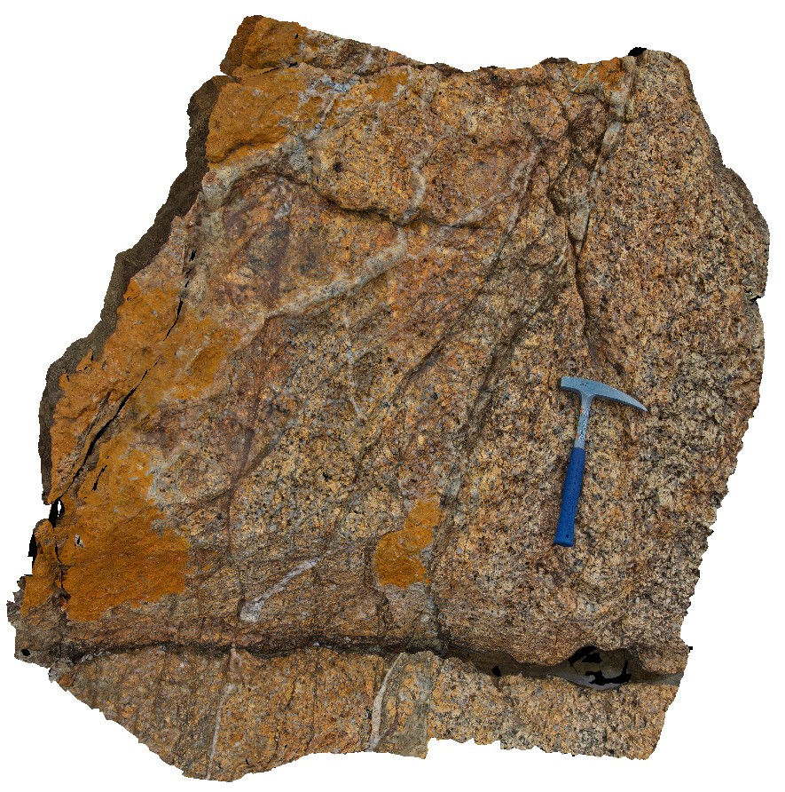
Late stage quartz veining within porphyritic Bicheno Granite of the Boobyalla Suite. Tas. |
1.00 |
-41.88046592000 |
148.30850660000 |
1.000 |
granite, igneous, vein, porphyritic |
Granite |
Bicheno14 Map
 |
20 |
03/13/2015 9:02 a.m. |
3D terrestrial photogrammetric model |
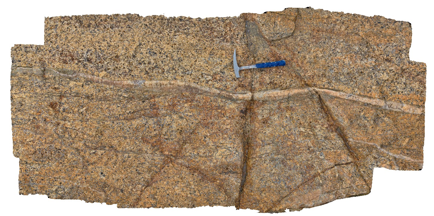
Late stage quartz vein within porphyritic Bicheno Granite of the Boobyalla Suite. Tas. |
2.50 |
-41.88043286000 |
148.30847061000 |
1.000 |
igneous, granite, porphyritic |
Granite, quartz |
Bicheno13 Map
 |
20 |
03/13/2015 9:02 a.m. |
3D terrestrial photogrammetric model |
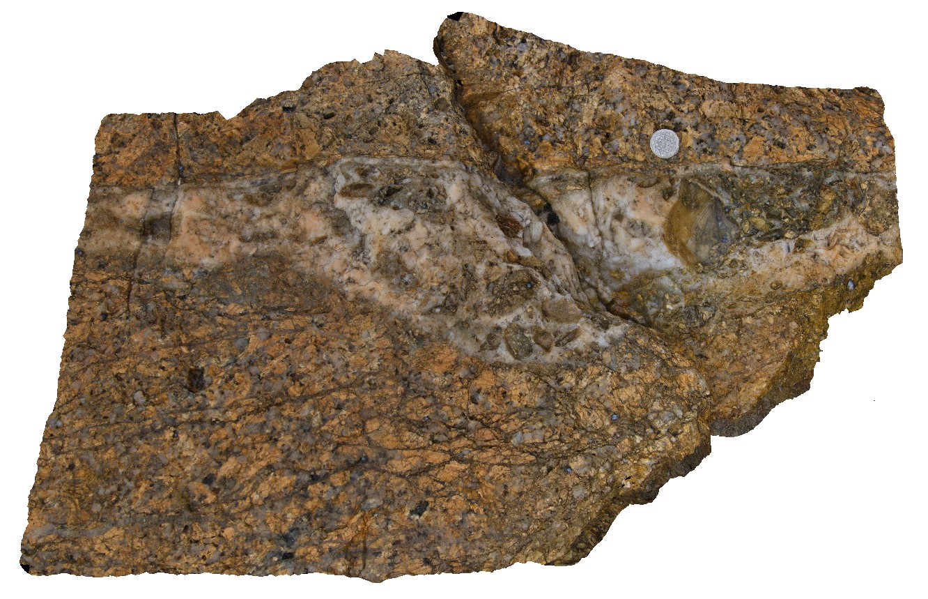
Late stage quartz vein with fragments of country rock within the porphyritic Bicheno Granite of the Boobyalla Suite. Tas. |
0.20 |
-41.88045570000 |
148.30850489000 |
1.000 |
vein, porphyritic, granite, igneous |
Granite |
BluestoneUAV7 Map
 |
20 |
01/01/9999 midnight |
3D UAV photogrammetric model |
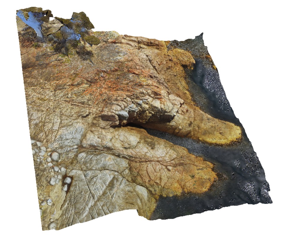
detailed aerial view of granite / granodiorite contact. Bluestone Bay, Freycinet. Tasmania. |
57.00 |
-42.10328800000 |
148.33594000000 |
10.600 |
intrusive contact, igneous intrusion, Coles Bay Granite, Bluestone Bay Granodiorite |
granite, granodiorite |
Bicheno12 Map
 |
20 |
03/13/2015 9:02 a.m. |
3D terrestrial photogrammetric model |
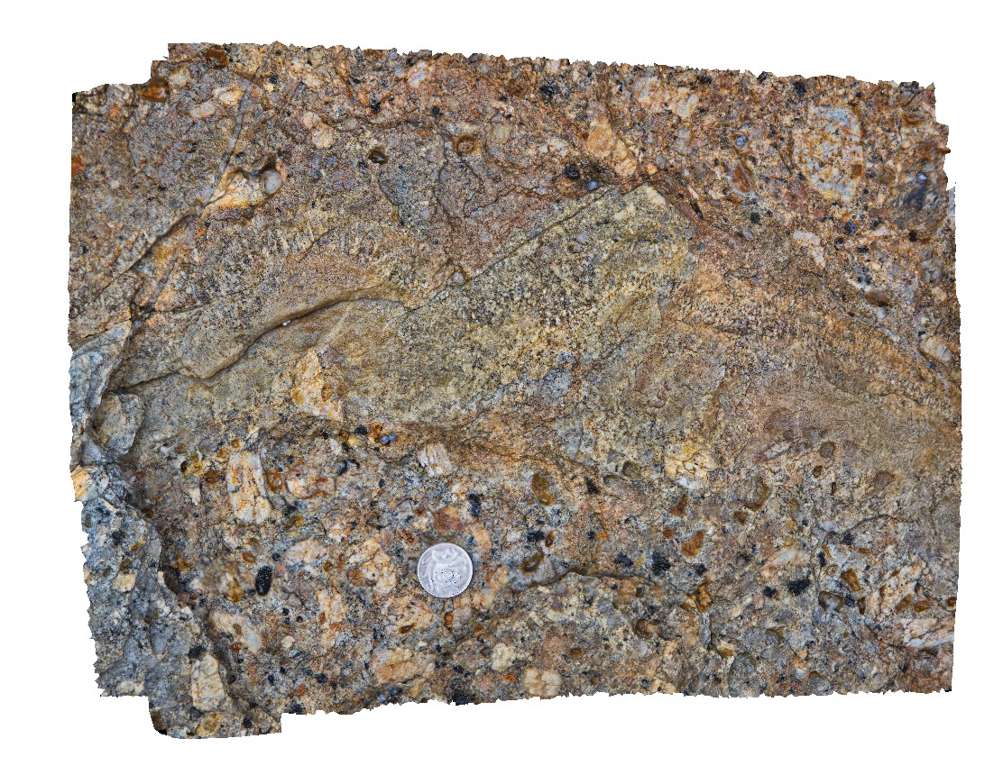
Porphyritic Bicheno Granite of the Boobyalla Suite with late stage segregations displaying UST (Unidirectional Solidification Textures). Tas. |
0.20 |
-41.88050304000 |
148.30853486000 |
1.000 |
Unidirectional Solidification Texture UST, granite, igneous, porphyritic |
Granite |
Bicheno10 Map
 |
20 |
03/13/2015 9:02 a.m. |
3D terrestrial photogrammetric model |
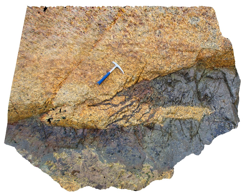
Late stage Devonian (?) dolerite dykes intruding Bicheno Granite of the Boobyalla Suite. Nice example of termination of dyke with dykelets. Tas. |
3.00 |
-41.88071585000 |
148.30855539000 |
0.000 |
dyke, dykelet, granite, igneous |
Granite, Dolerite |
WTasUAV3 Map
 |
20 |
01/01/9999 midnight |
3D UAV photogrammetric model |
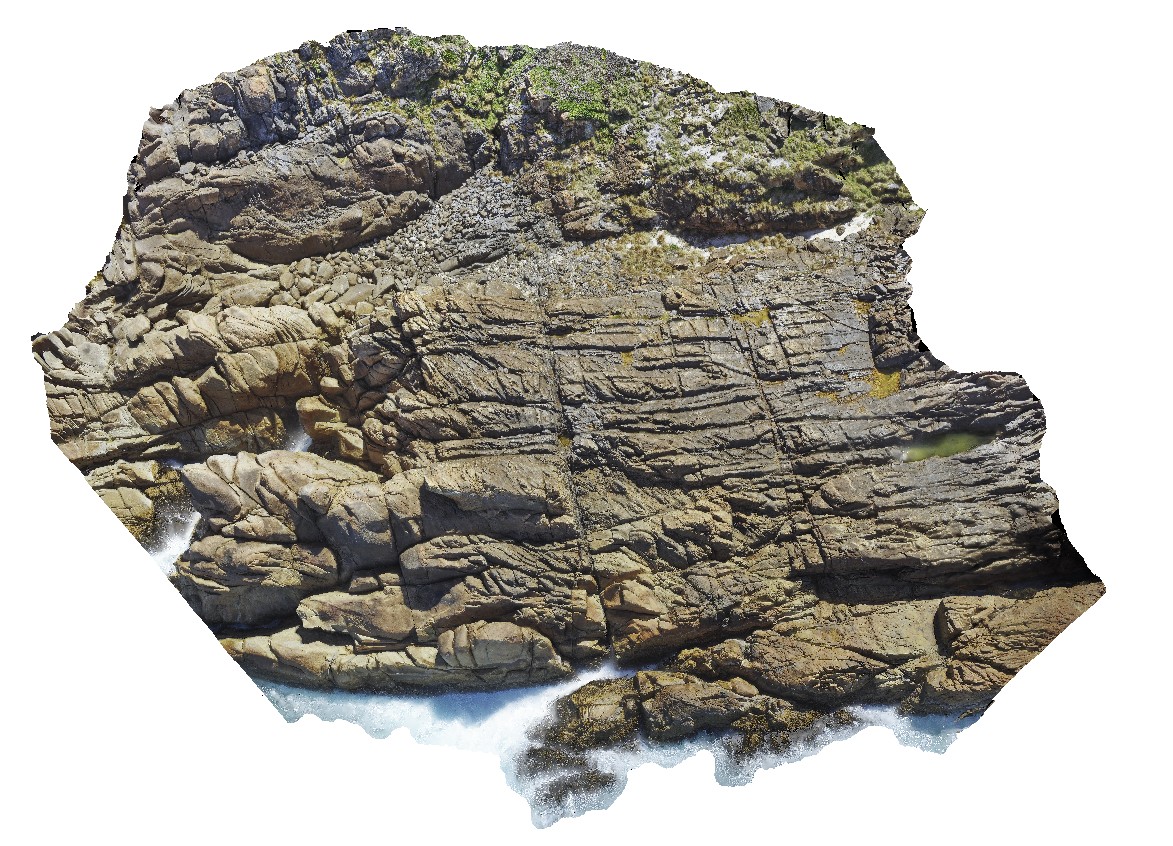
aerial view of jointed granite, with magmatic - hydrothermal alteration and veining. Trial Harbour, West Tasmania. |
100.00 |
-41.92280300000 |
145.15734300000 |
-9999.000 |
granite, tourmaline orbicules, intrusive contact |
granite |
Prices5 Map
 |
20 |
03/13/2015 9:13 a.m. |
3D terrestrial photogrammetric model |
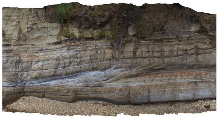
Cross bedded 'prograding' Triassic sandstone unit with clear erosional truncation. Prices Point, Tasman Peninsula, Tasmania. |
8.00 |
-43.03478900000 |
147.74734900000 |
0.500 |
cross bedding, sandstone, fluvial, sedimentology |
sandstone |
BurnieUAV1 Map
 |
20 |
01/01/9999 midnight |
3D UAV photogrammetric model |
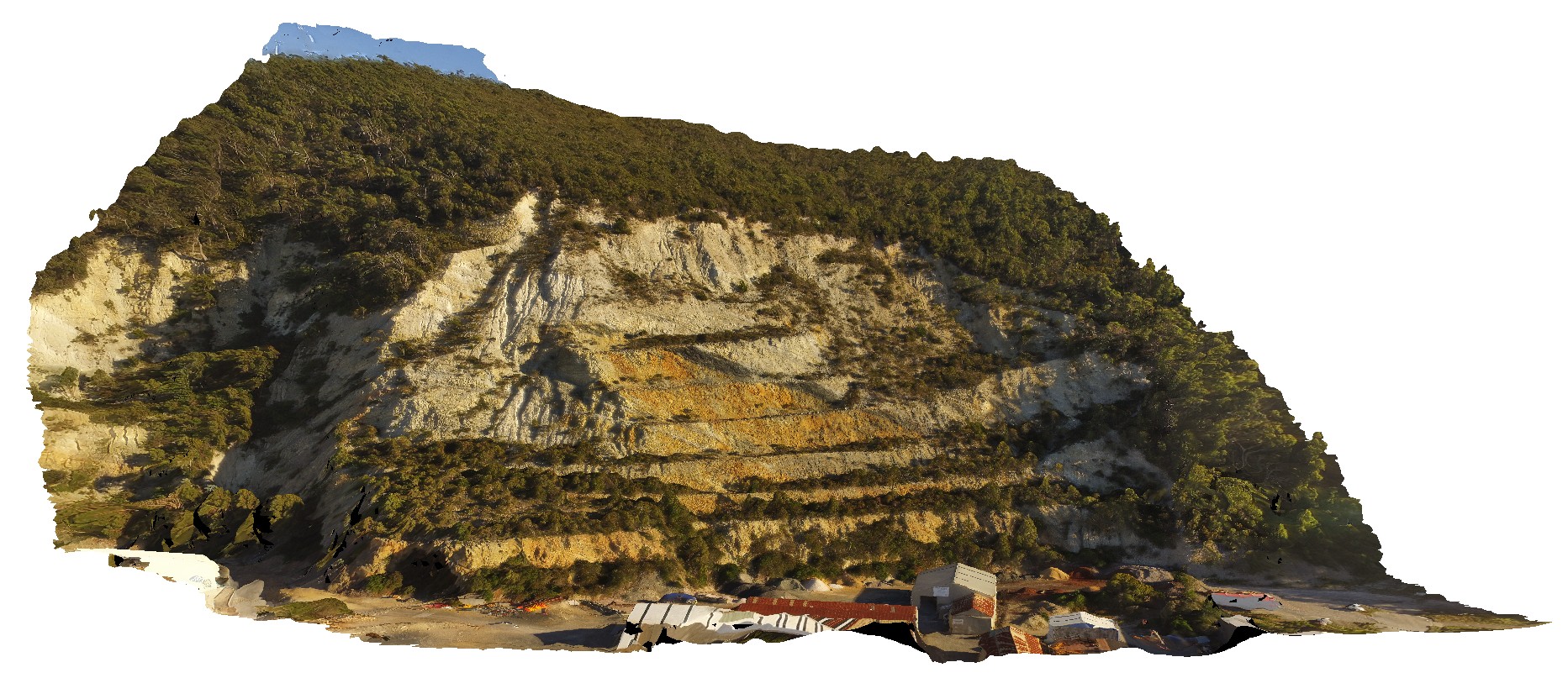
view of large quarry outcrop in quartzite? At the entrance to the township of Burnie. Burnie, north Tas. |
430.00 |
-41.06717200000 |
145.94652400000 |
70.000 |
quarry, quartzite |
quartzite |
Bicheno1 Map
 |
20 |
03/13/2015 9:01 a.m. |
3D terrestrial photogrammetric model |
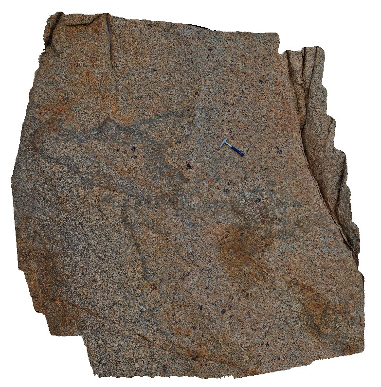
Biotite-tourmaline clots within coarse grained porphyritic Bicheno Granite of the Boobyalla Suite. Tas. |
0.40 |
-41.86975026000 |
148.30363407000 |
1.000 |
granite, igneous, clots, cognate inclusion |
Granite |
BH2014n9 Map
 |
20 |
03/18/2015 3:42 p.m. |
3D terrestrial photogrammetric model |
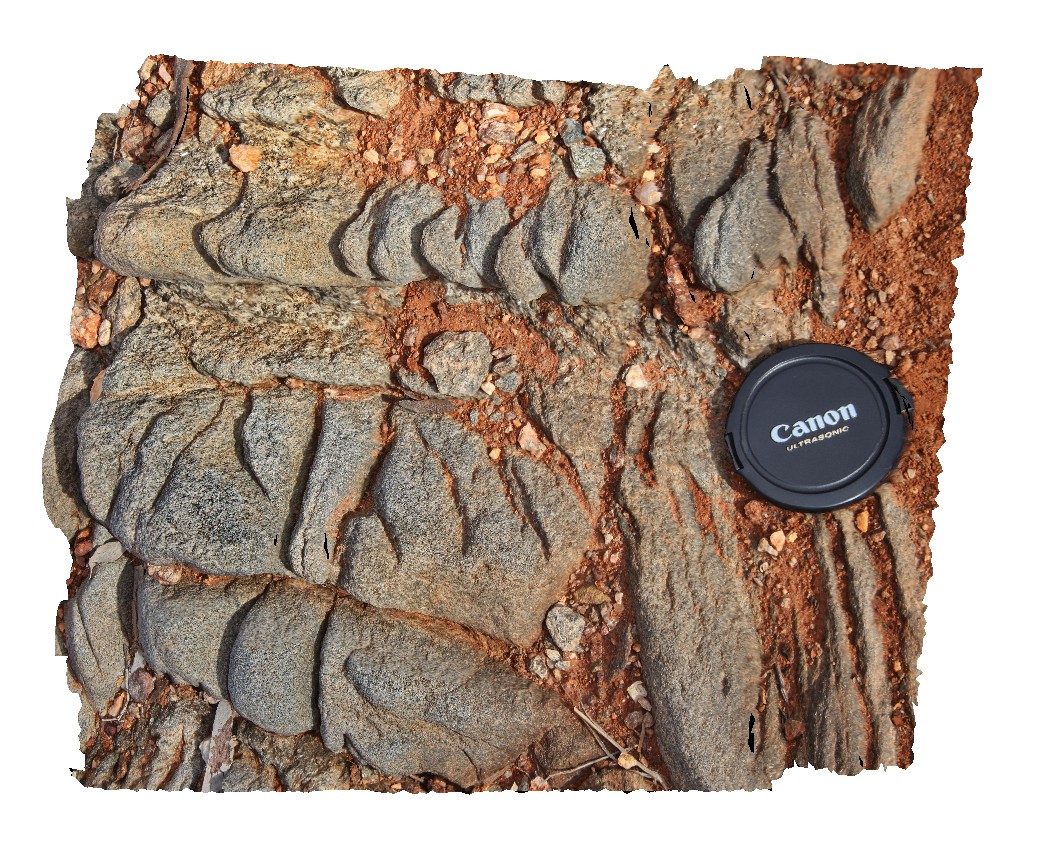
spaced cleavage in gneiss after metasediments. Broken Hill, N.S.W. |
0.30 |
-31.62006366000 |
141.49296080000 |
-9999.000 |
spaced cleavage, structure |
gneiss |
ParkersUAV1 Map
 |
20 |
01/01/9999 midnight |
3D UAV photogrammetric model |
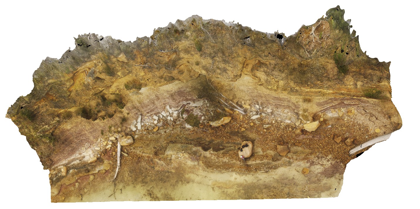
aerial overall view of Triassic outcrop, showing fluvial and floodplain sediments. Parkers Beach, Nubeena Tasmania. |
65.00 |
-43.04808900000 |
147.79449400000 |
27.000 |
fluvial, flood plain, sedimentology, Triassic |
sandstone |
ParkersUAV2 Map
 |
20 |
01/01/9999 midnight |
3D UAV photogrammetric model |
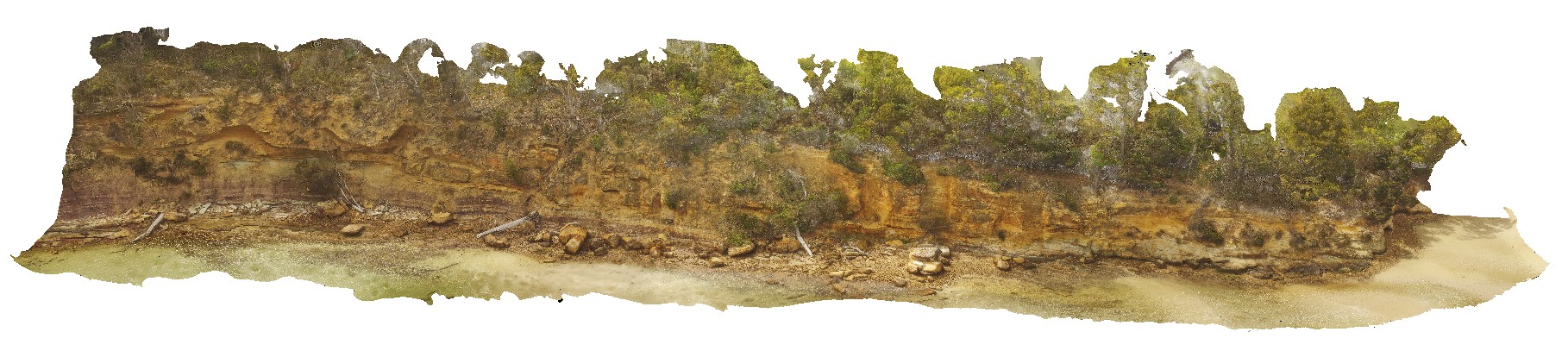
detailed view of Triassic fluvial and flood plain sediments. Parkers Beach, Nubeena Tasmania. |
180.00 |
-43.04860200000 |
147.79403500000 |
26.000 |
Triassic, fluvial, floodplain, sedimentology |
sandstone |
BH2014n8 Map
 |
20 |
03/18/2015 2:17 p.m. |
3D terrestrial photogrammetric model |
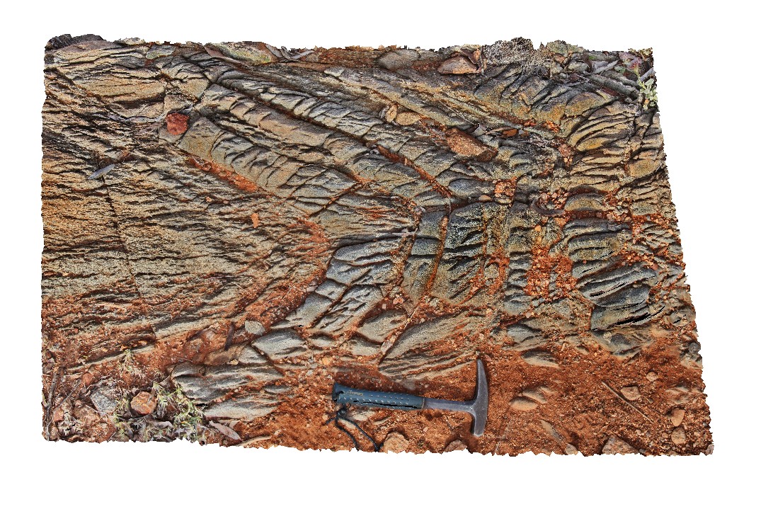
steeply plunging fold hinge in gneiss, with spaced axial planar cleavage. Broken Hill, N.S.W. |
2.00 |
-31.62004724000 |
141.49297042000 |
-9999.000 |
steeply plunging, fold hinge, spaced cleavage, structure |
gneiss |
Prices4 Map
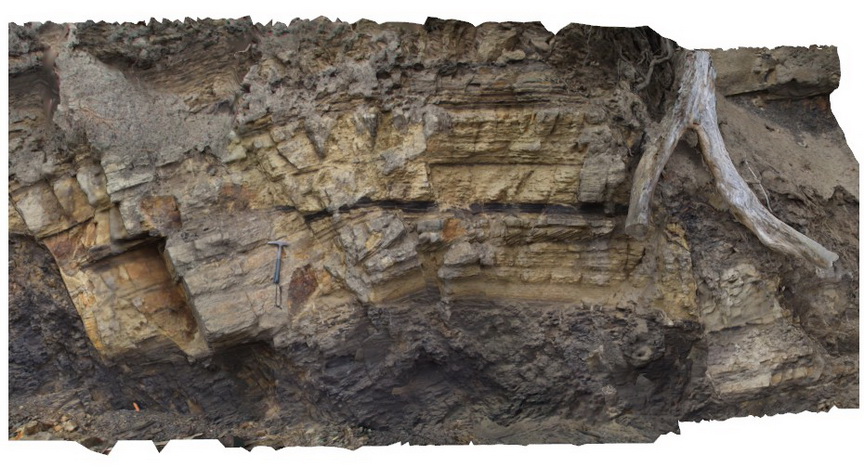 |
20 |
03/13/2015 9:13 a.m. |
3D terrestrial photogrammetric model |
Normal faults disrupting Triassic sandstone and siltstone layers - detail view of Prices3. Prices Point, Tasman Peninsula, Tasmania. |
7.00 |
-43.03492200000 |
147.74760300000 |
0.500 |
normal fault, sandstone, siltstone, fluvial sediments, structure, sedimentology |
sandstone, siltstone |
 AusGeol.org