ScottsPk2 Map
 |
0 |
02/23/2016 9:28 a.m. |
3D terrestrial photogrammetric model |
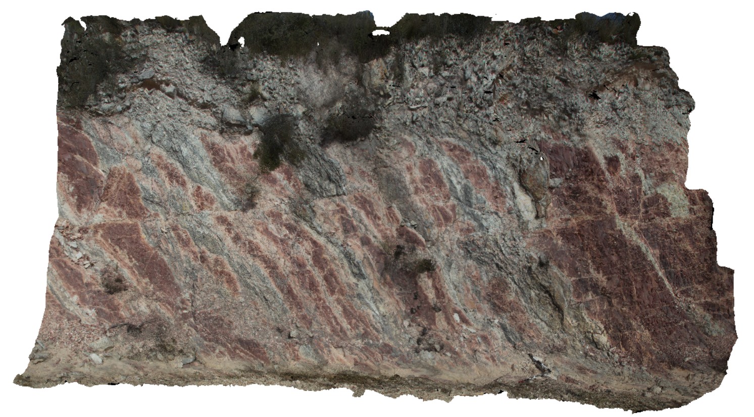
steeply dipping red mudstone and thin sandstone beds with small off-setting, sub horizontal faults. Scots Peak Dam road. Tasmania. |
8.00 |
-43.03230000000 |
146.33516000000 |
-9999.000 |
fault, structure |
mudstone |
ScottsPk3 Map
 |
0 |
02/23/2016 9:29 a.m. |
3D terrestrial photogrammetric model |
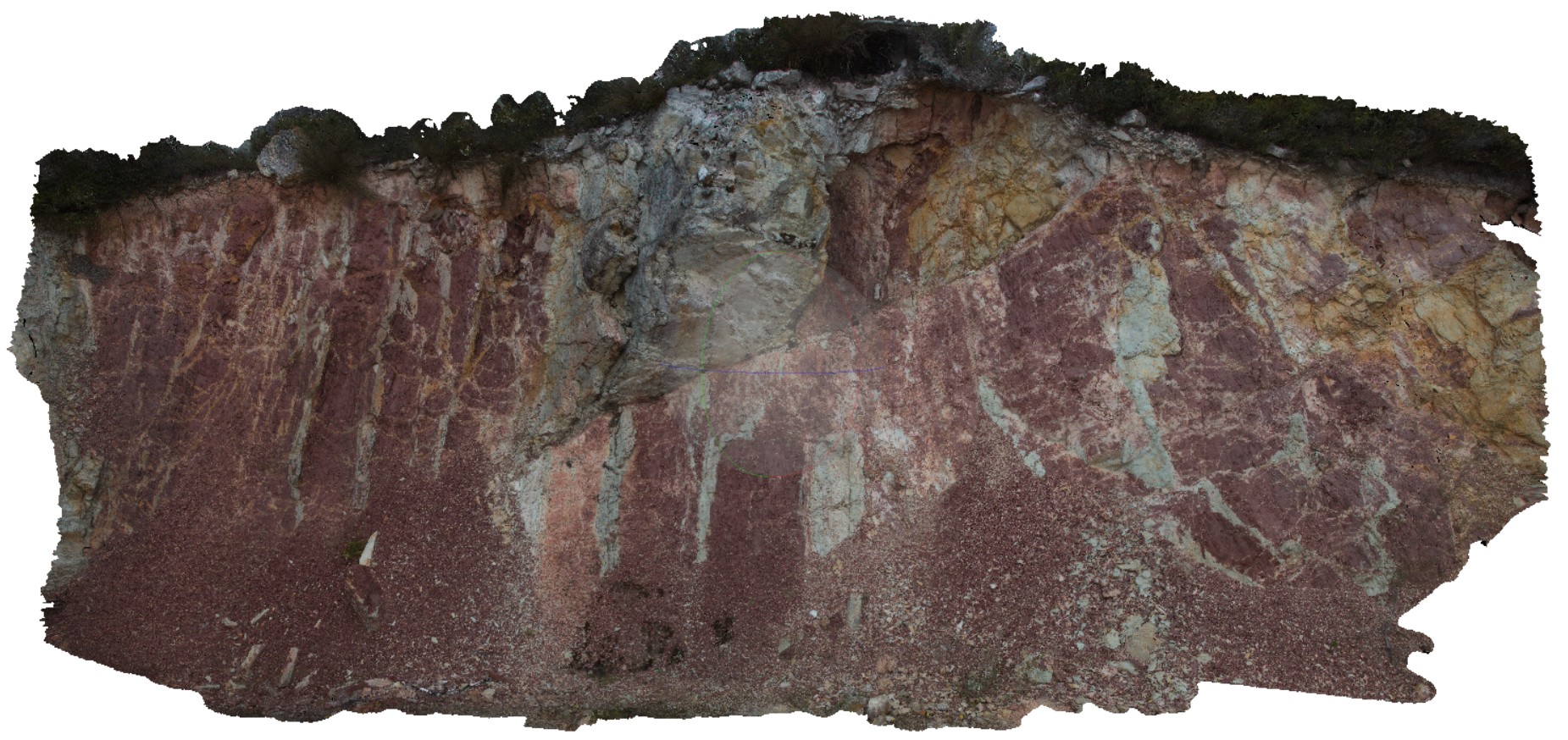
interbedded, steeply dipping / sub-vertical red mudstone, fine sandstone and thin sandstone units. Package has been faulted. Scots Peak Dam road, Tasmania. |
10.00 |
-43.03024000000 |
146.34120000000 |
-9999.000 |
mudstone, fault, structure |
mudstone |
GordonRd12 Map
 |
0 |
02/29/2016 1:42 p.m. |
3D terrestrial photogrammetric model |
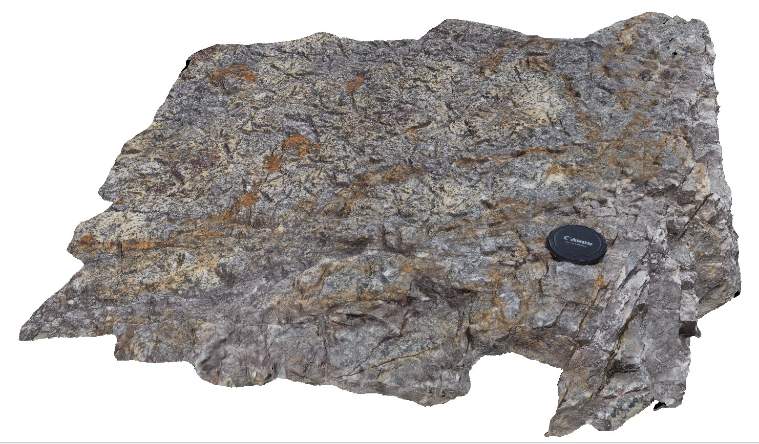
detail of psuedomorphs on bedding plane from image GordonRd11. Tasmania. |
0.60 |
-42.79335000000 |
146.39572000000 |
-9999.000 |
psuedomorphs, bedding plane |
sandstone |
GordonRd13 Map
 |
0 |
02/29/2016 11:20 a.m. |
3D terrestrial photogrammetric model |
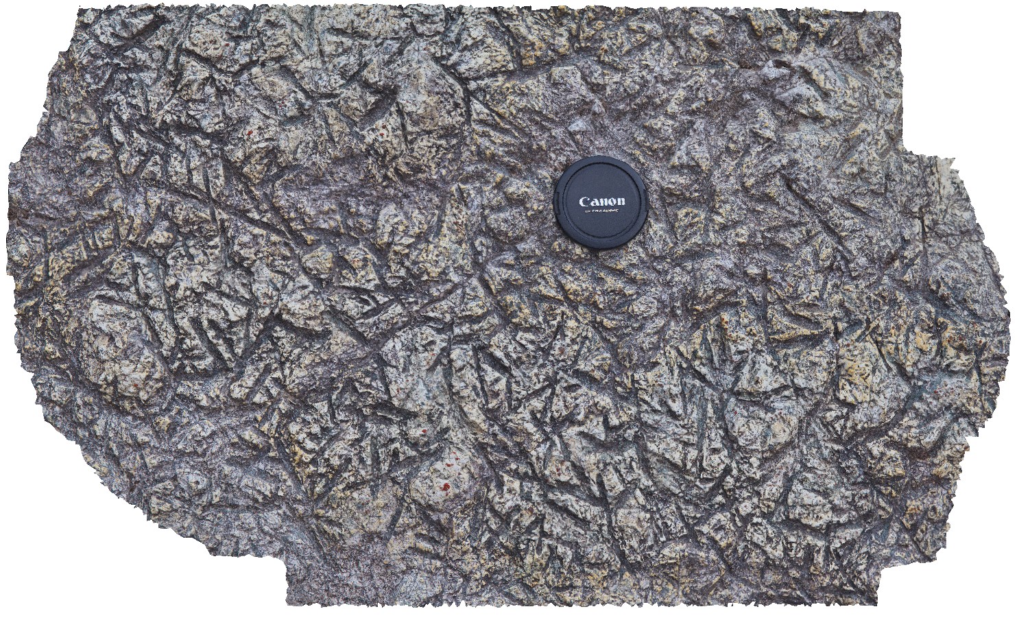
detail of psuedomorphs on bedding plane from image GordonRd11. Gordon Dam, Tasmania. |
0.30 |
-42.79327000000 |
146.39574000000 |
-9999.000 |
psuedomorphs, bedding plane |
sandstone |
BlackmansBayUAV1 Map
 |
0 |
04/12/2016 3:27 p.m. |
3D UAV photogrammetric model |
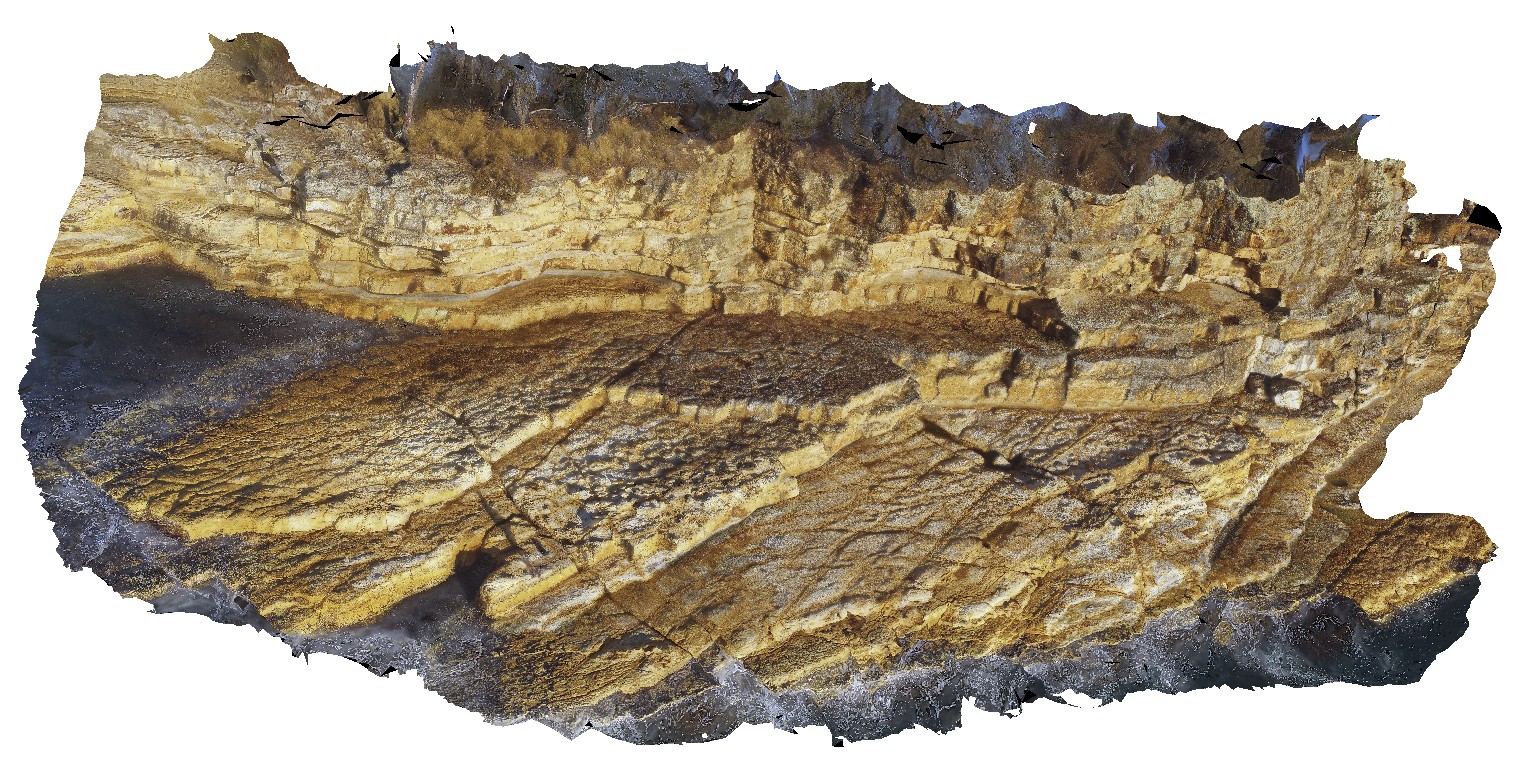
aerial view of Permian cliff at northern end of Blackmans Bay beach, showing bedding and exposed shore platform. Tasmania. |
100.00 |
-42.99987000000 |
147.32823000000 |
-9999.000 |
shore platform, strata, Permian |
siltstone |
BlackmansBay1 Map
 |
0 |
02/25/2016 2:46 p.m. |
3D terrestrial photogrammetric model |
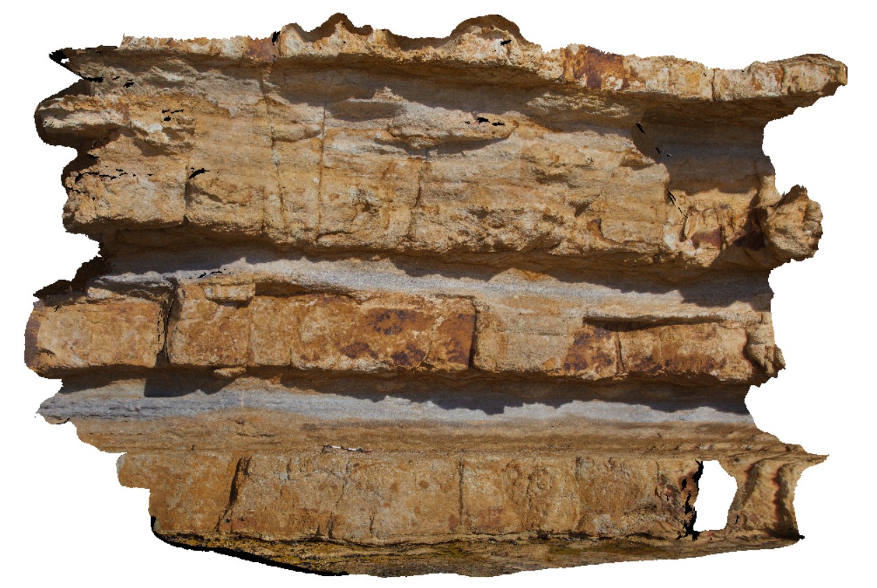
view of section of cliff exposure in Permian shallow marine sediments. Blackmans Bay, Tasmania. |
7.00 |
-42.99987000000 |
147.32823000000 |
-9999.000 |
Permian, strata |
siltstone |
BlackmansBay2 Map
 |
0 |
02/25/2016 2:47 p.m. |
3D terrestrial photogrammetric model |
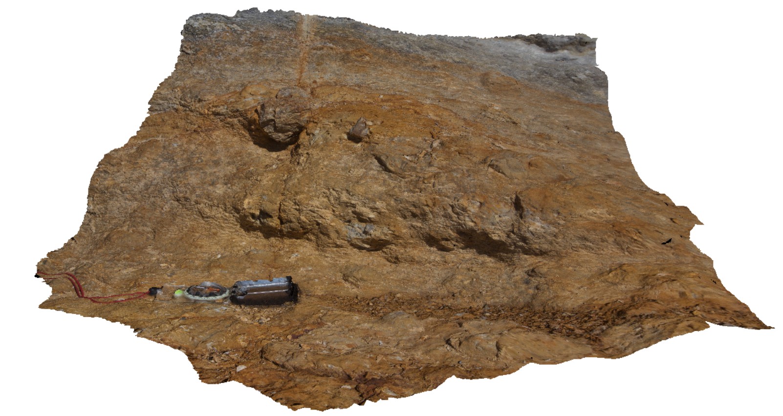
detail of dropstones in sandstone layer of Permian sediments. Blackmans Bay. Tasmania. |
0.40 |
-42.99987000000 |
147.32823000000 |
-9999.000 |
dropstone, sedimentology |
sandstone |
BlackmansBay3 Map
 |
0 |
02/25/2016 2:48 p.m. |
3D terrestrial photogrammetric model |
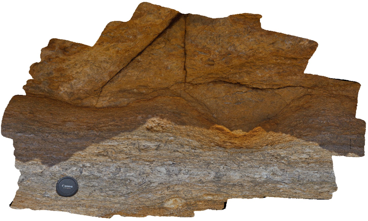
detail of bioturbated siltstone and overlaying pebbly sandstone. Blackmans Bay, Tasmania. |
0.80 |
-42.99987000000 |
147.32823000000 |
-9999.000 |
bioturbations, strata, palaeontology, sedimentology |
sandstone |
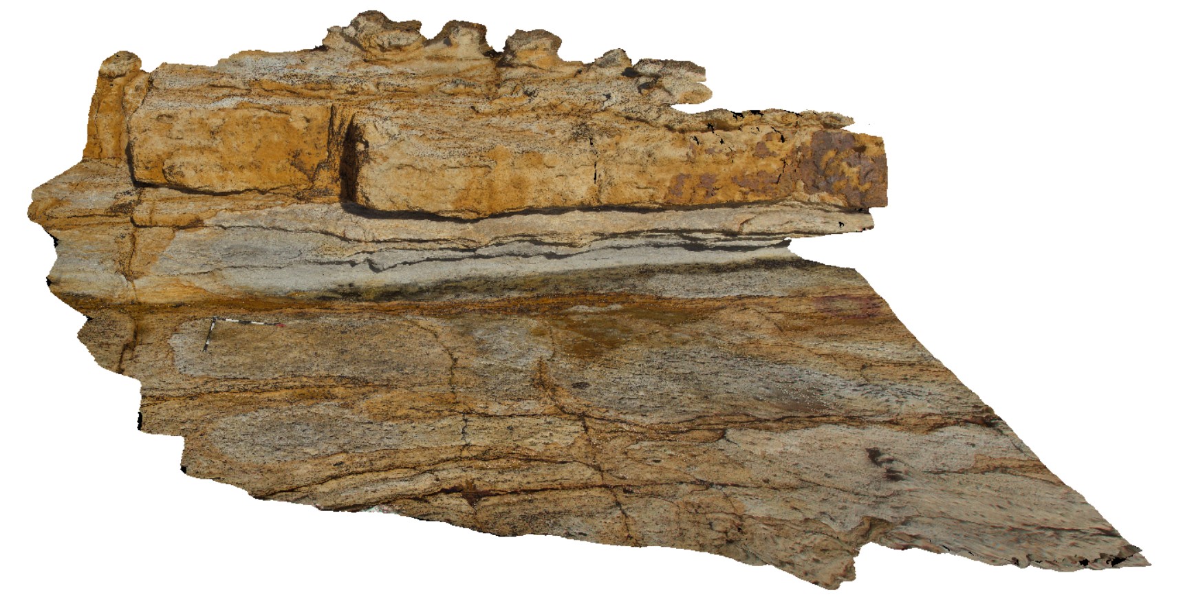
BlackmansBay4 Map
 |
0 |
02/25/2016 2:49 p.m. |
3D terrestrial photogrammetric model |
bedding in sandstone and siltstone in Permian sediments, Blackmans Bay. Tasmania. |
5.00 |
-42.99990000000 |
147.32851000000 |
-9999.000 |
bedding, sedimentology |
sandstone |
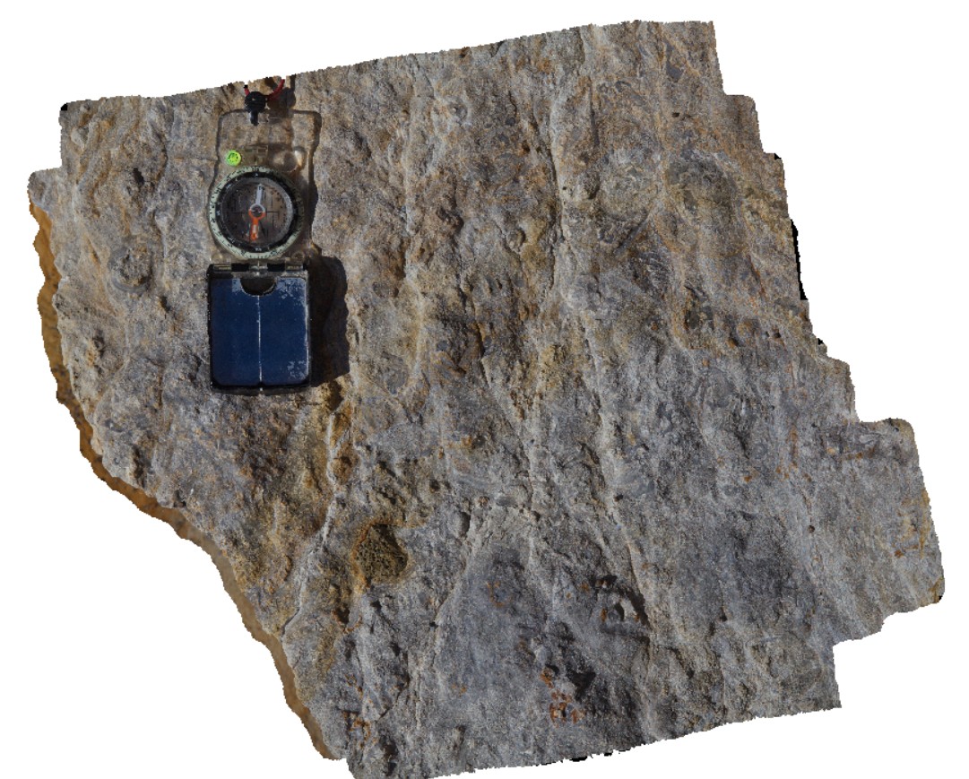
BlackmansBay5 Map
 |
0 |
04/06/2016 1:20 p.m. |
3D terrestrial photogrammetric model |
detail of bioturbation in siltstone layer from image BlackmansBay5. Blackmans Bay, Tasmania. |
0.30 |
-42.99991000000 |
147.32850000000 |
-9999.000 |
bioturbation, palaeontology, sedimentology |
siltstone |
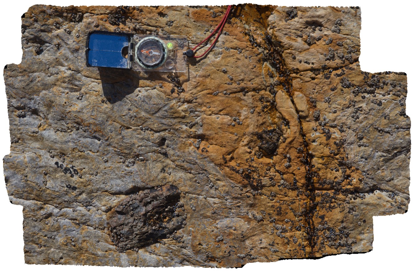
BlackmansBay6 Map
 |
0 |
04/06/2016 1:36 p.m. |
3D terrestrial photogrammetric model |
large dropstone in silty sandstone, Blackmans Bay, Tasmania. |
0.30 |
-42.99991000000 |
147.32855000000 |
-9999.000 |
dropstone, sedimentology |
sandstone |
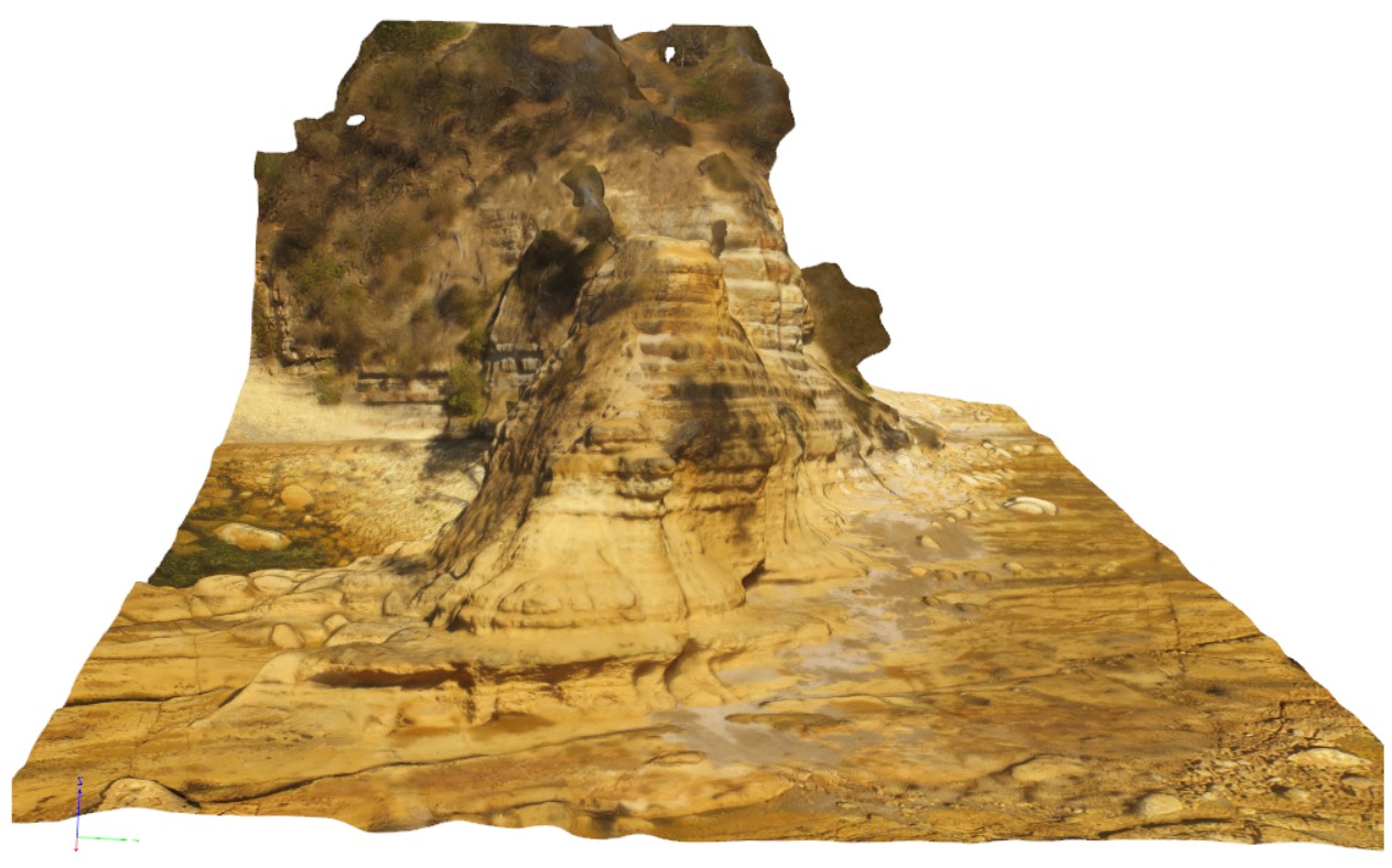
BlackmansBayUAV2 Map
 |
0 |
04/22/2016 3:17 p.m. |
3D UAV photogrammetric model |
aerial view of gently dipping Permian strata at southern end of Blackmans Bay, at Flower Pot Point. Tasmania. |
50.00 |
-43.00787000000 |
147.32793000000 |
-9999.000 |
strata |
sandstone |
BlackmansBay7 Map
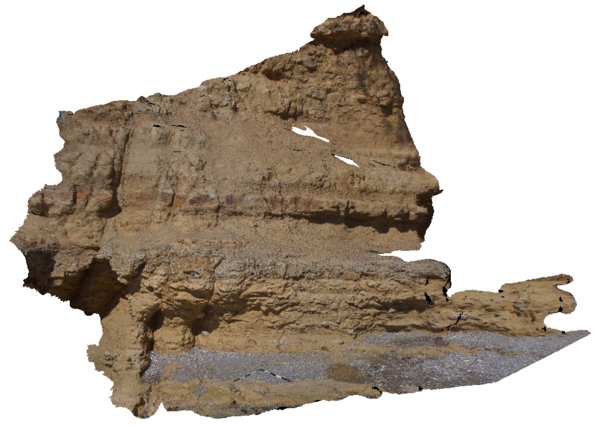 |
0 |
02/25/2016 2:50 p.m. |
3D terrestrial photogrammetric model |
view of cliff section including pebble layer and sandstone and siltstone. Blackmans Bay, Tasmania. |
5.00 |
-43.00797000000 |
147.32863000000 |
-9999.000 |
pebble band, strata, sedimentology |
siltstone |
BlackmansBay8 Map
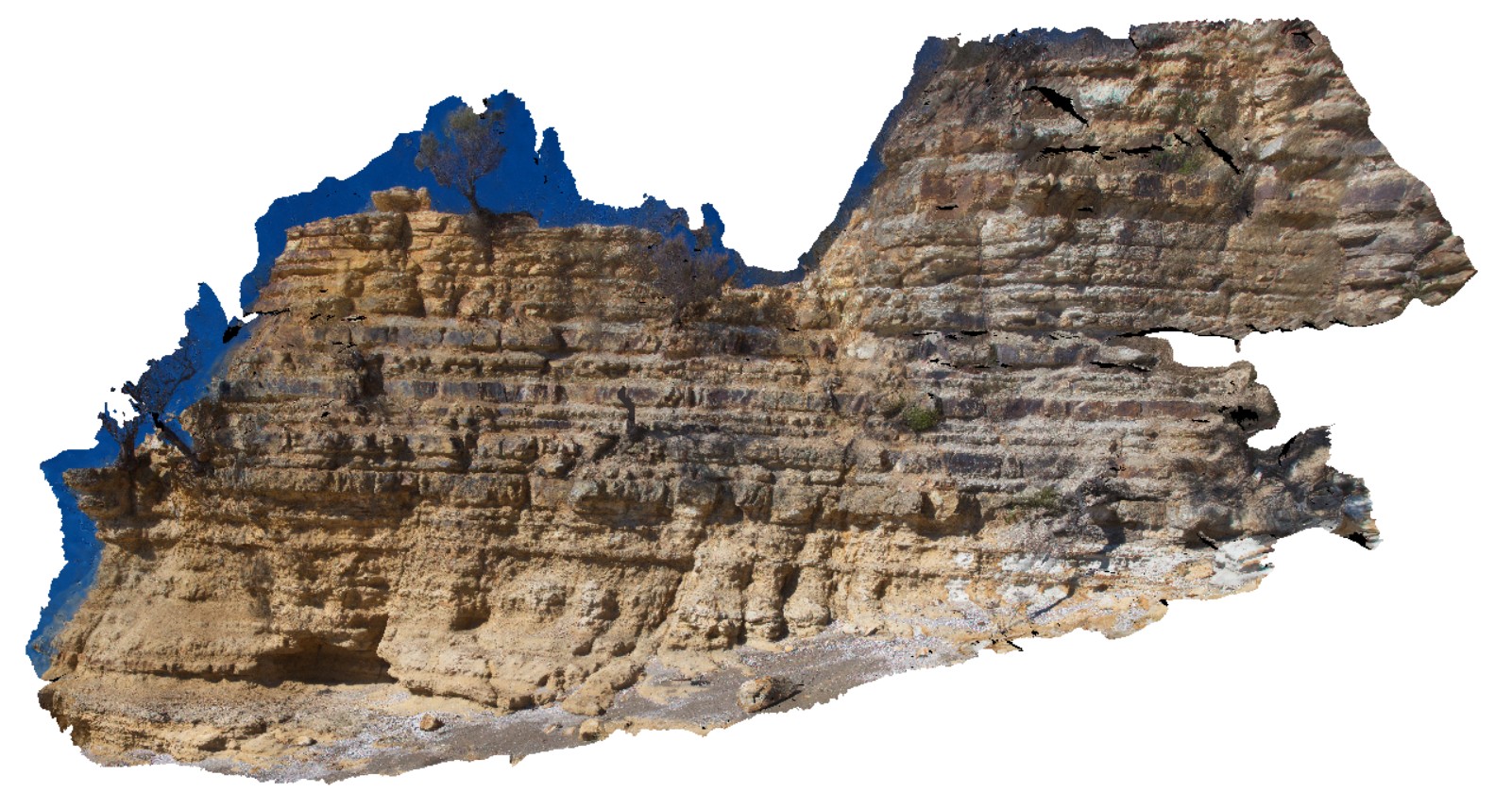 |
0 |
04/06/2016 1:53 p.m. |
3D terrestrial photogrammetric model |
over view of cliff exposure of gently dipping Permian sediments. Blackmans Bay, Tasmania. |
20.00 |
-43.00800000000 |
147.32854000000 |
-9999.000 |
Permian strata |
siltstone |
BlackmansBay9 Map
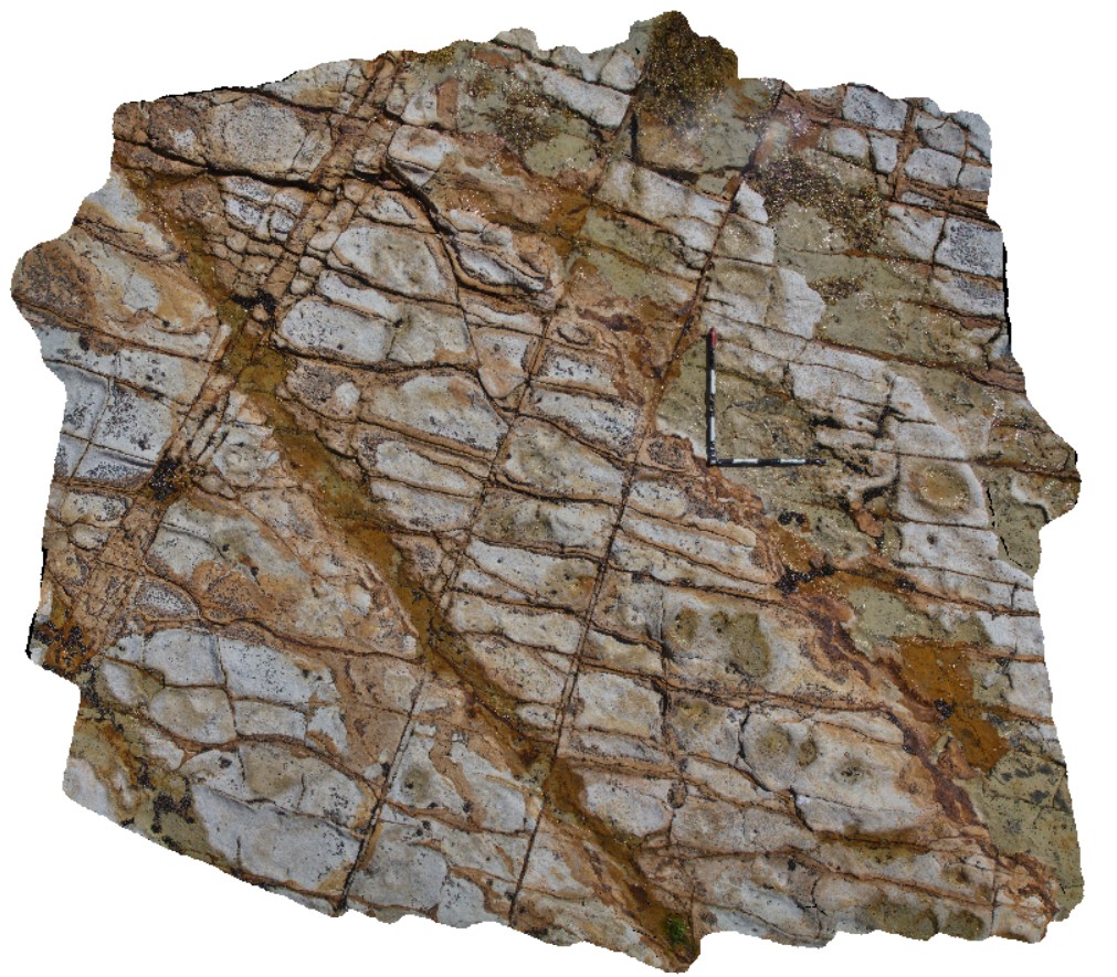 |
0 |
04/06/2016 1:56 p.m. |
3D terrestrial photogrammetric model |
Iron stained jointing in Permian silty sandstone / shore platform. Blackmans Bay, Tasmania. |
3.50 |
-43.00787000000 |
147.32793000000 |
-9999.000 |
strata, shore platform |
siltstone |
BlackmansBay10 Map
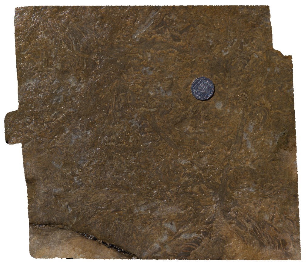 |
0 |
04/06/2016 2:07 p.m. |
3D terrestrial photogrammetric model |
bioturbation in silty sandstone in Permian sediments. Blackmans Bay, Tasmania. |
0.30 |
-43.00786000000 |
147.32712000000 |
-9999.000 |
bioturbation, sedimentology, palaeontology |
sandstone |
BlackmansBay11 Map
 |
0 |
03/21/2016 1:45 p.m. |
3D terrestrial photogrammetric model |
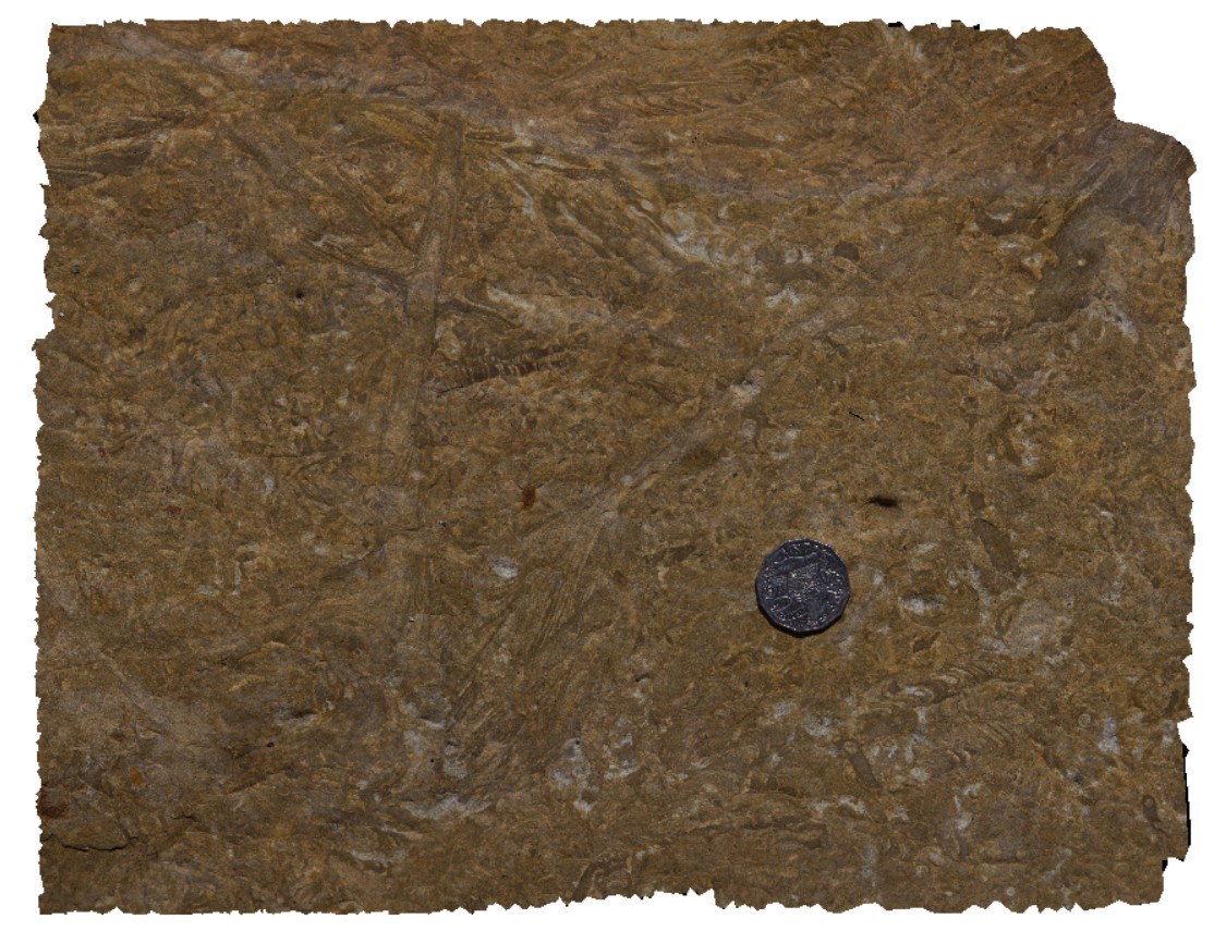
bioturbation in silty sandstone in Permian sediments. Blackmans Bay, Tasmania. |
0.35 |
-43.00785000000 |
147.32709000000 |
-9999.000 |
bioturbation, palaeontology, sedimentology |
sandstone |
Olary42 Map
 |
0 |
09/27/2015 6:22 p.m. |
3D terrestrial photogrammetric model |
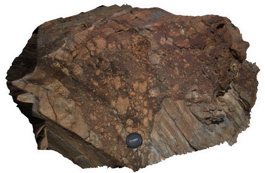
detail of the brecciated contact in site Olary41, showing breccia boundary and clasts. Cathedral Rock, Olary, S.A. |
0.50 |
-32.09007000000 |
140.31912000000 |
-9999.000 |
calc-silicate, breccia |
breccia |
MtGipps44 Map
 |
0 |
06/30/2016 noon |
3D terrestrial photogrammetric model |
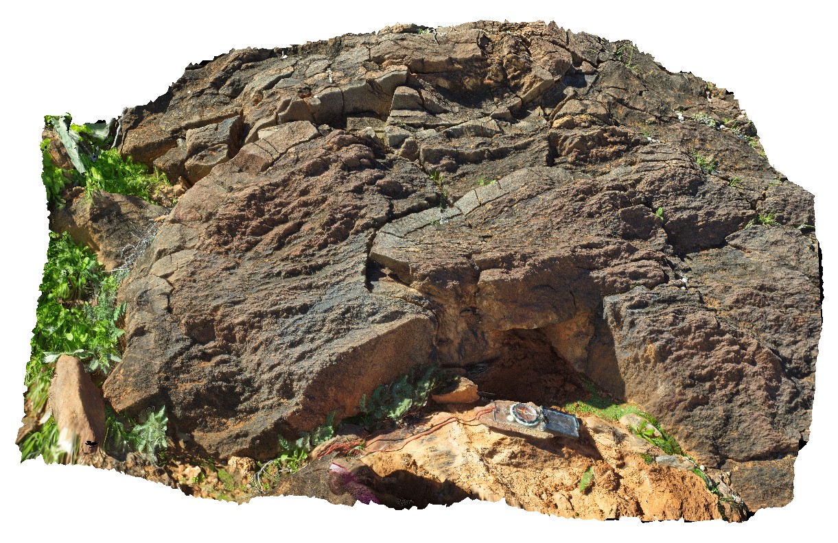
metasediments, Mount Gipps, N.S.W. |
1.40 |
-31.61661000000 |
141.50067000000 |
-9999.000 |
metasediment |
metasediment |
Olary41 Map
 |
0 |
09/27/2015 6:22 p.m. |
3D terrestrial photogrammetric model |
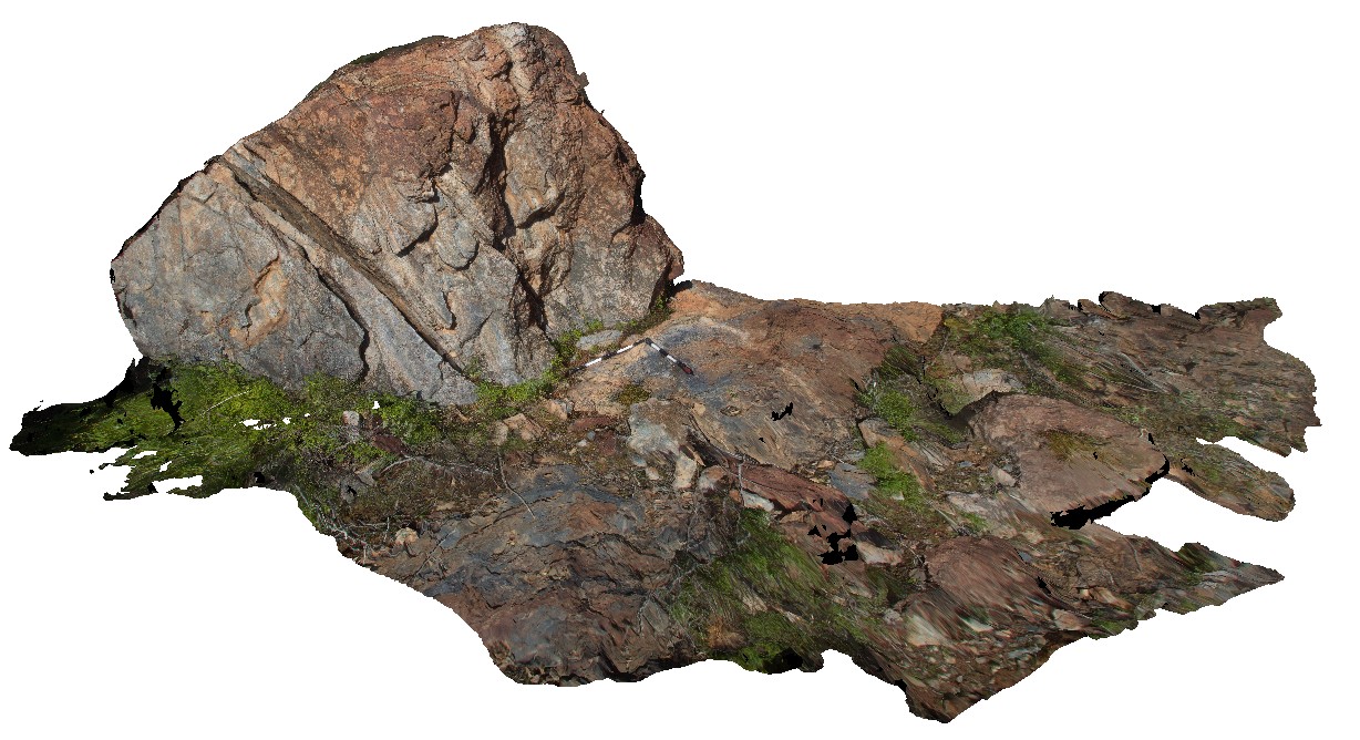
large boulder with hydrothermal breccia crosscutting sheared calc-silicate units. Cathedral Rock. Olary, S.A. |
4.00 |
-32.09007000000 |
140.31912000000 |
-9999.000 |
calc-silicate, breccia |
breccia |
Olary40 Map
 |
0 |
09/27/2015 6:21 p.m. |
3D terrestrial photogrammetric model |
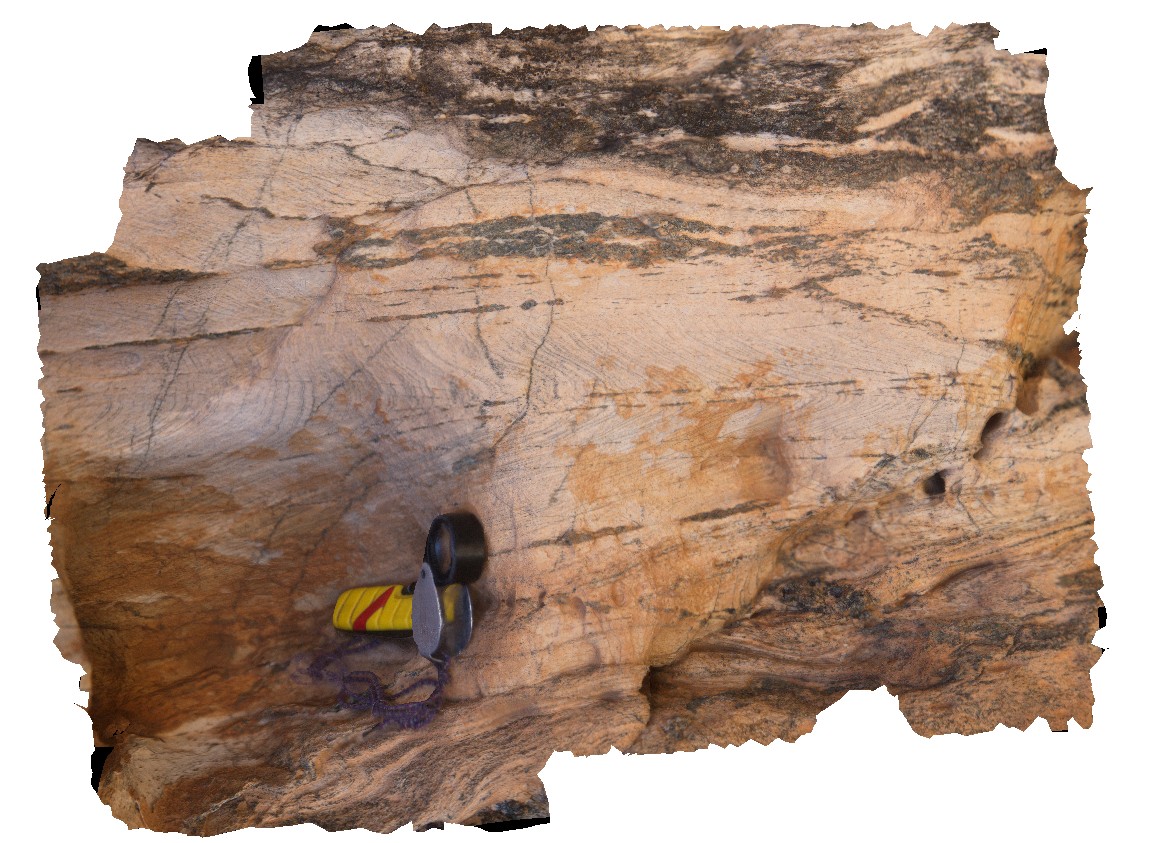
view of folded layering or foliation cut by axial planar amphiboles / dark mineral veins. Cathedral Rock. Olary, S.A. |
0.20 |
-32.09106000000 |
140.31787000000 |
-9999.000 |
fold, axial plane, structure |
metasediments |
Olary39 Map
 |
0 |
09/27/2015 6:21 p.m. |
3D terrestrial photogrammetric model |
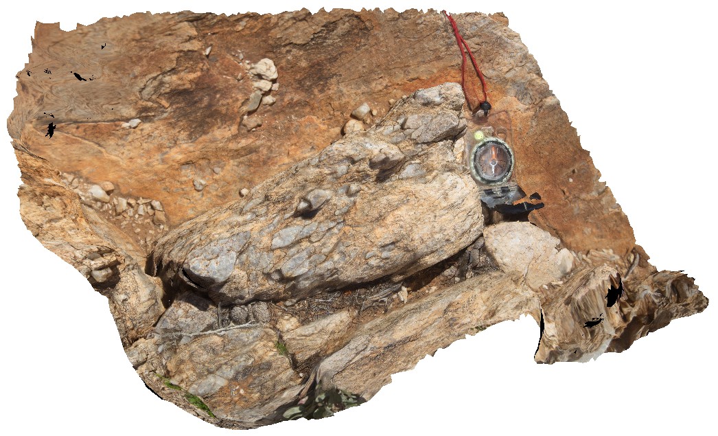
shear zone with sheared quartz vein in margin of calc-silicate lode of Cathedral Rock. Olary, S.A. |
0.60 |
-32.09121000000 |
140.31769000000 |
-9999.000 |
shear zone, quartz vein |
metasediments |
Bicheno19 Map
 |
0 |
02/25/2016 2:46 p.m. |
3D terrestrial photogrammetric model |
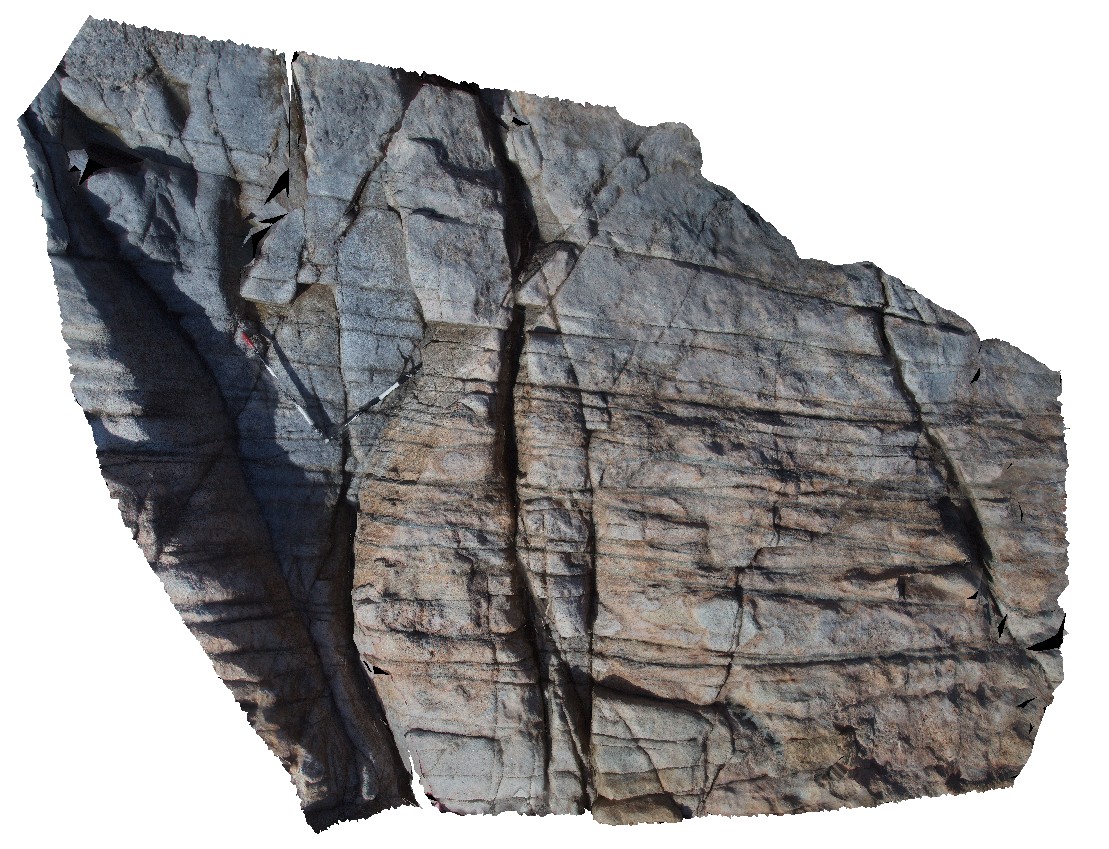
fault / shear in granite with micaceous selvages to fractures. Bicheno, Tasmania. |
3.50 |
-41.85644000000 |
148.27988000000 |
-9999.000 |
shear zone, fault, micaceous selvages |
granite |
LohreysRd1 Map
 |
0 |
02/23/2016 9:18 a.m. |
3D terrestrial photogrammetric model |
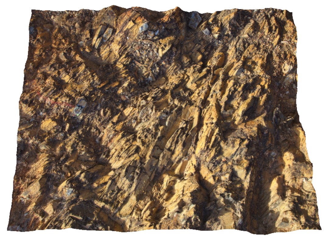
folded Mathinna Group sediments with pronounced cleavage and jointing. Catos Rd, Tasmania. |
1.00 |
-41.50162000000 |
148.11610000000 |
-9999.000 |
cleavage, jointing, folding |
siltstone |
LohreysRd2 Map
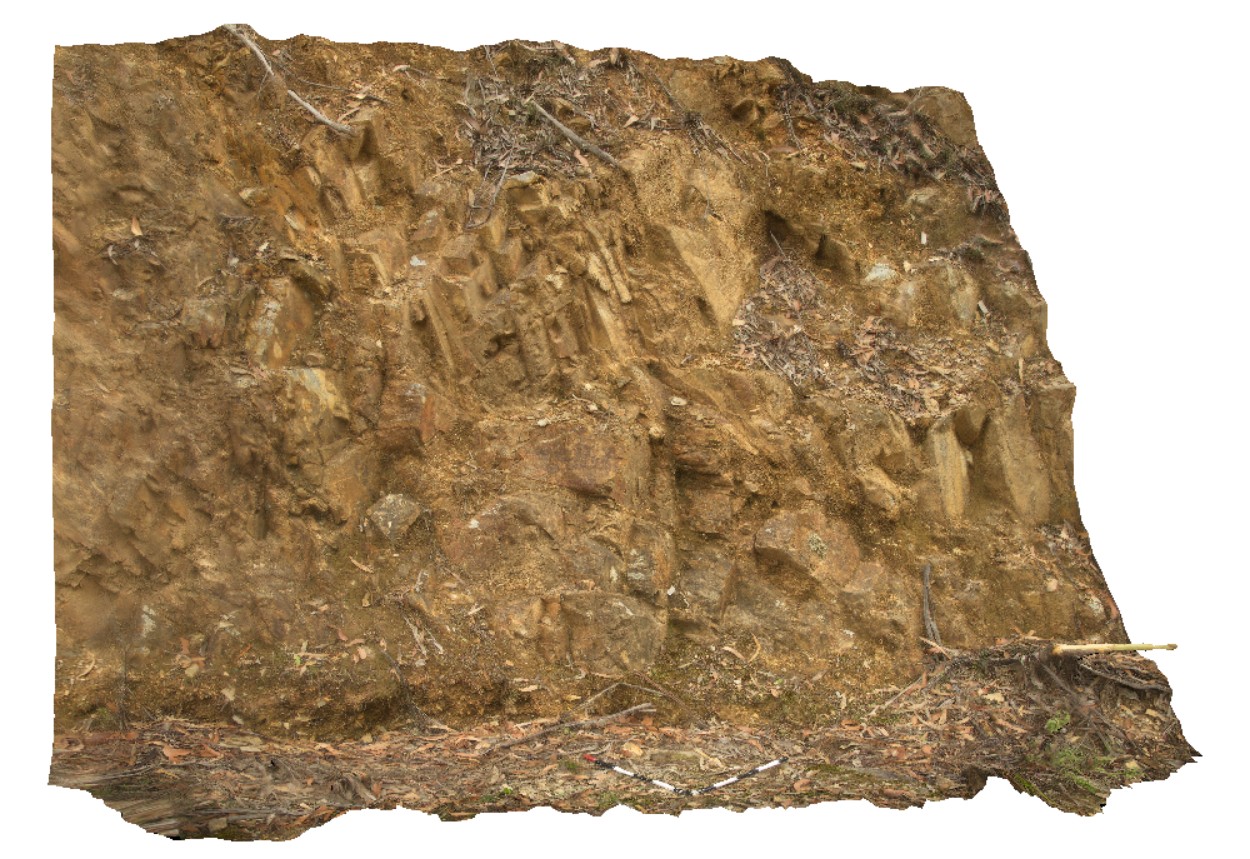 |
0 |
02/23/2016 9:18 a.m. |
3D terrestrial photogrammetric model |
complex folding in Mathinna Group sediments, Catos Rd, Tasmania. |
3.00 |
-41.50414000000 |
148.11336000000 |
-9999.000 |
folding, structure |
siltstone |
 AusGeol.org