NTas6 Map
 |
5 |
01/01/9999 midnight |
3D terrestrial photogrammetric model |
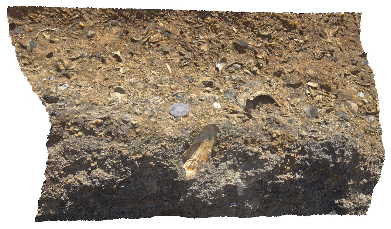
detail of fossiliferous layers, 1m above basal unconformity. Fossil Bluff Conservation Area, Wynyard. North Tasmania. |
0.50 |
-40.98113000000 |
145.73289000000 |
-9999.000 |
fossil, fossiliferous, palaeontology, Fossil Bluff Sandstone |
sandstone |
NTas4 Map
 |
5 |
01/01/9999 midnight |
3D terrestrial photogrammetric model |
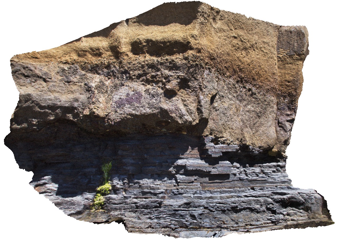
geological unconformity between the Fossil Bluff Sandstone and underlying Permian rocks. Fossil Bluff Conservation Area, Wynyard. North Tasmania. |
5.30 |
-40.98105000000 |
145.73289000000 |
-9999.000 |
unconformity, geological contact |
sandstone, sandstone |
NTas5 Map
 |
5 |
01/01/9999 midnight |
3D terrestrial photogrammetric model |
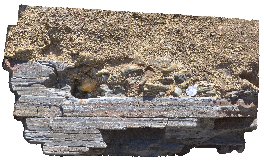
detailed view of geological unconformity between the Fossil Bluff Sandstone and underlying Permian rocks, showing irregular contact surface with large polymict cobbles in the Miocene rocks. Fossil Bluff Conservation Area, Wynyard. North Tasmania. |
0.50 |
-40.98105000000 |
145.73289000000 |
-9999.000 |
unconformity, geological contact |
sandstone, sandstone |
NTasFSP5 Map
 |
5 |
01/01/9999 midnight |
Full Spherical Panorama |
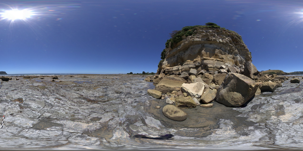
shore-cut platform in Wynyard Tillite with unconformity with the Fossil Bluff Sandstone at the base of the cliff. Fossil Bluff Conservation Area, Wynyard. North Tasmania. |
500.00 |
-40.98098000000 |
145.73296000000 |
-9999.000 |
unconformity, geological contact, tillite, Fossil Bluff |
tillite, sandstone |
NTasFSP6 Map
 |
5 |
01/01/9999 midnight |
Full Spherical Panorama |
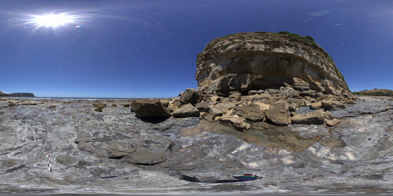
shore-cut platform in Wynyard Tillite with unconformity with the Fossil Bluff Sandstone at the base of the cliff. Fossil Bluff Conservation Area, Wynyard. North Tasmania. |
500.00 |
-40.98079000000 |
145.73262000000 |
-9999.000 |
unconformity, geological contact, Fossil Bluff Sandstone |
tillite, sandstone |
NTasFSP7 Map
 |
5 |
01/01/9999 midnight |
Full Spherical Panorama |
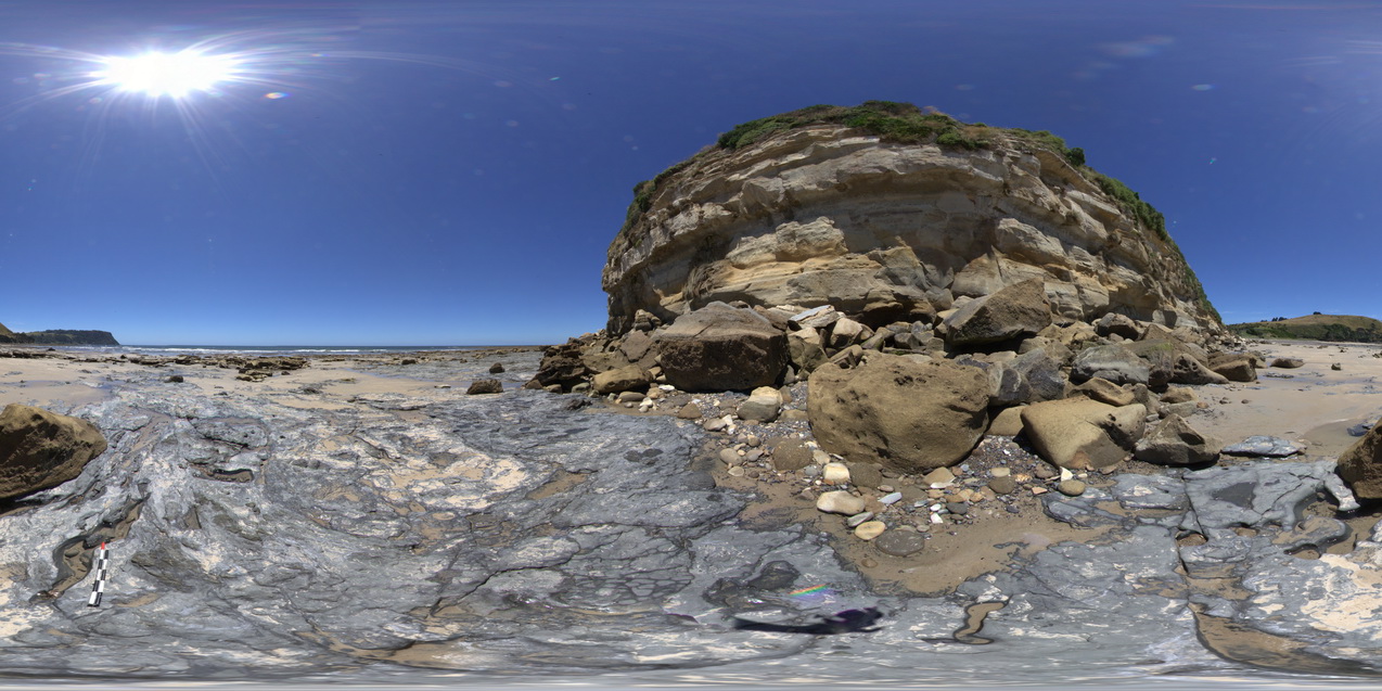
shore-cut platform in Wynyard Tillite with unconformity with the Fossil Bluff Sandstone at the base of the cliff. Fossil Bluff Conservation Area, Wynyard. North Tasmania. |
500.00 |
-40.98064000000 |
145.73222000000 |
-9999.000 |
tillite, Fossil Bluff, geological contact, unconformity |
tillite, sandstone |
NTas12 Map
 |
5 |
01/01/9999 midnight |
3D terrestrial photogrammetric model |
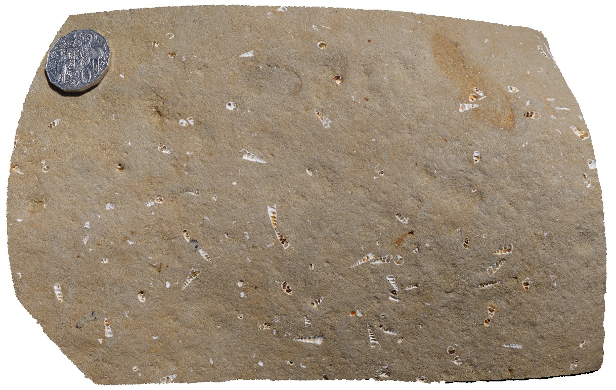
Turritellid gastropods exposed in weathered surface. Fossil Bluff Conservation Area, Wynyard. North Tasmania. |
0.20 |
-40.98050000000 |
145.73151000000 |
-9999.000 |
gastropod, Tentaculites, fossil, fossiliferous, Palaeontology |
sandstone |
NTas13 Map
 |
5 |
01/01/9999 midnight |
3D terrestrial photogrammetric model |
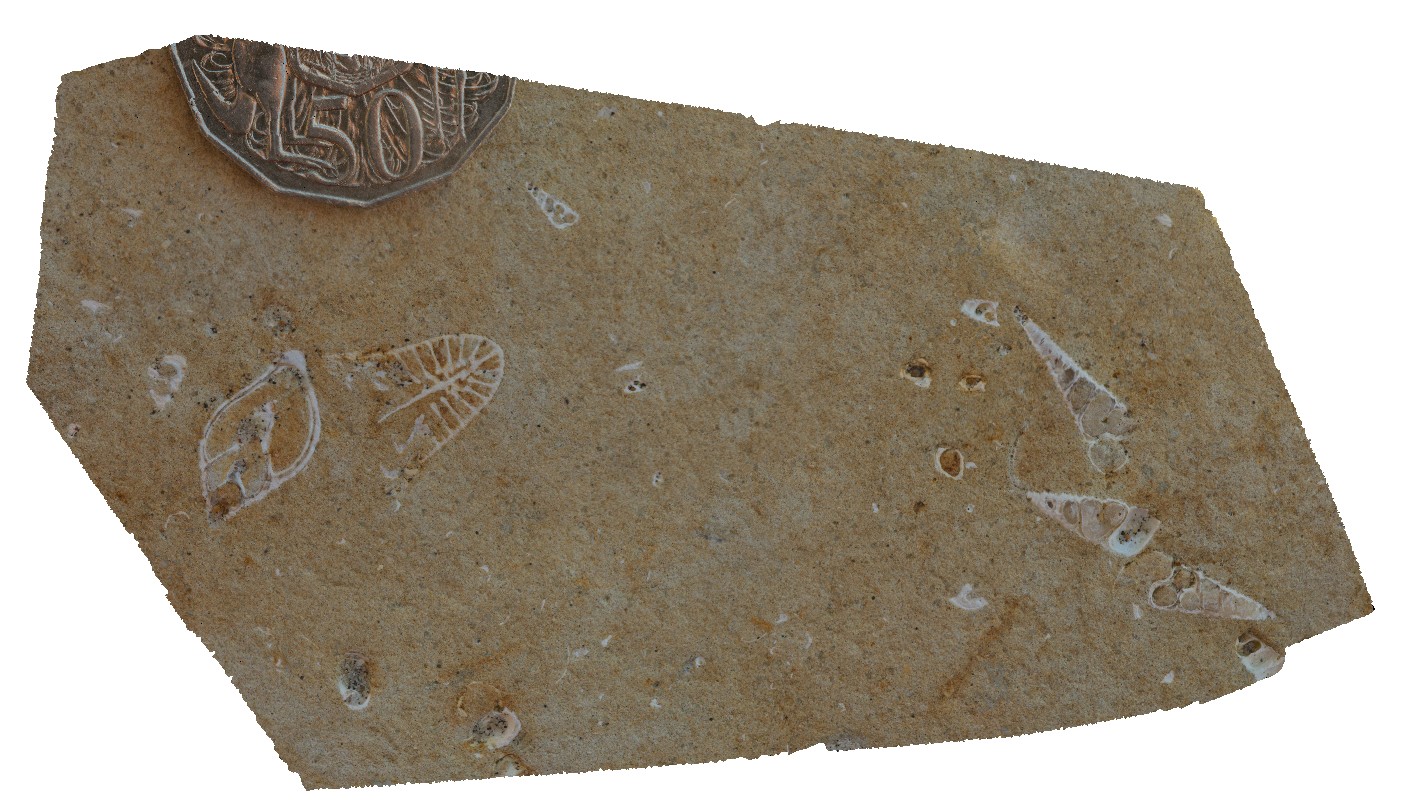
detailed view of gastropod fossils exposed in cross section. Fossil Bluff Conservation Area, Wynyard. North Tasmania. |
0.10 |
-40.98050000000 |
145.73151000000 |
-9999.000 |
gastropod, fossil, fossiliferous, Palaeontology |
sandstone |
NTasFSP8 Map
 |
5 |
01/01/9999 midnight |
Full Spherical Panorama |
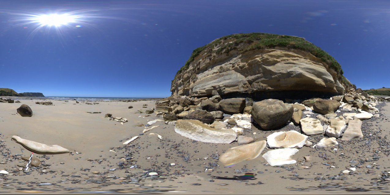
view of the stratigraphy of fossil bluff from the shore line. Fossil Bluff Conservation Area, Wynyard. North Tasmania. |
500.00 |
-40.98046000000 |
145.73158000000 |
-9999.000 |
stratigraphy, Fossil Bluff Sandstone |
sandstone |
NTas11 Map
 |
5 |
01/01/9999 midnight |
3D terrestrial photogrammetric model |
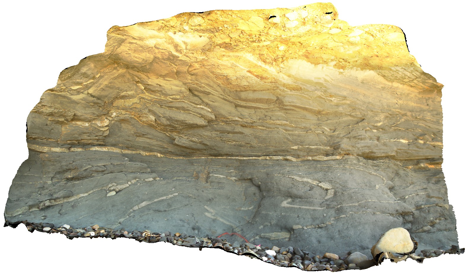
soft sediment deformation in Permian rocks immediately below the unconformity with Tertiary sandstone. Fossil Bluff Conservation Area, Wynyard. North Tasmania. |
2.30 |
-40.98043000000 |
145.73145000000 |
-9999.000 |
Wynyard Tillite, soft sediment deformation, sedimentology |
tillite |
NTasUAV5 Map
 |
20 |
01/01/9999 midnight |
3D UAV photogrammetric model |
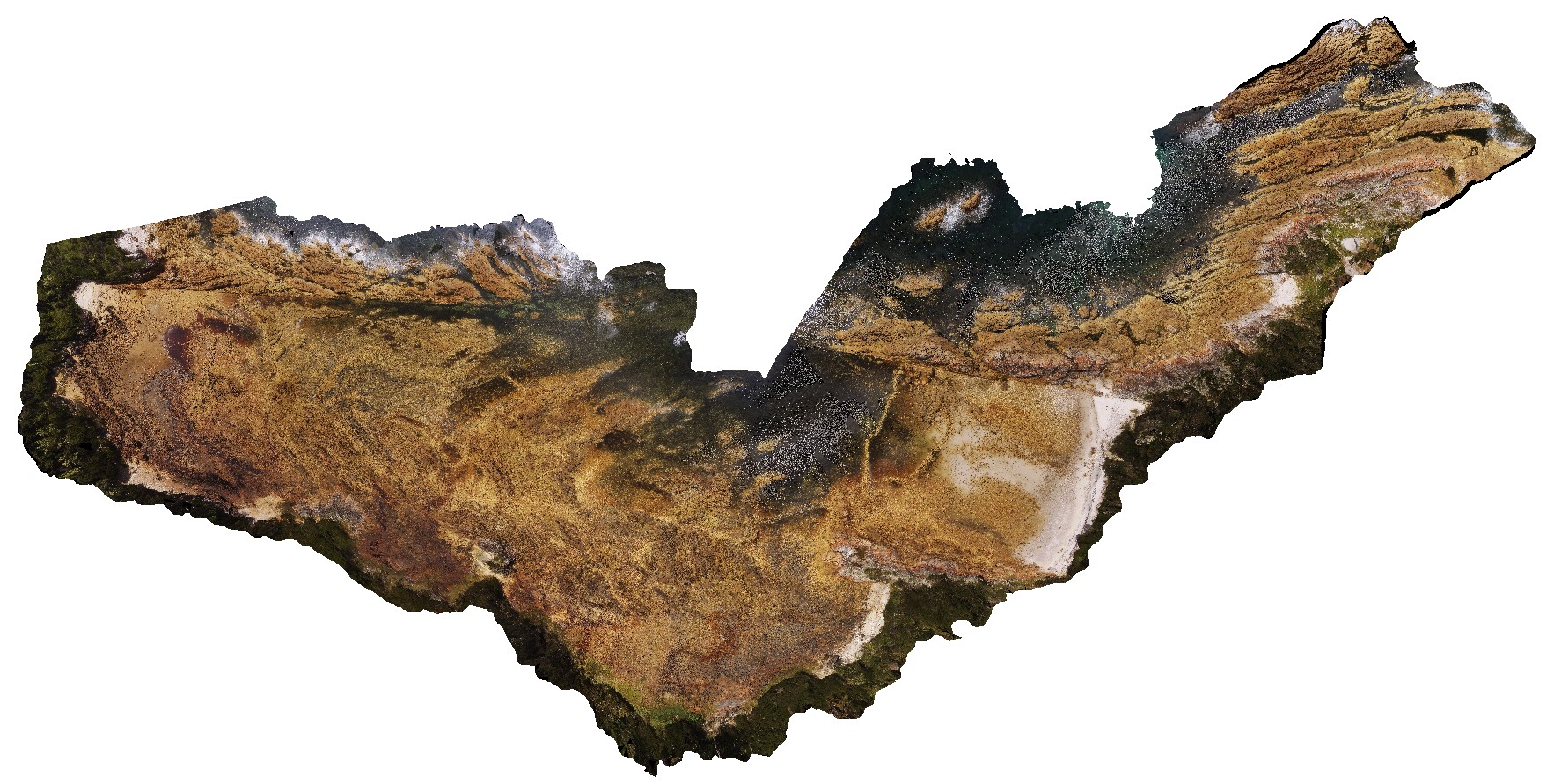
aerial view of Boat Harbour foreshore, showing macro-scale folding in moderately dipping rocks. Boat Harbour, north Tasmania. |
200.00 |
-40.92560000000 |
145.61093300000 |
-9999.000 |
fold, metamorphic rock |
quartzite |
NTasUAVFSP2 Map
 |
20 |
01/01/9999 midnight |
3D UAV photogrammetric model |
aerial view of Boat Harbour foreshore, showing macro-scale folding in moderately dipping rocks. Boat Harbour, north Tasmania. |
0.00 |
-40.92531200000 |
145.61275600000 |
-9999.000 |
fold, structure, bedding |
quartzite |
NTasUAV4 Map
 |
20 |
01/01/9999 midnight |
3D UAV photogrammetric model |
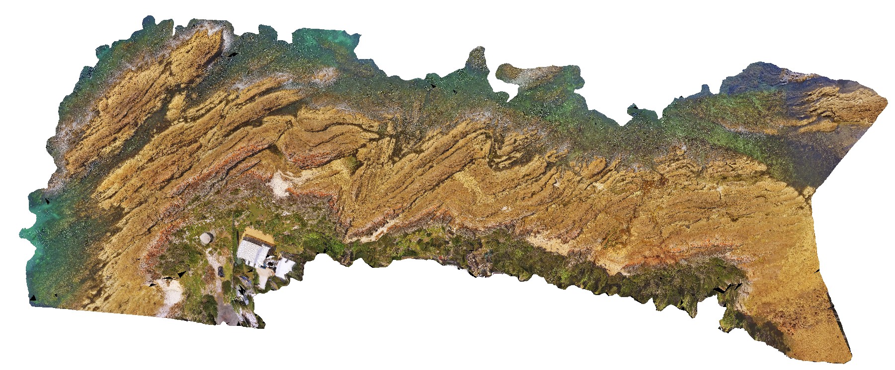
aerial view of Boat Harbour foreshore, showing macro-scale folding in moderately dipping rocks. Boat Harbour, north Tasmania. |
100.00 |
-40.92489400000 |
145.61249400000 |
-9999.000 |
fold, dip, structure |
quartzite |
SwanseaUAV1 Map
 |
20 |
01/01/9999 midnight |
3D terrestrial photogrammetric model |
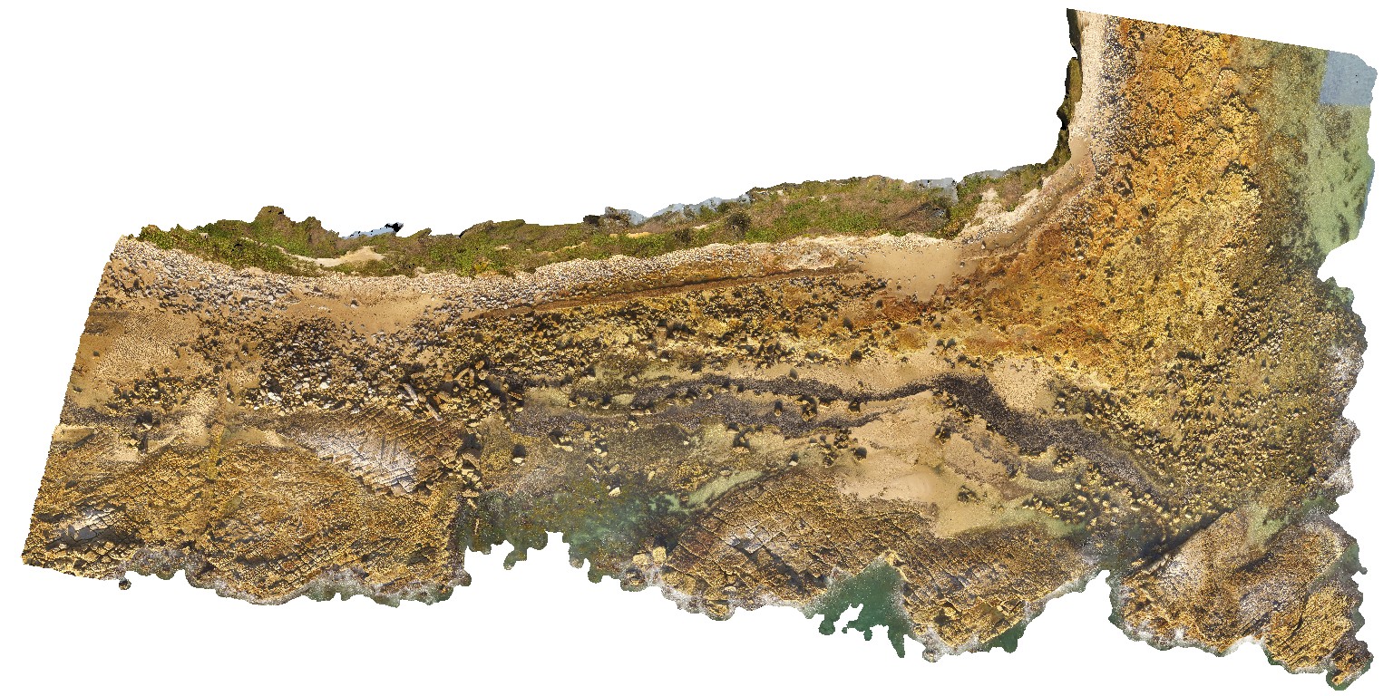
Coastal platform with numerous petrified/coalified tree stumps within tuffaceous rocks of the Permian Boolaroo Formation. Swansea, N.S.W. |
500.00 |
-33.08807500000 |
151.66484200000 |
17.500 |
tuff, petrified forest |
tuff |
BellinghamUAV1 Map
 |
20 |
01/01/9999 midnight |
3D UAV photogrammetric model |
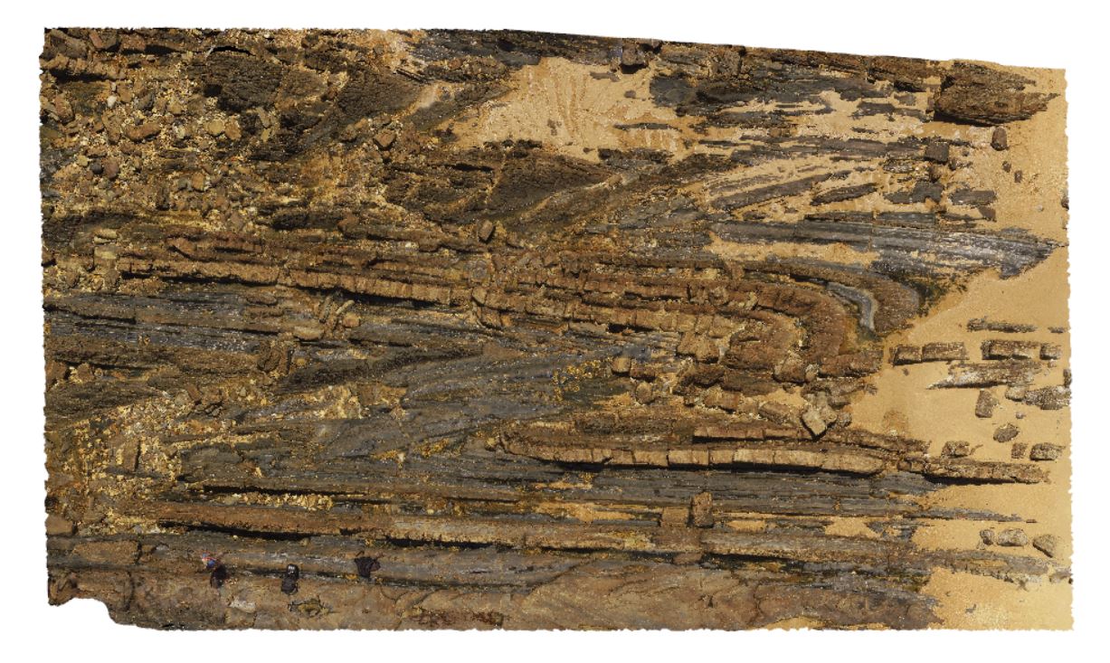
aerial overview of folded and faulted, thick turbidite package at Bellingham, NE Tasmania. View taken from 60m above the ground. |
500.00 |
-41.00721400000 |
147.16257300000 |
186.700 |
structure, turbidite package, fold, fault |
turbidite |
BellinghamUAV2 Map
 |
20 |
01/01/9999 midnight |
3D UAV photogrammetric model |
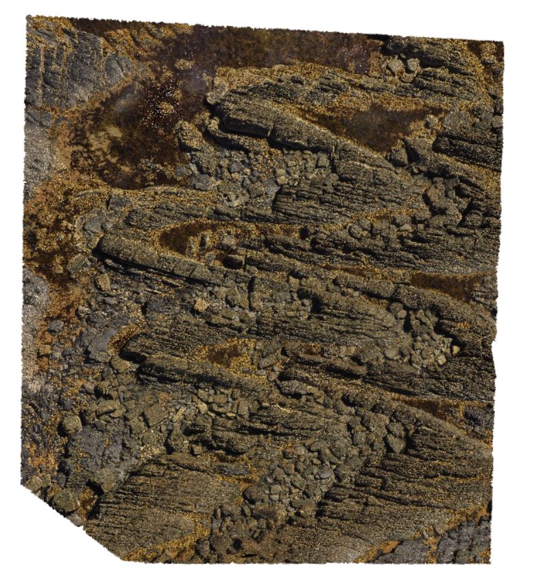
a 20m above the ground aerial overview of parasitic folds in the folded turbidites of the Retreat Formation. Bellingham, NE Tasmania. |
200.00 |
-41.00787100000 |
147.16577100000 |
20.000 |
turbidite, fold, parasitic fold, structure |
turbidite |
Bellingham1 Map
 |
5 |
01/01/9999 midnight |
3D terrestrial photogrammetric model |
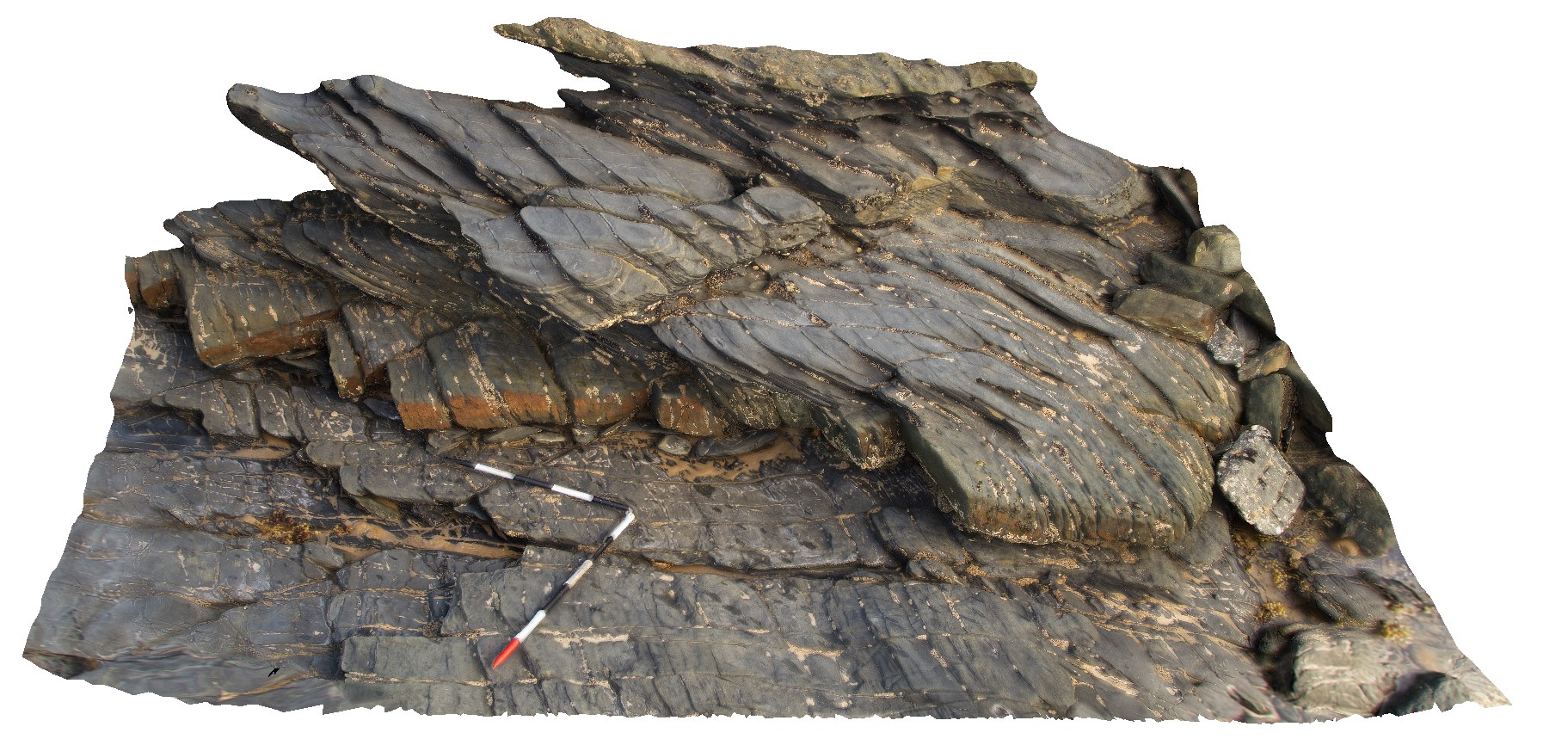
outcrop showing pronounced cleavage refraction - cleavage in fine-grained unit approximates the fold axial plane. Bellingham, NE Tasmania. |
3.00 |
-41.00683000000 |
147.16264000000 |
-9999.000 |
cleavage refraction, cleavage, structure, folding |
mudstone, sandstone |
Bellingham2 Map
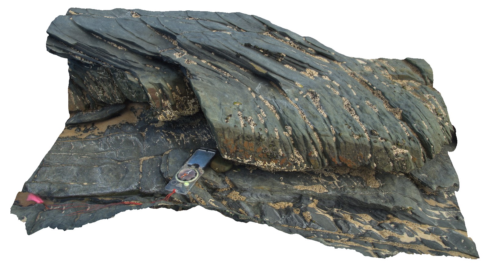 |
5 |
01/01/9999 midnight |
3D terrestrial photogrammetric model |
detail of refracted cleavage in mudstones and sandstone layers from site Bellingham1, showing cleavage in mudstone approximates the fold axial plane. Bellingham, NE Tasmania. |
1.00 |
-41.00683000000 |
147.16264000000 |
-9999.000 |
refracted cleavage, cleavage, structure |
mudstone, sandstone |
Bellingham3 Map
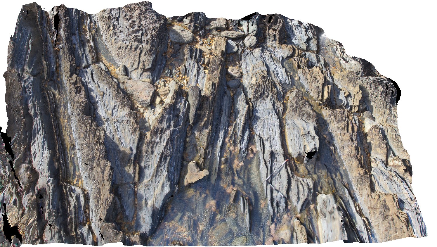 |
5 |
01/01/9999 midnight |
3D terrestrial photogrammetric model |
gently plunging antiform and synform in turbiditic sediments, with pronounced cleavage in the fine-grained layers. Bellingham, NE Tasmania. |
7.00 |
-41.00751000000 |
147.16188000000 |
-9999.000 |
turbidite, antiform, synform, cleavage, fold, structure |
turbidite |
Bellingham4 Map
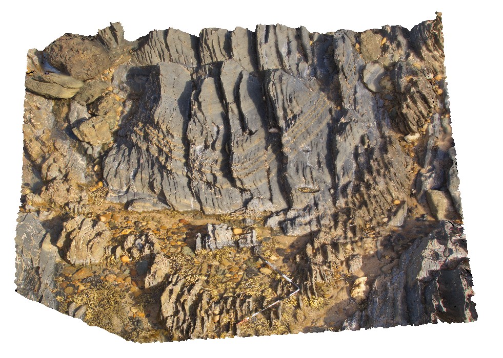 |
5 |
01/01/9999 midnight |
3D terrestrial photogrammetric model |
open synform in turbiditic sequences of the Retreat Formation Mathinna Supergroup sediments. Bellingham, NE Tasmania. |
4.00 |
-41.00761000000 |
147.16130000000 |
-9999.000 |
open fold, synform, turbidite, fold, structure |
turbidite |
Bellingham5 Map
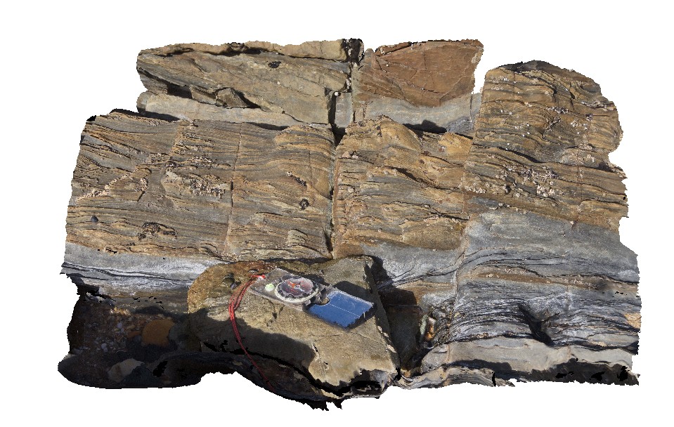 |
5 |
01/01/9999 midnight |
3D terrestrial photogrammetric model |
cross beds in fine-grained sandstone with facing direction indicating right-way up. Bellingham, NE Tasmania. |
0.70 |
-41.00771000000 |
147.16132000000 |
-9999.000 |
cross bedding, facing direction, right-way up, younging, sandstone |
sandstone |
Bellingham6 Map
 |
5 |
01/01/9999 midnight |
3D terrestrial photogrammetric model |
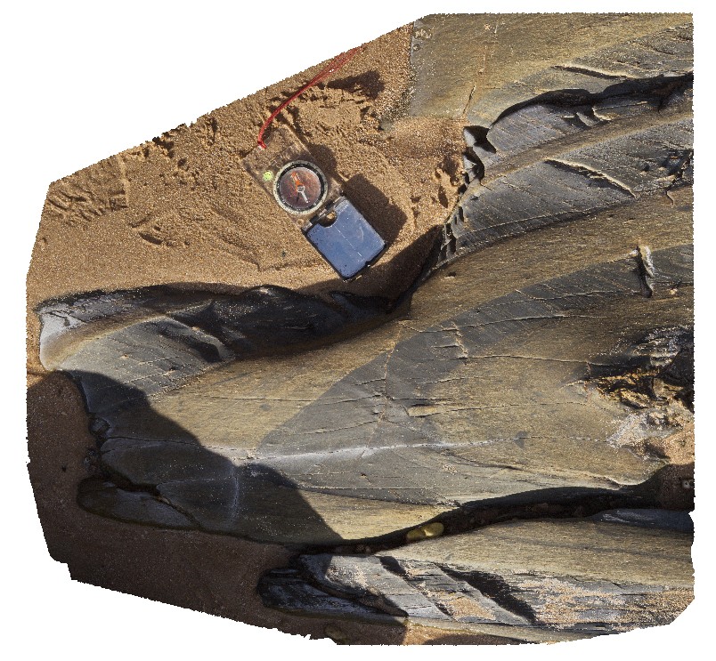
fold hinge with axial planar S1 and transecting S2 crenulation cleavage. Bellingham, NE Tasmania. |
0.70 |
-41.00806000000 |
147.16135000000 |
-9999.000 |
fold hinge, sediments, axial planar cleavage, S1, S2, crenulation cleavage, structure |
turbidite |
Bellingham7 Map
 |
5 |
01/01/9999 midnight |
3D terrestrial photogrammetric model |
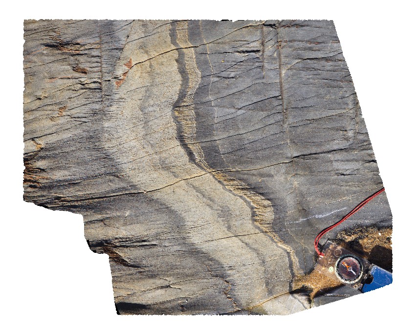
detail of 2 structural fabrics in bedded turbidite sequence, showing S0, S1 and S2 crenulation. Bellingham, NE Tasmania. |
0.50 |
-41.00810000000 |
147.16145000000 |
-9999.000 |
crenulation cleavage, S0, S1, S2, cleavage, structure, turbidite |
turbidite |
Bellingham8 Map
 |
5 |
01/01/9999 midnight |
3D terrestrial photogrammetric model |
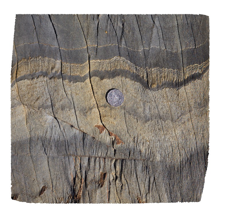
detail of 2 structural fabrics in bedded turbidite sequence, showing S0, S1 and S2 crenulation from site Bellingham7. Bellingham, NE Tasmania. |
0.40 |
-41.00810000000 |
147.16145000000 |
-9999.000 |
crenulation cleavage, cleavage, structure, S0, S1, S2, turbidite |
turbidite |
Bellingham9 Map
 |
5 |
01/01/9999 midnight |
3D terrestrial photogrammetric model |
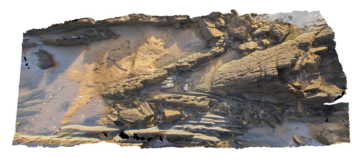
plunging antiform in mudstone and fine-grained sandstone turbiditic units of the Retreat Formation. Bellingham, NE Tasmania. |
6.00 |
-41.00822000000 |
147.16116000000 |
-9999.000 |
antiform, turbidite, structure, fold |
turbidite |
 AusGeol.org