BH2011n7 Map
 |
20 |
03/16/2015 2:55 p.m. |
3D terrestrial photogrammetric model |
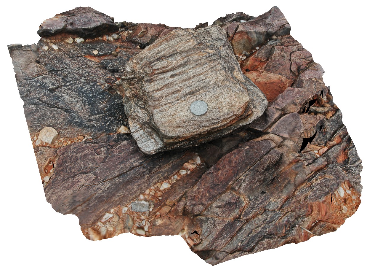
mica rich schist, with small folds and cross cutting cleavage. Broken Hill, N.S.W. |
0.30 |
-31.63596042000 |
141.53388023000 |
-9999.000 |
cleavage, fold, structure |
schist |
NTasUAV1 Map
 |
20 |
01/01/9999 midnight |
3D UAV photogrammetric model |
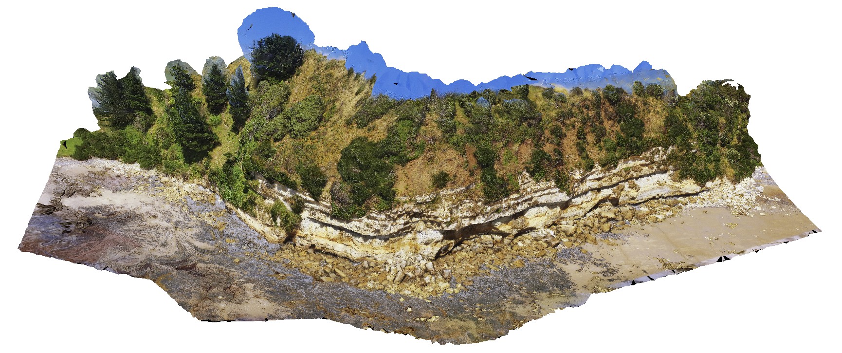
flat-lying sandstone beds of the Fossil Bluff Sandstone. Fossil Bluff Conservation Area, Wynyard. North Tasmania. |
200.00 |
-40.98145800000 |
145.73336400000 |
-9999.000 |
sandstone, bedding |
sandstone |
NTasUAVFSP1 Map
 |
20 |
01/01/9999 midnight |
3D UAV photogrammetric model |
flat-lying sandstone beds of the Fossil Bluff Sandstone. Fossil Bluff Conservation Area, Wynyard. North Tasmania. |
0.00 |
-40.98145800000 |
145.73336400000 |
-9999.000 |
sandstone, Fossil Bluff |
sandstone |
BH2011n6 Map
 |
20 |
04/17/2015 12:32 p.m. |
3D terrestrial photogrammetric model |
psammitic metasediments with small-scale folding. Broken Hill, N.S.W. |
0.50 |
-31.63603514000 |
141.53417627000 |
-9999.000 |
fold |
metasediment |
BH2011n5 Map
 |
20 |
04/17/2015 11:47 a.m. |
3D terrestrial photogrammetric model |
multiply folded quartz vein intruding fine-grained metasediments. Broken Hill, N.S.W. |
2.00 |
-31.63604914000 |
141.53520384000 |
-9999.000 |
fold, structure, complex folding |
metasediment |
ParkersUAV3 Map
 |
20 |
01/01/9999 midnight |
3D UAV photogrammetric model |
aerial view of entire Parkers Beach outcrop of fluvial and flood plain Triassic sediments. Parkers Beach, Nubeena Tasmania. |
385.00 |
-42.94254100000 |
147.69614700000 |
19.000 |
fluvial, floodplain, sedimentology, Triassic |
sandstone |
BH2011n4 Map
 |
20 |
04/17/2015 11:37 a.m. |
3D terrestrial photogrammetric model |
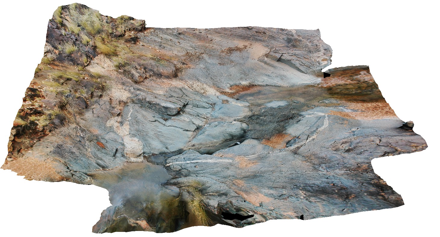
shallow basin folding in metasediments. Broken Hill, N.S.W. |
5.00 |
-31.63580894000 |
141.53475285000 |
-9999.000 |
basin folding, fold, structure |
metasediments |
BH2011n3 Map
 |
20 |
03/16/2015 2:54 p.m. |
3D terrestrial photogrammetric model |
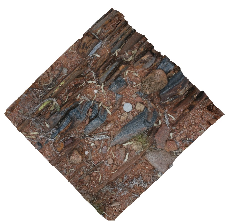
moderately plunging parasitic folds in quartzite layer. Broken Hill, N.S.W. |
0.50 |
-31.63595890000 |
141.53825045000 |
-9999.000 |
fold plunge, parasitic fold, metasediments, structure |
metasediment |
BH2011n2 Map
 |
20 |
03/16/2015 2:54 p.m. |
3D terrestrial photogrammetric model |
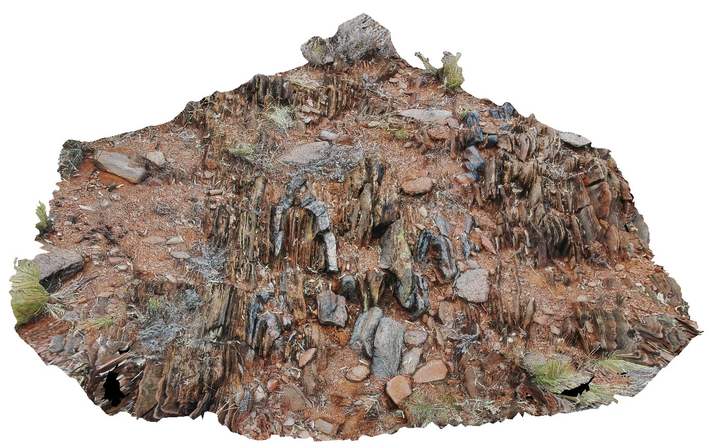
moderately plunging, tight folds in thinly bedded quartzite and mudstones metasediments. Strong cleavage also evident. Broken Hill. N.S.W. |
1.00 |
-31.63628271000 |
141.53839687000 |
-9999.000 |
fold plunge, tight fold, fold, structure, metasediments, cleavage |
metasediments |
BH2011n14 Map
 |
20 |
03/16/2015 2:54 p.m. |
3D terrestrial photogrammetric model |
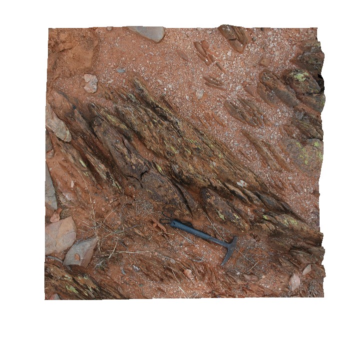
view of metasediment with strongly developed S-C fabric. Broken Hill, N.S.W. |
2.00 |
-31.63442634000 |
141.54044540000 |
-9999.000 |
S - C fabric, structure, metasediment |
metasediment |
BH2011n13 Map
 |
20 |
03/16/2015 2:54 p.m. |
3D terrestrial photogrammetric model |
tight to isoclinal, inclined and steeply plunging fold in psammites. Broken Hill, N.S.W. |
5.00 |
-31.64525745000 |
141.53586586000 |
-9999.000 |
fold hinge, tight fold, isoclinal fold, fold plunge, structure, psammite, inclined fold |
psammite |
BH2011n12 Map
 |
20 |
03/16/2015 2:53 p.m. |
3D terrestrial photogrammetric model |
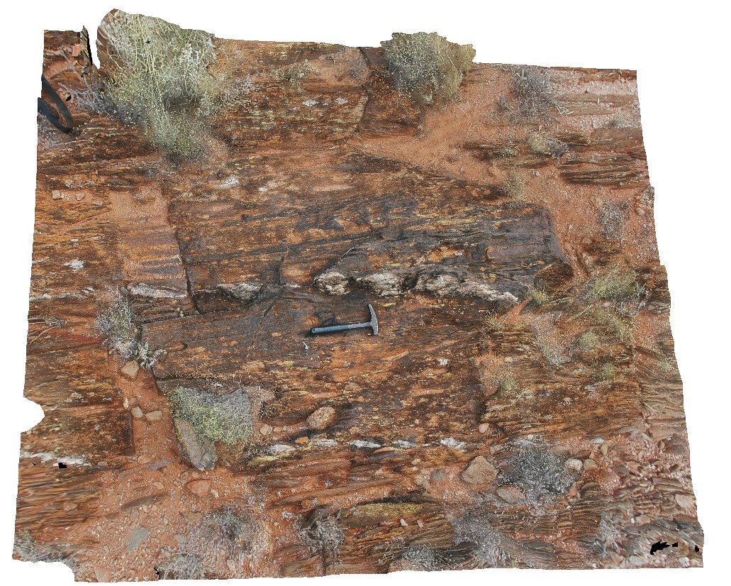
boudinaged quartz veins in metasediments. Broken Hill, N.S.W. |
2.50 |
-31.63409414000 |
141.54039789000 |
-9999.000 |
boudinage, metasediment, structure |
metasediment |
BH2011n11 Map
 |
20 |
09/14/2015 10:35 a.m. |
3D terrestrial photogrammetric model |
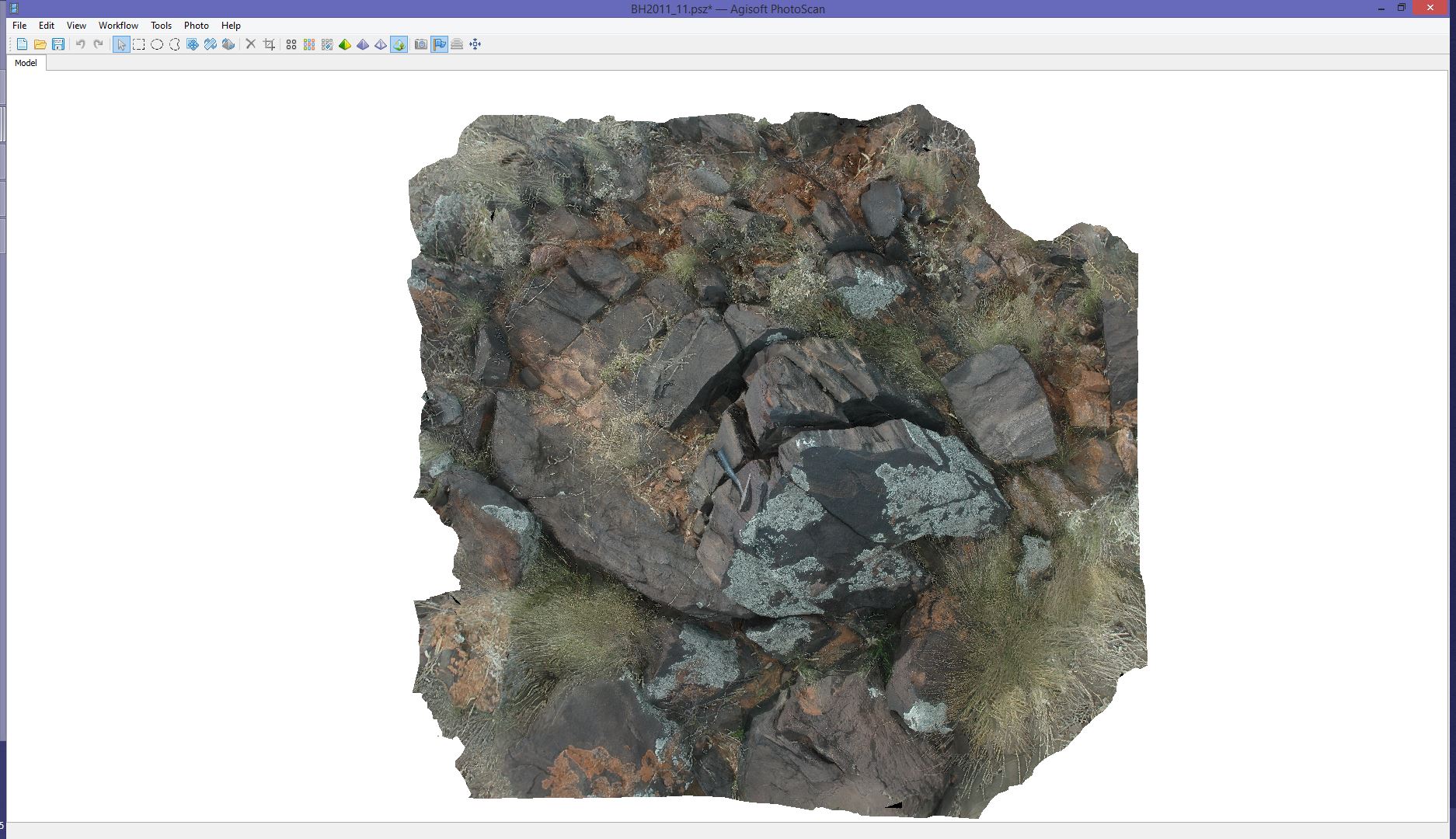
view of metadacite / fine-grained gneiss. Broken Hill, N.S.W. |
3.00 |
-31.64335967000 |
141.54101707000 |
-9999.000 |
metadacite |
gneiss |
BH2011n10 Map
 |
20 |
03/16/2015 2:53 p.m. |
3D terrestrial photogrammetric model |
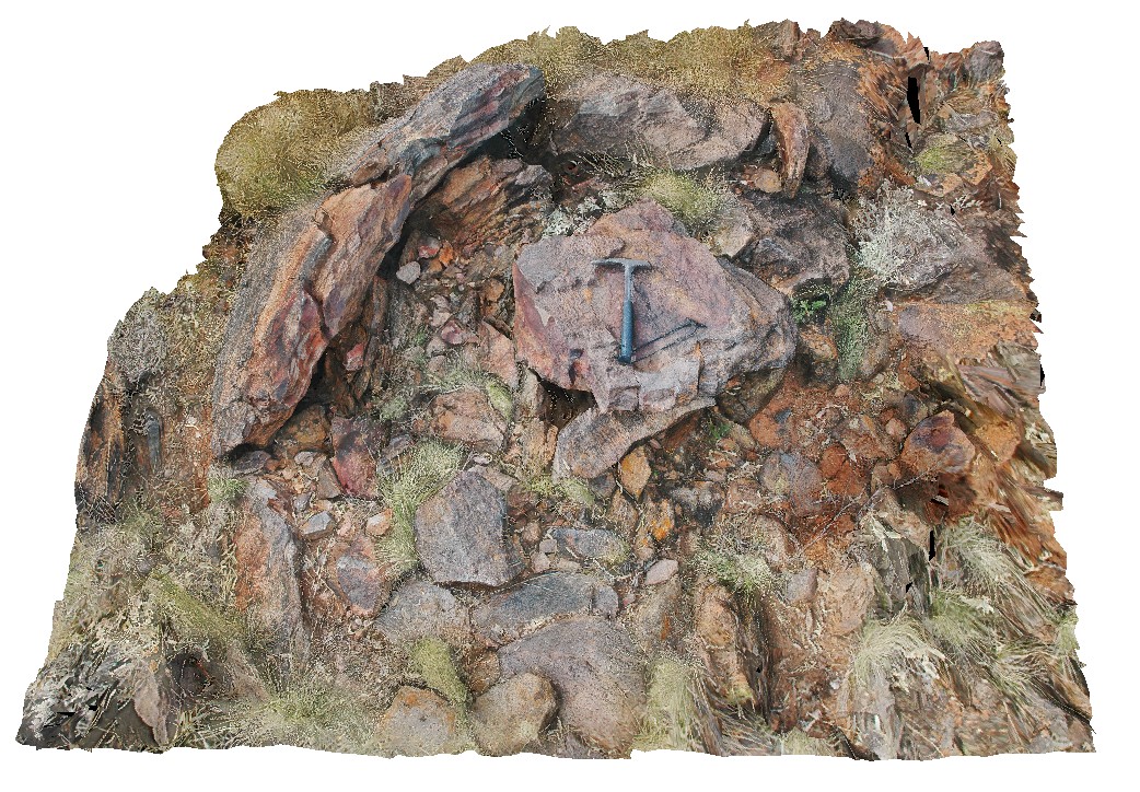
view of preserved dome in metasediments. Broken Hill, N.S.W. |
3.00 |
-31.64098561000 |
141.54132199000 |
-9999.000 |
dome, fold, metasediment, structure |
metasediment |
BH2011n1 Map
 |
20 |
03/16/2015 2:53 p.m. |
3D terrestrial photogrammetric model |
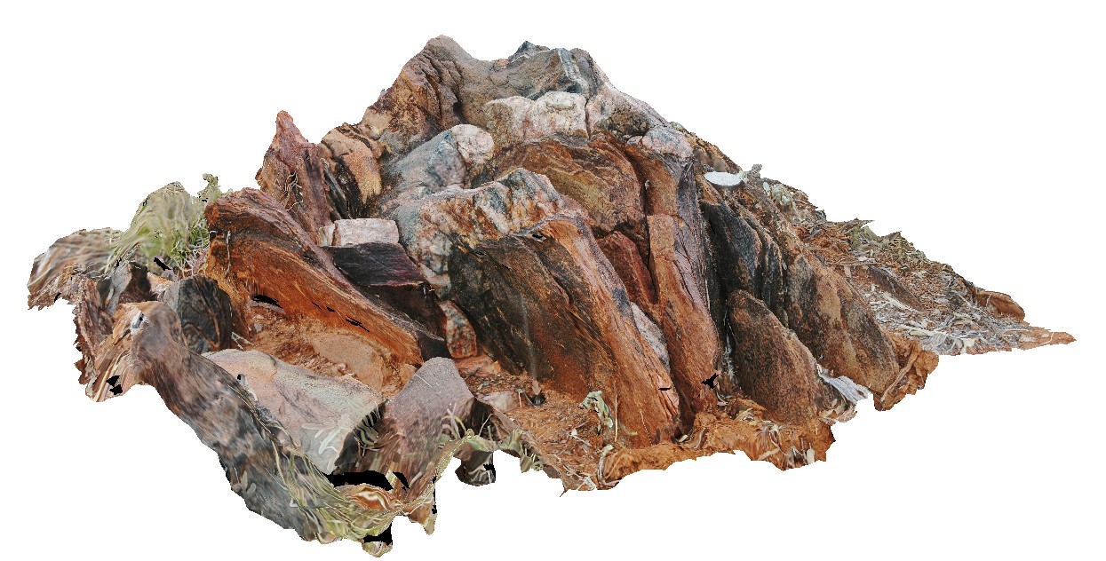
tightly folded and moderately plunging folds in Hores Gneiss. Broken Hill, N.S.W. |
0.80 |
-31.63547118000 |
141.53853471000 |
-9999.000 |
gneiss, tight fold, fold, structure |
gneiss |
BH2013Adelaidean2 Map
 |
20 |
03/24/2015 5:49 p.m. |
3D terrestrial photogrammetric model |
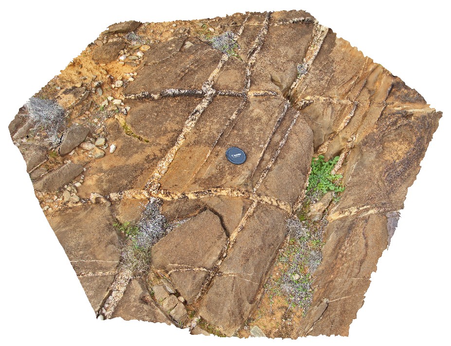
cross bedded sandstone pavement with sheeted vein sets. First set of bucky quartz veins are off-set by second set, with apparent sinistral movement direction and growth of quartz within the veins. Broken Hill, N.S.W. |
0.50 |
-31.59924614000 |
141.59926357000 |
-9999.000 |
sinistral movement, quartz vein, direction indicators, structure, sheeted veins |
sandstone |
Splitpoint18 Map
 |
20 |
06/17/2015 10:51 a.m. |
3D terrestrial photogrammetric model |
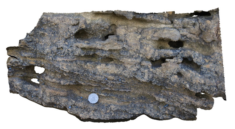
detail of thinly bedded limestone of the Torquay Group showing cross beds, shell fossils and the effects of differential weathering. Split Point, Vic. |
1.00 |
-38.46777000000 |
144.10634000000 |
2.000 |
palaeontology, cross bedding, sedimentology |
limestone |
Splitpoint17 Map
 |
20 |
06/17/2015 10:49 a.m. |
3D terrestrial photogrammetric model |
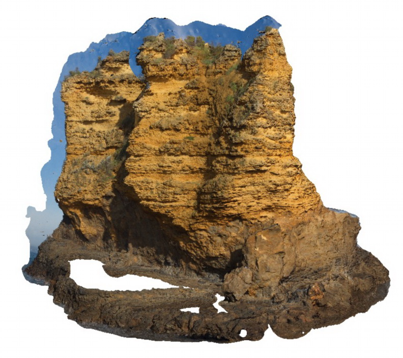
sea stack showing bedded limestone of the Torquay Group disconformably overlying basalt of the Oligocene Angahook Formation. Split Point, Vic. |
30.00 |
-38.46854000000 |
144.10675000000 |
-9999.000 |
disconformity, volcanology, sedimentology |
limestone, basalt |
LordHowe6 Map
 |
20 |
03/16/2015 2:52 p.m. |
3D terrestrial photogrammetric model |
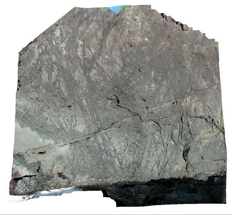
basalt cut by multi-directional dyke swarm. Lord Howe Island. |
12.00 |
-31.55469752000 |
159.09578331000 |
0.000 |
basalt, dyke, intrusive |
basalt |
SwanseaPole1 Map
 |
20 |
10/13/2015 12:30 p.m. |
3D terrestrial photogrammetric model |
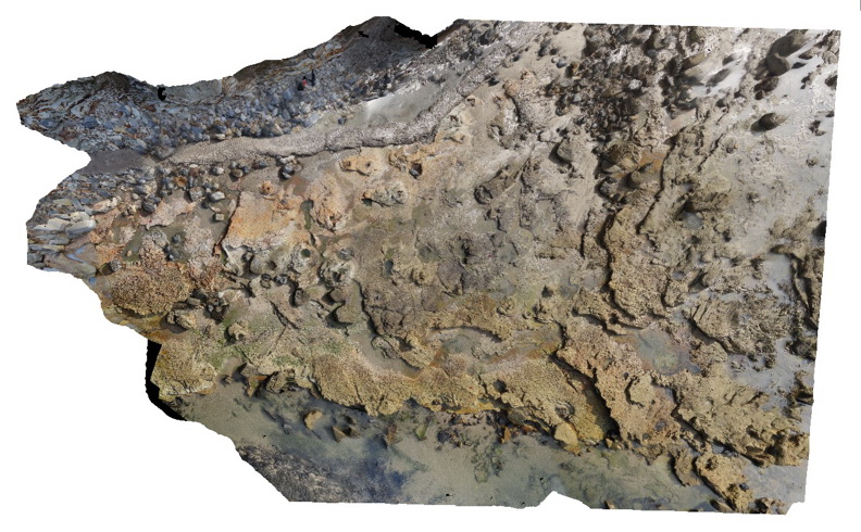
Coastal platform with numerous petrified/coalified tree stumps within tuffaceous rocks of the Permian Boolaroo Formation. Swansea, N.S.W. |
70.00 |
-33.08800000000 |
151.66470000000 |
0.000 |
petrified stumps, coalified stumps, volcanology, palaeontology |
tuff |
Ebor1 Map
 |
20 |
06/16/2015 5:35 p.m. |
3D terrestrial photogrammetric model |
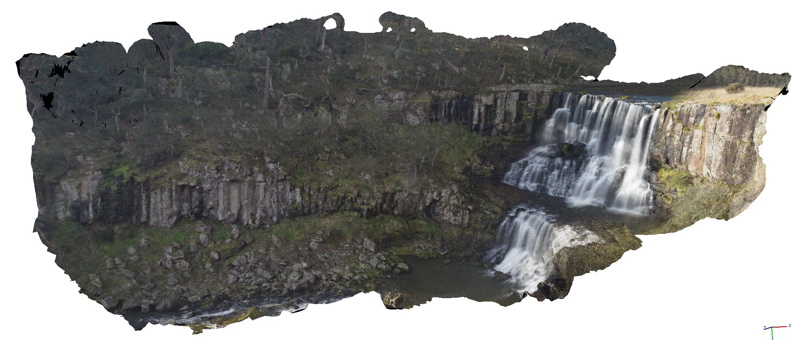
Basalt columns forming the escarpment at Ebor falls. Ebor Falls, N.S.W. |
80.00 |
-30.40222000000 |
152.34140000000 |
1238.000 |
columnar basalt, igneous, geomorphology |
basalt |
Merimbula11 Map
 |
20 |
01/01/9999 midnight |
3D terrestrial photogrammetric model |
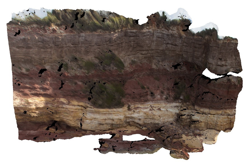
overview of large cliff face, showing layered sandstone beds. Merimbula, N.S.W. |
10.00 |
-36.89641000000 |
149.93002000000 |
2.000 |
sandstone, sedimentology, bedding |
sandstone |
Eden3 Map
 |
20 |
07/09/2015 9:04 a.m. |
3D terrestrial photogrammetric model |
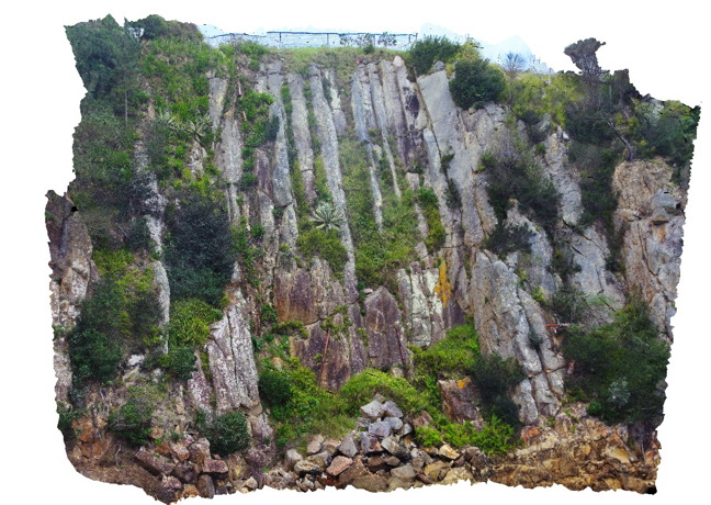
Cooling columns at the base of B.R. volcanics. Eden, N.S.W. |
25.00 |
-37.07526500000 |
149.91372100000 |
0.000 |
rhyolite, columnar joints, igneous, volcanology |
rhyolite |
Prices2 Map
 |
20 |
03/13/2015 9:12 a.m. |
3D terrestrial photogrammetric model |
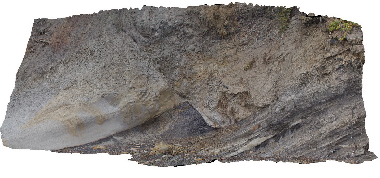
normal fault offsetting a contact between Triassic sandstone and siltstone. Prices Point, Tasman Peninsula, Tasmania. |
10.00 |
-43.03500200000 |
147.74783500000 |
0.500 |
normal fault, sandstone, siltstone, structure, sedimentology |
sandstone, siltstone |
Prices1 Map
 |
20 |
03/13/2015 9:12 a.m. |
3D terrestrial photogrammetric model |
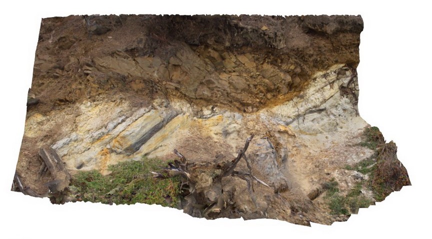
low angle thrust fault? Contact between Triassic fluvial sediments and overlying Jurassic dolerite. Prices Point, Tasman Peninsula, Tasmania. |
10.00 |
-43.03506500000 |
147.74806700000 |
0.500 |
thrust fault, fluvial sediments, structure |
dolerite, sandstone |
 AusGeol.org