Eildon10 Map
 |
5 |
07/18/2015 3:32 p.m. |
3D terrestrial photogrammetric model |
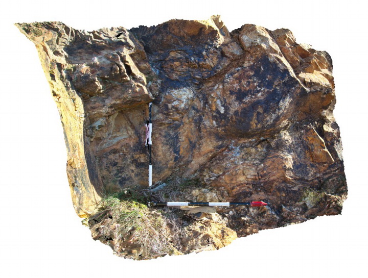
large load casts on the base of a bedding plane in Devonian sandstone of the Eildon Sandstone. Eildon, Vic. |
1.50 |
-37.22460000000 |
145.93092000000 |
275.000 |
load casts, sedimentology |
sandstone |
Eildon3 Map
 |
5 |
07/18/2015 3:27 p.m. |
3D terrestrial photogrammetric model |
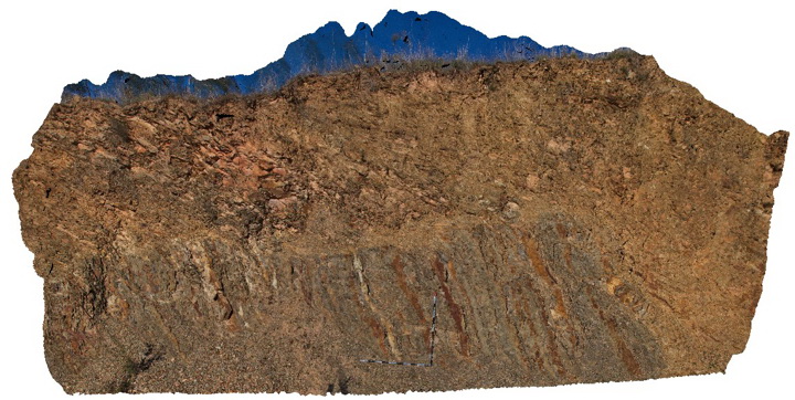
downslope creep in surface sandstone beds of the Devonian Norton Gully Sandstone. Eildon, Vic. |
8.00 |
-37.22004000000 |
145.84851000000 |
530.000 |
creep |
sandstone |
EildonFSP3 Map
 |
5 |
09/02/2015 2:59 p.m. |
Full Spherical Panorama |
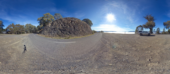
View of folded sandstone units of the Devonian Norton Gully Sandstone. Eildon, Vic. |
50.00 |
-37.20937000000 |
145.84433000000 |
590.000 |
folds, structure |
sandstone |
EildonFSP2 Map
 |
5 |
09/02/2015 2:59 p.m. |
Full Spherical Panorama |
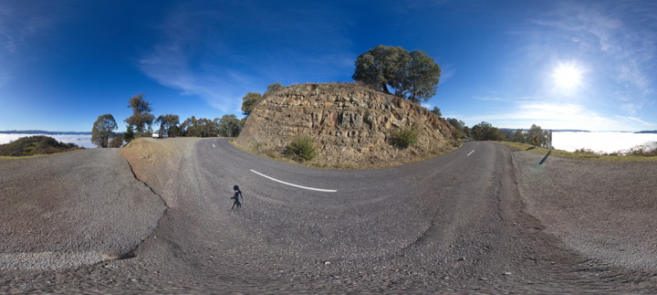
View of folded sandstone units of the Devonian Norton Gully Sandstone. Eildon, Vic. |
50.00 |
-37.20912000000 |
145.84433000000 |
590.000 |
folds, structure |
sandstone |
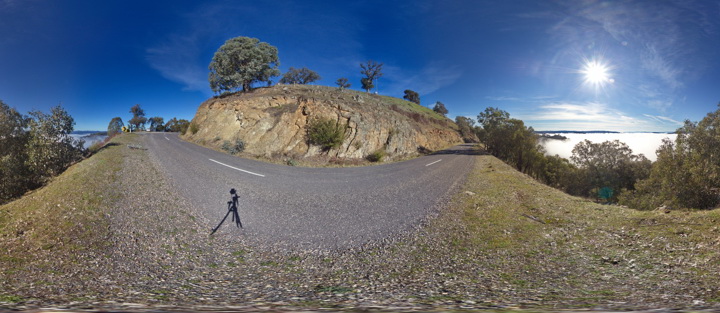
EildonFSP1 Map
 |
5 |
09/02/2015 2:59 p.m. |
Full Spherical Panorama |
View of folded sandstone units of the Devonian Norton Gully Sandstone. Eildon, Vic. |
50.00 |
-37.20893000000 |
145.84412000000 |
590.000 |
folds, structure |
sandstone |
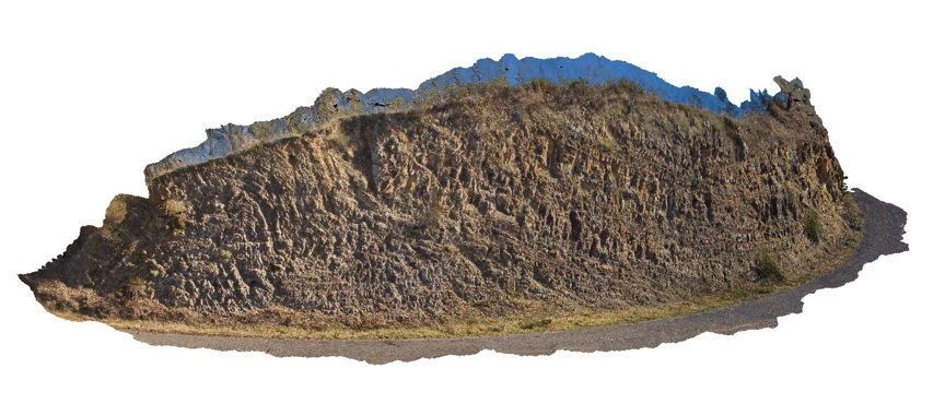
Eildon2 Map
 |
5 |
07/18/2015 3:26 p.m. |
3D terrestrial photogrammetric model |
bedding and folds in sandstone units of the Devonian Norton Gully Sandstone. Eildon, Vic. |
30.00 |
-37.20935000000 |
145.84427000000 |
590.000 |
folds, structure |
sandstone |
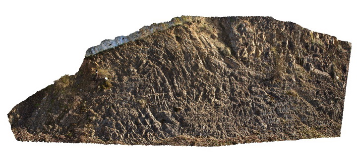
Eildon1 Map
 |
5 |
08/04/2015 11:57 a.m. |
3D terrestrial photogrammetric model |
folds in fine grained thinly bedded sandstone units of the Devonian Norton Gully Sandstone. Eildon, Vic. |
15.00 |
-37.20941000000 |
145.84427000000 |
590.000 |
fold, structure |
sandstone |
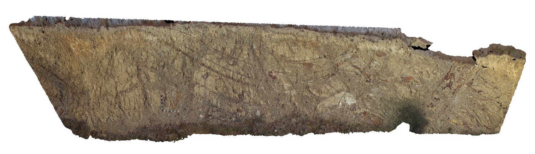
MansfieldRd5 Map
 |
5 |
06/17/2015 10:29 a.m. |
3D terrestrial photogrammetric model |
open fold in bedded sandstone of the Devonian Norton Gully Sandstone. Mansfield Road, Vic. |
20.00 |
-37.02049000000 |
145.89662000000 |
332.000 |
fold, structure |
sandstone |
MansfieldRd4 Map
 |
5 |
06/17/2015 10:28 a.m. |
3D terrestrial photogrammetric model |
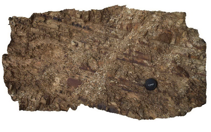
detail of bedding/cleavage relationship in Devonian Norton Gully Sandstone. Mansfield Road, Vic. |
1.50 |
-37.02679000000 |
145.95461000000 |
337.000 |
cleavage, bedding, structure |
sandstone |
MansfieldRd3 Map
 |
5 |
06/17/2015 10:26 a.m. |
3D terrestrial photogrammetric model |
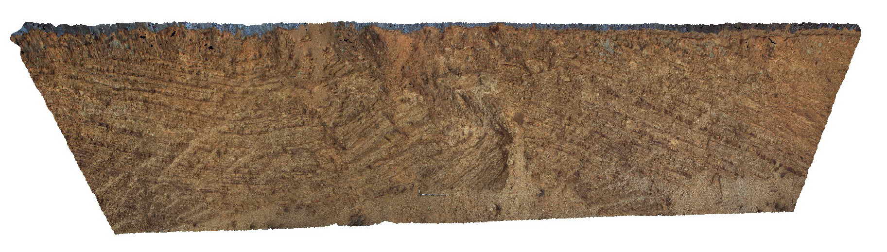
folded and faulted sandstone units of the Devonian Norton Gully Sandstone. Mansfield Road, Vic. |
20.00 |
-37.02679000000 |
145.95461000000 |
337.000 |
folds, faults, structure |
sandstone |
MansfieldRd2 Map
 |
5 |
06/17/2015 10:25 a.m. |
3D terrestrial photogrammetric model |
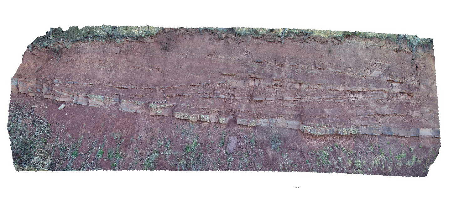
Large scale cross stratification in interbedded sandstone and mudstone of the Devonian-Carboniferous Snowy Plains Formation. Mansfield Road, Vic. |
20.00 |
-36.93927000000 |
146.20639000000 |
900.000 |
cross stratification, sedimentology |
mudstone, sandstone |
MansfieldRd2 Map
|
5 |
06/17/2015 10:25 a.m. |
3D terrestrial photogrammetric model |
Large scale cross stratification in interbedded sandstone and mudstone of the Devonian-Carboniferous Snowy Plains Formation. Mansfield Road, Vic. |
20.00 |
-36.93927000000 |
146.20639000000 |
900.000 |
cross stratification, sedimentology |
mudstone, sandstone |
MansfieldRd1 Map
 |
5 |
06/17/2015 10:24 a.m. |
3D terrestrial photogrammetric model |
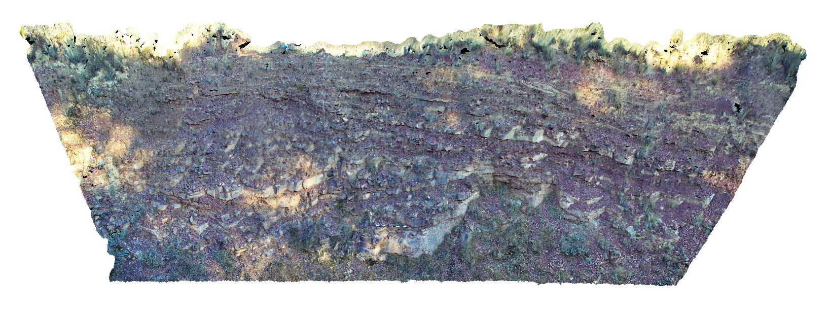
low angle fault in bedded sandstone and mudstone of the Devonian to Carboniferous Snowy Plains Formation. Mansfield Road, Vic. |
15.00 |
-36.88522000000 |
146.30833000000 |
900.000 |
fault, structure, sedimentology |
sandstone, mudstone |
MansfieldRd1 Map
|
5 |
06/17/2015 10:24 a.m. |
3D terrestrial photogrammetric model |
low angle fault in bedded sandstone and mudstone of the Devonian to Carboniferous Snowy Plains Formation. Mansfield Road, Vic. |
15.00 |
-36.88522000000 |
146.30833000000 |
900.000 |
fault, structure, sedimentology |
sandstone, mudstone |
PowersFSP1 Map
 |
5 |
06/17/2015 10:39 a.m. |
Full Spherical Panorama |
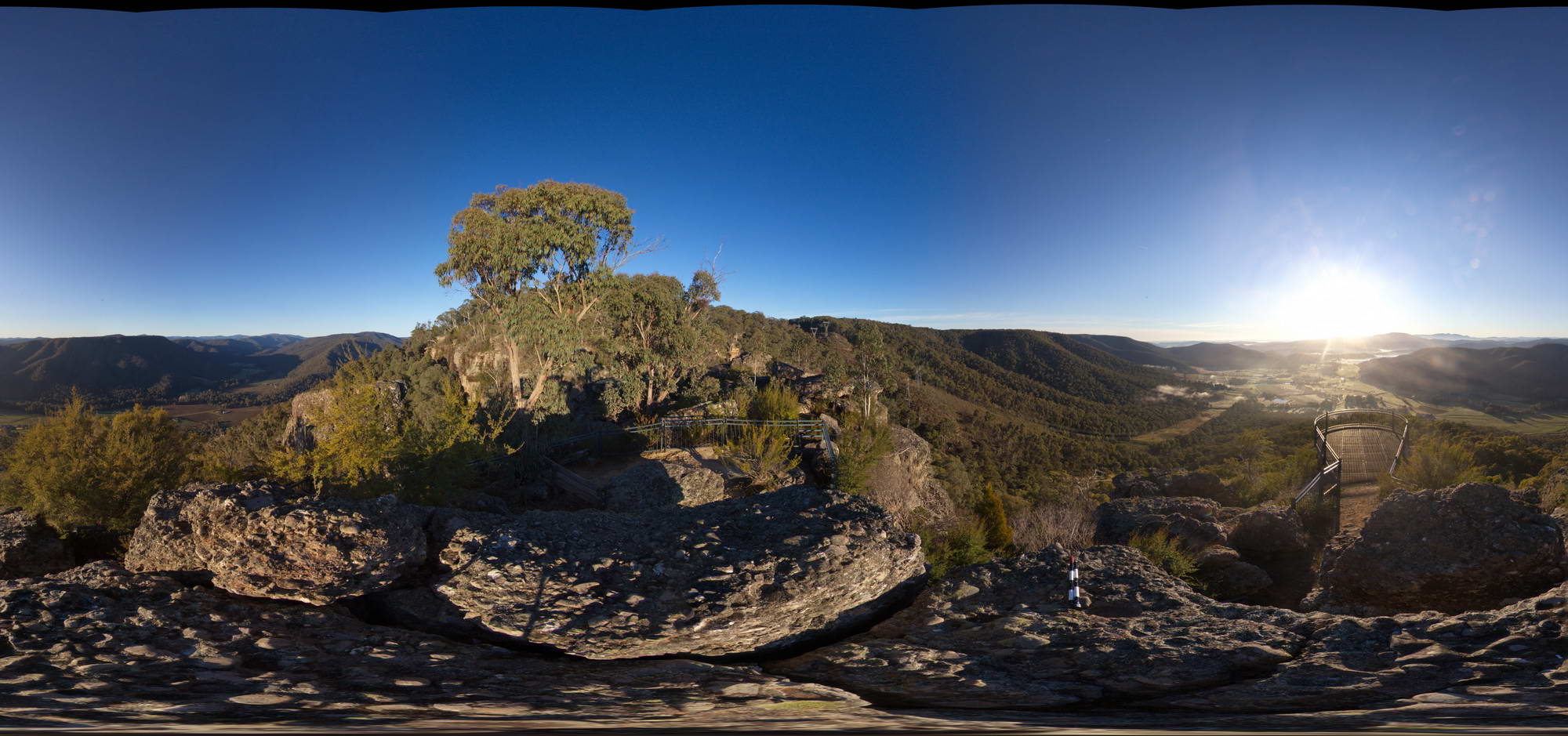
View of conglomerate of the Devonian-Carboniferous Snowy Plains Formation at Powers lookout, Vic. |
50.00 |
-36.84502000000 |
146.37177000000 |
750.000 |
sedimentology |
conglomerate |
Powers1 Map
 |
5 |
06/17/2015 10:38 a.m. |
3D terrestrial photogrammetric model |
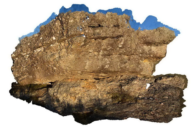
conglomerate of the Devonian-Carboniferous Snowy Plains Formation. Powers Lookout, VIC. |
5.00 |
-36.84499000000 |
146.37143000000 |
750.000 |
sedimentology |
conglomerate |
RoseRiver1 Map
 |
5 |
06/17/2015 10:39 a.m. |
3D terrestrial photogrammetric model |
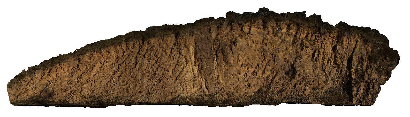
folds and faults thickly bedded sandstone of the Silurian Cobbabbah Group. Rose River road, VIC. |
20.00 |
-36.82015000000 |
146.58731000000 |
365.000 |
folds, faults, structure |
sandstone |
Nugnug7 Map
 |
5 |
01/01/9999 midnight |
3D terrestrial photogrammetric model |
tectonic melange in Ordovician Pinnak Sandstone within the Nug Nug Shear Zone. Nugnug, Vic. |
1.00 |
-36.68078000000 |
146.67796000000 |
240.000 |
melange, mylonite, shear zone, structure |
melange |
Nugnug6 Map
 |
5 |
01/01/9999 midnight |
3D terrestrial photogrammetric model |
tectonic melange in Ordovician Pinnak Sandstone within the Nug Nug Shear Zone. Nugnug, Vic. |
0.40 |
-36.68078000000 |
146.67798000000 |
240.000 |
melange, mylonite, shear zone, structure |
melange |
Nugnug5 Map
 |
5 |
01/01/9999 midnight |
3D terrestrial photogrammetric model |
mylonite in tectonic melange in Ordovician Pinnak Sandstone within the Nug Nug Shear Zone. Nugnug, Vic. |
1.00 |
-36.68079000000 |
146.67789000000 |
240.000 |
mylonite, melange, shear zone, structure |
melange |
Nugnug4 Map
 |
5 |
01/01/9999 midnight |
3D terrestrial photogrammetric model |
tectonic melange in Ordovician Pinnak Sandstone within the Nug Nug Shear Zone. Nugnug, Vic. |
0.30 |
-36.68085000000 |
146.67783000000 |
240.000 |
melange, mylonite, shear zone, structure |
melange |
Nugnug3 Map
 |
5 |
01/01/9999 midnight |
3D terrestrial photogrammetric model |
tectonic melange in Ordovician Pinnak Sandstone within the Nug Nug Shear Zone. Nugnug, Vic. |
1.00 |
-36.68085000000 |
146.67783000000 |
240.000 |
melange, mylonite, structure |
melange |
Nugnug2 Map
 |
5 |
01/01/9999 midnight |
3D terrestrial photogrammetric model |
deformation (soft sediment?) in sandstone of the Ordovician Pinnak Sandstone. Nugnug, Vic. |
0.50 |
-36.68110000000 |
146.67729000000 |
240.000 |
folds, structure, sedimentology |
sandstone |
Nugnug1 Map
 |
5 |
01/01/9999 midnight |
3D terrestrial photogrammetric model |
tectonic melange in Ordovician Pinnak Sandstone within the Nug Nug Shear Zone. Nugnug, Vic. |
1.00 |
-36.68114000000 |
146.67752000000 |
240.000 |
melange, mylonite, shear zone, structure |
melange |
Kiewa5 Map
 |
5 |
06/17/2015 10:22 a.m. |
3D terrestrial photogrammetric model |
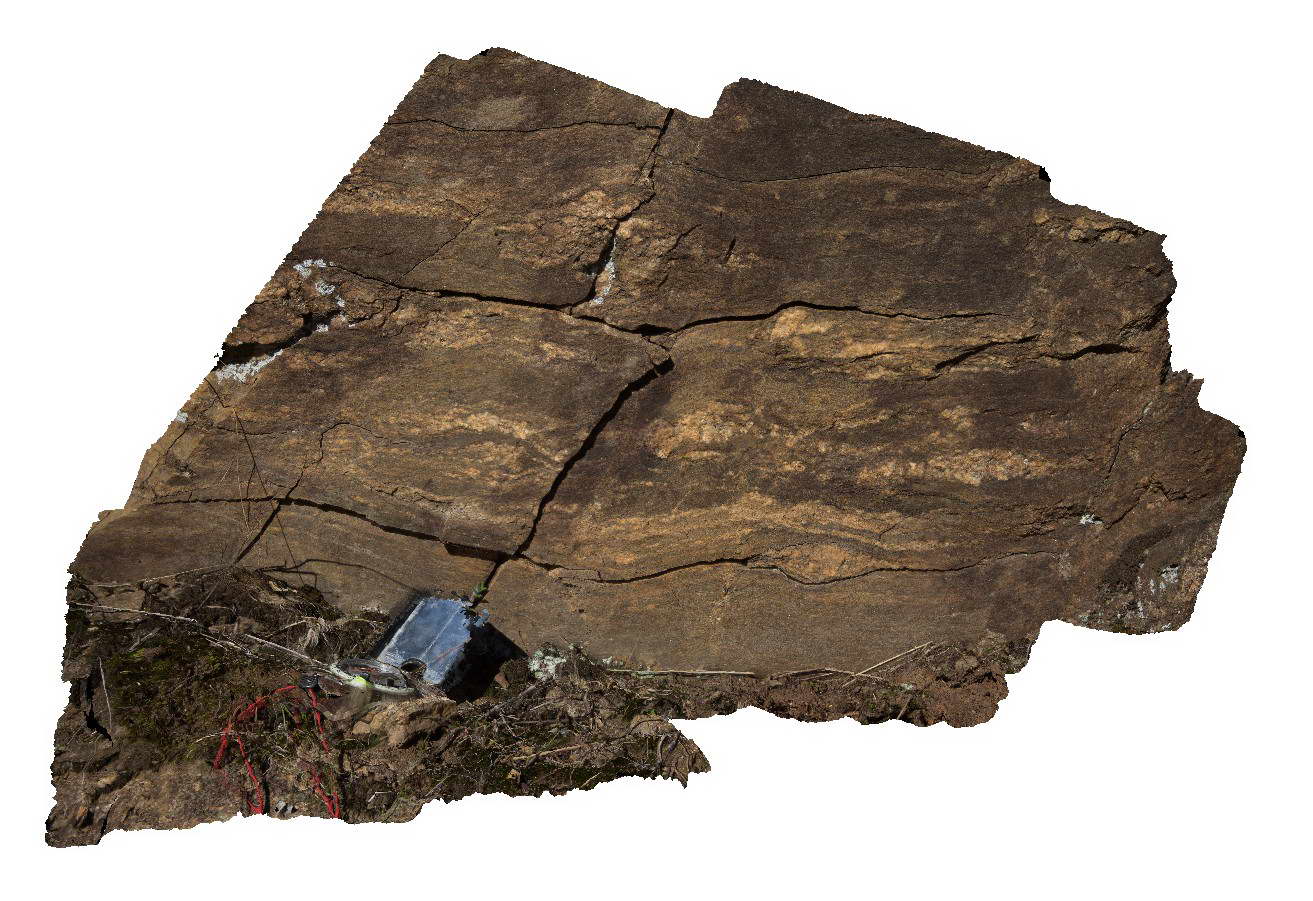
Migmatitic segregations in gneissic rocks of the Silurian Omeo Metamorphic Complex. Kiewa, Vic. |
1.00 |
-36.72432166000 |
147.12949028000 |
711.000 |
migmatite, structure, igneous |
migmatite |
 AusGeol.org