LohreysRd3 Map
 |
0 |
02/23/2016 9:19 a.m. |
3D terrestrial photogrammetric model |
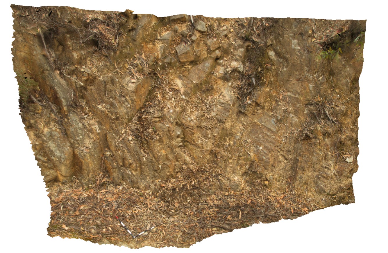
inclined anticline in Mathinna Group sediments, Catos Rd, Tasmania. |
4.50 |
-41.50421000000 |
148.11351000000 |
-9999.000 |
inclined fold, anticline, deformation |
siltstone |
LohreysRd4 Map
 |
0 |
02/23/2016 9:19 a.m. |
3D terrestrial photogrammetric model |
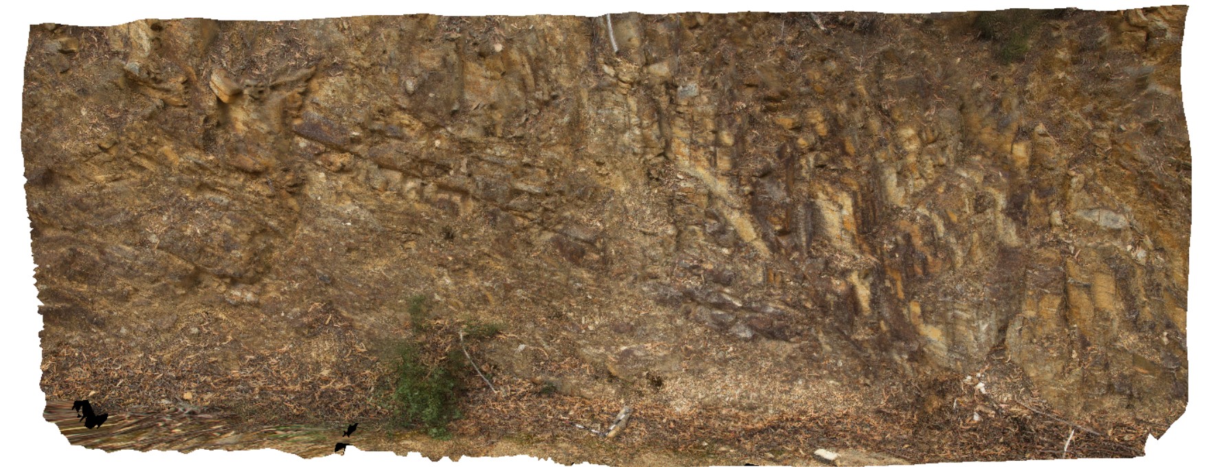
faulted synform and antiform in Mathinna Group sediments, Catos Rd, Tasmania. |
10.00 |
-41.50368000000 |
148.11310000000 |
-9999.000 |
synform, antiform, folding, fault |
siltstone |
LohreysRd5 Map
 |
0 |
04/07/2016 1:55 p.m. |
3D terrestrial photogrammetric model |
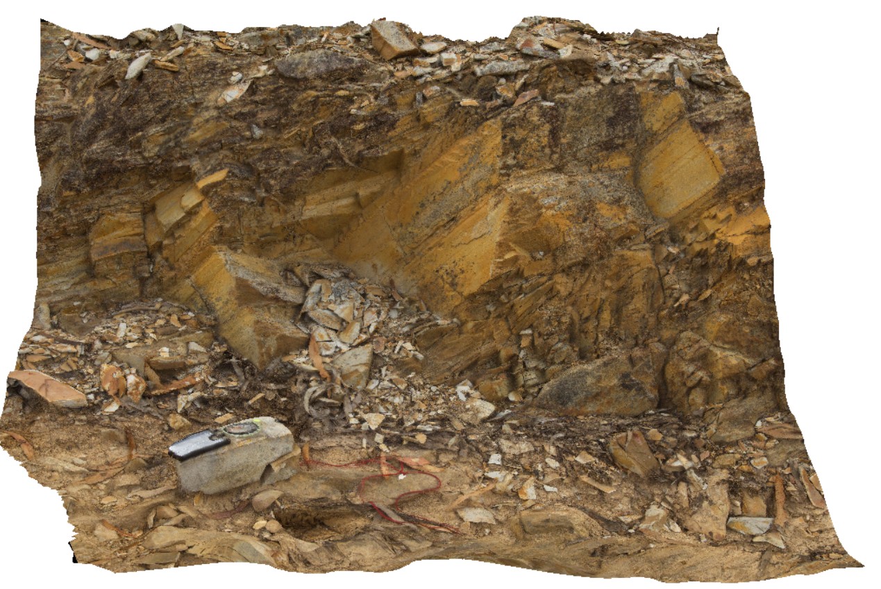
small outcrop showing bedding, cleavage and jointing in Mathinna Group sediments. Catos Rd, Tasmania. |
0.60 |
-41.50318000000 |
148.11304000000 |
-9999.000 |
cleavage, jointing |
siltstone |
LohreysRd6 Map
 |
0 |
04/07/2016 1:56 p.m. |
3D terrestrial photogrammetric model |
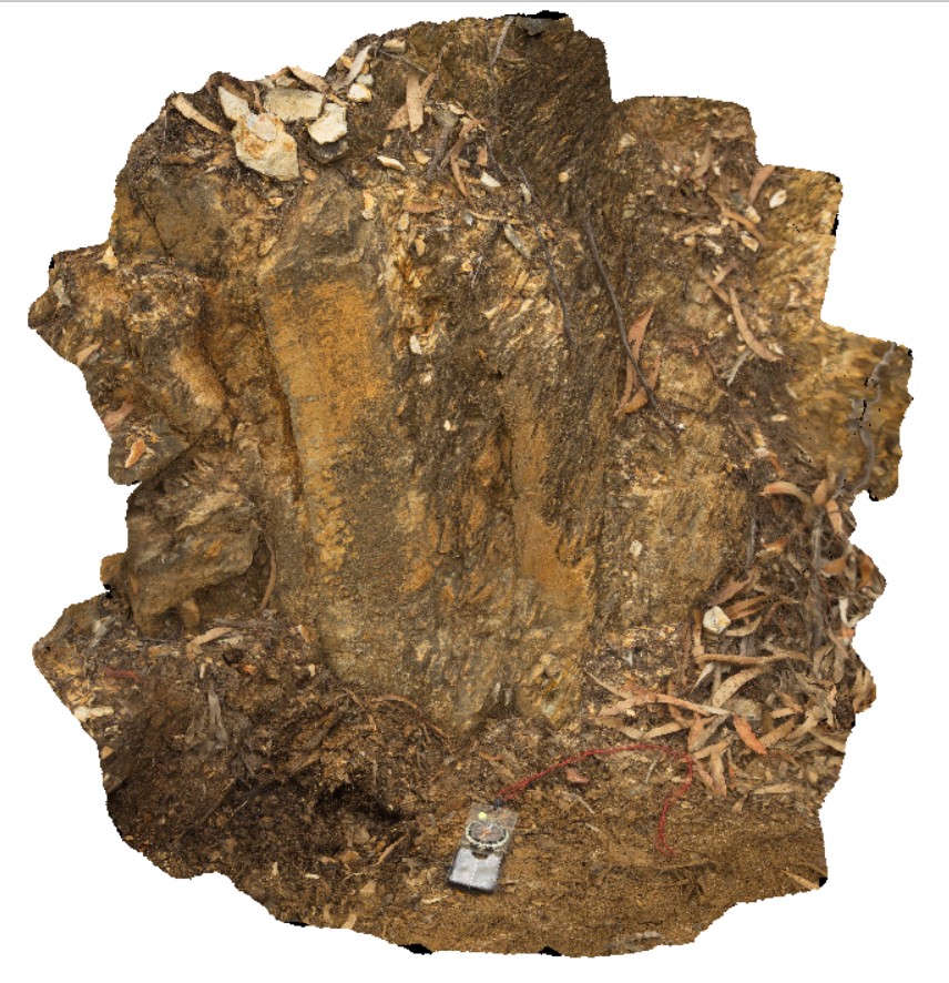
view of bedding and cleavage relationship in fold limb. Catos Rd, Tasmania. |
0.60 |
-41.50292000000 |
148.11360000000 |
-9999.000 |
cleavage, fold limb, bedding |
siltstone |
LohreysRd7 Map
 |
0 |
04/07/2016 1:56 p.m. |
3D terrestrial photogrammetric model |
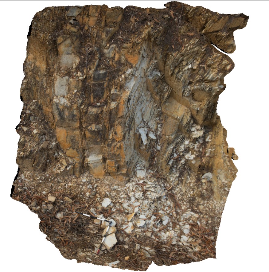
bedding to cleavage relationships in Mathinna Group sediments, Catos Rd, Tasmania. |
2.00 |
-41.50263000000 |
148.11432000000 |
-9999.000 |
cleavage, bedding, fold |
siltstone |
LohreysRd8 Map
 |
0 |
04/07/2016 1:56 p.m. |
3D terrestrial photogrammetric model |
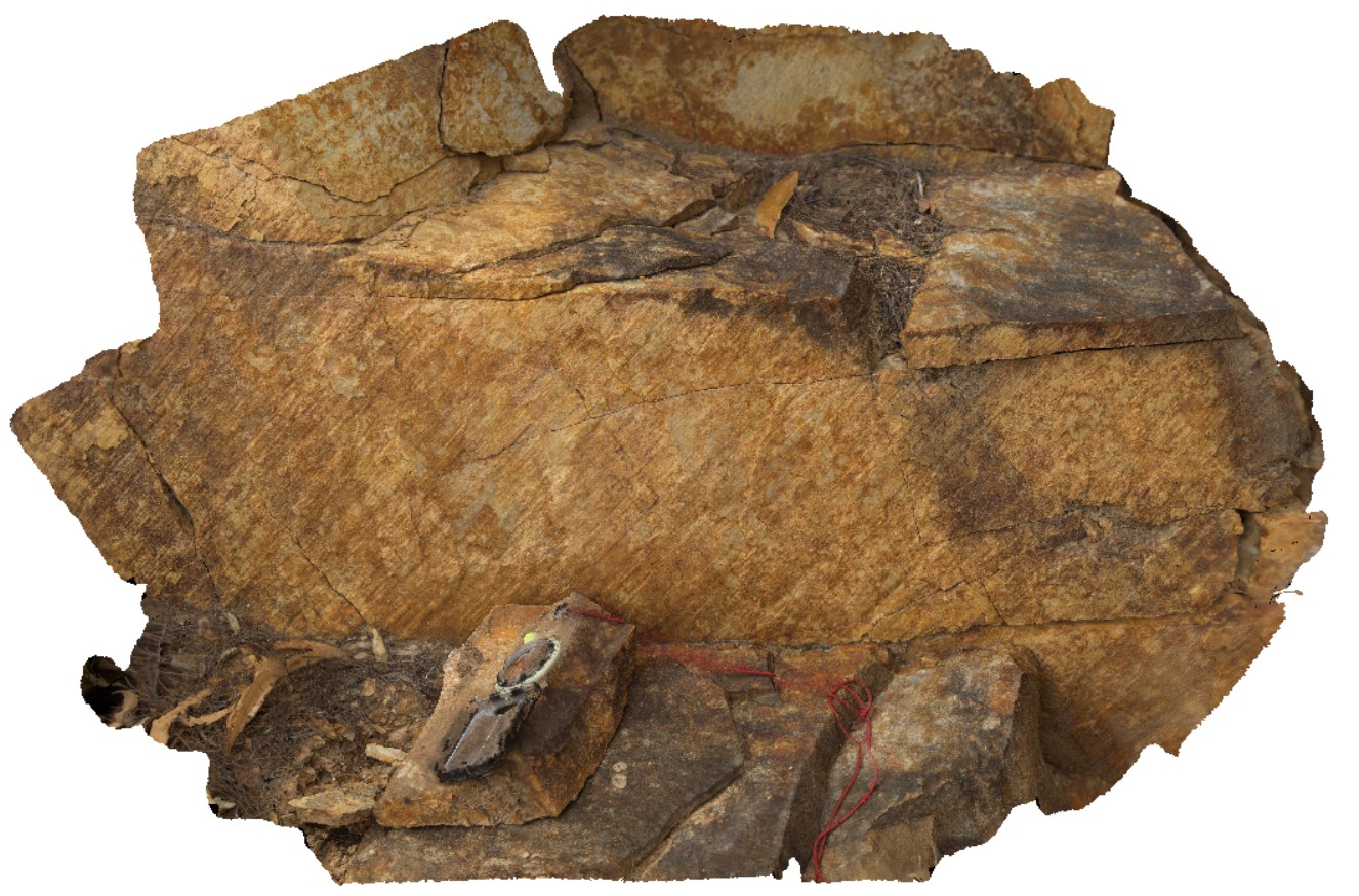
fault striations and steps on surface. Catos Rd, Tasmania. |
0.40 |
-41.50199000000 |
148.11554000000 |
-9999.000 |
fault surface, striations, fault steps |
sandstone |
LohreysRd9 Map
 |
0 |
04/07/2016 1:55 p.m. |
3D terrestrial photogrammetric model |
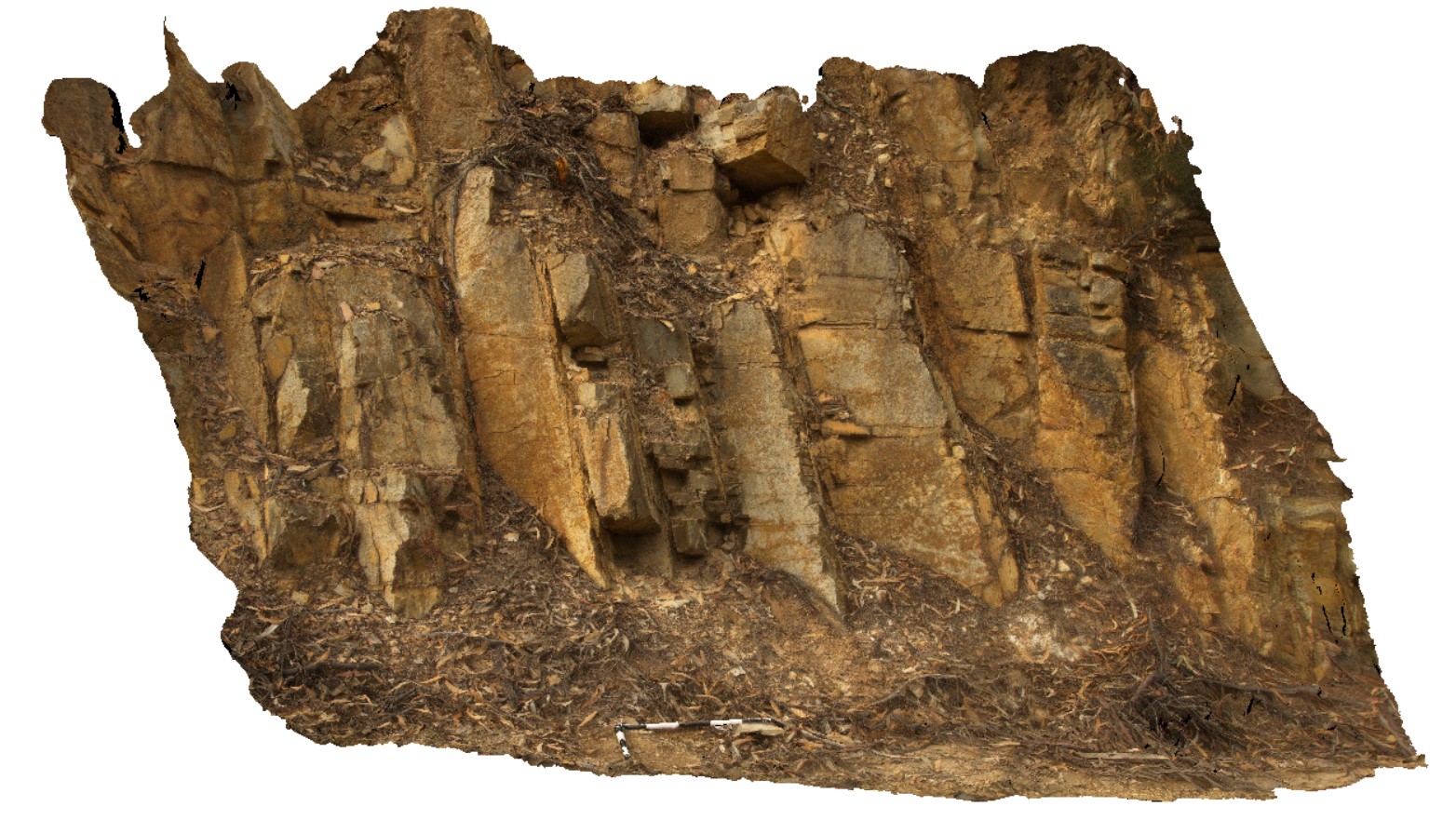
bedding, jointing and cleavage relationships in Mathinna Group sediments, Catos Rd, Tasmania. |
2.50 |
-41.50143000000 |
148.11740000000 |
-9999.000 |
cleavage, bedding, joint |
sandstone |
TimberCreek1 Map
 |
0 |
06/18/2016 noon |
3D terrestrial photogrammetric model |
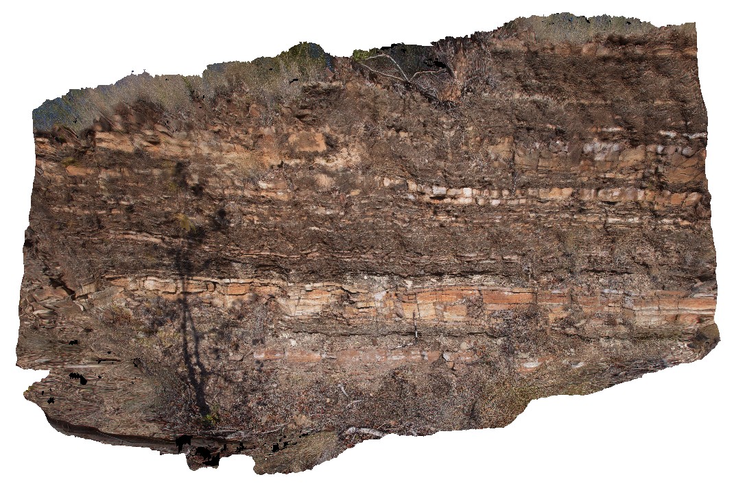
view of shallowly dipping sandstone with thick beds at the bottom and laminated siltstone at the top. Cliff exposure near water tanks, Timber Creek settlement, N.T. |
8.50 |
-15.65278000000 |
130.46318000000 |
-9999.000 |
bedded sandstone, shallow dip, sedimentology, facies grading, graded bedding |
sandstone |
TimberCreek2 Map
 |
0 |
06/18/2016 noon |
3D terrestrial photogrammetric model |
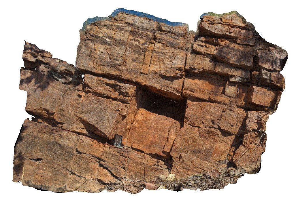
cross beds in quartzite. Cliff exposure near water tanks, Timber Creek settlement, N.T. |
1.40 |
-15.65414000000 |
130.46182000000 |
-9999.000 |
cross bedding, quartzite, sedimentology |
quartzite |
TimberCreek3 Map
 |
0 |
06/18/2016 noon |
3D terrestrial photogrammetric model |
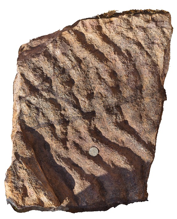
view of preserved ripple marks on sandstone bedding plane. Cliff exposure near water tanks, Timber Creek settlement, N.T. |
0.60 |
-15.65383000000 |
130.46185000000 |
-9999.000 |
ripple marks, sandstone, sedimentology |
sandstone |
TimberCreekFSP1 Map
 |
0 |
06/18/2016 noon |
Full Spherical Panorama |
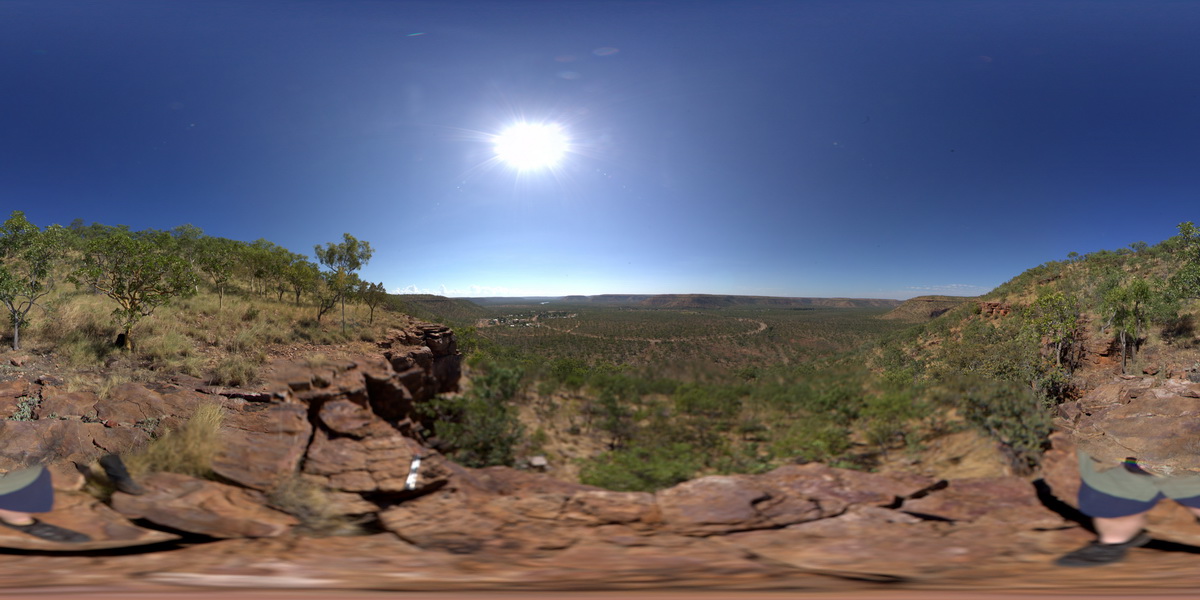
view from hill of surrounding valley, showing flat-lying cross bedded quartzite unit and overlying interbedded sandstone and siltstones. Timber Creek, W.A. |
2000.00 |
-15.65412000000 |
130.46182000000 |
-9999.000 |
quartzite, sedimentology |
quartzite |
TOM1 Map
 |
0 |
07/21/2016 4:53 p.m. |
3D terrestrial photogrammetric model |
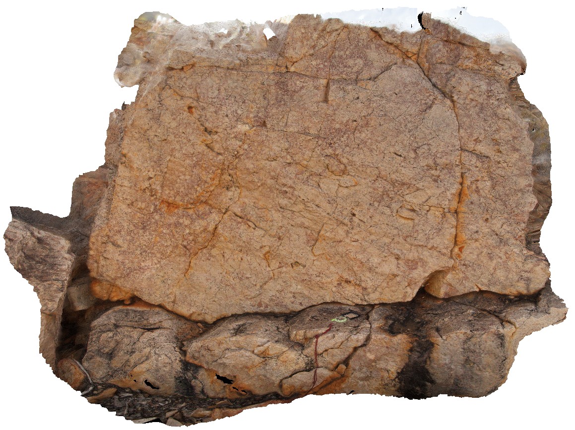
brecciated quartzite unit at Bunka Bunka Station. Cherty, cement in breccia. Monomict quartzite clastic. Stuart Highway, Bunka Bunka Station. N.T. |
2.20 |
-18.79355300000 |
134.02839200000 |
319.490 |
quartzite, breccia, sedimentology, metamorphic |
quartzite |
TomPrice1 Map
 |
0 |
05/29/2016 noon |
3D terrestrial photogrammetric model |
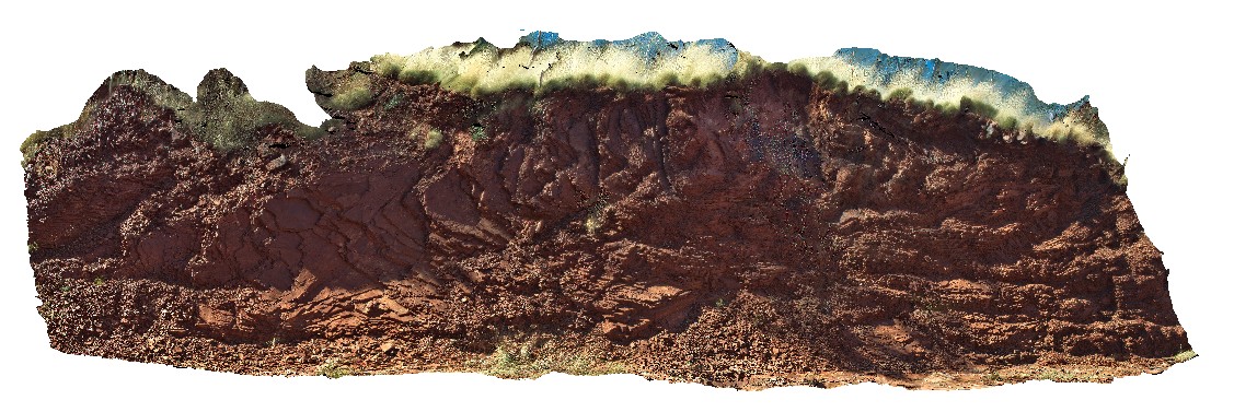
oblique section through open folds in the Mount McRae Shale on the western side of Mount Nameless, Tom Price. W.A. |
16.00 |
-22.72532000000 |
117.74970000000 |
-9999.000 |
open folds, Hamersley Group, Mount McRae Shale, structure |
shale |
FingalTas1 Map
 |
0 |
01/01/9999 midnight |
3D terrestrial photogrammetric model |
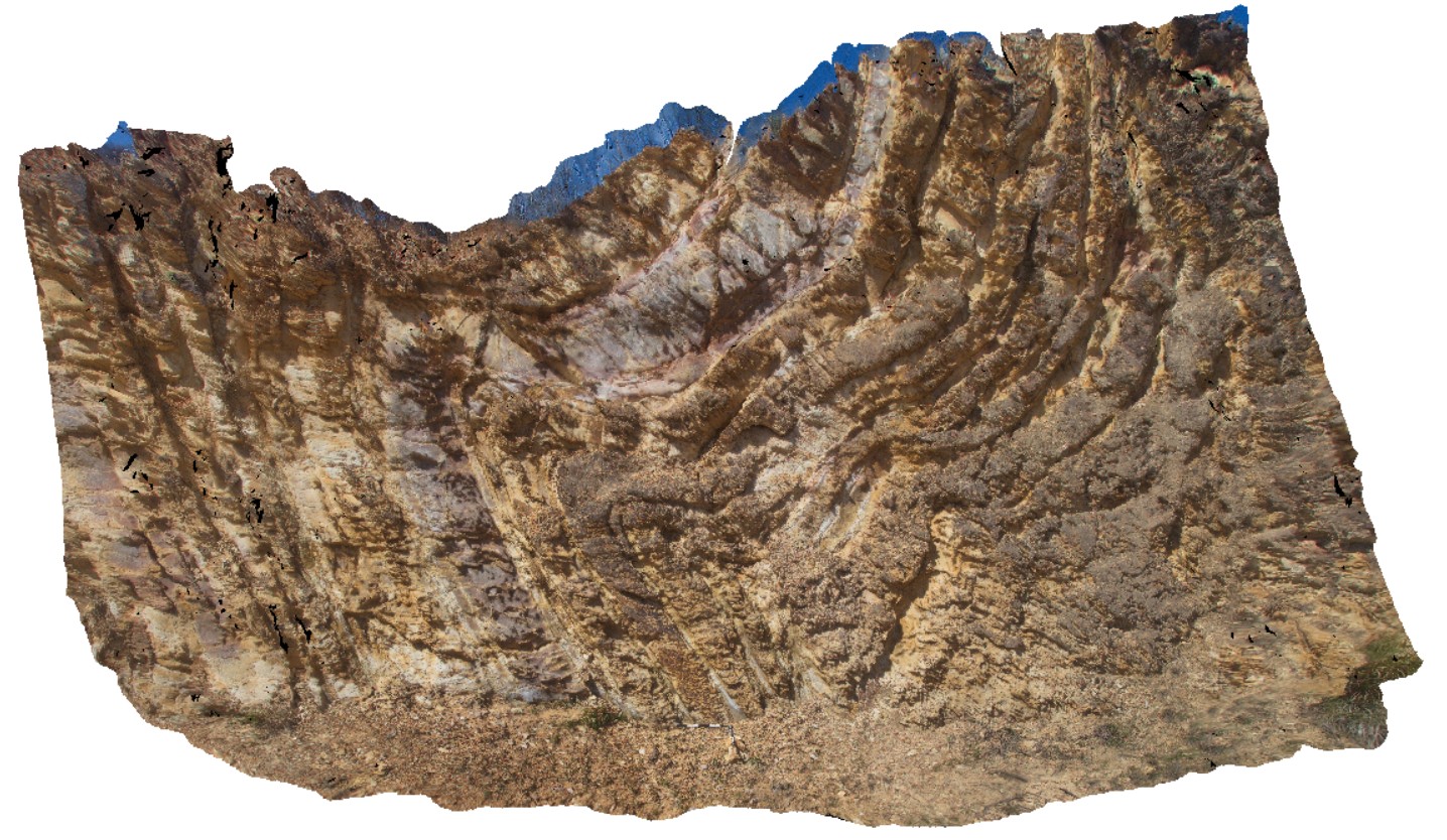
folds with well defined cleavage in Mathinna Group sediments, Esk Highway. Fingal, Tas. |
8.00 |
-41.65031000000 |
147.93181000000 |
-9999.000 |
fold, cleavage |
sandstone |
FingalTas2 Map
 |
0 |
01/01/9999 midnight |
3D terrestrial photogrammetric model |
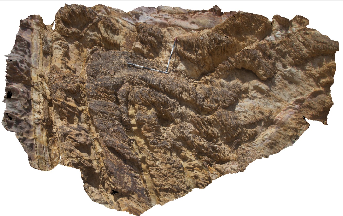
detail of inclined antiform in sandstone layers. Mathinna Group sediments. Fingal, Tas. |
4.00 |
-41.65031000000 |
147.93181000000 |
-9999.000 |
anticline, inclined fold |
sandstone |
FingalTas3 Map
 |
0 |
01/01/9999 midnight |
3D terrestrial photogrammetric model |
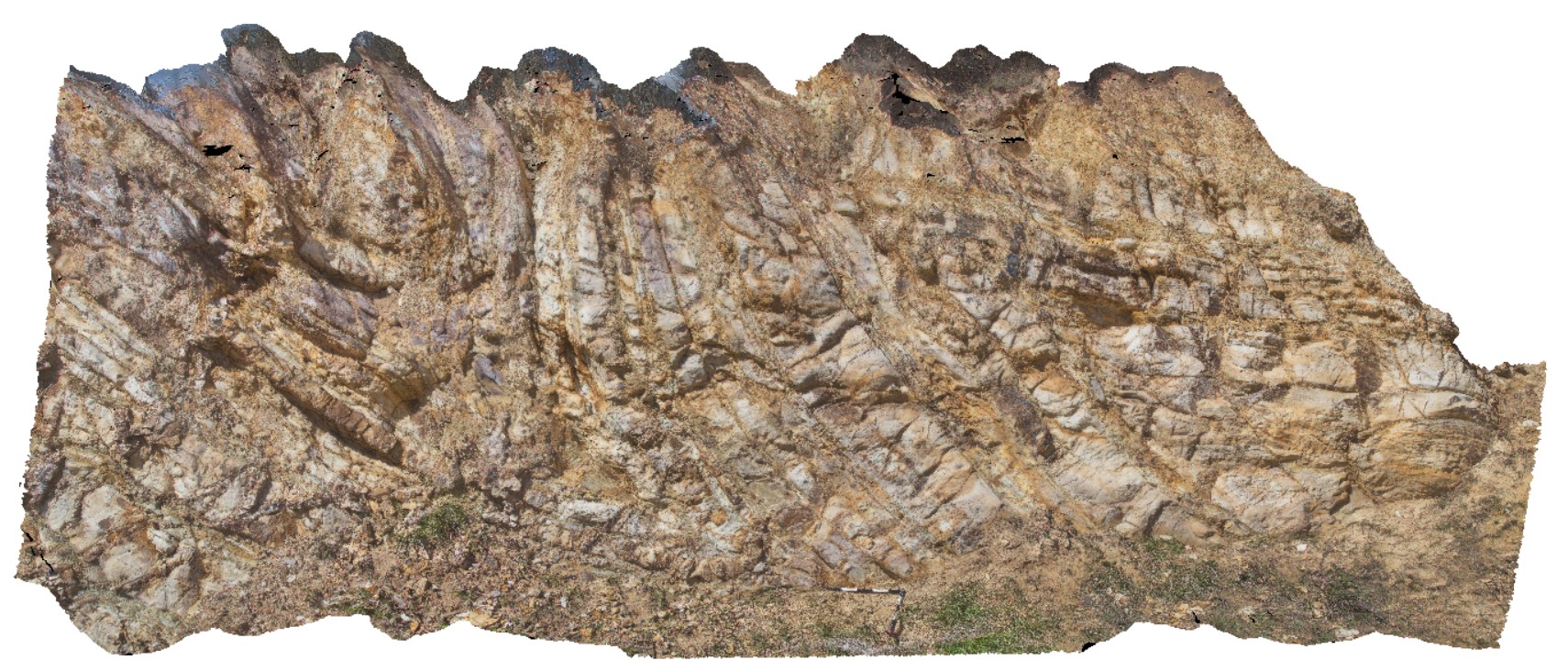
folds with inclined axial surfaces in Mathinna Group sediments. Esk Highway, Tasmanian. |
8.00 |
-41.65028000000 |
147.93211000000 |
-9999.000 |
inclined fold, axial surface |
sandstone |
FingalTas4 Map
 |
0 |
01/01/9999 midnight |
3D terrestrial photogrammetric model |
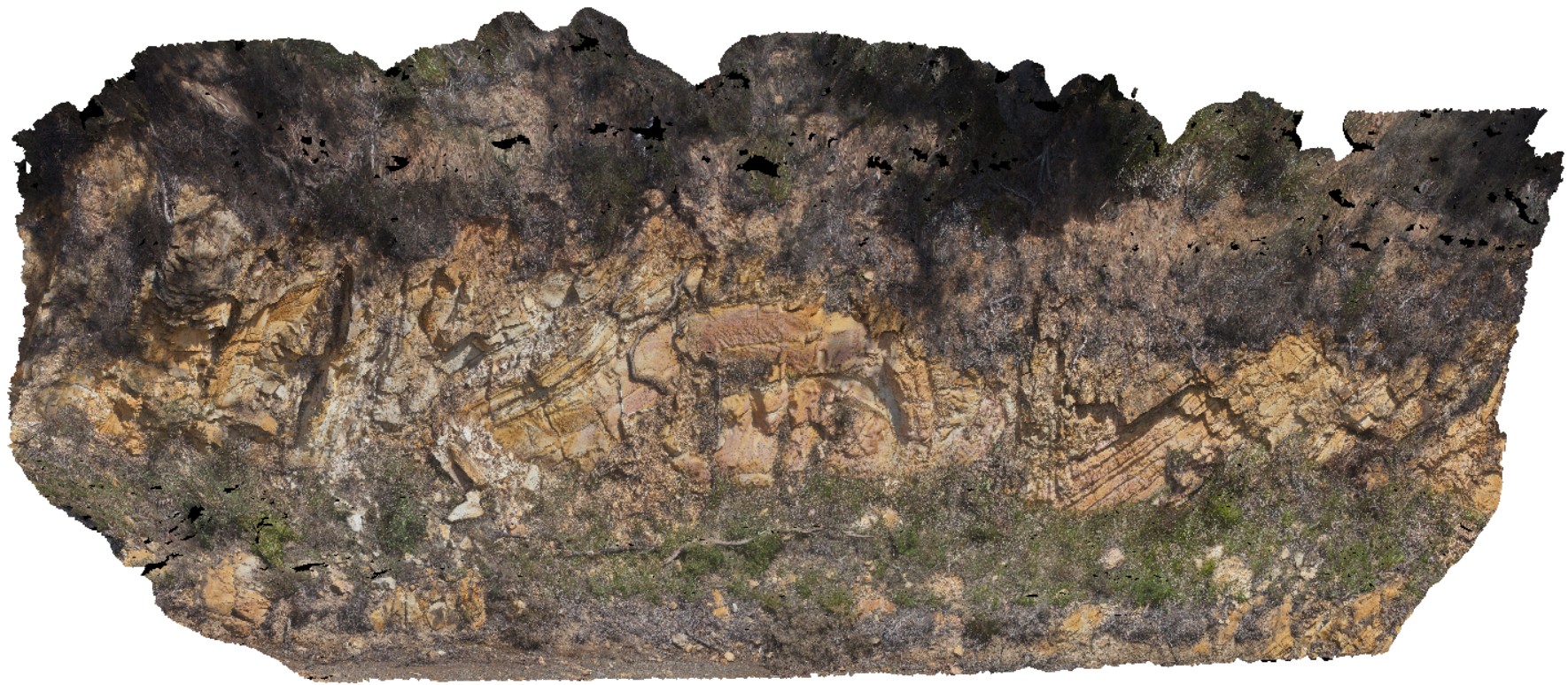
view of Chris Powell's folds at Tallochgoren. Esk Highway, Tasmania. |
15.00 |
-41.65804000000 |
147.91606000000 |
-9999.000 |
fold, synform, antiform |
sandstone |
FingalTas5 Map
 |
0 |
01/01/9999 midnight |
3D terrestrial photogrammetric model |
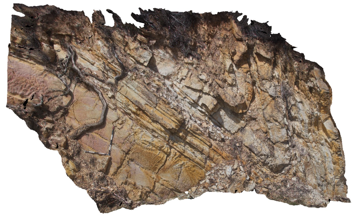
detail of antiform fold, with inclined axial plane, in road cutting. Esk Highway, Tasmania. From image Fingal4. |
6.00 |
-41.65804000000 |
147.91606000000 |
-9999.000 |
axial plane, fold, structure |
sandstone |
FingalTas6 Map
 |
0 |
01/01/9999 midnight |
3D terrestrial photogrammetric model |
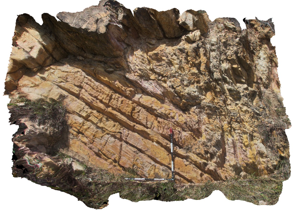
detail of synform fold, with inclined axial plane, in road cutting. Esk Highway, Tasmania. From image Fingal4. |
6.50 |
-41.65800000000 |
147.91608000000 |
-9999.000 |
inclined fold, axial plane |
sandstone |
TomPrice2 Map
 |
0 |
05/29/2016 noon |
3D terrestrial photogrammetric model |
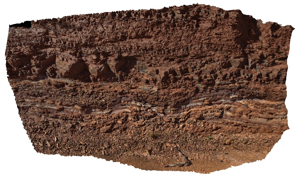
view of open folds in interbedded Shale and banded Iron on the western side of Mount Nameless, Tom Price. W.A. |
5.50 |
-22.72650000000 |
117.74983000000 |
-9999.000 |
shale, open folds, structure, folding, Hamersley Group |
shale |
Oatlands2 Map
 |
0 |
02/23/2016 9:26 a.m. |
3D terrestrial photogrammetric model |
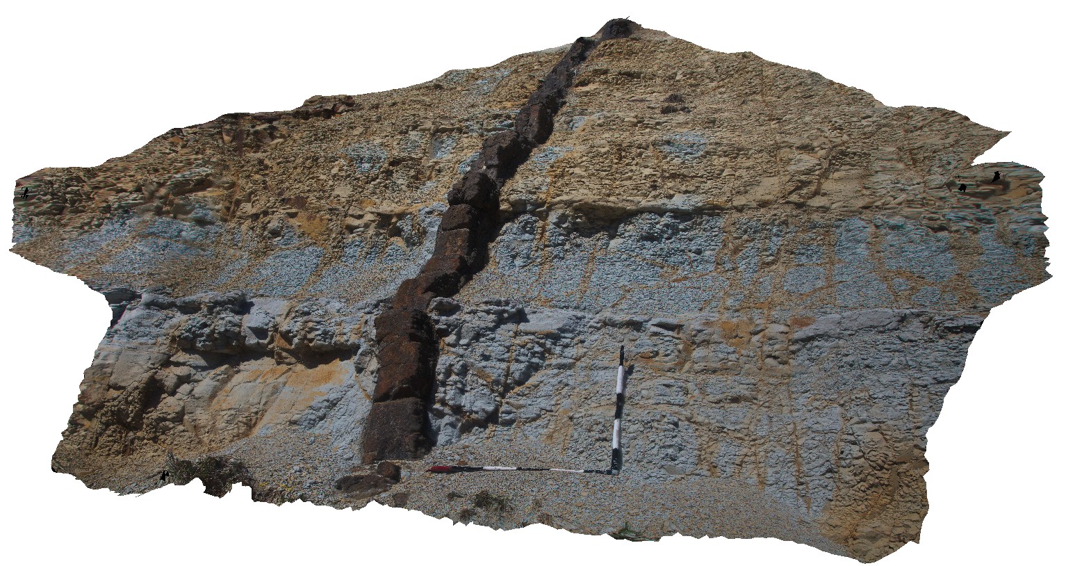
Jurassic? Dyke cross-cutting fine-grained Triassic sediments. Oatlands, Tasmania. |
2.50 |
-42.34642000000 |
147.33798000000 |
-9999.000 |
intrusive contact, dyke |
mudstone, dolerite |
OlaryUAV2 Map
 |
0 |
09/27/2015 6:50 p.m. |
3D UAV photogrammetric model |
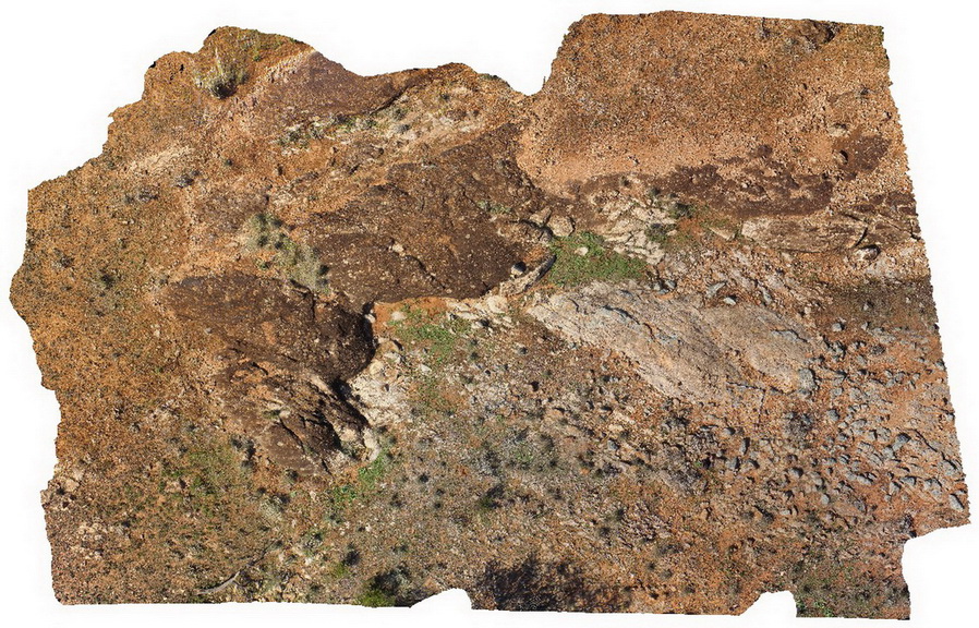
aerial view of Old Boolcoomata Conglomerate Member, showing interbedded conglomerate with pebbly sandstone and siltstone. Old Boolcoomata Station. Olary. S.A. |
0.00 |
-32.09433000000 |
140.27747000000 |
-9999.000 |
conglomerate, sedimentology |
conglomerate |
OatlandsGiga1 Map
 |
0 |
02/23/2016 9:26 a.m. |
Gigapixel image |
unconformity, showing Triassic Sediments overlain by younger, unconsolidated sediments. Oatlands, Tasmania. |
0.00 |
-42.42698000000 |
147.25957000000 |
-9999.000 |
unconformity |
sandstone, talus |
StyxRd1 Map
 |
0 |
02/23/2016 9:29 a.m. |
3D terrestrial photogrammetric model |
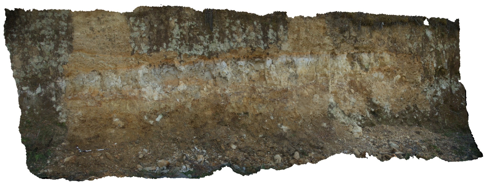
regolith profile, showing fine colluvial scree overlying silty-clay (aeolian), overlying coarser colluvial sediments. Styx road, Tasmania. |
7.00 |
-42.80639000000 |
146.59326000000 |
-9999.000 |
colluvium, scree |
scree |
StyxRd2 Map
 |
0 |
02/23/2016 9:29 a.m. |
3D terrestrial photogrammetric model |
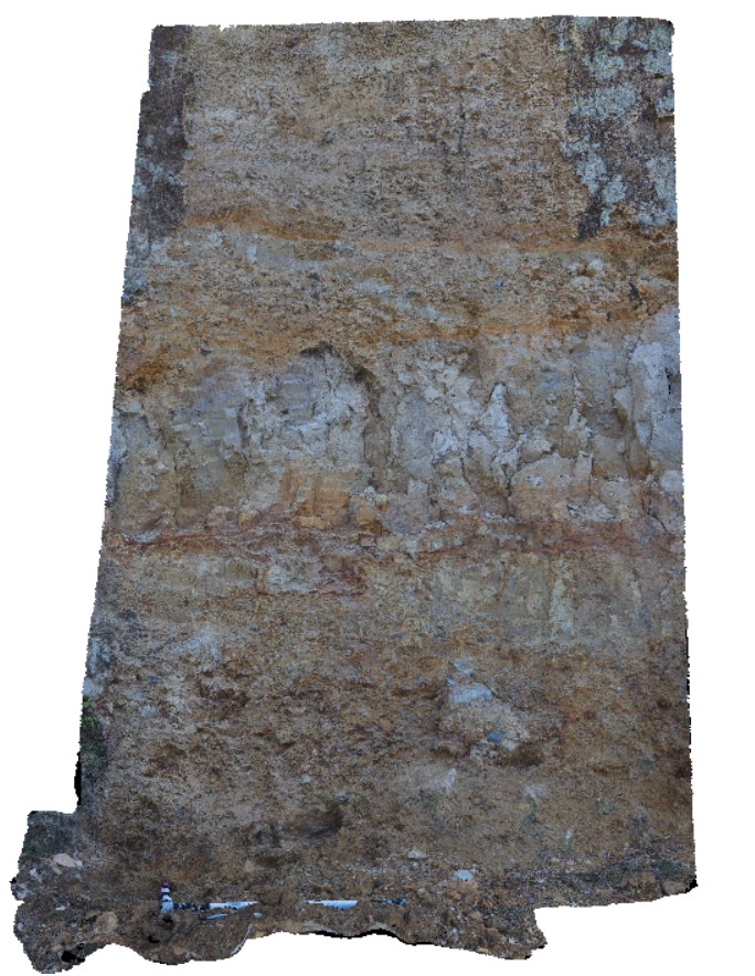
detail of location StyxRd1, showing regolith profile; fine colluvial scree overlying silty-clay (aeolian), overlying coarser colluvial sediments. Styx road, Tasmania. |
2.50 |
-42.80639000000 |
146.59326000000 |
-9999.000 |
colluvium |
scree |
 AusGeol.org