Fishery12 Map
 |
0 |
02/15/2016 11:34 a.m. |
3D terrestrial photogrammetric model |
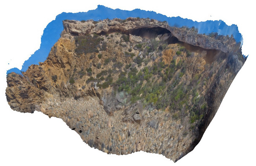
View of Tertiary unconformity, showing weathered gneiss truncated and overlain by Tertiary deposits. Fishery Bay, S.A. |
8.00 |
-34.91291400000 |
135.69209100000 |
-9999.000 |
geological unconformity, metamorphics |
gneiss, sediment |
CrowdyPole1 Map
 |
5 |
06/16/2015 5:34 p.m. |
3D terrestrial photogrammetric model |
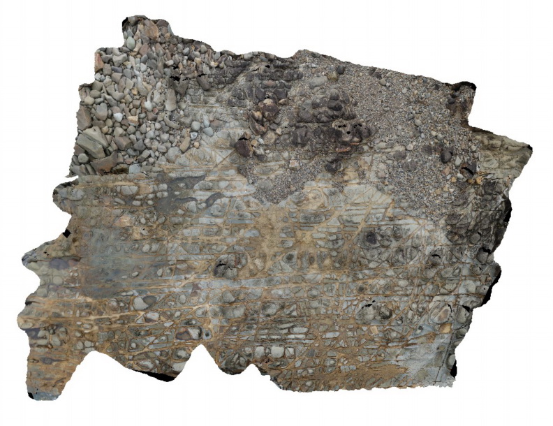
View of tessellated pavement generated by intersecting joints in sandstone of the Devonian Cowangara Formation. Crowdy Head Cliffs, N.S.W. |
12.00 |
-31.84576000000 |
152.75128000000 |
2.000 |
tessellated pavement, joints, structure |
sandstone |
WindjanaUAV1 Map
 |
0 |
06/05/2016 noon |
3D UAV photogrammetric model |
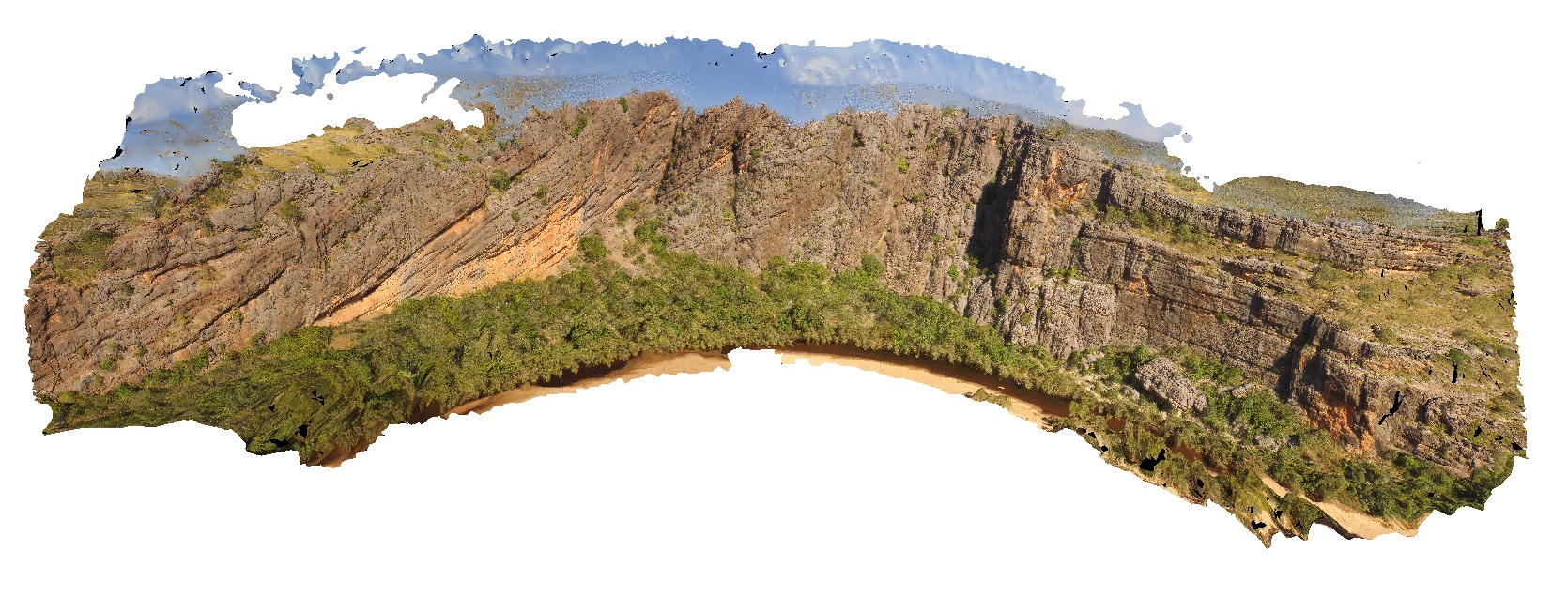
view of the ~400m 'Classic Face' of the reef facies at Windana Gorge, showing fore-reef, reefal-slope and platform facies and also, reef front and other reef facies. Windjana Gorge, W.A. |
400.00 |
-17.41218800000 |
124.96265530000 |
-9999.000 |
Reef facies, limestone, Windgana Gorge, sedimentology |
limestone, limestone |
TREPHFSP1 Map
 |
0 |
07/27/2016 4:26 p.m. |
Full Spherical Panorama |
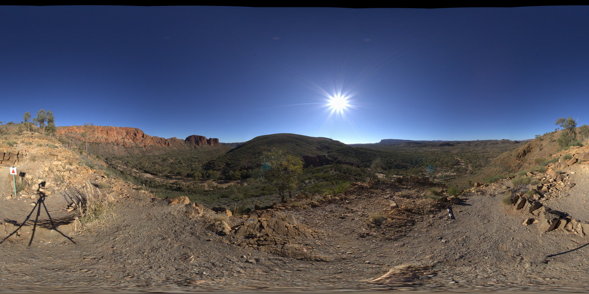
view of 'The Bluff', with tight folding. Trephina Gorge, Mordor Pound. N.T. |
1000.00 |
-23.51895600000 |
134.39911100000 |
642.214 |
tight folds, folds, structure, sedimentology, Trephina Gorge |
sandstone |
PurnululuFSP9 Map
 |
0 |
06/12/2016 noon |
Full Spherical Panorama |
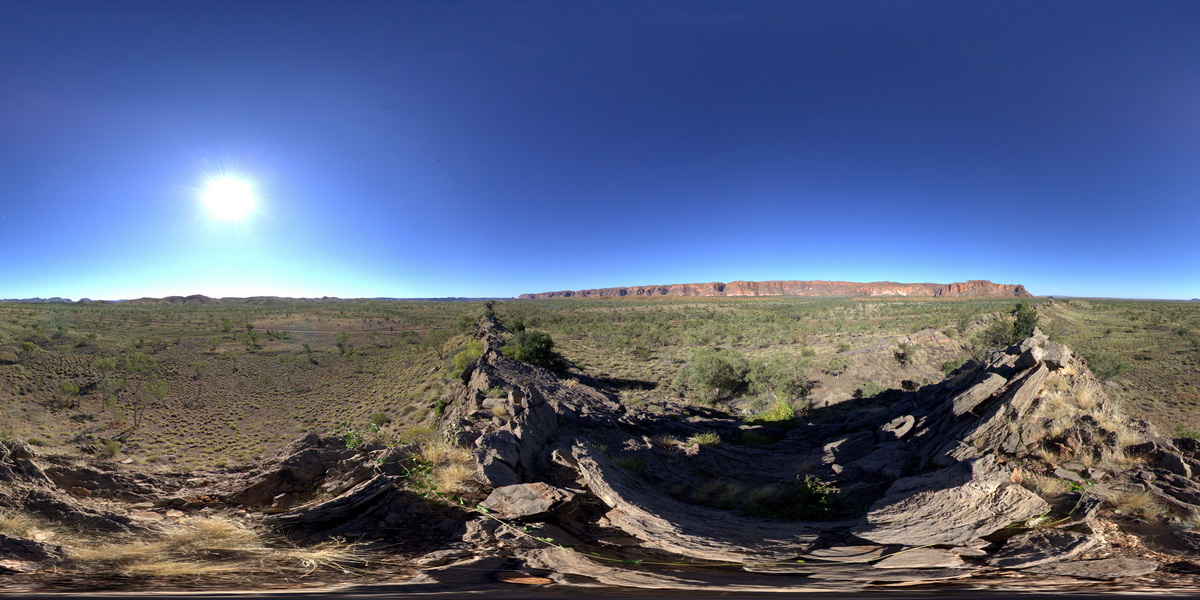
view of 'The Bungle Bungles' sandstone escarpment from small carbonate ridge. Faults crosscutting thinly bedded carbonate rocks in foreground. Purnululu National Park, W.A. |
2000.00 |
-17.40924000000 |
128.31894000000 |
-9999.000 |
sedimentology, fault, Purnululu National Park, The Bungle Bungles |
limestone |
WindjanaFSP1 Map
 |
0 |
06/05/2016 noon |
Full Spherical Panorama |
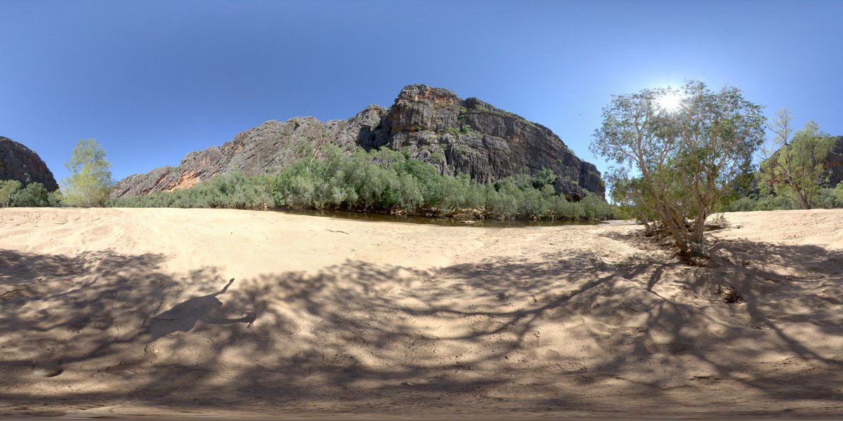
view of the 'Classic Face' of Windjana Gorge, showing different reef facies. Windjana Gorge, W.A. |
500.00 |
-17.41155000000 |
124.96238000000 |
-9999.000 |
palaeontology, fossil, Classic Face, reef |
limestone, limestone |
WindjanaFSP2 Map
 |
0 |
06/05/2016 noon |
Full Spherical Panorama |
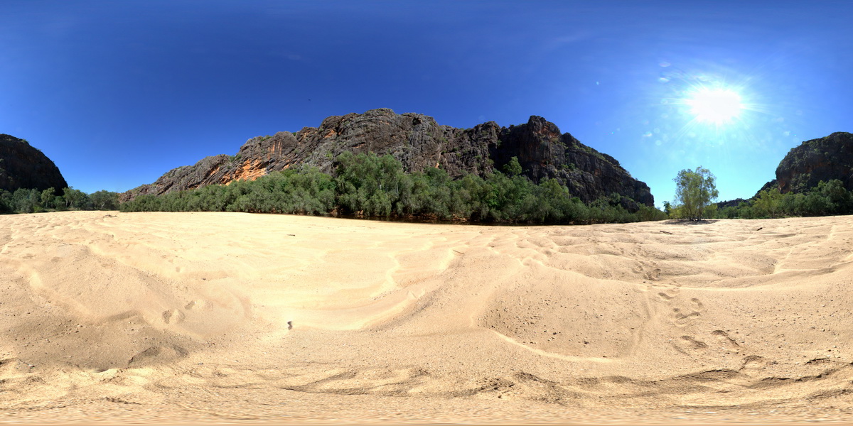
view of the 'Classic Face' of Windjana Gorge, showing different reef facies. Windjana Gorge, W.A. |
500.00 |
-17.41243000000 |
124.96246000000 |
-9999.000 |
Classic Face, Windjana Gorge, Reef Facies, Devonian reef, palaeontology |
limestone, limestone |
WindjanaFSP3 Map
 |
0 |
06/05/2016 noon |
Full Spherical Panorama |
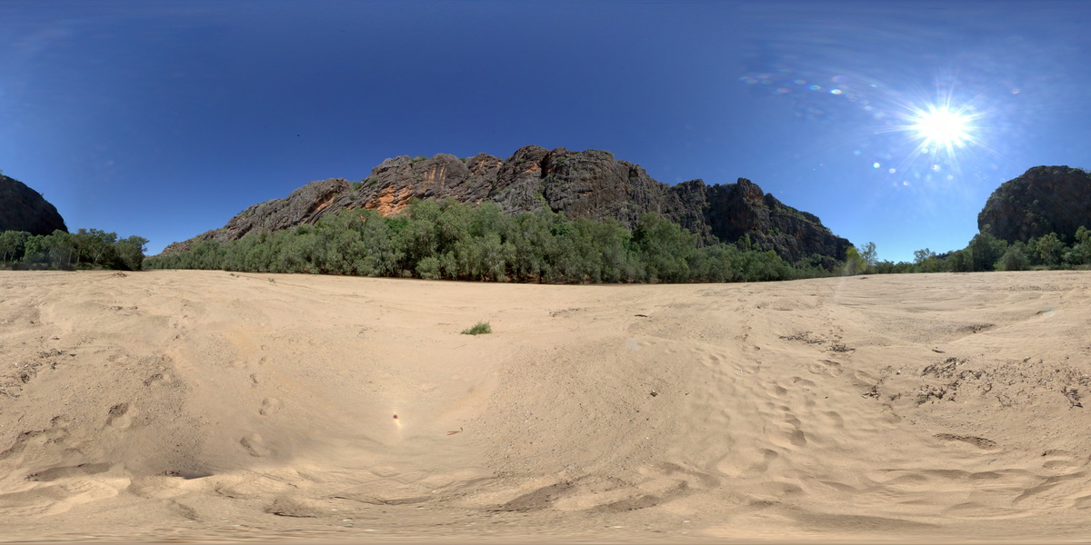
view of the 'Classic Face' of Windjana Gorge, showing different reef facies. Windjana Gorge, W.A. |
500.00 |
-17.41253000000 |
124.96309000000 |
-9999.000 |
palaeontology, Devonian Reef, Classic Face, Windjana Gorge |
limestone, limestone |
Albany17 Map
 |
0 |
01/01/9999 midnight |
3D terrestrial photogrammetric model |
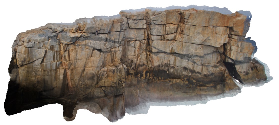
view of the cliff at 'The Gap', Albany, showing granodiorite intrusion in granitic gneiss. |
20.00 |
-35.11831000000 |
117.89301000000 |
-9999.000 |
granodiorite, cliff, igneous intrusion |
granitic gneiss, granodiorite |
BomboFSP1 Map
 |
5 |
08/25/2015 12:20 p.m. |
Full Spherical Panorama |
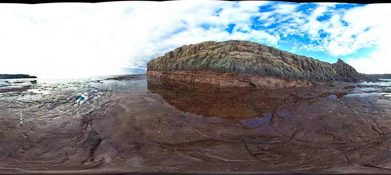
View of the contact between the Bombo Latite and the underlying tuffaceous sandstones. Bombo, N.S.W. |
50.00 |
-34.65257000000 |
150.86333000000 |
1.000 |
volcanology |
latite, sandstone |
BomboFSP2 Map
 |
5 |
08/25/2015 12:20 p.m. |
Full Spherical Panorama |
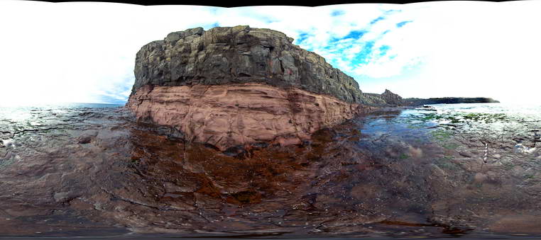
View of the contact between the Bombo Latite and the underlying tuffaceous sandstones. Bombo, N.S.W. |
50.00 |
-34.65273000000 |
150.86366000000 |
1.000 |
volcanology, sedimentology |
latite, sandstone |
BomboFSP3 Map
 |
5 |
08/25/2015 12:20 p.m. |
Full Spherical Panorama |
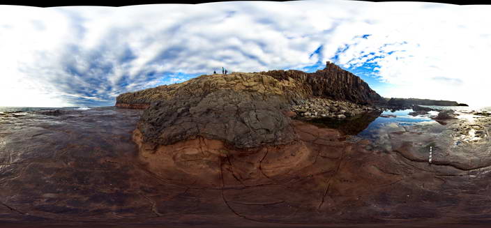
View of the contact between the Bombo Latite and the underlying tuffaceous sandstones. Bombo, N.S.W. |
50.00 |
-34.65239000000 |
150.86319000000 |
1.000 |
volcanology, sedimentology |
latite, sandstone |
BomboFSP5 Map
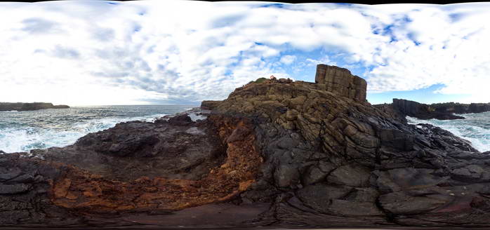 |
5 |
08/25/2015 12:20 p.m. |
Full Spherical Panorama |
View of the contact between the Permian Bumbo Latite and an underlying volcanic breccia. Bombo, N.S.W. |
50.00 |
-34.65197000000 |
150.86296000000 |
2.000 |
volcanology |
latite |
BomboFSP4 Map
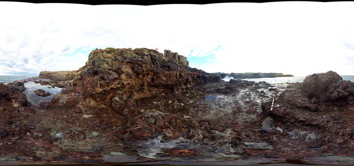 |
5 |
08/25/2015 12:20 p.m. |
Full Spherical Panorama |
View of the contact between the Permian Bumbo Latite and an underlying volcanic breccia. Bombo, N.S.W. |
50.00 |
-34.65204000000 |
150.86305000000 |
1.000 |
breccia, volcanology |
latite, breccia |
Kalbarri3 Map
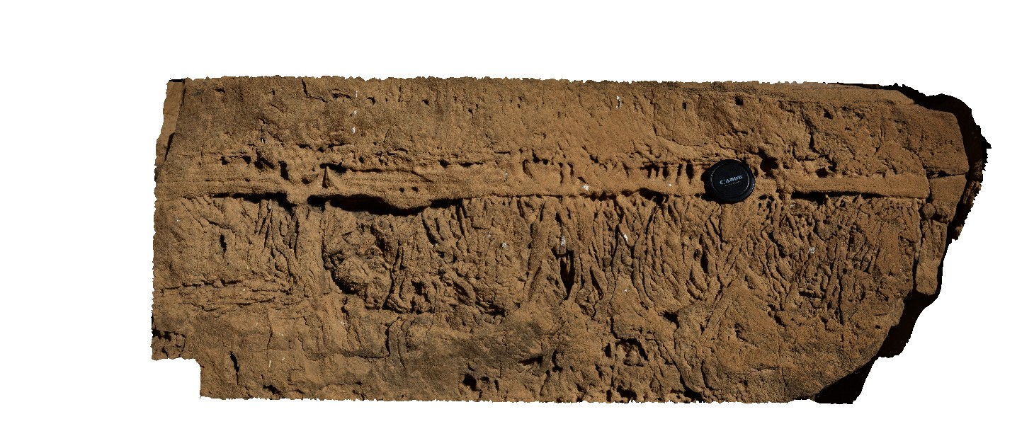 |
0 |
05/20/2016 noon |
3D terrestrial photogrammetric model |
view of the detail of bioturbation perpendicular to bedding in the Tumblagooda Sandstone. Hawks Head Lookout, Kalbarri National Park. W.A. |
0.80 |
-27.78985000000 |
114.46956000000 |
-9999.000 |
bioturbation, sandstone, sedimentology, fossil, palaeontology |
sandstone |
DudleyPole1 Map
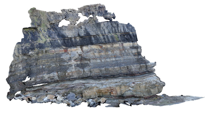 |
5 |
06/17/2015 10:15 a.m. |
3D terrestrial photogrammetric model |
View of the Dudley cliff face showing the top of the Nobbys Tuff at the base, overlain by floodplain sediments and then the base of the Victoria Tunnel coal seam. Dudley Beach, N.S.W. |
10.00 |
-32.96896000000 |
151.73640000000 |
0.000 |
coal, fluvial, sedimentology, tuff |
coal, tuff, mudstone |
ArkaroolaUAV2 Map
 |
20 |
04/20/2016 12:28 p.m. |
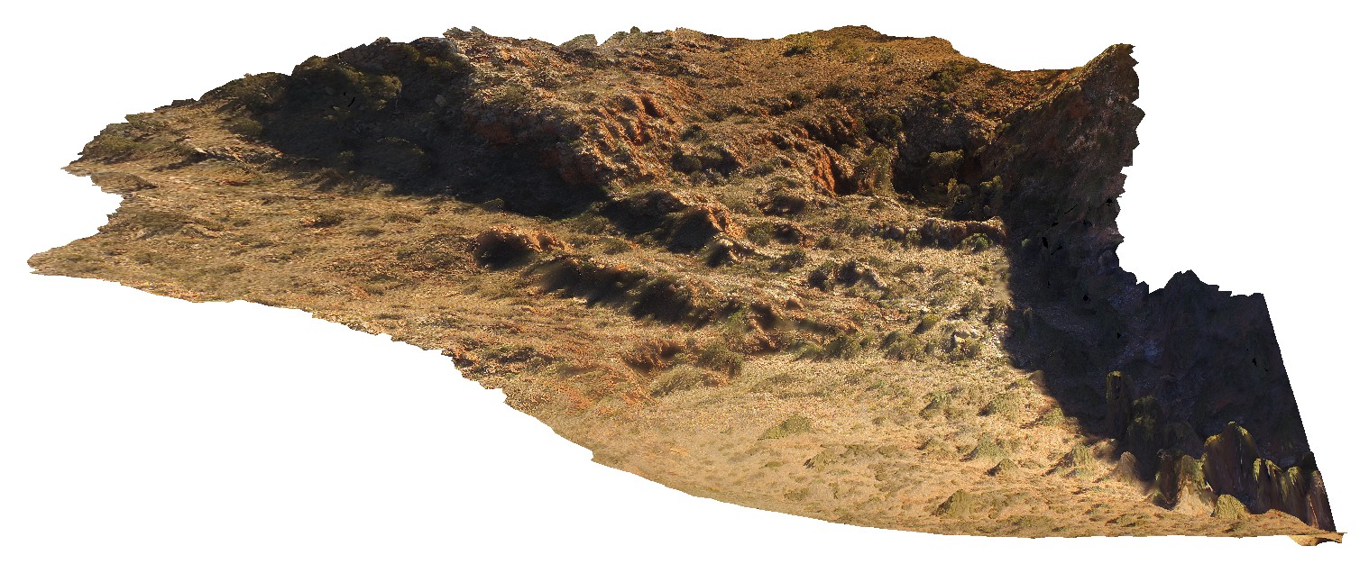
3D UAV photogrammetric model |
View of the Eastern face of Mt Gee, showing outcrop of Radium Ridge Breccia and Mt Gee Sinter, Arkaroola. Northern Flinders Ranges, S.A. |
300.00 |
-30.22948900000 |
139.34489100000 |
-9999.000 |
Radium Ridge Breccia, Mt Gee Sinter |
breccia, Sinter |
Corny5 Map
 |
0 |
11/17/2015 12:23 p.m. |
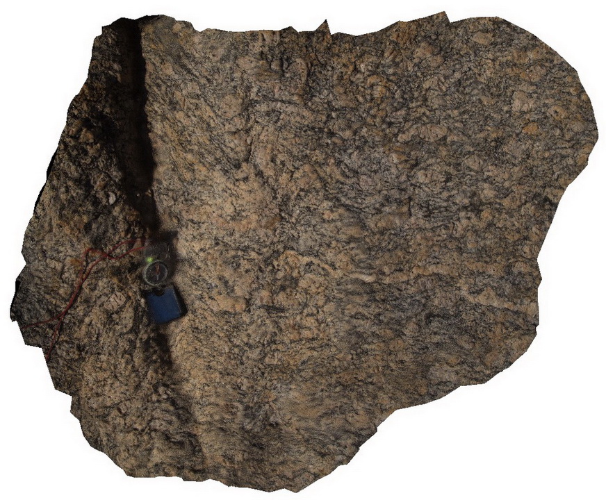
3D terrestrial photogrammetric model |
view of the fabric of folded Augen gneiss. Point Corny. S.A. |
0.50 |
-34.92128000000 |
137.01132000000 |
-9999.000 |
augen gneiss, metamorphic |
augen gneiss |
SmokyCapeFSP4 Map
 |
5 |
06/16/2015 5:41 p.m. |
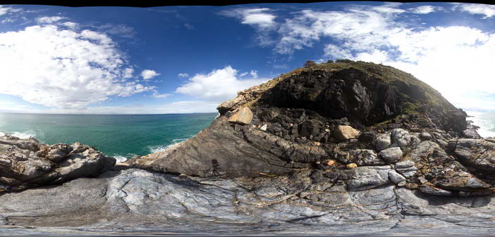
Full Spherical Panorama |
View of the intrusive contact between the Triassic Smokey Cape Monzogranite and Permo-Carboniferous metasediments of the Kempsey Beds. Smoky Cape, N.S.W |
50.00 |
-30.92407000000 |
153.08887000000 |
10.000 |
intrusive contact, igneous |
monzogranite, sandstone |
SmokyCapeFSP1 Map
 |
5 |
06/16/2015 5:40 p.m. |
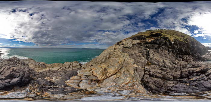
Full Spherical Panorama |
View of the intrusive contact between the Triassic Smokey Cape Monzogranite and Permo-Carboniferous metasediments of the Kempsey Beds. Smoky Cape, N.S.W |
50.00 |
-30.92389000000 |
153.08904000000 |
10.000 |
intrusive contact, chilled margin, igneous |
monzogranite, sandstone |
SmokyCapeFSP2 Map
 |
5 |
06/16/2015 5:41 p.m. |
3D terrestrial photogrammetric model |
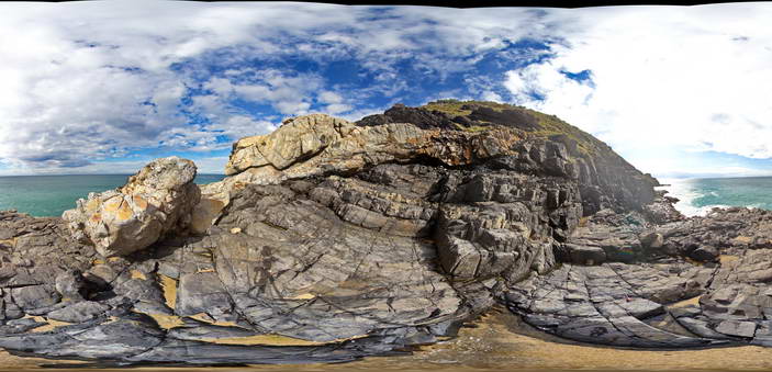
View of the intrusive contact between the Triassic Smokey Cape Monzogranite and Permo-Carboniferous metasediments of the Kempsey Beds. Smoky Cape, N.S.W |
50.00 |
-30.92399000000 |
153.08891000000 |
10.000 |
intrusive contact, igneous |
monzogranite, sandstone |
SmokyCapeFSP3 Map
 |
5 |
06/16/2015 5:41 p.m. |
Full Spherical Panorama |
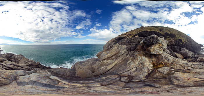
View of the intrusive contact between the Triassic Smokey Cape Monzogranite and Permo-Carboniferous metasediments of the Kempsey Beds. Smoky Cape, N.S.W |
50.00 |
-30.92406000000 |
153.08893000000 |
10.000 |
intrusive contact, igneous |
monzogranite, sandstone |
WTasFSP2 Map
 |
5 |
01/01/9999 midnight |
Full Spherical Panorama |
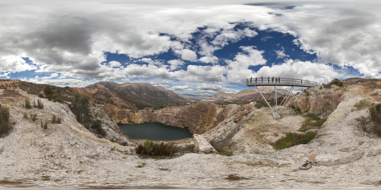
view of the Iron Blow at My Lyell with view of the Lyell Schist and Owen Group. Gormanston, West Tasmania. |
1000.00 |
-42.06907000000 |
145.58952000000 |
-9999.000 |
Iron Blow, Mount Lyell Copper Mine, Lyell Schist, Mine, open pit |
schist, conglomerate |
MarbleBarFSP1 Map
 |
0 |
06/01/2016 noon |
Full Spherical Panorama |
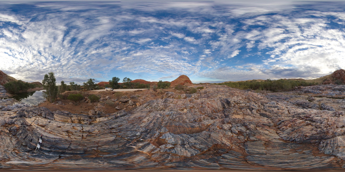
view of the Marble Bar across the Coongan River. Layered chert. Marble Bar, W.A. |
1000.00 |
-21.18630000000 |
119.71178000000 |
-9999.000 |
Marble Bar Chert Member |
chert |
ArkaroolaFSP2 Map
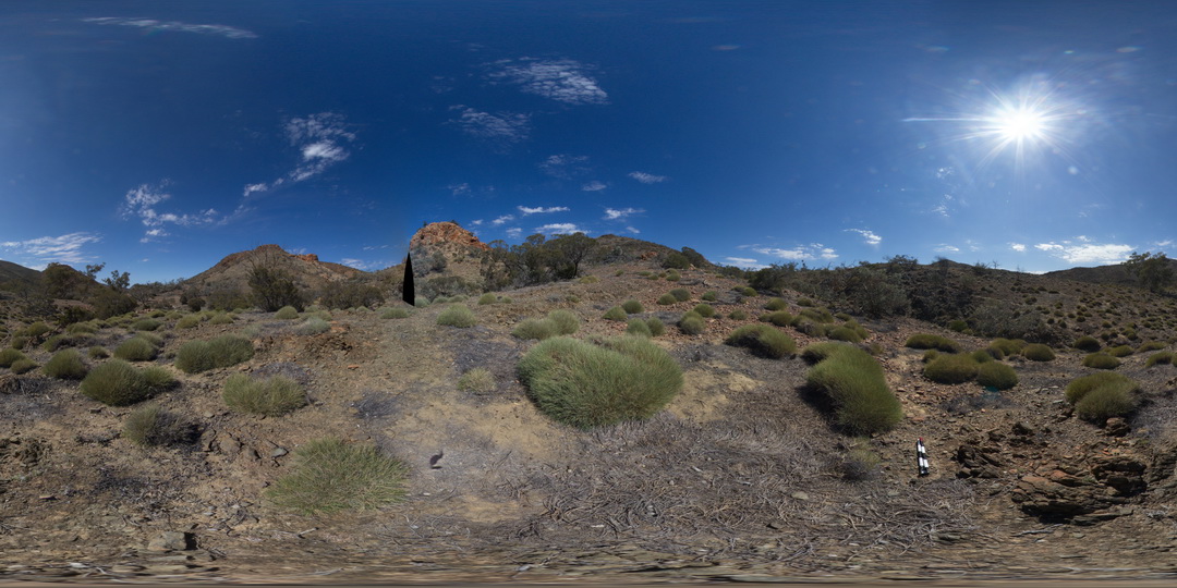 |
5 |
11/26/2015 2:07 p.m. |
Full Spherical Panorama |
View of the Pinnacles outcrop, Arkaroola. Northern Flinders Ranges, S.A. |
0.00 |
-30.29601000000 |
139.31133000000 |
-9999.000 |
granite |
granite |
 AusGeol.org