Canberra1 Map
 |
5 |
06/20/2016 3:47 p.m. |
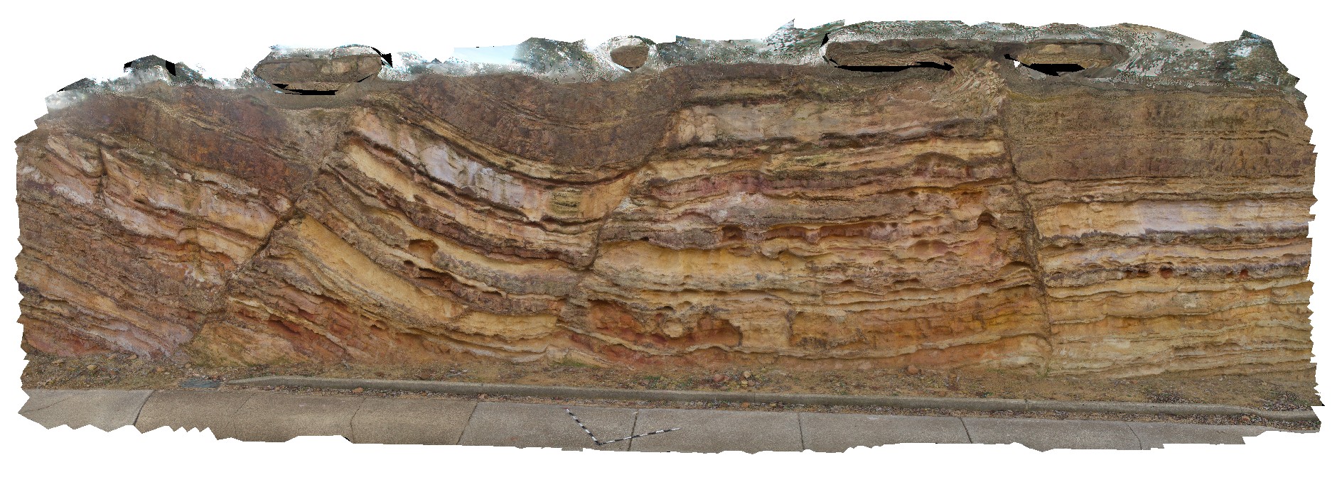
3D terrestrial photogrammetric model |
Open folds and faults in Silurian sandstone and mudstone at the Sate Circle in Canberra, A.C.T. |
10.00 |
-35.30408000000 |
149.12651000000 |
580.000 |
folds, faults, structure |
sandstone |
CanberraFSP7 Map
 |
5 |
09/03/2015 1:20 p.m. |
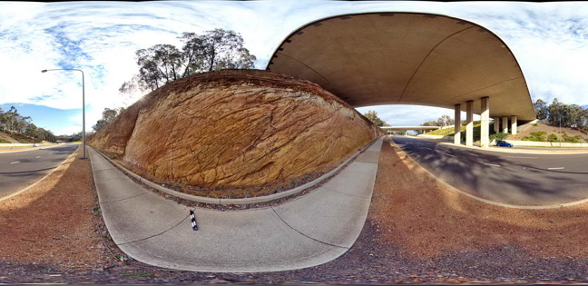
Full Spherical Panorama |
Open folds and faults in Silurian sandstone and mudstone of the Camp Hill Sandstone unconformably overlying tightly folded Silurian State Circle Shale. A.C.T. |
50.00 |
-35.30431000000 |
149.12711000000 |
580.000 |
folds, faults, structure, angular unconformity |
sandstone, shale |
CanberraFSP6 Map
 |
5 |
09/03/2015 1:20 p.m. |
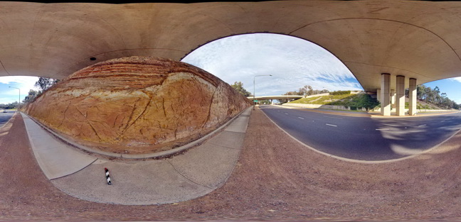
Full Spherical Panorama |
Open folds and faults in Silurian sandstone and mudstone of the Camp Hill Sandstone unconformably overlying Silurian State Circle Shale which contains disaggregated rafts of sandstone. A.C.T. |
50.00 |
-35.30445000000 |
149.12733000000 |
580.000 |
folds, faults, structure, sedimentology |
sandstone, shale |
CanberraFSP5 Map
 |
5 |
09/03/2015 1:20 p.m. |
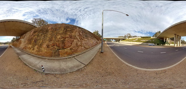
Full Spherical Panorama |
Open folds and faults in Silurian sandstone and mudstone of the Camp Hill Sandstone unconformably overlying Silurian State Circle Shale which contains disaggregated rafts of sandstone. A.C.T. |
50.00 |
-35.30453000000 |
149.12744000000 |
580.000 |
structure, sedimentology, folds, faults, angular unconformity |
sandstone |
CanberraFSP4 Map
 |
5 |
06/17/2015 10:25 a.m. |
Full Spherical Panorama |
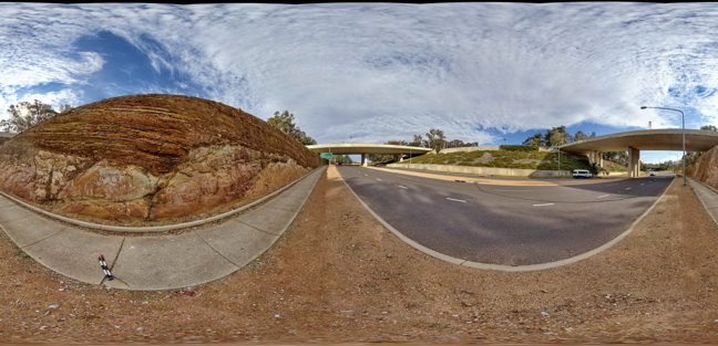
Open folds and faults in Silurian sandstone and mudstone of the Camp Hill Sandstone unconformably overlying Silurian State Circle Shale. A.C.T. |
50.00 |
-35.30456000000 |
149.12755000000 |
580.000 |
folds, faults, unconformity, sedimentology, structure |
sandstone, shale |
CanberraFSP3 Map
 |
5 |
06/17/2015 10:24 a.m. |
Full Spherical Panorama |
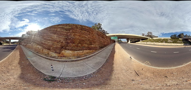
Open folds and faults in Silurian sandstone and mudstone of the Camp Hill Sandstone unconformably overlying Silurian State Circle Shale. A.C.T. |
50.00 |
-35.30463000000 |
149.12769000000 |
580.000 |
folds, faults, structure, unconformity, sedimentology |
sandstone, shale |
CanberraFSP2 Map
 |
5 |
09/03/2015 1:19 p.m. |
Full Spherical Panorama |
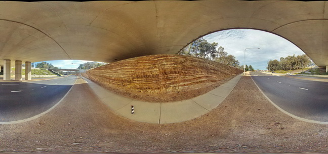
Open folds and faults in Silurian sandstone and mudstone of the Camp Hill Sandstone. A.C.T. |
50.00 |
-35.30493000000 |
149.12813000000 |
580.000 |
folds, faults, structure, sedimentology |
sandstone |
CanberraFSP1 Map
 |
5 |
06/17/2015 10:22 a.m. |
Full Spherical Panorama |
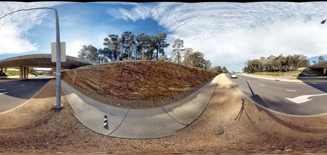
Open folds and faults in Silurian sandstone and mudstone of the Camp Hill Sandstone. A.C.T. |
50.00 |
-35.30497000000 |
149.12817000000 |
580.000 |
folds, faults, structure |
sandstone |
Canberra4 Map
 |
5 |
10/08/2015 3:09 p.m. |
3D terrestrial photogrammetric model |
Faults and open folds in the Silurian Camp Hill Sandstone of the Canberra Formation. A.C.T. |
25.00 |
-35.30492000000 |
149.12816000000 |
580.000 |
|
sandstone |
Canberra2 Map
 |
5 |
09/08/2015 3:34 p.m. |
3D terrestrial photogrammetric model |
Faults and folds in Silurian metasedimentary rocks of the Canberra Formation at the top and left of the view. There is an angular unconformity between these rocks and the underlying Silurian State Circle Shale. A.C.T. |
20.00 |
-35.30429000000 |
149.12701000000 |
580.000 |
folds, faults, structure, unconformity |
sandstone, shale |
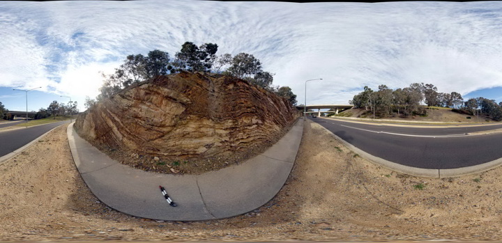
CanberraFSP11 Map
 |
5 |
09/04/2015 9:28 a.m. |
Full Spherical Panorama |
Open folds and faults in Silurian sandstone and mudstone of the Camp Hill Sandstone. A.C.T. |
50.00 |
-35.30400000000 |
149.12634000000 |
580.000 |
folds, faults, structure, sedimentology |
sandstone |
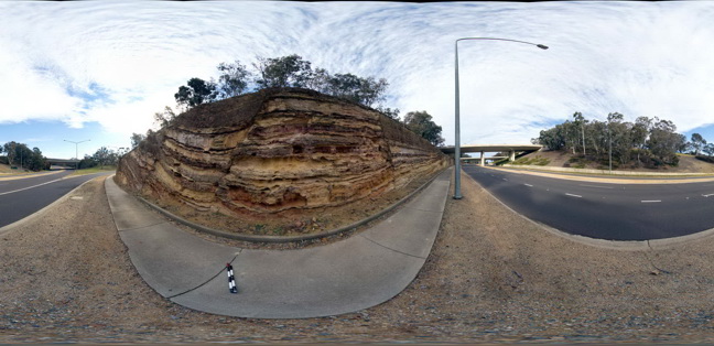
CanberraFSP10 Map
 |
5 |
09/04/2015 9:28 a.m. |
Full Spherical Panorama |
Open folds and faults in Silurian sandstone and mudstone of the Camp Hill Sandstone. A.C.T. |
50.00 |
-35.30414000000 |
149.12650000000 |
580.000 |
folds, faults, structure, sedimentology |
sandstone |
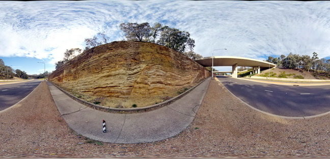
CanberraFSP9 Map
 |
5 |
09/03/2015 1:20 p.m. |
Full Spherical Panorama |
Open folds and faults in Silurian sandstone and mudstone of the Camp Hill Sandstone unconformably overlying tightly folded Silurian State Circle Shale. A.C.T. |
50.00 |
-35.30420000000 |
149.12686000000 |
580.000 |
folds, faults, structure, angular unconformity, sedimentology |
sandstone, shale |
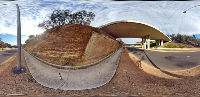
CanberraFSP8 Map
 |
5 |
09/03/2015 1:20 p.m. |
Full Spherical Panorama |
Open folds and faults in Silurian sandstone and mudstone of the Camp Hill Sandstone unconformably overlying tightly folded Silurian State Circle Shale. A.C.T. |
50.00 |
-35.30430000000 |
149.12703000000 |
580.000 |
|
sandstone, shale |
ENTIA7 Map
 |
5 |
07/26/2016 10:05 a.m. |
3D terrestrial photogrammetric model |
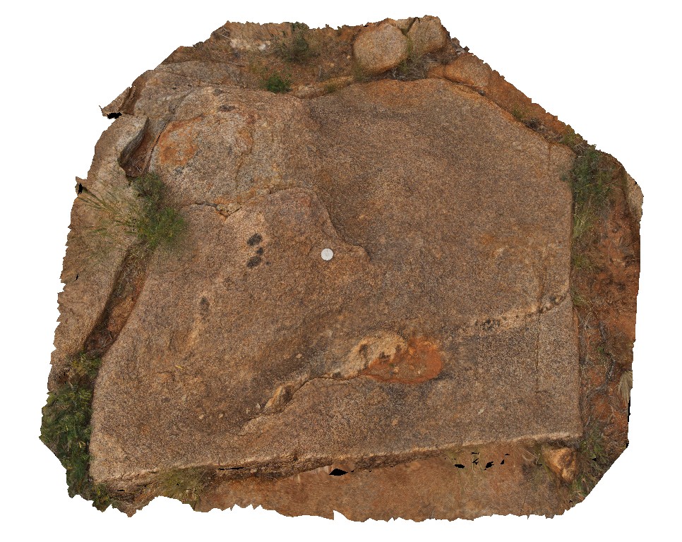
pods of mafic and felsic migmatite layers in Entia Gneiss Complex. Entia Dome. Harts Range, N.T. |
1.00 |
-23.13483100000 |
135.29648200000 |
583.262 |
gneiss, metamorphic, Entia Dome, Harts Range, migmatite |
gneiss |
ENTIA8 Map
 |
5 |
01/01/9999 midnight |
3D terrestrial photogrammetric model |
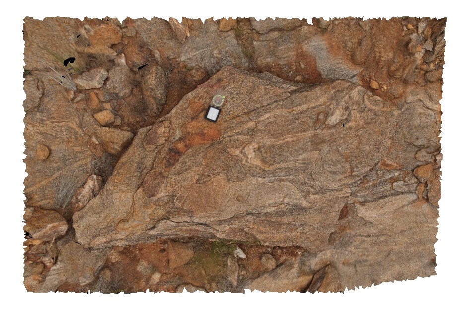
folded migmatitic bands in Entia Gneiss Complex orthogneiss. Harts Range, N.T. |
2.20 |
-23.13483100000 |
135.29648200000 |
583.262 |
orthogneiss, migmatite, structure, metamorphic, Harts Range |
gneiss |
EildonFSP3 Map
 |
5 |
09/02/2015 2:59 p.m. |
Full Spherical Panorama |
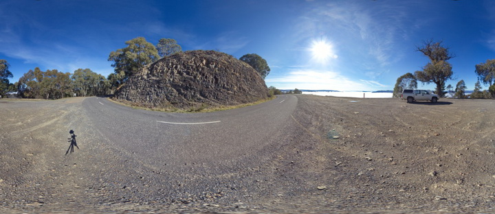
View of folded sandstone units of the Devonian Norton Gully Sandstone. Eildon, Vic. |
50.00 |
-37.20937000000 |
145.84433000000 |
590.000 |
folds, structure |
sandstone |
Eildon2 Map
 |
5 |
07/18/2015 3:26 p.m. |
3D terrestrial photogrammetric model |
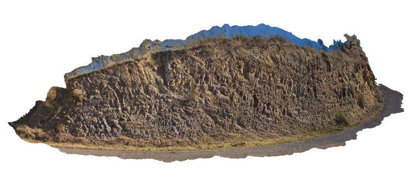
bedding and folds in sandstone units of the Devonian Norton Gully Sandstone. Eildon, Vic. |
30.00 |
-37.20935000000 |
145.84427000000 |
590.000 |
folds, structure |
sandstone |
EildonFSP1 Map
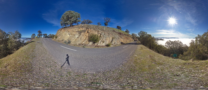 |
5 |
09/02/2015 2:59 p.m. |
Full Spherical Panorama |
View of folded sandstone units of the Devonian Norton Gully Sandstone. Eildon, Vic. |
50.00 |
-37.20893000000 |
145.84412000000 |
590.000 |
folds, structure |
sandstone |
EildonFSP2 Map
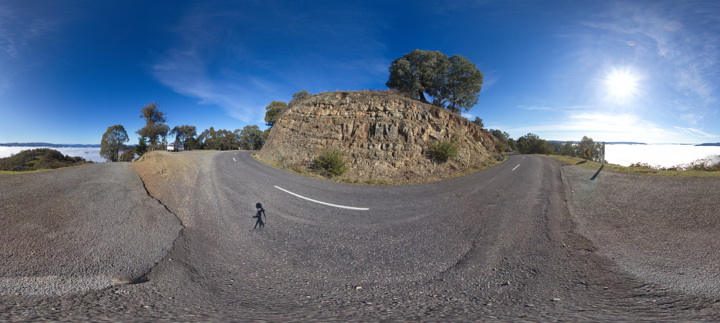 |
5 |
09/02/2015 2:59 p.m. |
Full Spherical Panorama |
View of folded sandstone units of the Devonian Norton Gully Sandstone. Eildon, Vic. |
50.00 |
-37.20912000000 |
145.84433000000 |
590.000 |
folds, structure |
sandstone |
Eildon1 Map
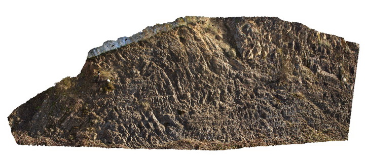 |
5 |
08/04/2015 11:57 a.m. |
3D terrestrial photogrammetric model |
folds in fine grained thinly bedded sandstone units of the Devonian Norton Gully Sandstone. Eildon, Vic. |
15.00 |
-37.20941000000 |
145.84427000000 |
590.000 |
fold, structure |
sandstone |
ENTIA9 Map
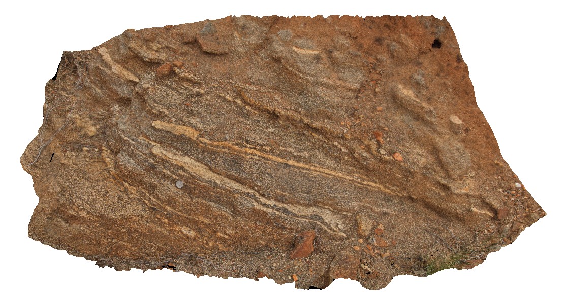 |
0 |
07/26/2016 10:47 a.m. |
3D terrestrial photogrammetric model |
view of amphibolite gneiss outcrop of the Entia Gneiss Complex. Harts Range, N.T. |
1.50 |
-23.16934200000 |
135.30153200000 |
590.790 |
amphibolite, metamorphic, Harts Range, Entia Gneiss Complex, gneiss |
gneiss |
ENTIA5 Map
 |
5 |
07/25/2016 5:24 p.m. |
3D terrestrial photogrammetric model |
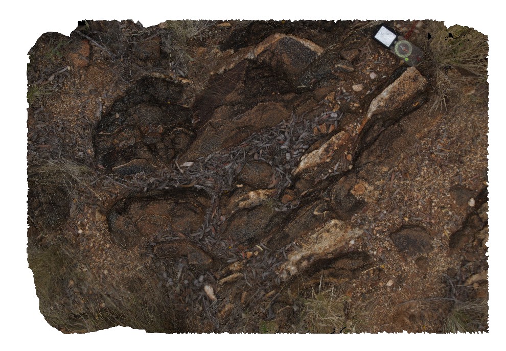
quartz-feldspar leucocratic layers (tonalite?) in bt-gneiss of the Entia Gneiss Complex. Entia Dome. Harts Range, N.T. |
1.60 |
-23.03309300000 |
135.22411200000 |
593.067 |
leucocratic, metamorphic, gneiss, Entia Dome, Harts Range |
gneiss |
ENTIA1 Map
 |
0 |
07/25/2016 1:51 p.m. |
3D terrestrial photogrammetric model |
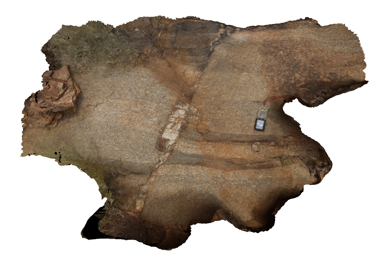
view of intrusive relationship between Entia Gneiss Complex (light coloured rocks) and calc-silicate gneiss (dark) and faulted pegmatite. Enita Dome, East Harts Range, N.T. |
0.00 |
-23.04863200000 |
135.15582500000 |
594.330 |
gneiss, intrusive contact, pegmatite, harts range, Entia Gneiss |
gneiss, pegmatite |
ENTIA6 Map
 |
5 |
07/25/2016 5:30 p.m. |
3D terrestrial photogrammetric model |
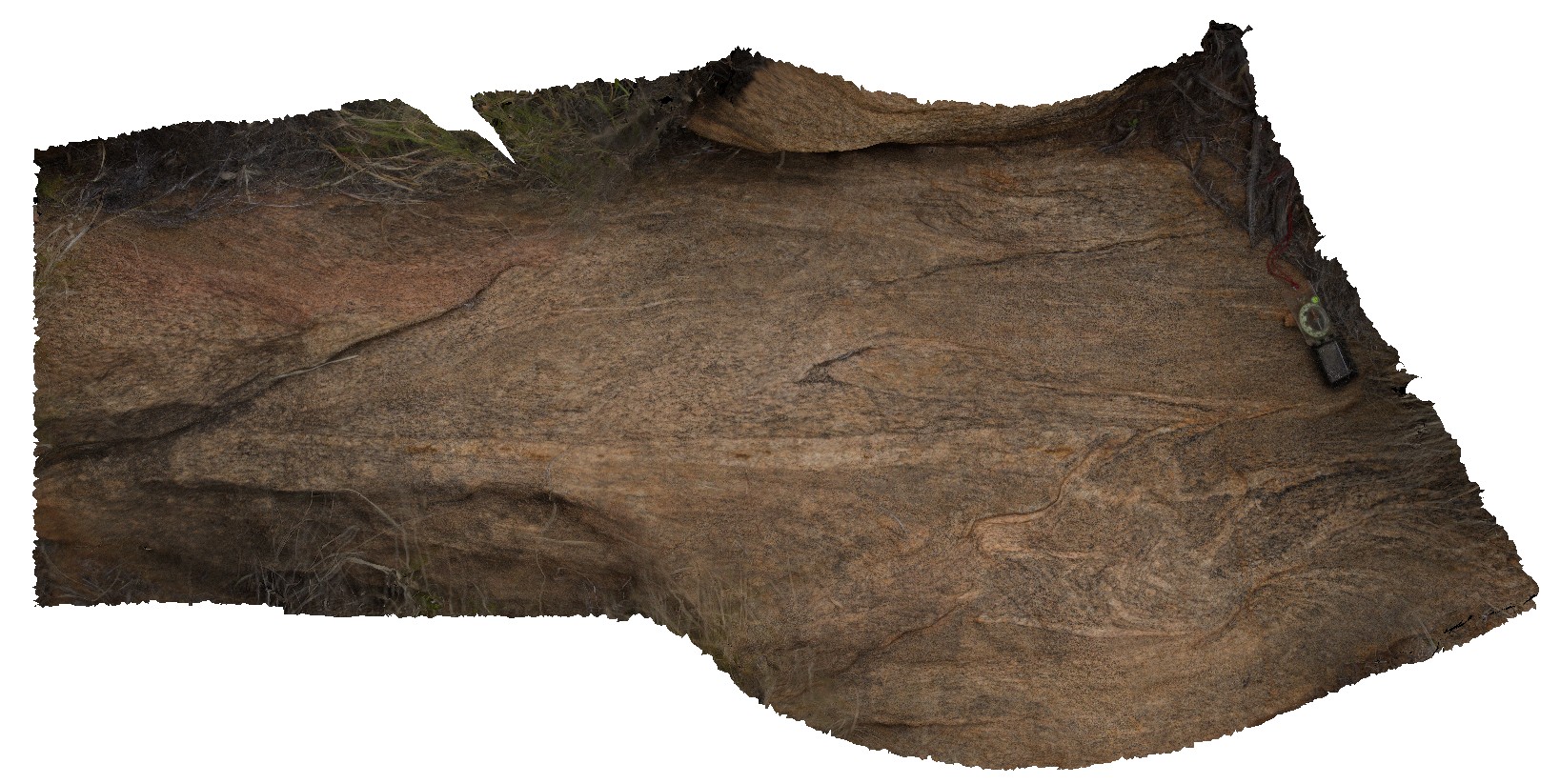
small-scale isoclinal folds in orthogneiss of the Entia Gneiss Complex. Entia Dome. Harts Range, N.T. |
2.00 |
-23.03303200000 |
135.22423100000 |
594.750 |
Entia Gneiss Complex, gneiss, metamorphic, harts range, isoclinal fold, fold, structure |
gneiss |
 AusGeol.org