BremerUAV1 Map
 |
20 |
01/01/9999 midnight |
3D UAV photogrammetric model |
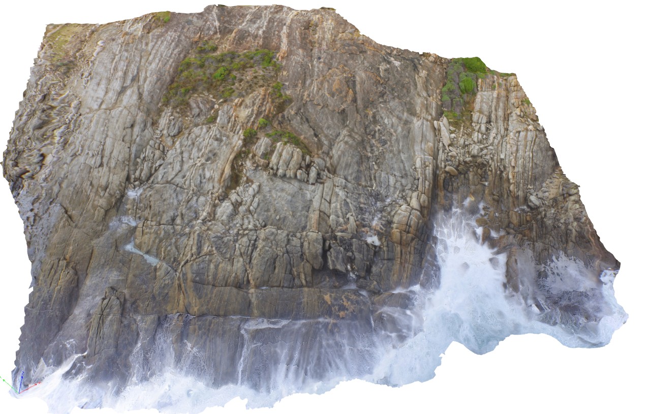
aerial view of gneissic outcrop at Nature Dog Beach. Bremer Bay, W.A. |
20.00 |
-34.45622300000 |
119.36205000000 |
17.500 |
banded gneiss |
gneiss |
CapeAridUAV1 Map
 |
0 |
06/05/2016 10:37 a.m. |
3D UAV photogrammetric model |
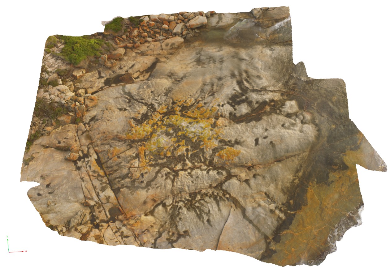
aerial view of gneissic rocks with thick compositional layering and shears. Cape Arid, W.A. |
0.00 |
-33.90596000000 |
123.35376000000 |
-9999.000 |
gneiss, shear, compositional layering |
gneiss |
CapeAridUAV2 Map
 |
20 |
01/01/9999 midnight |
3D UAV photogrammetric model |
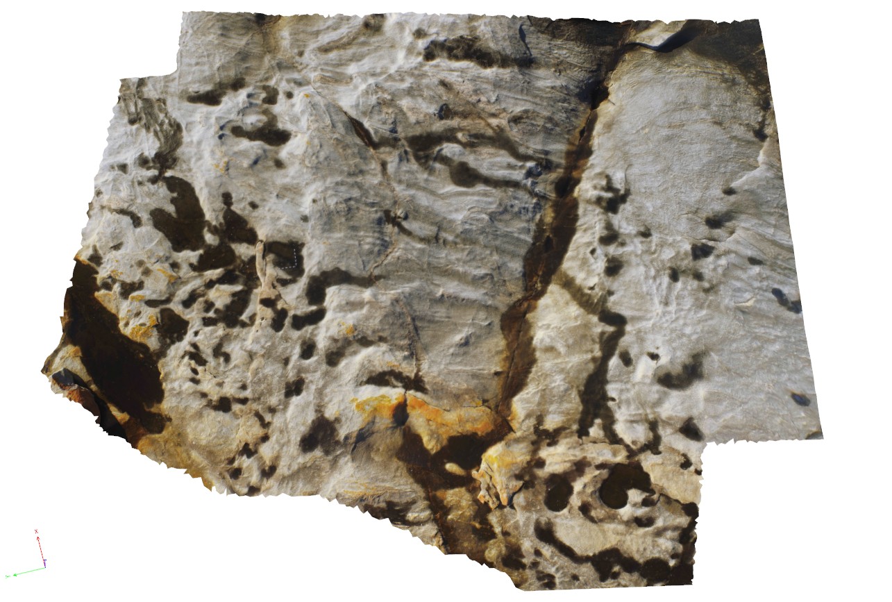
aerial view of folded pegmatite and gneissic layers. Cape Arid, W.A. |
200.00 |
-33.90626600000 |
123.35366500000 |
5.800 |
pegmatite, gneiss |
gneiss, pegmatite |
CapeAridUAV3 Map
 |
0 |
01/01/9999 midnight |
3D UAV photogrammetric model |
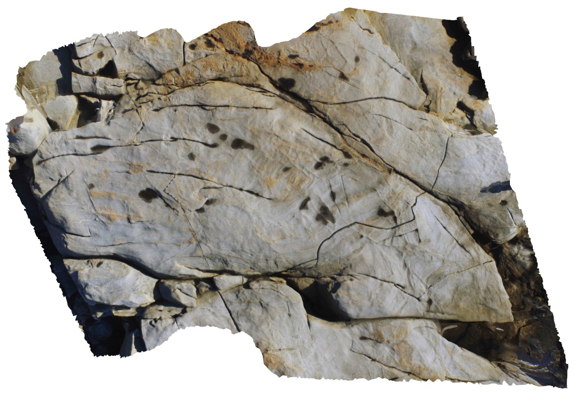
aerial view of folded and sheared gneissic layering and leucosomes, Cape Arid. W.A. |
8.00 |
-33.90668000000 |
123.35332000000 |
-9999.000 |
fold, shear |
gneiss |
StarvationBayUAV1 Map
 |
0 |
01/01/9999 midnight |
3D UAV photogrammetric model |
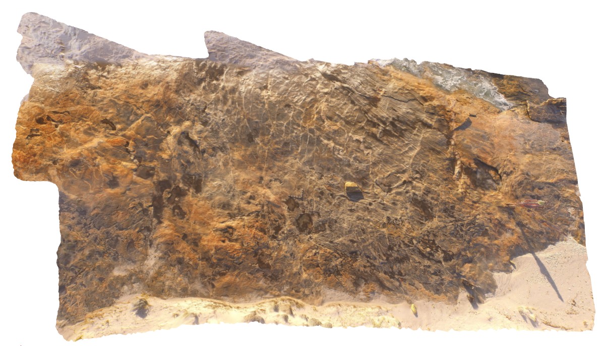
overall view of outcrop pavement, showing folded and sheared gneissic rocks. Starvation Bay, W.A. |
20.00 |
-33.92010800000 |
120.56163100000 |
5.100 |
gneiss, structure |
gneiss |
StarvationBayUAV2 Map
 |
0 |
01/01/9999 midnight |
3D UAV photogrammetric model |
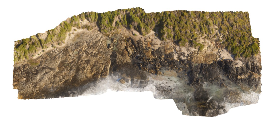
overall view of amphibole gneiss contact with gneiss. Starvation Bay, W.A. |
50.00 |
-33.92200700000 |
120.55943400000 |
34.400 |
contact, amphibolite, gneiss |
amphibolite |
StarvationBayUAV3 Map
 |
0 |
01/01/9999 midnight |
3D UAV photogrammetric model |
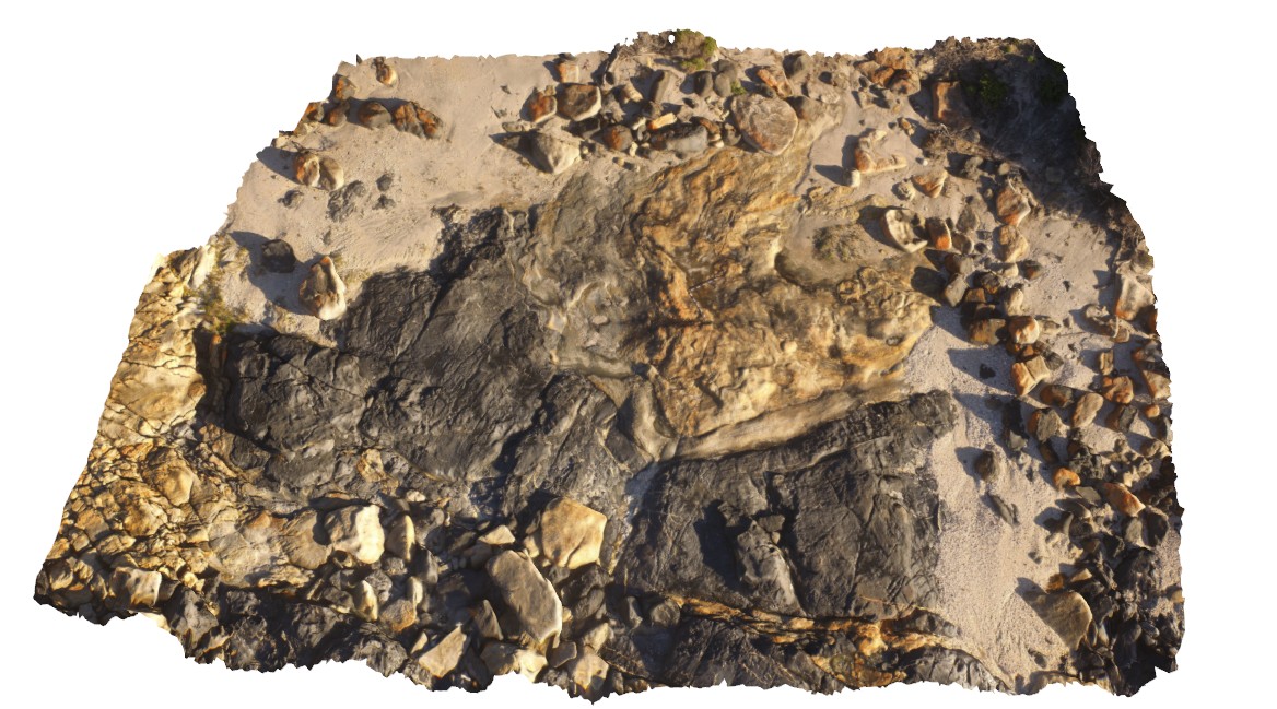
overall view of outcrop pavement, showing folded and sheared gneissic rocks. Starvation Bay, W.A. |
9.00 |
-33.92180700000 |
120.55943200000 |
5.500 |
amphibole gneiss, gneiss, geological contact |
amphibolite, gneiss |
CapeLeGrandeUAV1 Map
 |
0 |
01/01/9999 midnight |
3D UAV photogrammetric model |
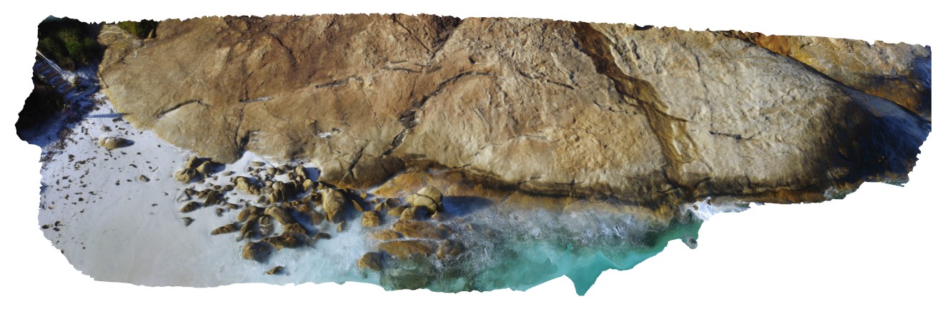
aerial view of disaggregated mafic dykes in gneiss, Cape Le Grande. South coast W.A. |
100.00 |
-34.00378000000 |
122.16901000000 |
-9999.000 |
disaggregated mafic dyke, gneiss |
gneiss, mafic |
AMADUAV2 Map
 |
5 |
01/01/9999 midnight |
3D UAV photogrammetric model |
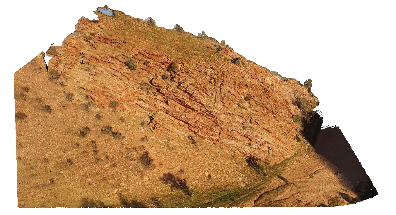
bedding in quartzose Heavitree Sandstone. The Gap, Alice Springs. N.T. |
500.00 |
-23.72543800000 |
133.86616800000 |
534.638 |
bedding, sandstone, sedimentology |
sandstone |
AMADUAV1 Map
 |
5 |
07/27/2016 11:20 a.m. |
3D UAV photogrammetric model |
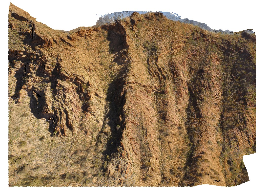
aerial view of chaotic folded sediments from the Bitter Springs Group. Bitter Springs Gorge, N.T. |
500.00 |
-23.54199600000 |
134.46085000000 |
534.638 |
chaotic folding, sediments, fold, structure, Bitter Springs |
sediments |
NTasUAV6 Map
 |
20 |
01/01/9999 midnight |
3D UAV photogrammetric model |
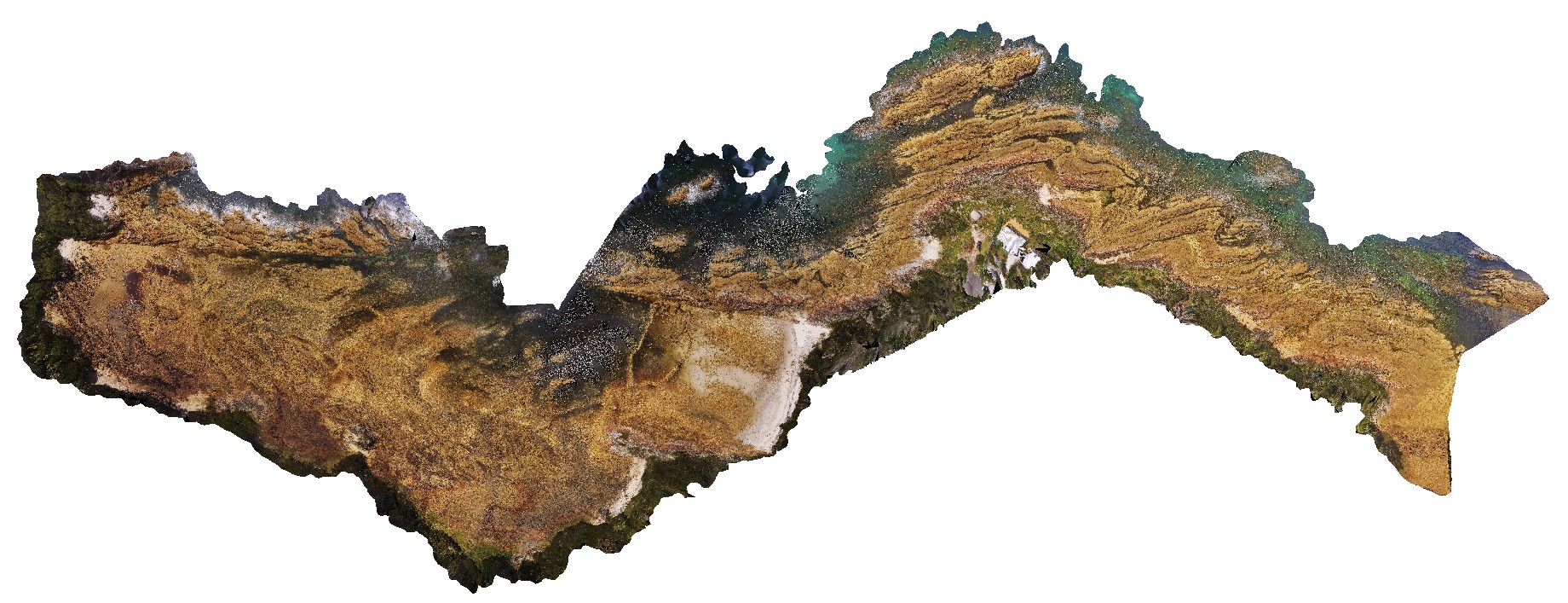
aerial view of Boat Harbour foreshore, combine NTasUAVs 4 & 5 |
0.00 |
-40.92560000000 |
145.61093300000 |
-9999.000 |
|
|
BunkerBayUAV1 Map
 |
0 |
05/15/2016 noon |
3D UAV photogrammetric model |
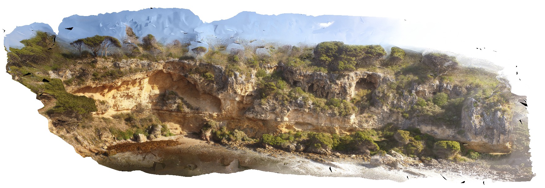
unconformity between basement gneiss and Tamala Limestone. Bunker Bay, Cape Naturaliste. W.A. gneiss unit may also be known as high grade metamorphic rocks 74341 |
50.00 |
-33.53685000000 |
115.03130000000 |
-9999.000 |
geological unconformity, gneiss, Tamala Limestone |
gneiss, limestone |
CervantesUAV2 Map
 |
0 |
05/18/2016 noon |
3D UAV photogrammetric model |
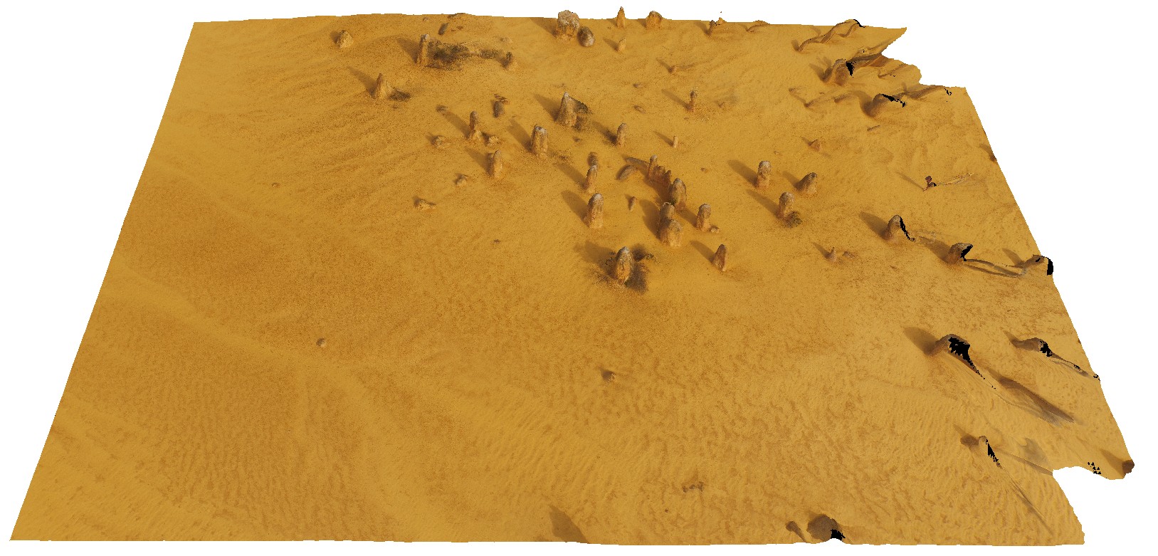
aerial view of pinnacles, 'Pinnacles Desert', Nambung National Park, Cervantes, W.A. |
50.00 |
-30.60426800000 |
115.16101400000 |
-9999.000 |
weathering features, limestone weathering feature |
limestone |
CervantesUAV4 Map
 |
0 |
05/18/2016 noon |
3D UAV photogrammetric model |
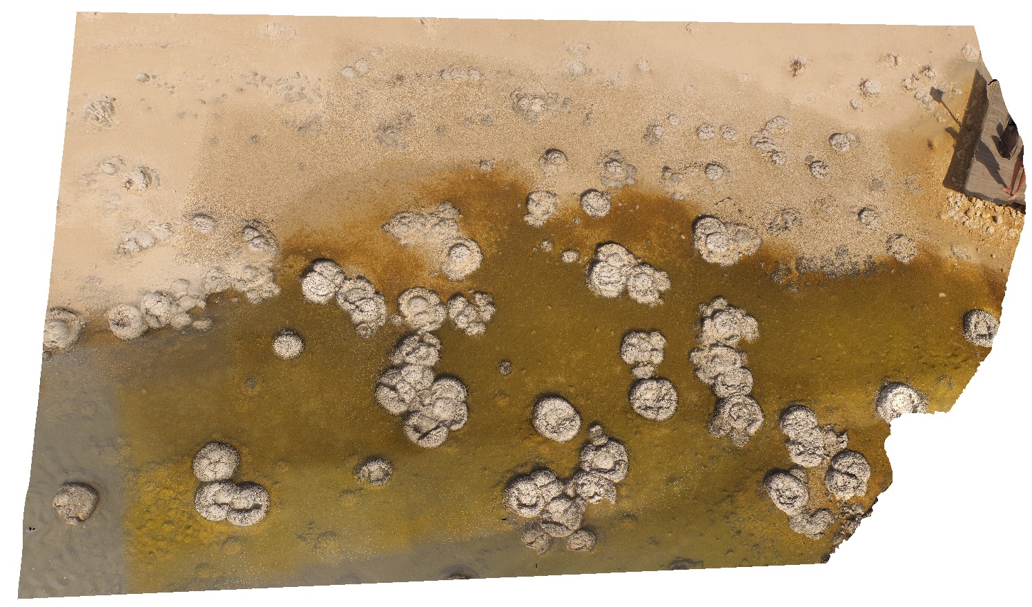
detail of stromatolites in Lake Thetis, Cervantes, W.A. |
50.00 |
-30.50759200000 |
115.08074200000 |
-9999.000 |
stromatolites |
limestone |
DevmUAV1 Map
 |
5 |
07/22/2016 12:22 p.m. |
3D UAV photogrammetric model |
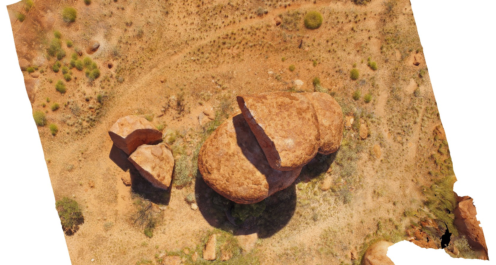
aerial view of Devil's Marbles granite outcrop. Karlu Karlu / Devils Marbles Conservation Reserve. N.T. |
50.00 |
-20.55873500000 |
134.26646600000 |
410.176 |
Devils Marbles, granite, weathering |
granite |
DixonRangeUAV1 Map
 |
0 |
06/14/2016 noon |
3D UAV photogrammetric model |
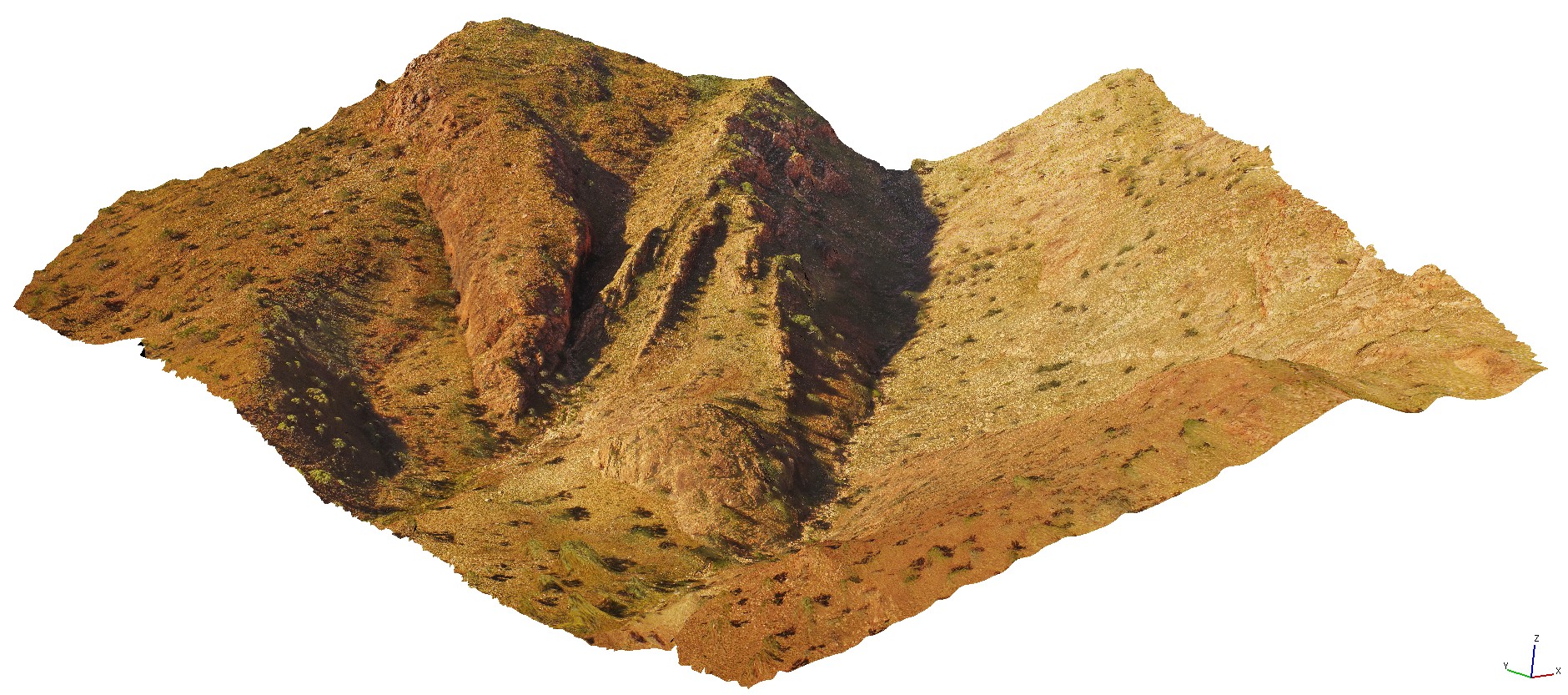
aerial view of steep faults in metasediments. Road to Dixon Range, W.A. |
50.00 |
-17.17800000000 |
128.25186000000 |
-9999.000 |
steep fault, metasediments, structure |
metasediments |
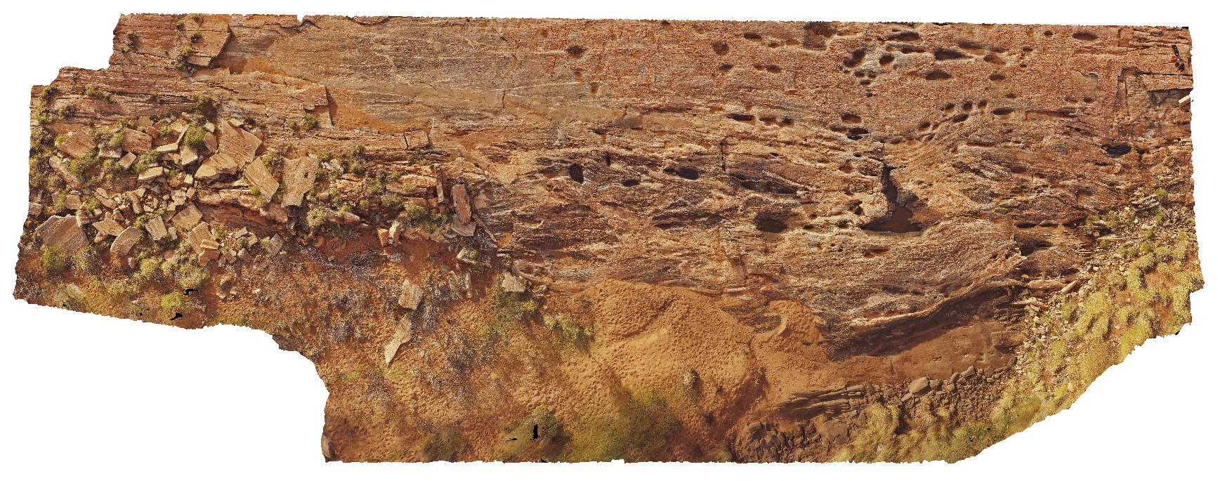
EPilbaraUAV1 Map
 |
0 |
06/01/2016 noon |
3D UAV photogrammetric model |
pavement of amphibolite stringers in granitic gneiss with pegmatite and other granitic intrusions. Woodstock - Rocky Island Road, East Pilbara, W.A. |
50.00 |
-21.53905700000 |
119.33549700000 |
-9999.000 |
amphibolite, granitic gneiss, igneous intrusions |
granitic gneiss |
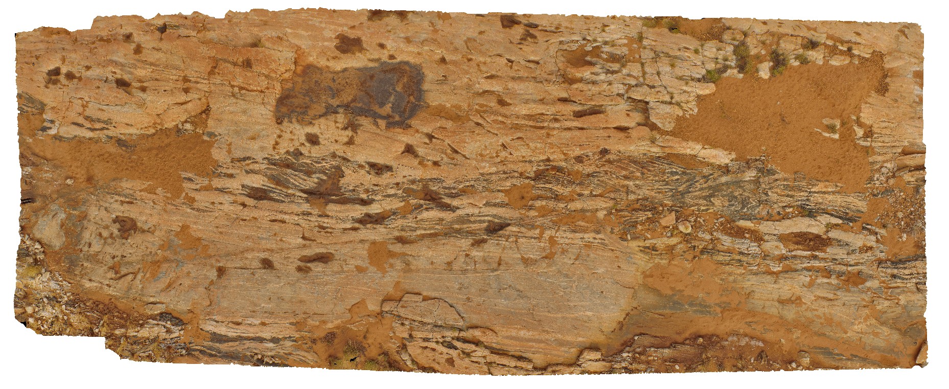
EPilbaraUAV2 Map
 |
0 |
06/01/2016 noon |
3D UAV photogrammetric model |
pavement of amphibolite stringers in granitic gneisses and pegmatite. Woodstock - Rocky Island Road, East Pilbara, W.A. |
50.00 |
-21.53884610000 |
119.33498690000 |
-9999.000 |
amphibolite stringers, granitic gneiss, pegmatite |
gneiss |
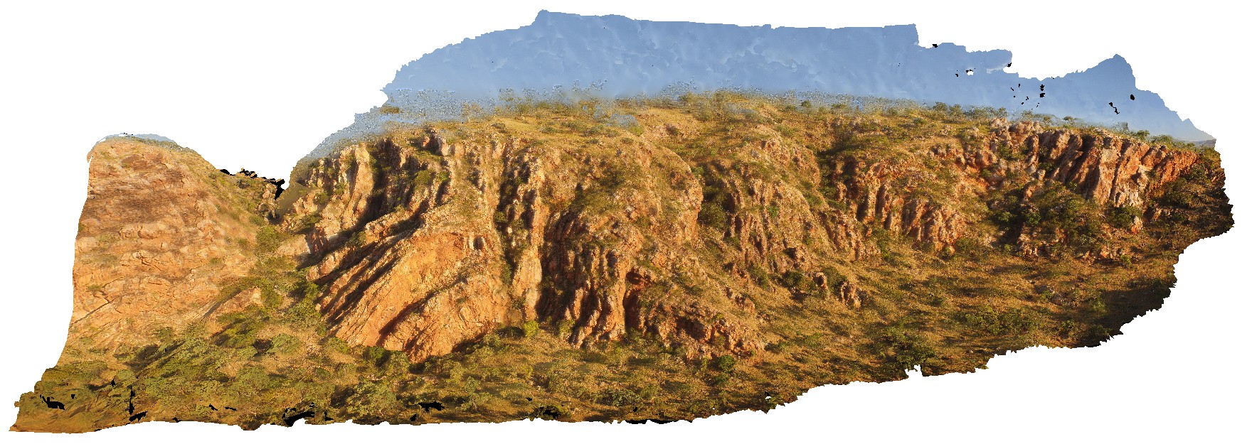
GibbRiverUAV1 Map
 |
0 |
06/06/2016 noon |
3D UAV photogrammetric model |
aerial view near Mount Bell, showing open, upright folded King Leopold sandstone. Derby-Gibb River Road, Kimberly, W.A. |
100.00 |
-17.17522100000 |
125.29286500000 |
-9999.000 |
open fold, sandstone, structure |
sandstone |
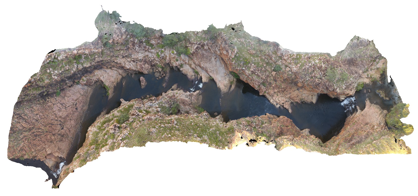
GibbRiverUAV2 Map
 |
0 |
06/06/2016 noon |
3D UAV photogrammetric model |
aerial view of Bell Creek Gorge, showing cascades over gently dipping sandstone beds. Bell Creek Gorge, Derby - Gibb River Road, Kimberly, W.A. |
100.00 |
-16.99212500000 |
125.20405400000 |
-9999.000 |
Bell Creek Gorge, dip, sandstone |
sandstone |
HamelinUAV1 Map
 |
0 |
05/23/2016 noon |
3D UAV photogrammetric model |
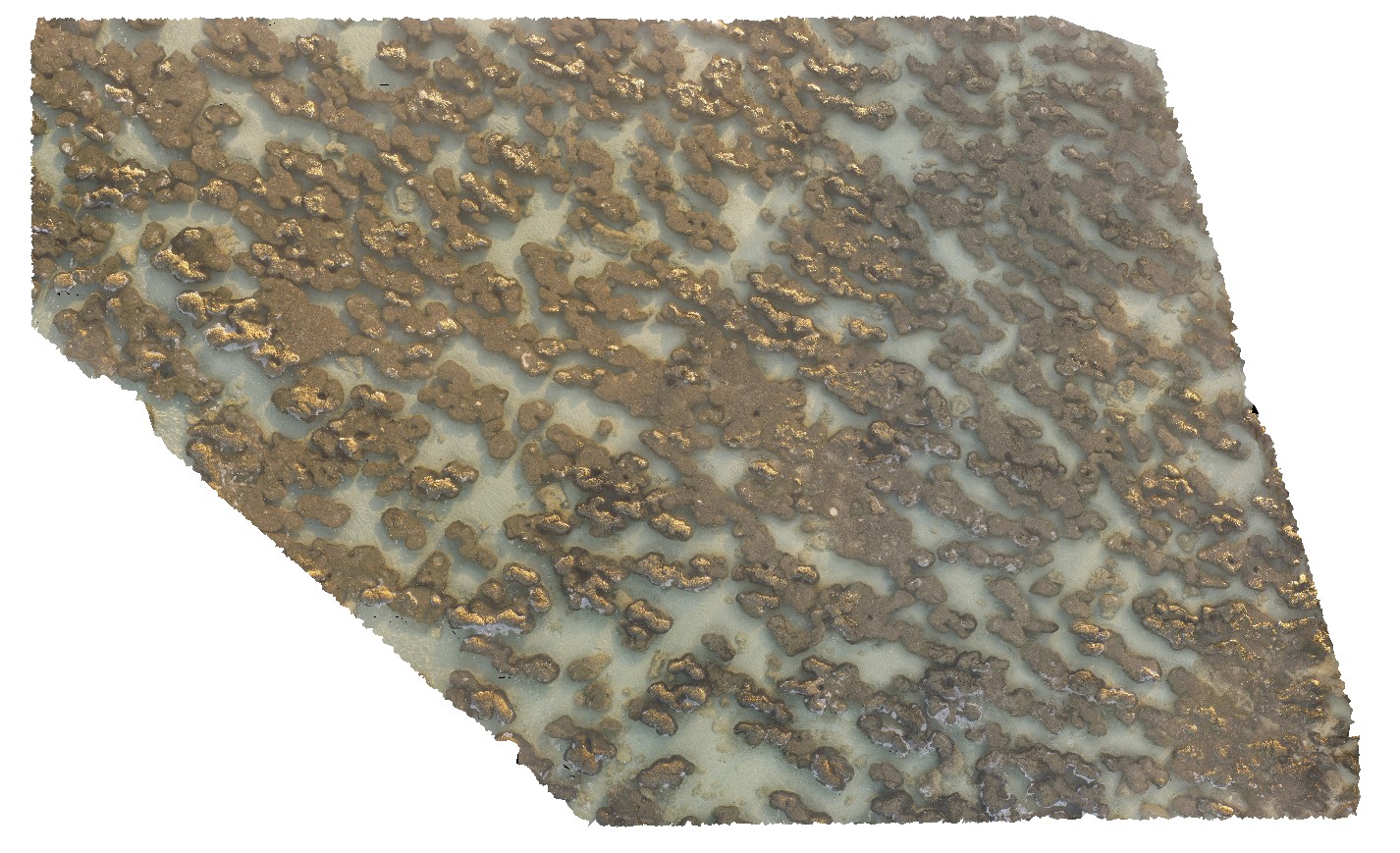
aerial view of submerged stromatolite colony. Hamelin Pool. Shark Bay, W.A. |
50.00 |
-26.40043900000 |
114.15878700000 |
-9999.000 |
tidal flat deposits, stromatolite |
tidal flat deposits |
HamelinUAV2 Map
 |
0 |
05/23/2016 noon |
3D UAV photogrammetric model |
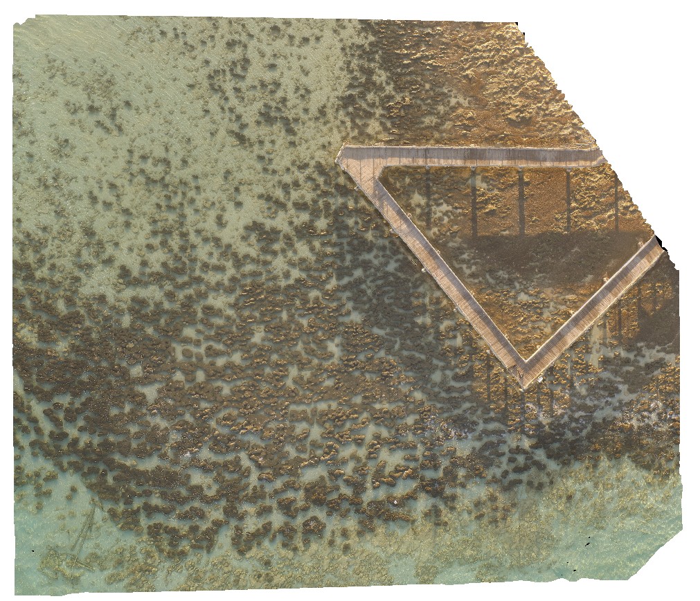
aerial view of submerged stromatolite colony. Hamelin Pool. Shark Bay, W.A. |
100.00 |
-26.40027700000 |
114.15869900000 |
-9999.000 |
tidal flat deposits, stromatolite |
tidal flat deposits |
HamelinUAV3 Map
 |
0 |
05/23/2016 noon |
3D UAV photogrammetric model |
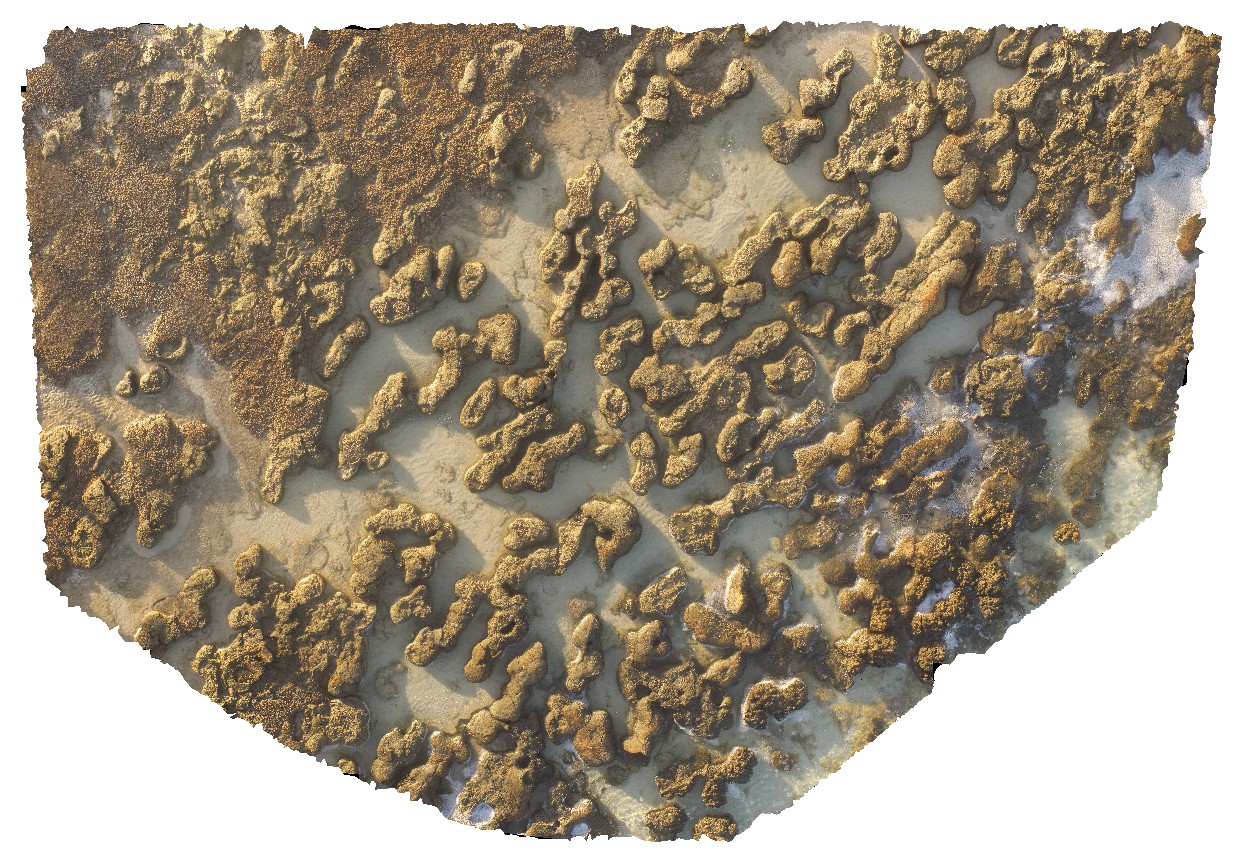
aerial view of stromatolites and fine interstitial sediments. Hamelin Pool. Shark Bay, W.A. |
25.00 |
-26.40072100000 |
114.15898800000 |
-9999.000 |
tidal flat deposits, stromatolite |
tidal flat deposits |
HamelinUAV4 Map
 |
0 |
05/23/2016 noon |
3D UAV photogrammetric model |
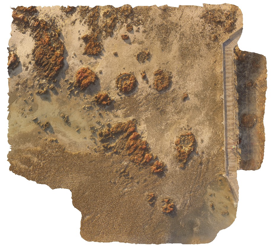
aerial view of large stromatolite mounds - supra-tidal. Hamelin Pool. Shark Bay, W.A. |
50.00 |
-26.40053100000 |
114.15087300000 |
-9999.000 |
tidal flat deposits, stromatolites |
tidal flat deposits |
HamelinUAV5 Map
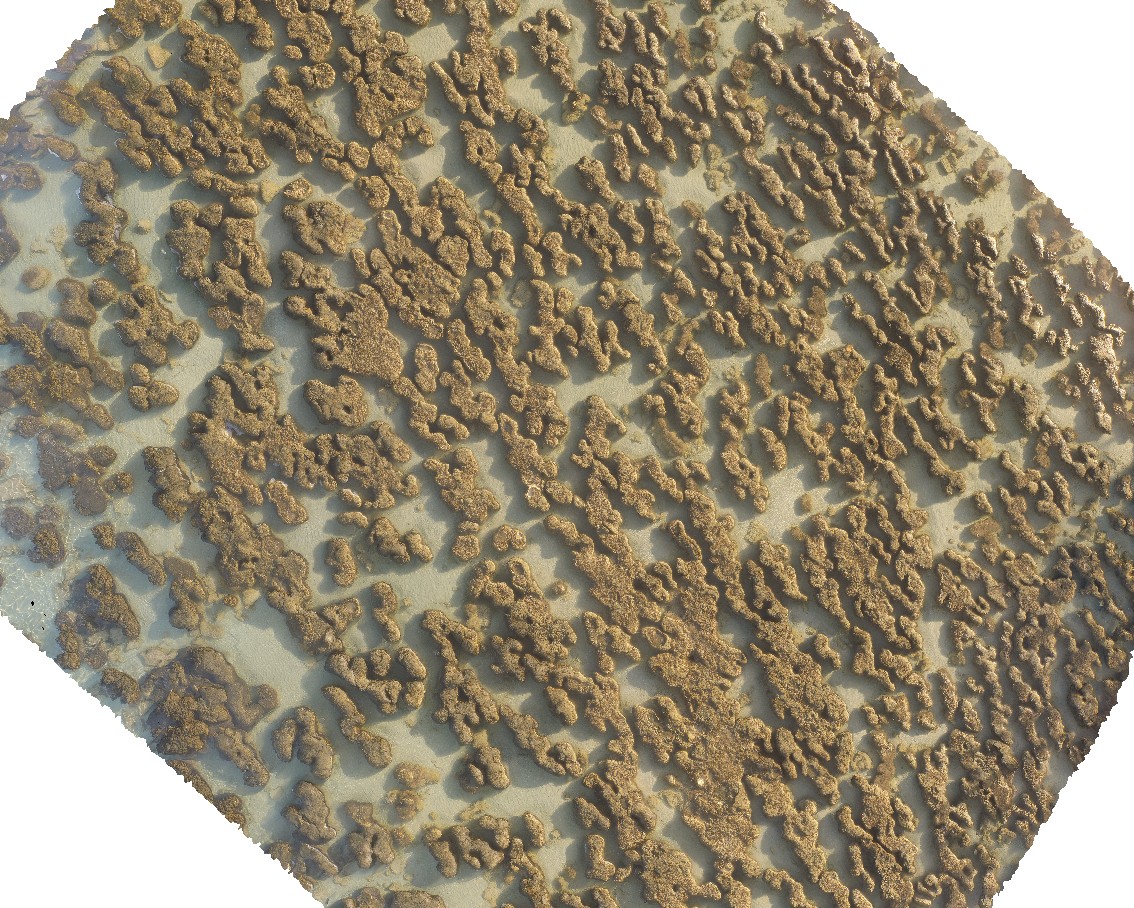 |
0 |
05/23/2016 noon |
3D UAV photogrammetric model |
aerial view of submerged stromatolites. Hamelin Pool. Shark Bay, W.A. |
50.00 |
-26.40031000000 |
114.15875100000 |
-9999.000 |
tidal flat deposits, stromatolite |
tidal flat deposits |
 AusGeol.org