BrachinaUAV4 Map
 |
20 |
04/22/2016 11:15 a.m. |
Full Spherical Panorama |
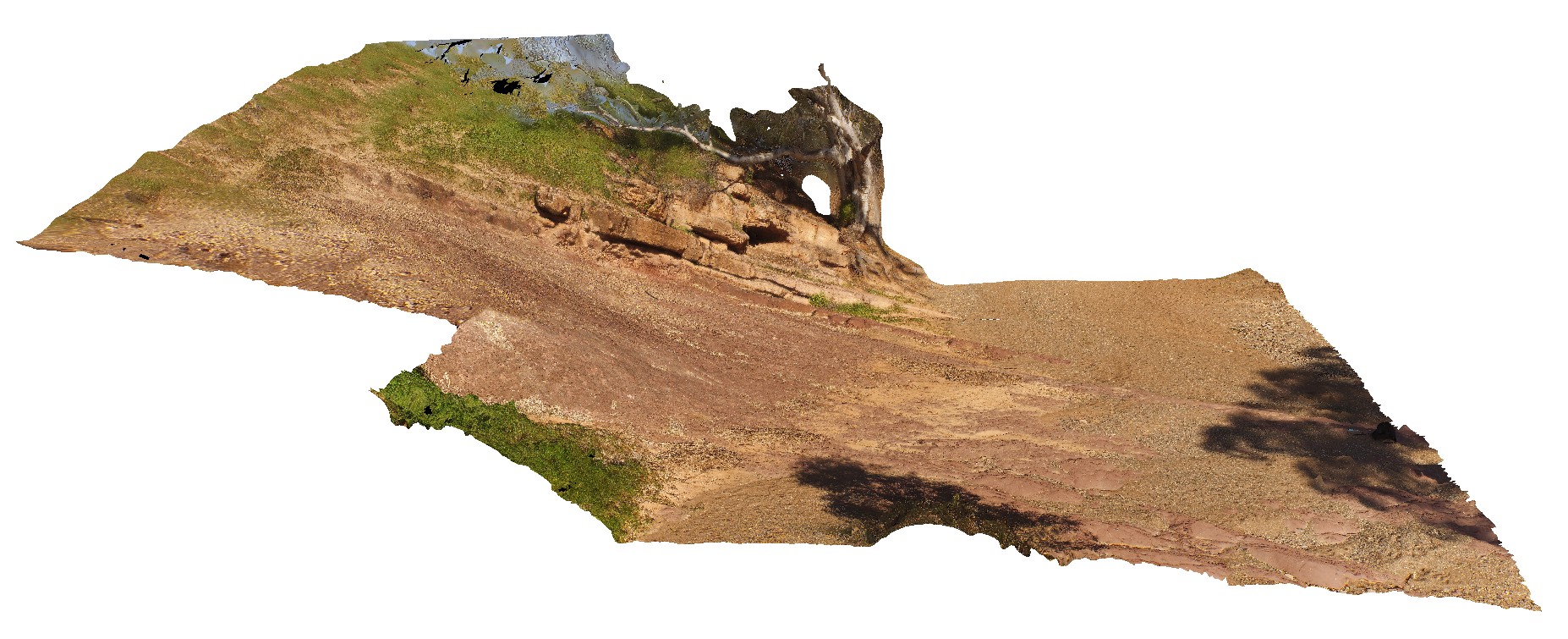
Golden Spike. Contact between the diamictite of the Elatina Formation and the dolomite of the Nuccaleena Formation. S.A. |
20.00 |
-31.33155000000 |
138.63344000000 |
-9999.000 |
golden spike, geological contact |
diamictite, dolomite |
Carnot10 Map
 |
20 |
10/29/2015 9:46 a.m. |
3D terrestrial photogrammetric model |
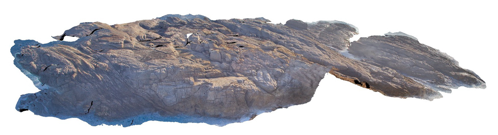
Aerial view, looking back toward Cape Carnot, showing banded gneiss / shear zone. Cape Carnot. S.A. |
50.00 |
-34.94329600000 |
135.61994200000 |
-9999.000 |
gneiss, shear zone |
gneiss |
Carnot4 Map
 |
20 |
10/29/2015 9:40 a.m. |
3D terrestrial photogrammetric model |
Overview of coast outcrop exposure, showing unconformity with older gneiss and Holocene sediments, Cape Carnot. S.A. |
200.00 |
-34.94264900000 |
135.62080600000 |
-9999.000 |
unconformity, gneiss, sand |
gneiss, sand |
Coffin1 Map
 |
20 |
10/29/2015 8:55 a.m. |
3D terrestrial photogrammetric model |
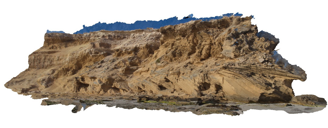
beach exposure showing cross-bedded calcareous sand and calcarenite? Point Avoid. S.A. |
10.00 |
-34.68882700000 |
135.32904100000 |
-9999.000 |
cross-bedding, calcareous sand, calcarenite |
calcarenite |
KirtonUAV3 Map
 |
20 |
10/20/2015 3:08 p.m. |
3D UAV photogrammetric model |
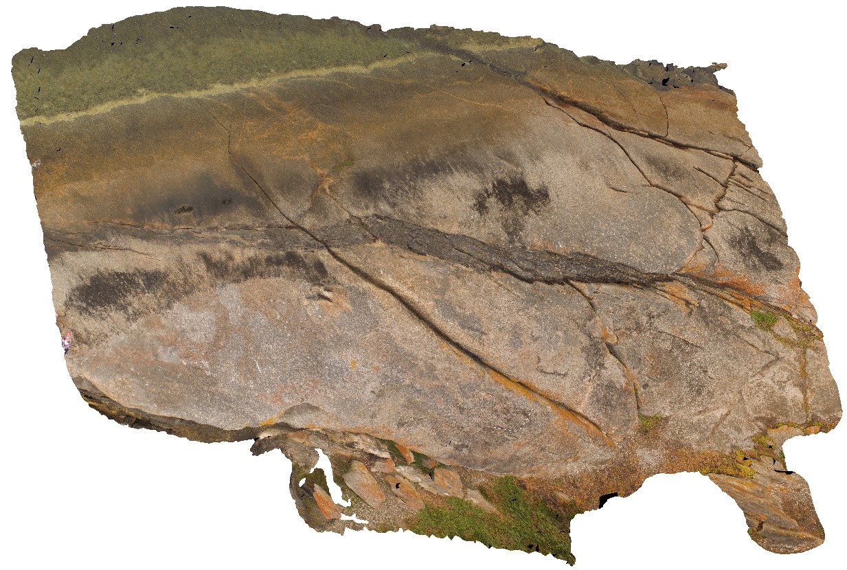
View of mafic dykes intruding granitic gneiss host rock. Kirton Point, Port Lincon. S.A. |
20.00 |
-34.72473000000 |
135.88480000000 |
-9999.000 |
mafic dyke, granitic gneiss, intrusive contact |
granitic gneiss, amphibolite |
KirtonUAV2 Map
 |
20 |
10/20/2015 3:08 p.m. |
3D UAV photogrammetric model |
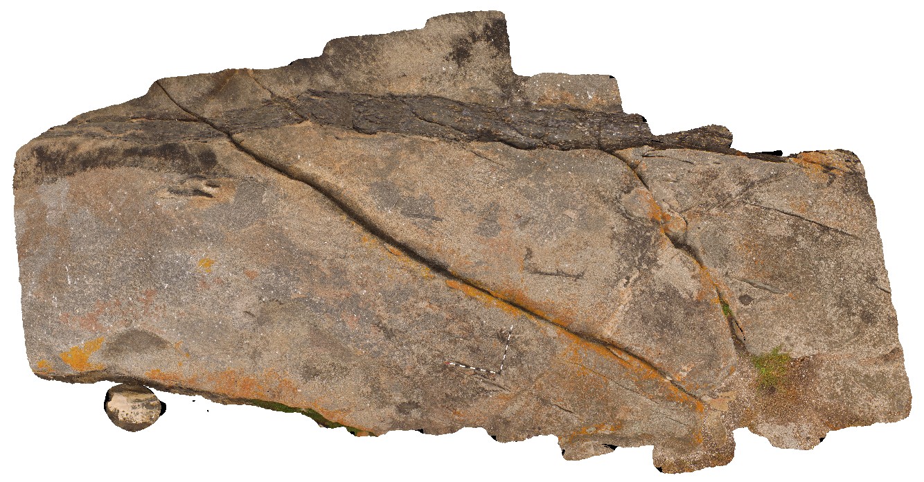
aerial view of mafic dyke in granitic gneiss. Kirton Point. Port Lincoln. S.A. |
7.00 |
-34.72473000000 |
135.88480000000 |
-9999.000 |
mafic dyke, granitic gneiss, intrusive contact |
granitic gneiss, amphibolite |
KirtonUAV1 Map
 |
20 |
10/20/2015 3:07 p.m. |
3D UAV photogrammetric model |
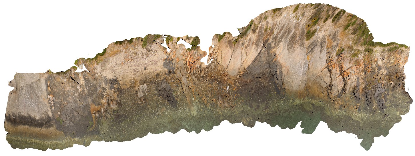
aerial view of exposed shore platform, showing Kirton Point and the Colbert Granite/ granite gneiss, with mafic intrusives? Port Lincoln. S.A. |
300.00 |
-34.72473000000 |
135.88480000000 |
-9999.000 |
granite gneiss |
granite |
Wilka14 Map
 |
20 |
09/27/2015 5:10 p.m. |
3D terrestrial photogrammetric model |
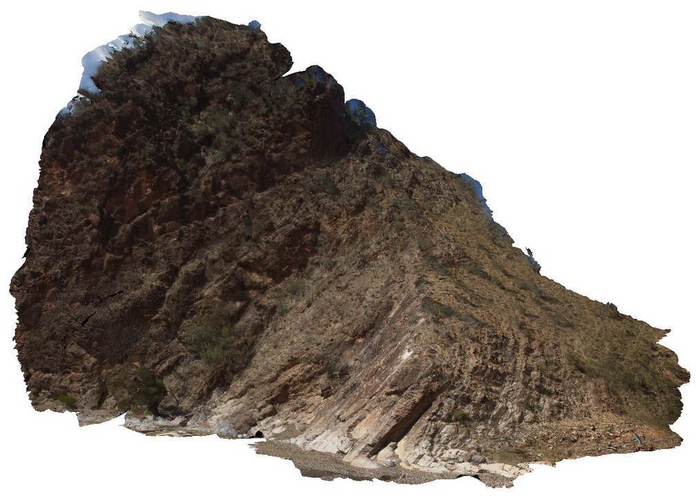
out crop of moderately dipping beds showing the contact between the Rownsley Quartzite and the Wilkawillina Limestone. Wilkawillina Trail, Flinders Ranges. |
20.00 |
-31.30021000000 |
138.90201000000 |
-9999.000 |
geological contact |
quartzite, limestone |
BrachinaUAV3 Map
 |
20 |
04/22/2016 11:02 a.m. |
Full Spherical Panorama |
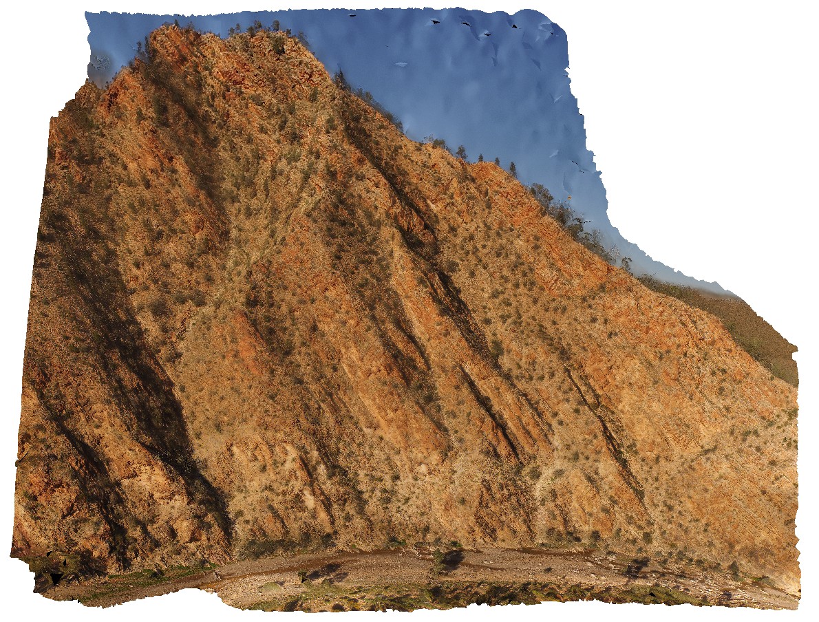
View of surrounding Rawnsley Quartzite from hill above Brachina Gorge Road. S.A. |
1000.00 |
-31.34426900000 |
138.55557900000 |
-9999.000 |
sedimentology |
quartzite |
BrachinaUAV2 Map
 |
20 |
04/20/2016 4:10 p.m. |
Full Spherical Panorama |
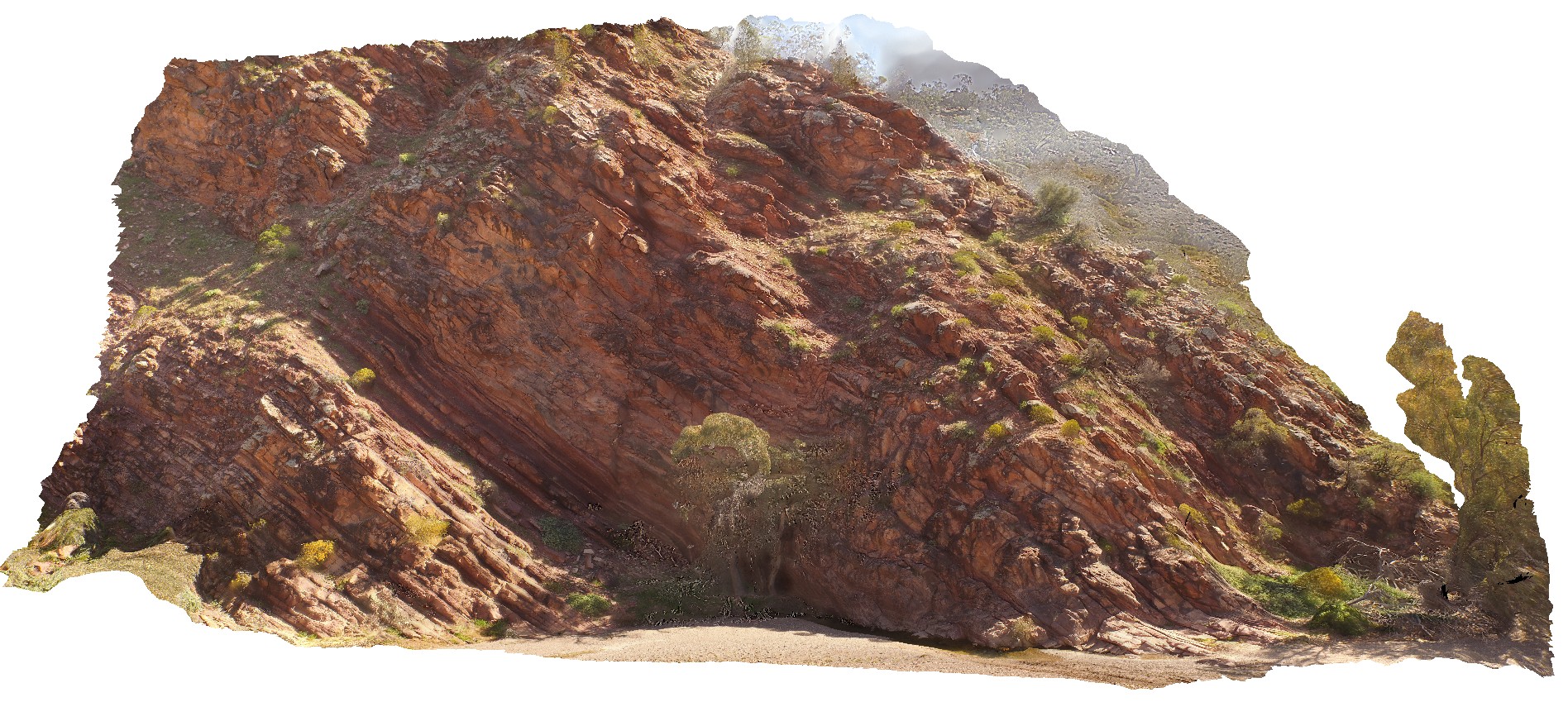
view of cliff exposure of the Bonney Sandstone, showing gently folded, moderately dipping stratigraphy. Brachina Gorge. S.A. |
100.00 |
-31.33480600000 |
138.56632900000 |
-9999.000 |
bedding, sedimentology |
sandstone |
BrachinaUAV1 Map
 |
20 |
04/21/2016 5:09 p.m. |
Full Spherical Panorama |
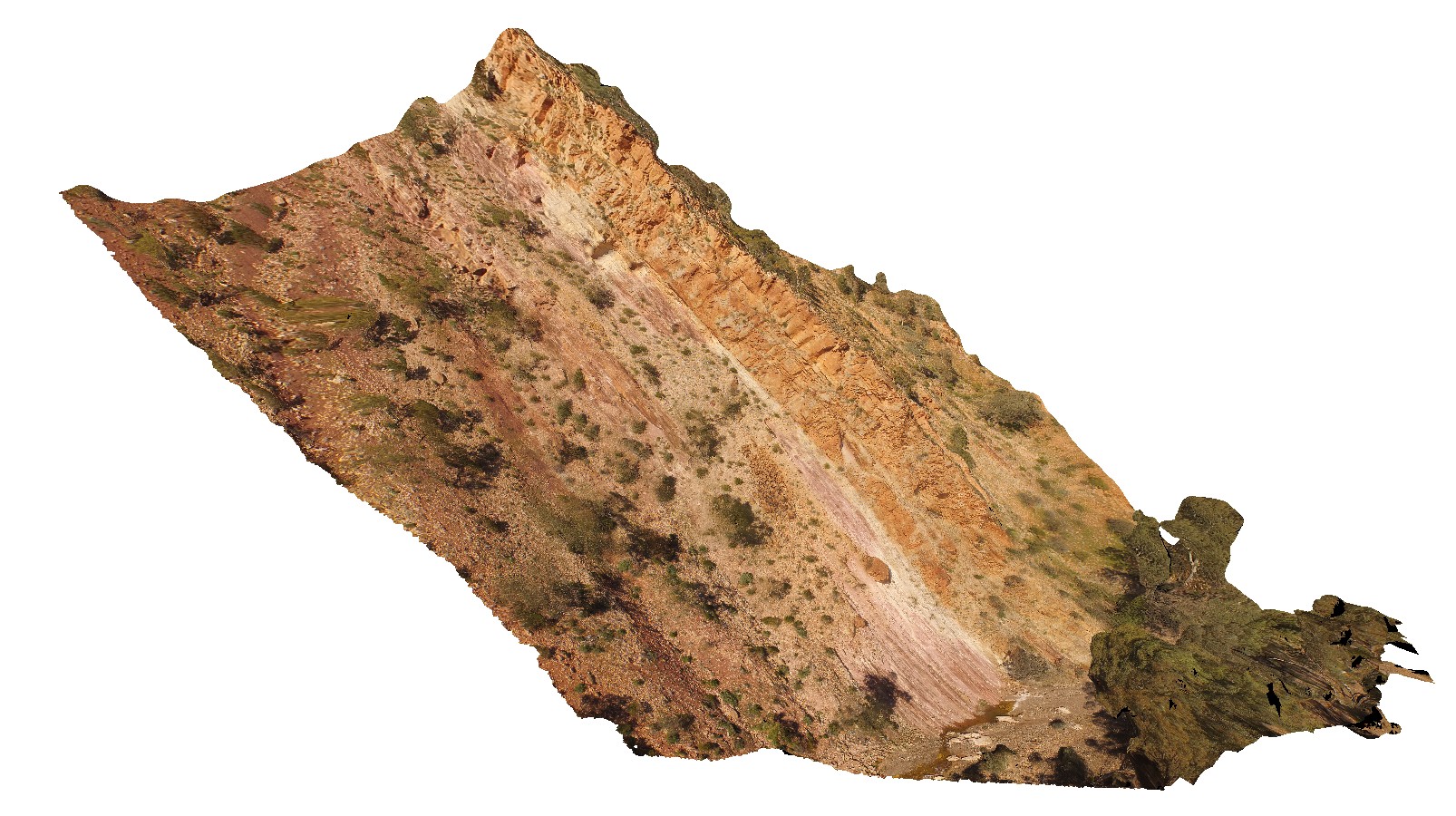
large cliff section showing contact between the Bonny Sandstone and the Rawnsley Quartzite, Brachina Gorge. S.A. |
250.00 |
-31.34345800000 |
138.56331600000 |
-9999.000 |
geological contact |
quartzite, sandstone |
BluestoneUAV8 Map
 |
20 |
01/01/9999 midnight |
3D UAV photogrammetric model |
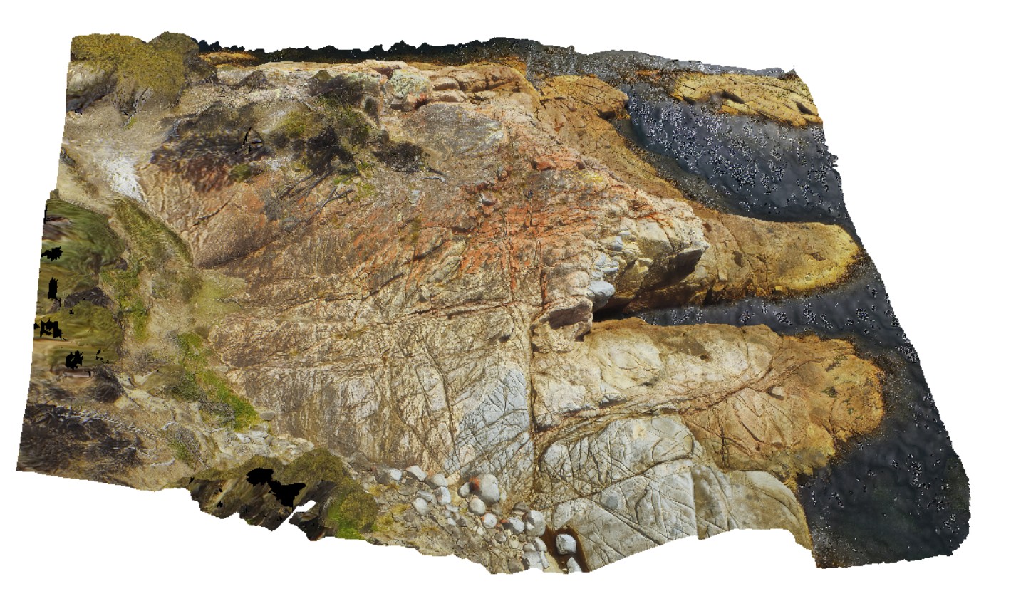
detailed aerial view of granite / granodiorite contact. Bluestone Bay, Freycinet. Tasmania. |
78.00 |
-42.10331200000 |
148.33529300000 |
29.300 |
intrusive contact, Coles Bay Granite, Bluestone Bay Granodiorite |
granite, granodiorite |
DaisyBanksPit3 Map
 |
20 |
03/17/2015 1:37 p.m. |
3D terrestrial photogrammetric model |
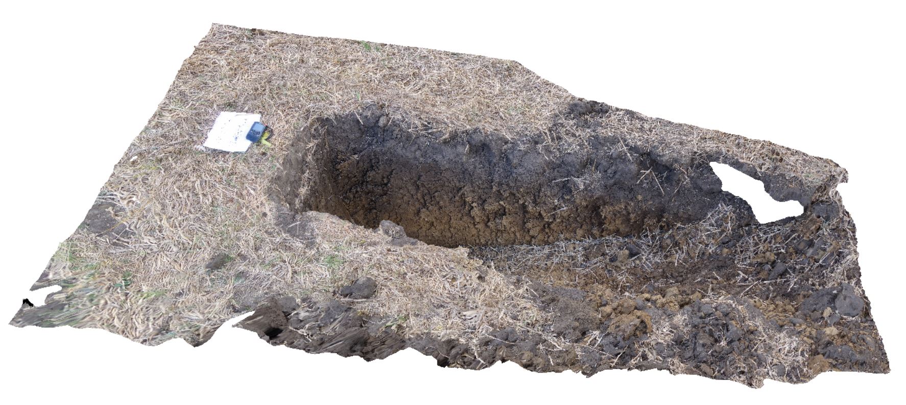
~80cm deep pit into soil and clays overlying Quaternary alluvial and marsh deposits of modern flood plains; of gravel, sand, silt and clay. Richmond, Tas. |
2.00 |
-42.73071600000 |
147.42842100000 |
-9999.000 |
clay, alluvium, regolith |
Clay |
SulphurCreekUAV1 Map
 |
20 |
01/01/9999 midnight |
3D UAV photogrammetric model |
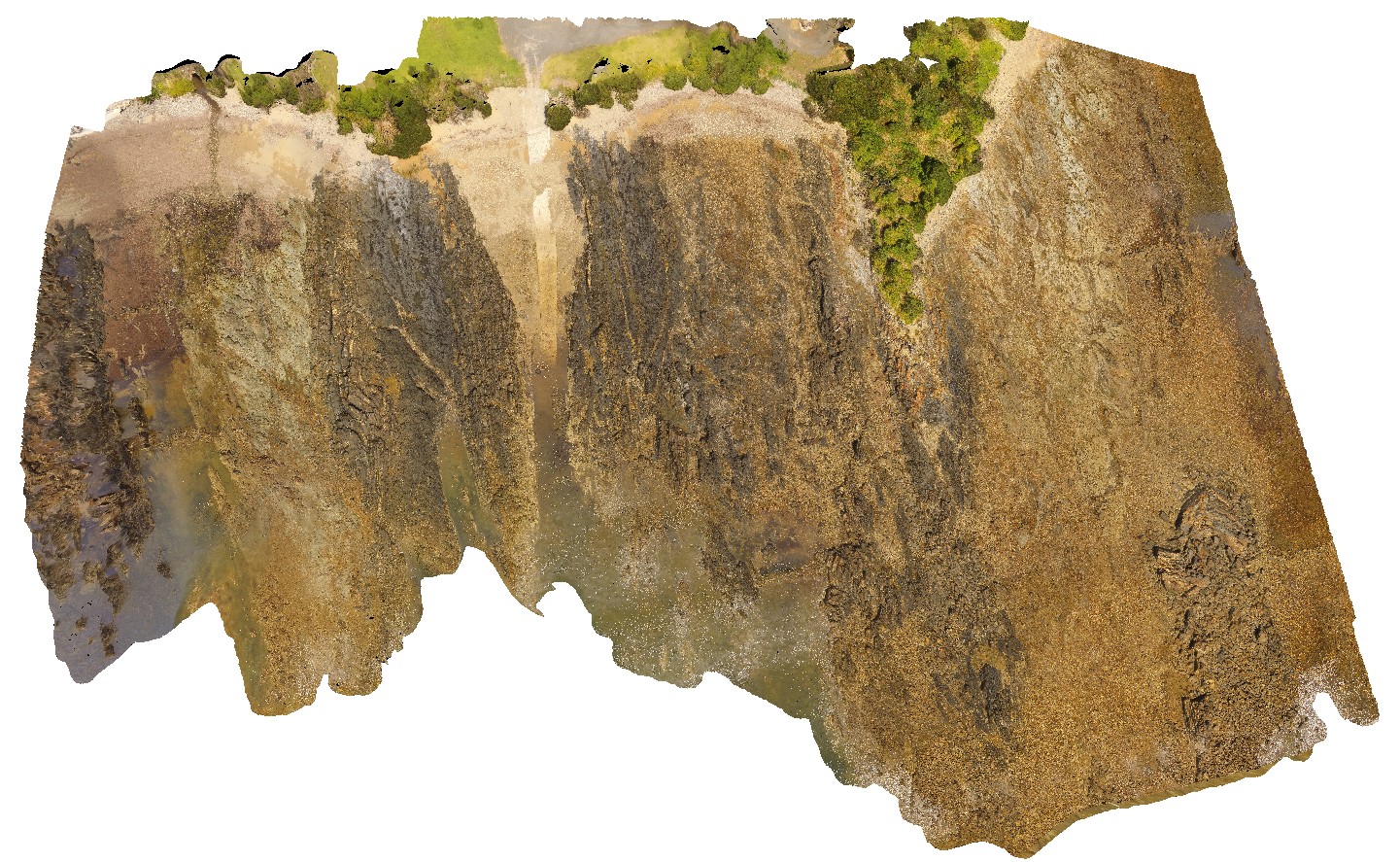
aerial view of shore outcrop, showing region of folded metasediments in contact with altered basalts. Sulphur Creek, north Tas. |
232.00 |
-41.09104300000 |
146.02016600000 |
108.600 |
metasediments, basalt, fold, fault |
metasediments, basalt |
WaterfallbayUAV1 Map
 |
20 |
01/01/9999 midnight |
3D UAV photogrammetric model |
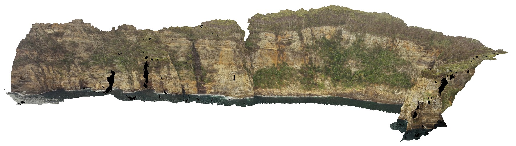
extensive aerial view of 'clean' Permian sediment cliffs. Waterfall Bay, Tasmania. |
500.00 |
-43.05168000000 |
147.94986900000 |
170.448 |
Permian sediments, dolerite dyke, faults, sedimentology |
sediments |
BlackjackUAV1 Map
 |
20 |
01/01/9999 midnight |
3D UAV photogrammetric model |
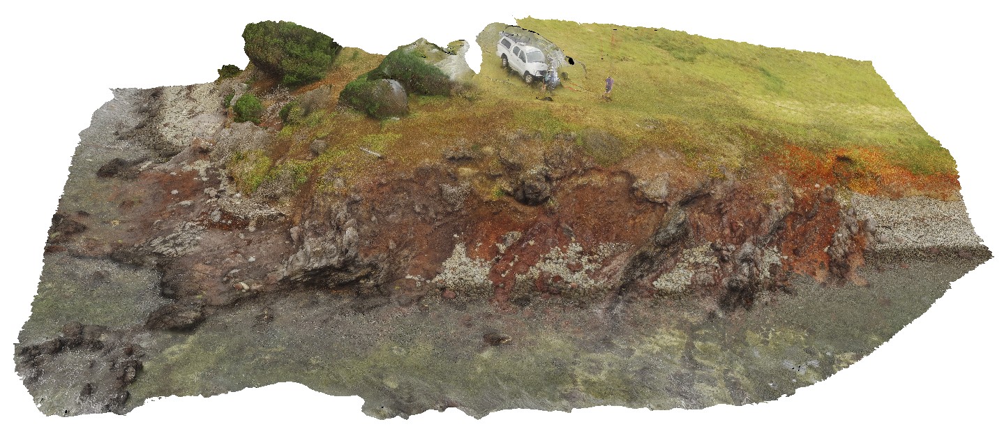
aerial view of exposed layered volcanic package, including basalt lava flows and volcanic breccias. Black Jack Hills, Tas. |
100.00 |
-42.99280500000 |
147.65259900000 |
-9999.000 |
breccia, lava flow, basalt, volcanics, volcanic package |
basalt |
BlackjackUAV2 Map
 |
20 |
01/01/9999 midnight |
3D UAV photogrammetric model |
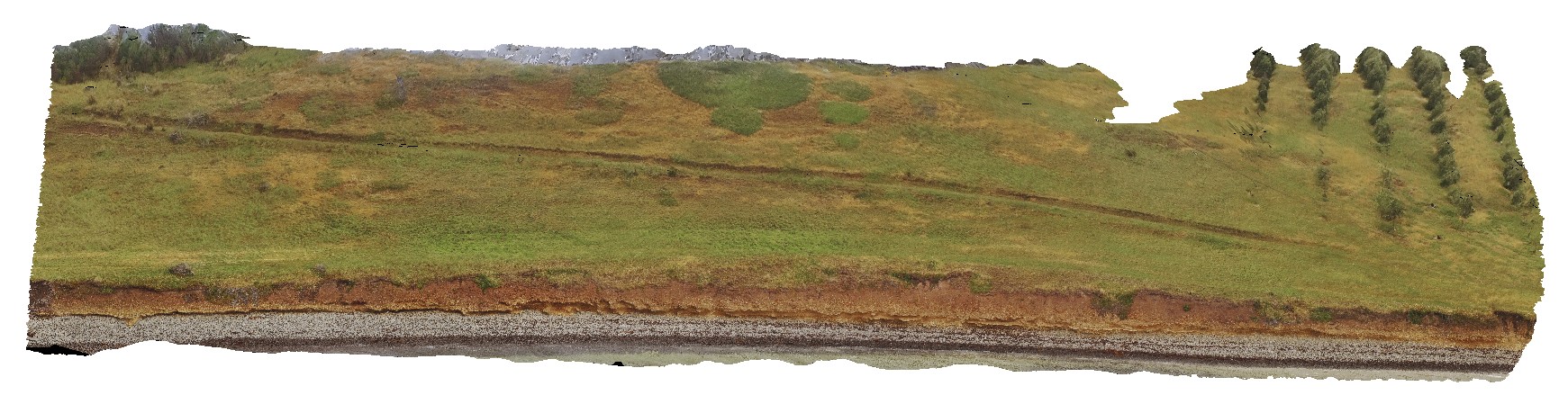
aerial view of exposed modern paleo-beach deposits of flat cobble shingles. Black Jack Hills, Tas. |
50.00 |
-42.99353100000 |
147.65130500000 |
70.729 |
paleo-beach deposit, paleo land form, shingles |
conglomerate |
KakaduUAV1 Map
 |
20 |
01/01/9999 midnight |
3D UAV photogrammetric model |
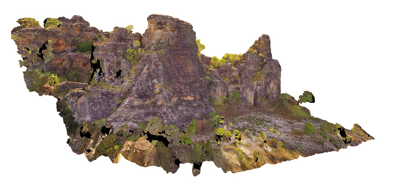
270 degree view of tall (~30m) sandstone tower with shallowly dipping cross beds and planar beds. Bardedjilidji Walk. Kakadu National Park. N.T. |
40.00 |
-12.43749000000 |
132.96887000000 |
-9999.000 |
tower, sandstone, cross bedding, weathering feature |
sandstone |
KakaduUAV2 Map
 |
20 |
01/01/9999 midnight |
3D UAV photogrammetric model |
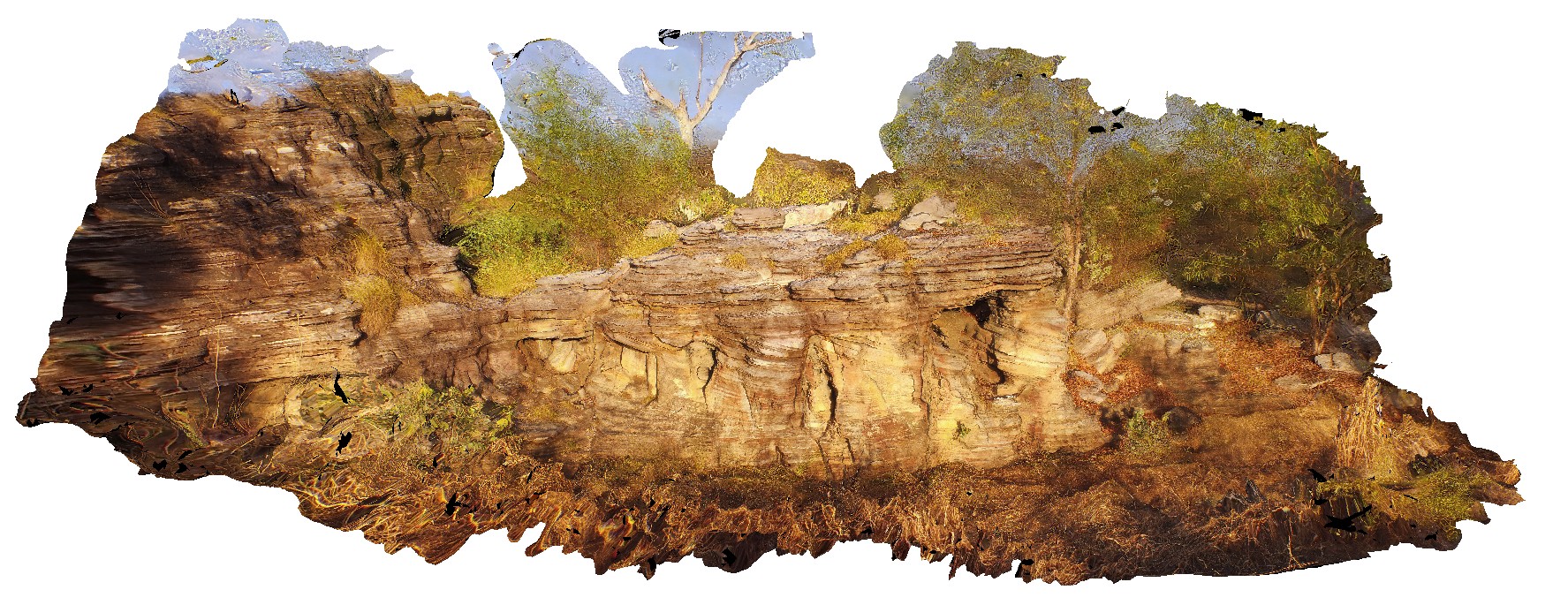
aerial view of small cliff exposure, showing gently dipping cross beds, truncated by planar bedded sandstone. Bardedjilidji Walk. Kakadu National Park. N.T. |
10.00 |
-12.43685000000 |
132.97076000000 |
-9999.000 |
cross bedding, sandstone, sedimentology |
sandstone |
Prices8 Map
 |
20 |
03/13/2015 9:13 a.m. |
3D terrestrial photogrammetric model |
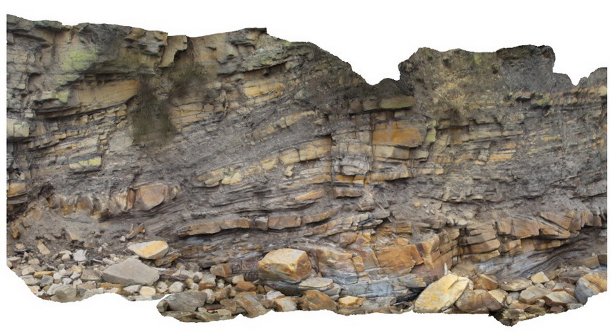
Triassic fluvial/floodplain sediments. Prices Point, Tasman Peninsula, Tasmania. |
10.00 |
-43.03366100000 |
147.74592300000 |
0.500 |
fluvial, floodplain, sedimentology |
sandstone |
Boya3 Map
 |
20 |
01/01/9999 midnight |
3D terrestrial photogrammetric model |
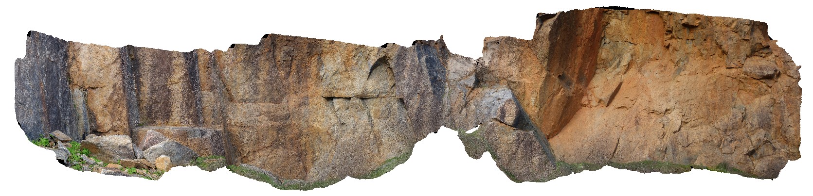
view of granite quarry walls, showing joint surfaces and blocky granite. Boya quarry, Boya, Western Australia. |
10.00 |
-31.91484580000 |
116.06239402000 |
-9999.000 |
quarry, Boya, granite |
granite |
SBay1 Map
 |
20 |
03/13/2015 9:17 a.m. |
3D terrestrial photogrammetric model |
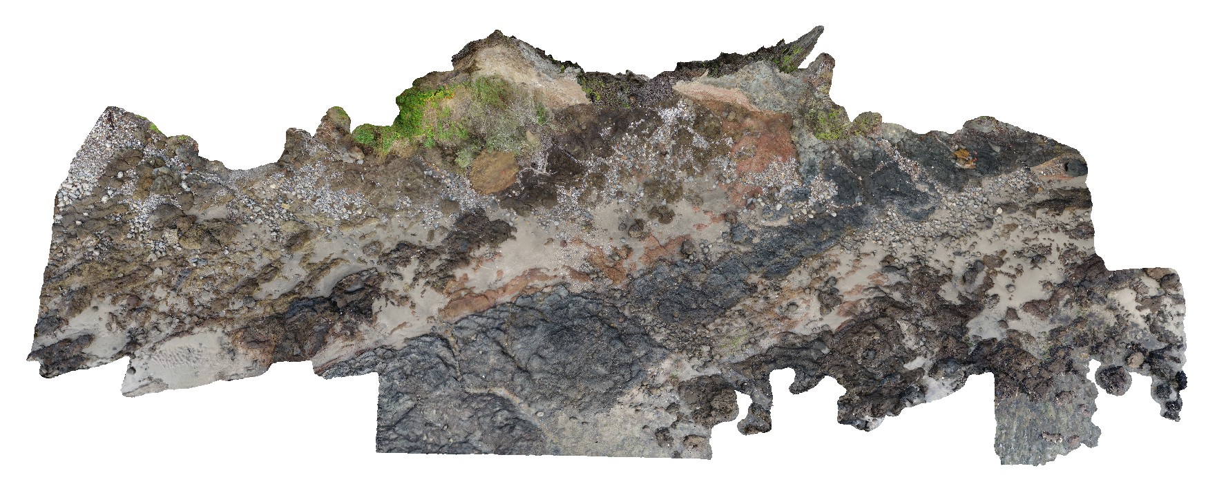
Pole photography of the Charles Darwin Cliff at Sandy Bay. Tertiary basaltic lava flows and pyroclastic material deposited from a small volcanic vent approximately 200m to the west |
25.00 |
-42.91649600000 |
147.36026000000 |
-9999.000 |
basalt, tuff, agglomerate, volcanology, igneous |
basalt, tuff |
Boya4 Map
 |
20 |
01/01/9999 midnight |
3D terrestrial photogrammetric model |
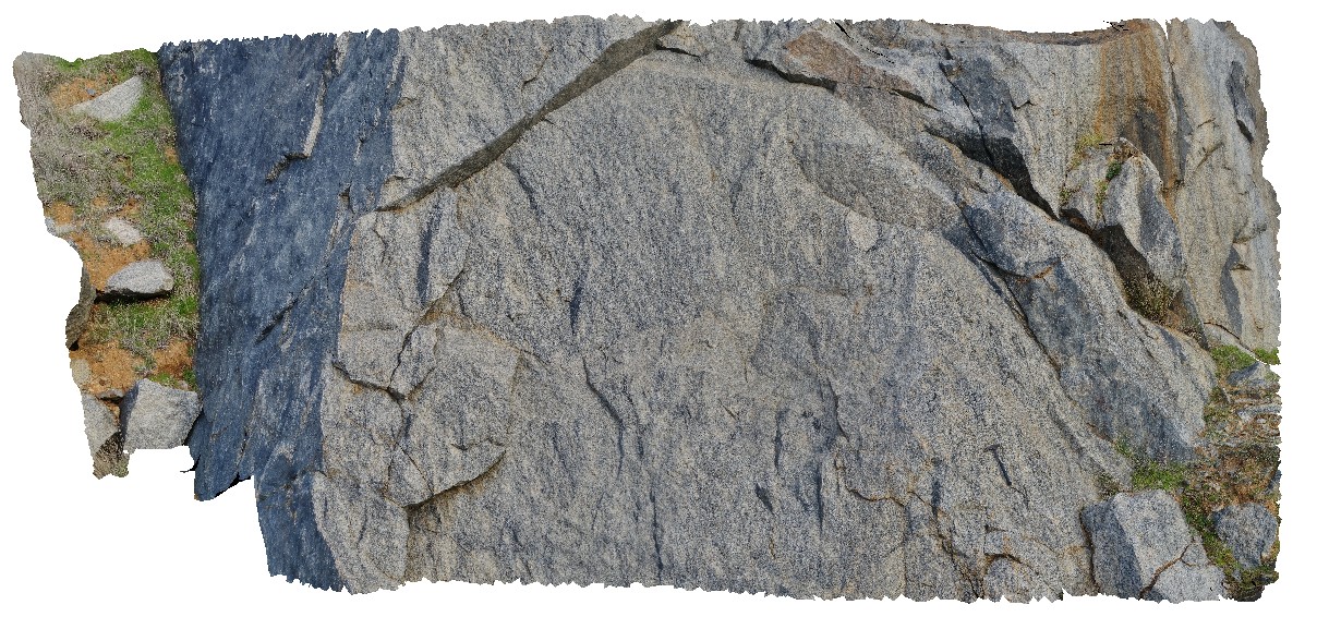
view of dark mineral (manganese oxide?) coating joint surface on granite. Boya quarry, Boya, Western Australia. |
2.00 |
-31.91484580000 |
116.06239402000 |
-9999.000 |
joint surface, granite, manganese oxide |
granite |
Prices3 Map
 |
20 |
06/20/2016 3:22 p.m. |
3D terrestrial photogrammetric model |
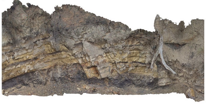
Normal faults disrupting Triassic sandstone and carbonaceous siltstone layers. Prices Point, Tasman Peninsula, Tasmania. |
13.00 |
-43.03491300000 |
147.74760800000 |
0.500 |
fluvial sediments, normal fault, sandstone, siltstone, structure, sedimentology |
sandstone, siltstone |
Blackjack10 Map
 |
20 |
01/01/9999 midnight |
3D terrestrial photogrammetric model |
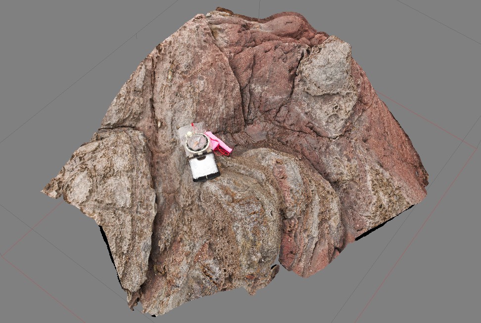
contact between volcanic breccia and a basalt lava flow. Black Jack Hills, Tas. |
0.60 |
-42.99270000000 |
147.65276000000 |
-9999.000 |
lava, basalt, flow |
basalt |
 AusGeol.org