Mitchell2 Map
 |
0 |
06/08/2016 noon |
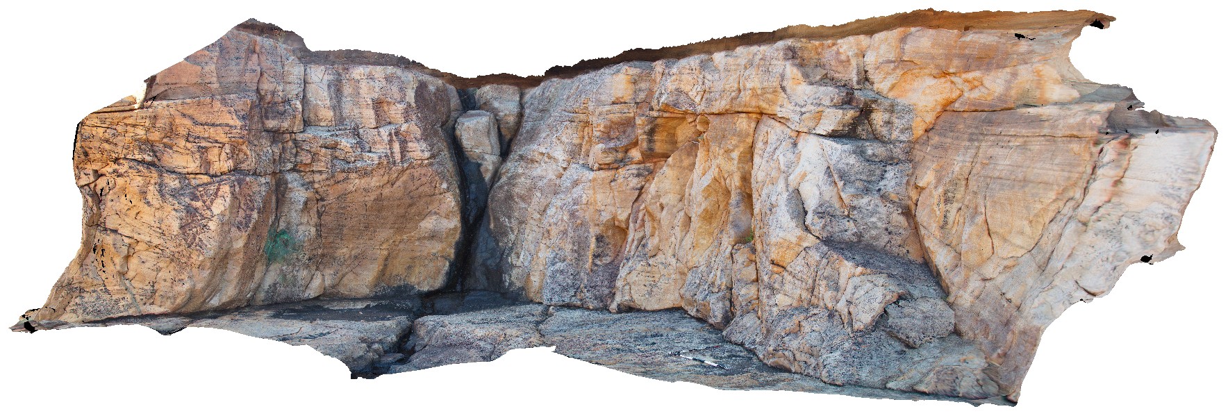
3D terrestrial photogrammetric model |
bedforms in King Leopold Sandstone, including cross beds and convoluted bedding. Mitchell Falls, Mitchell River, Kimberley. W.A. |
7.50 |
-14.82099000000 |
125.69496000000 |
-9999.000 |
King Leopold Sandstone, cross bedding, convoluted bedding |
sandstone |
MitchellFSP1 Map
 |
0 |
06/08/2016 noon |
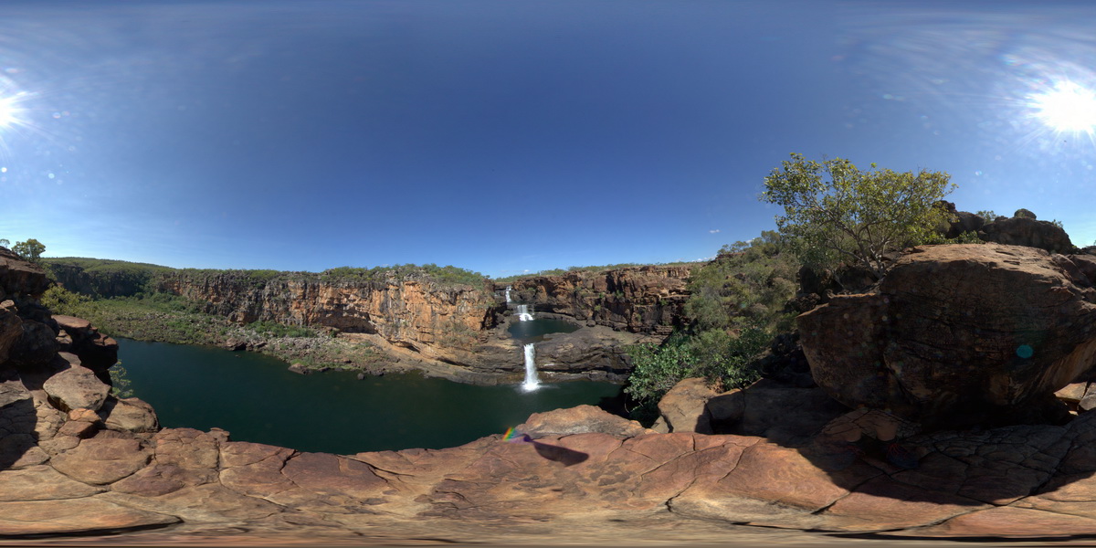
Full Spherical Panorama |
overview of Mitchell Falls, Mitchell River, Kimberley. W.A. |
500.00 |
-14.82099000000 |
125.69604000000 |
-9999.000 |
Mitchell Falls, waterfall, sedimentology |
sandstone |
Mitchell1 Map
 |
0 |
06/08/2016 noon |
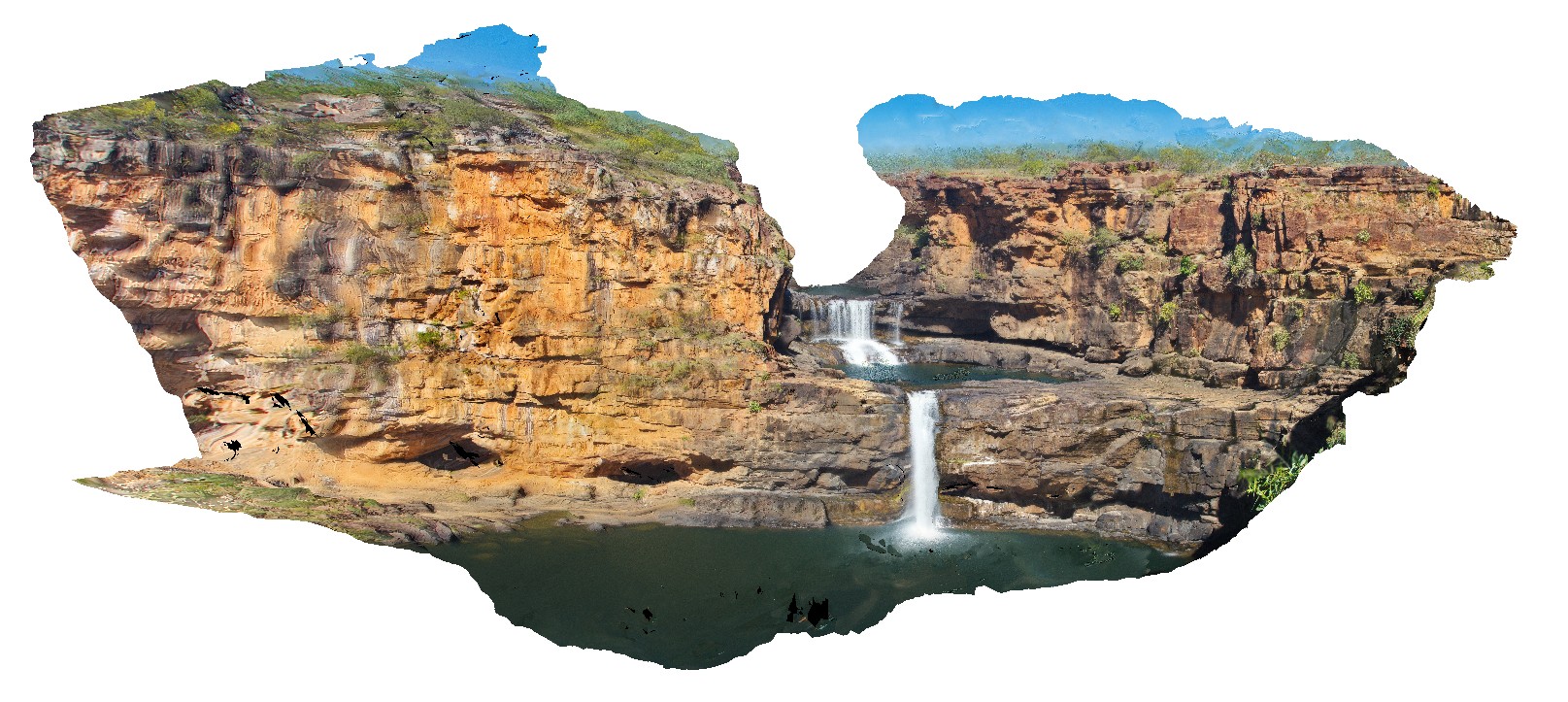
3D terrestrial photogrammetric model |
overview of Mitchell Falls, Mitchell River, Kimberley. W.A. |
75.00 |
-14.82099000000 |
125.69496000000 |
-9999.000 |
water fall, Mitchell Falls, King Leopold Sandstone |
sandstone |
LimestoneCreek1 Map
 |
0 |
06/21/2016 noon |
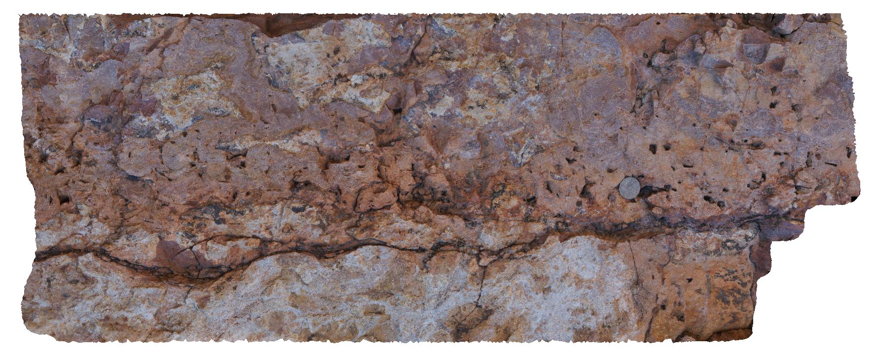
3D terrestrial photogrammetric model |
bed of laminated, conchoidal stromatolitic limestone with irregular, wavy contact with massive dolostone. Near Limestone Creek, Victoria Highway, N.T. |
0.00 |
-14.81136000000 |
131.93707000000 |
-9999.000 |
stromatolitic limestone, dolostone, stromatolite, fossil, palaeontology |
limestone |
MitchellFSP3 Map
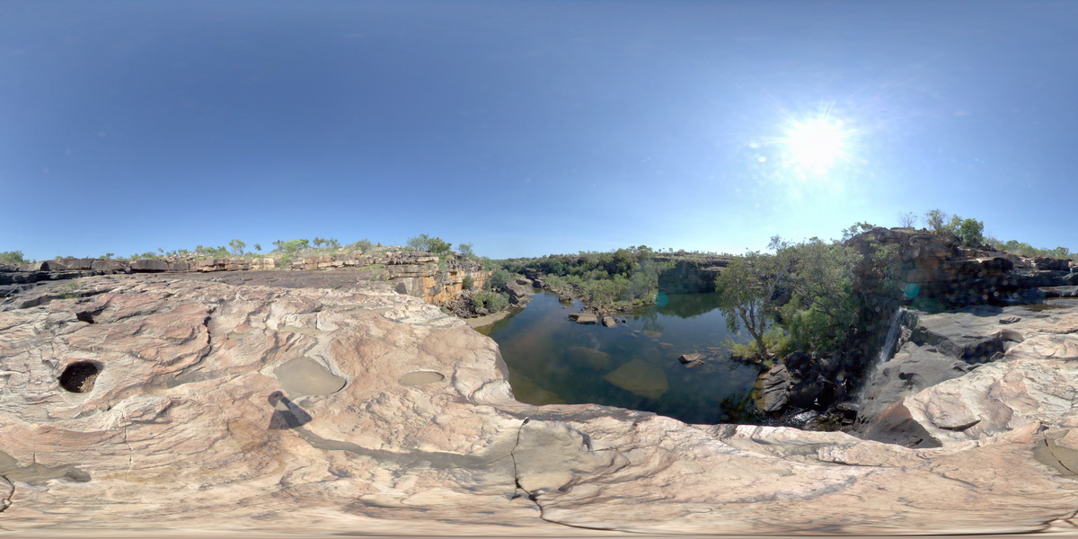 |
0 |
06/08/2016 noon |
Full Spherical Panorama |
view looking downstream from Mitchell Falls, Mitchell River, Kimberley. W.A. |
500.00 |
-14.67411000000 |
125.73240000000 |
-9999.000 |
bedding, sandstone, Mitchell Falls |
sandstone |
Mitchell16 Map
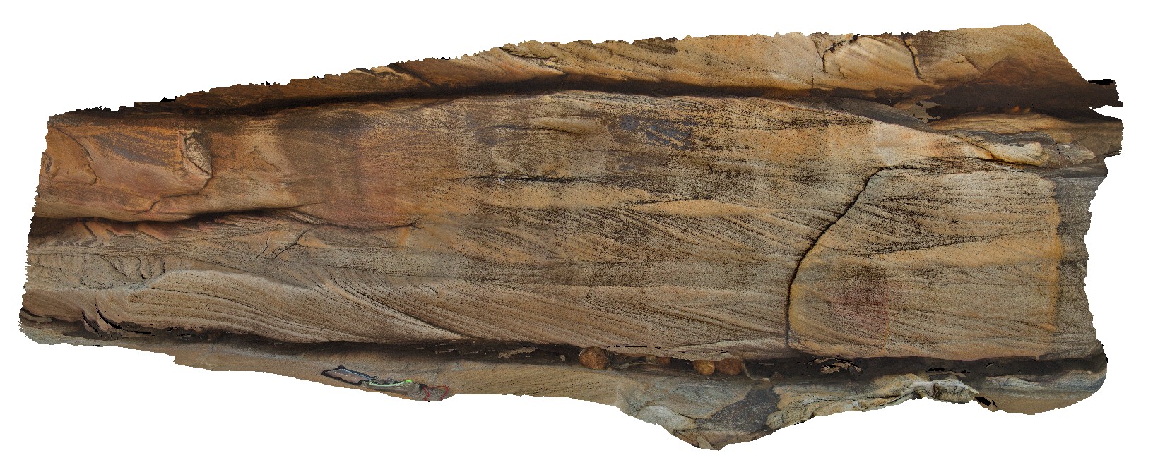 |
0 |
06/08/2016 noon |
3D terrestrial photogrammetric model |
small scale cross beds in King Leopold Sandstone and surveyors pool. Mitchell Plateau, Kimberley, W.A. |
1.50 |
-14.67411000000 |
125.73260000000 |
-9999.000 |
cross bedding, King Leopold Sandstone, surveyors pool |
sandstone |
Mitchell17 Map
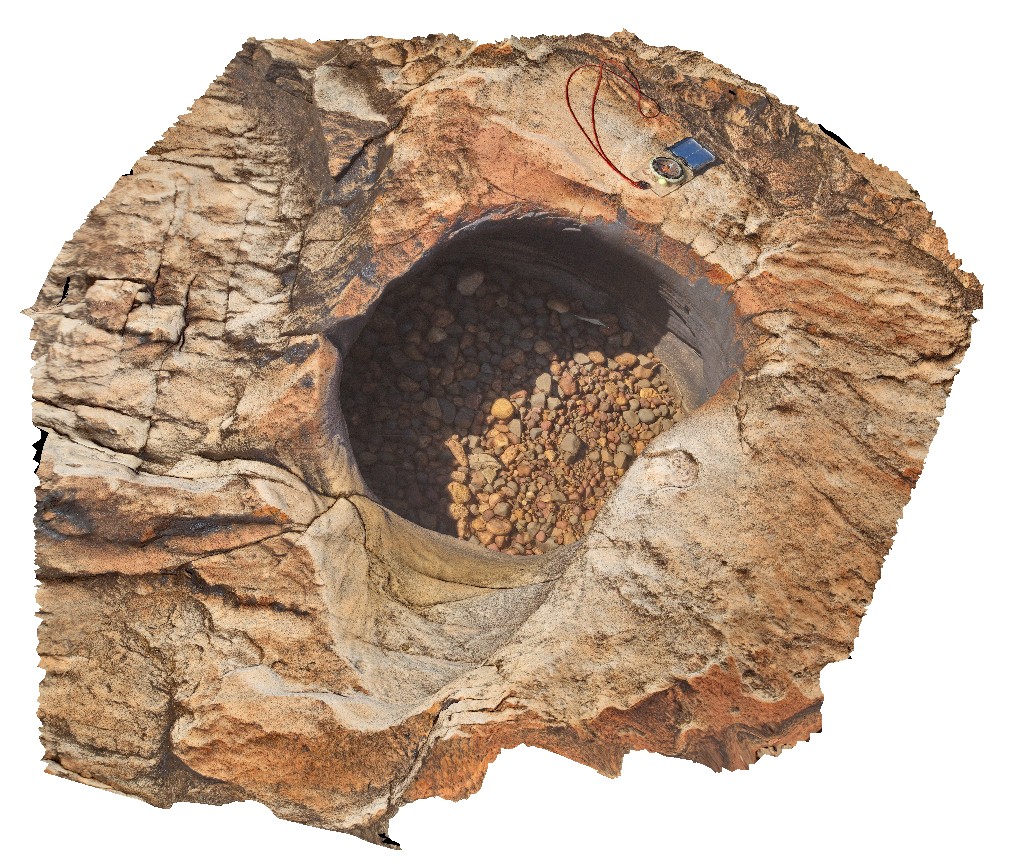 |
0 |
06/08/2016 noon |
3D terrestrial photogrammetric model |
pot hole with small rounded grind stones. Surveyors pool. Mitchell Plateau, Kimberley, W.A. |
0.00 |
-14.67411000000 |
125.73239000000 |
-9999.000 |
sandstone, King Leopold Sandstone, pot hole, grind stone |
sandstone |
Florina3 Map
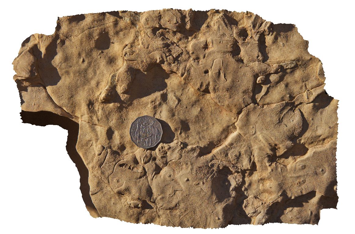 |
0 |
06/22/2016 noon |
3D terrestrial photogrammetric model |
close up view of impression of segmented worm? Fossil. Florina Homestead at Daly River, N.T. |
0.20 |
-14.63042000000 |
131.70625000000 |
-9999.000 |
fossil, segmented worm, palaeontology |
dolostone |
Florina4 Map
 |
0 |
06/22/2016 noon |
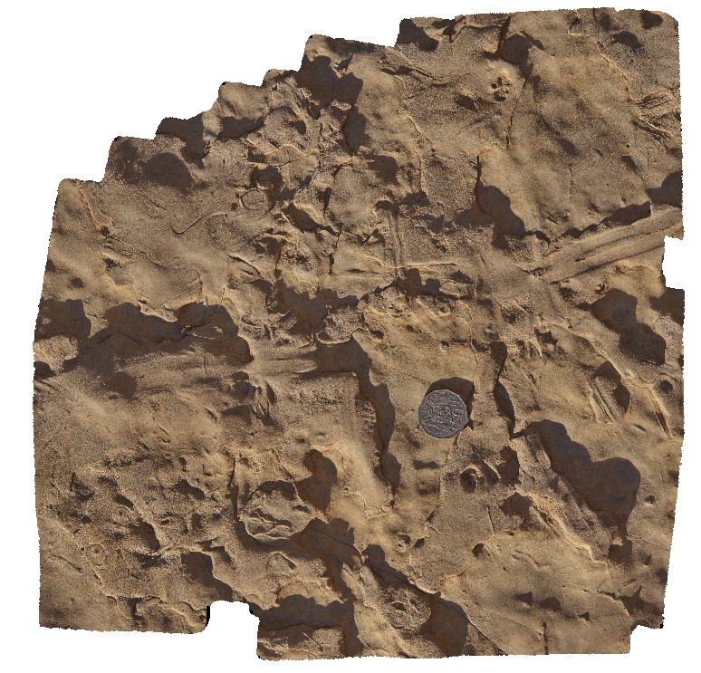
3D terrestrial photogrammetric model |
view of elongate, soft-bodied impression (approx. 40cm long) in dolostone. Florina Homestead at Daly River, N.T. |
0.50 |
-14.63042000000 |
131.70625000000 |
-9999.000 |
soft bodied fossil, dolostone, fossil, palaeontology |
dolostone |
Florina1 Map
 |
0 |
06/22/2016 noon |
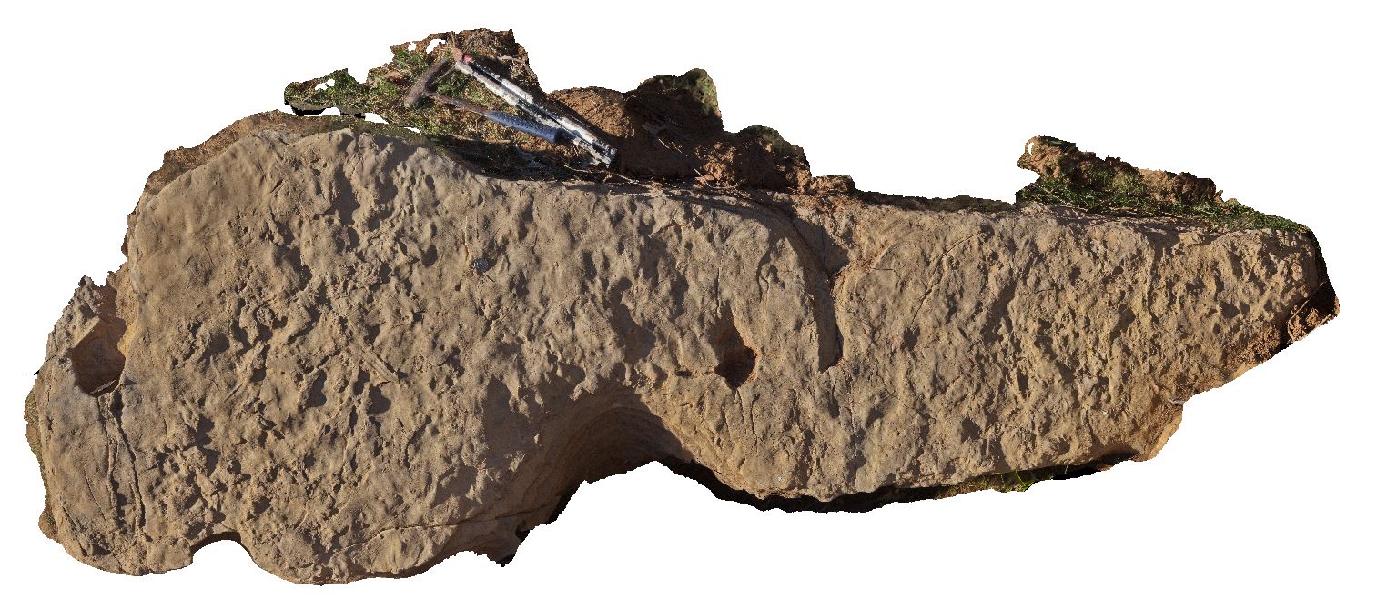
3D terrestrial photogrammetric model |
slumped block of dolostone with soft bodied impressions and trace fossils. Florina Homestead at Daly River, N.T. |
3.10 |
-14.63042000000 |
131.70625000000 |
-9999.000 |
soft bodied fossil impressions, dolostone, fossil, palaeontology |
dolostone |
Florina2 Map
 |
0 |
06/22/2016 noon |
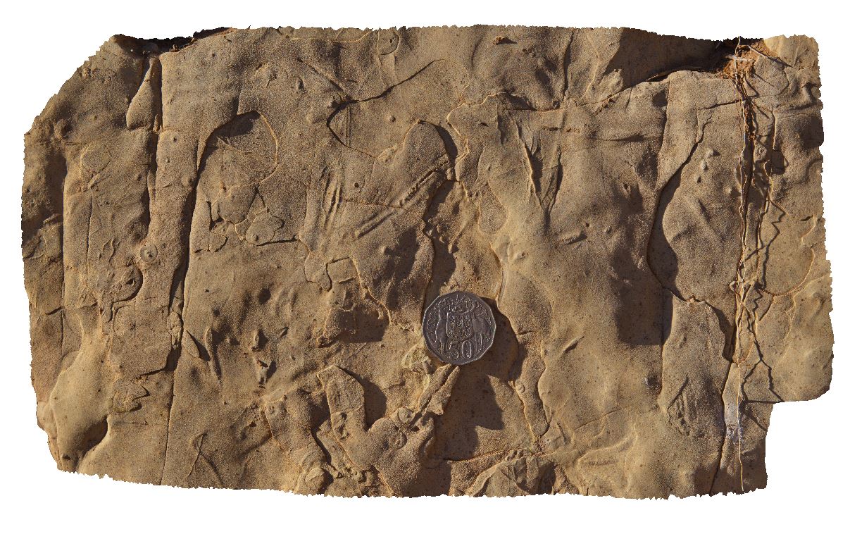
3D terrestrial photogrammetric model |
view of resting trace fossil in dolostone. Florina Homestead at Daly River, N.T. |
0.30 |
-14.63042000000 |
131.70625000000 |
-9999.000 |
trace fossil, dolostone, sedimentology, palaeontology, fossil |
dolostone |
Florina5 Map
 |
0 |
06/22/2016 noon |
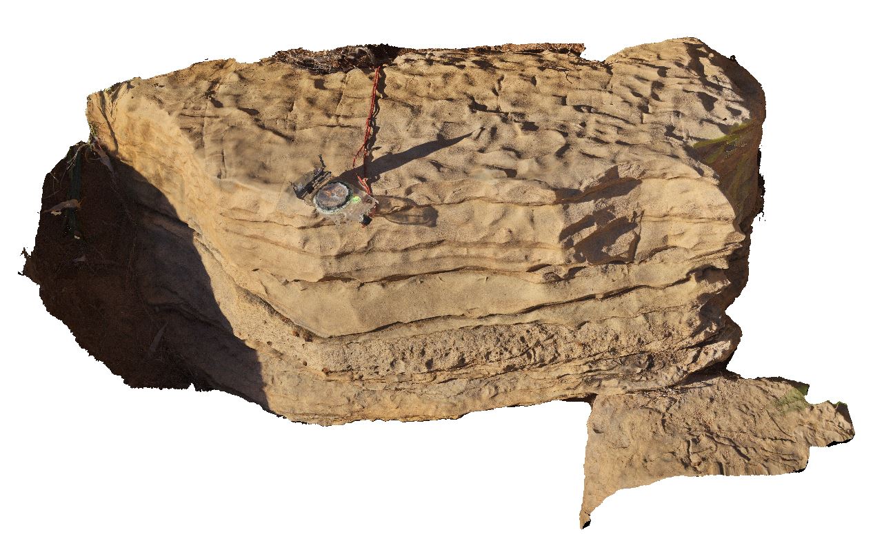
3D terrestrial photogrammetric model |
interbedded glauconitic, dolomitic siltstone and fossiliferous dolostone. Florina Homestead at Daly River, N.T. |
1.00 |
-14.63014000000 |
131.70613000000 |
-9999.000 |
glauconite, fossiliferous, dolostone, fossil, palaeontology |
dolostone |
Florina6 Map
 |
0 |
06/22/2016 noon |
3D terrestrial photogrammetric model |
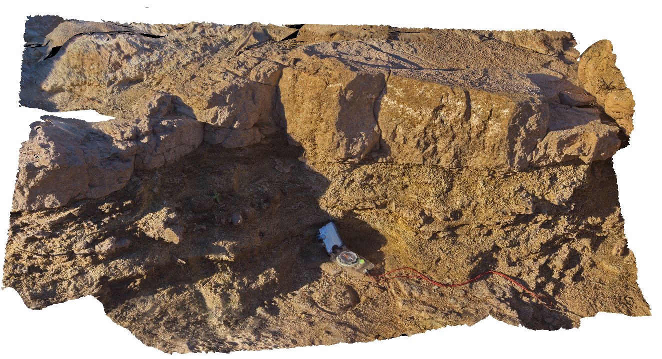
interbedded dolostone and recessive glauconitic shale. Florina Homestead at Daly River, N.T. |
1.40 |
-14.59339000000 |
131.71446000000 |
-9999.000 |
glauconite, shale, dolostone, sedimentology |
dolostone |
Mitchell13 Map
 |
0 |
06/08/2016 noon |
3D terrestrial photogrammetric model |
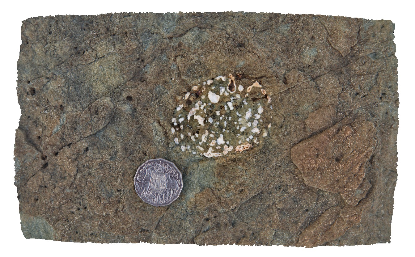
Carson Volcanics basalt with tube vesicles. Port Warrender Road, Kimberley. W.A. |
0.20 |
-14.56894000000 |
125.84576000000 |
-9999.000 |
tube vesicles, basalt, Carson Volcanics |
basalt |
Mitchell12 Map
 |
0 |
06/08/2016 noon |
3D terrestrial photogrammetric model |
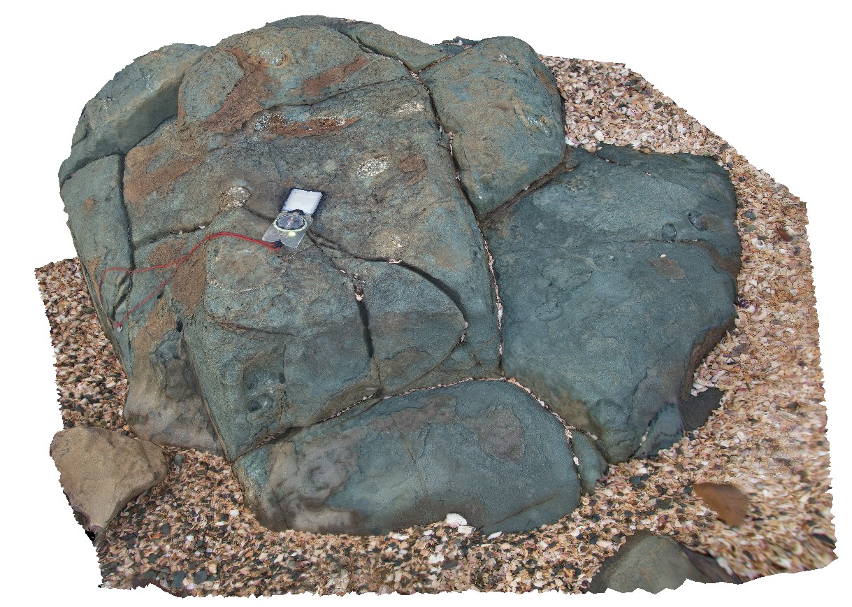
Carson Volcanics basalt with tube vesicles. Port Warrender Road, Kimberley. W.A. |
1.30 |
-14.56894000000 |
125.84576000000 |
-9999.000 |
vesicles, basalt |
basalt |
Mitchell14 Map
 |
0 |
06/08/2016 noon |
3D terrestrial photogrammetric model |
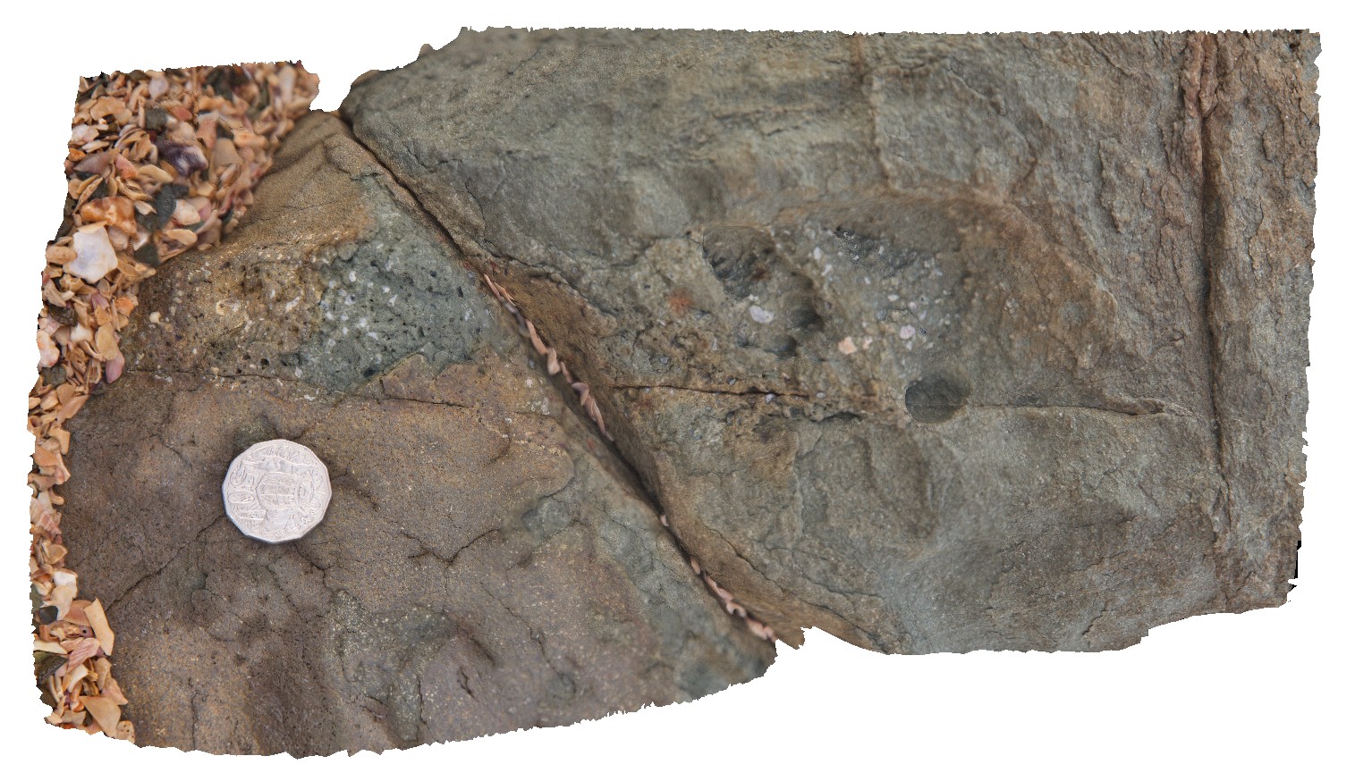
detail of tube vesicles in long section. Port Warrender Road, Kimberley. W.A. |
0.30 |
-14.56894000000 |
125.84576000000 |
-9999.000 |
vesicles, basalt, Carson Volcanics |
basalt |
Mitchell10 Map
 |
0 |
06/08/2016 noon |
3D terrestrial photogrammetric model |
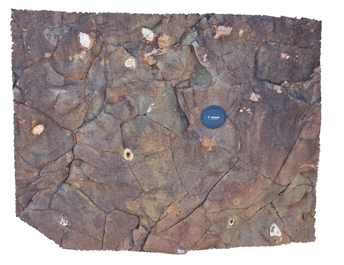
polygonal jointing and large amygdales in Carson Vale basalt block. Port Warrender Road, Kimberley. W.A. |
0.60 |
-14.56892000000 |
125.84583000000 |
-9999.000 |
basalt, polygonal jointing, amygdale |
basalt |
Mitchell11 Map
 |
0 |
06/08/2016 noon |
3D terrestrial photogrammetric model |
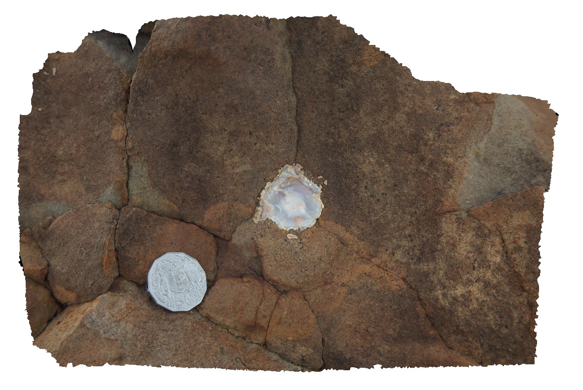
large amygdales filled with opaline silica at the intersection of polygonal joints. Port Warrender Road, Kimberley. W.A. |
0.30 |
-14.56892000000 |
125.84583000000 |
-9999.000 |
amygdale, opaline silica, polygonal joints |
basalt |
Mitchell15 Map
 |
0 |
06/08/2016 noon |
3D terrestrial photogrammetric model |
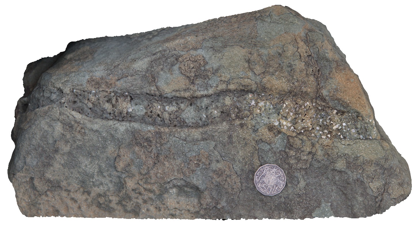
long section detail of tube vesicles in basalt block. Port Warrender Road, Kimberley. W.A. |
0.45 |
-14.56887000000 |
125.84565000000 |
-9999.000 |
vesicle, basalt, Carson Volcanics |
basalt |
MitchellGIGa1 Map
 |
0 |
06/08/2016 noon |
Gigapixel image |
Port Warrender Road, Kimberley. W.A. |
0.00 |
-14.56782000000 |
125.84389000000 |
-9999.000 |
|
|
Florina8 Map
 |
0 |
06/22/2016 noon |
3D terrestrial photogrammetric model |
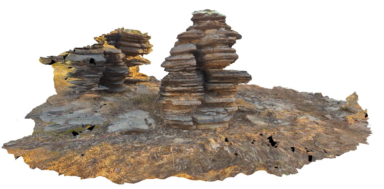
'pancake stacks' of finely bedded dolostone near Florina Homestead at Daly River, N.T. |
7.00 |
-14.54226000000 |
131.73149000000 |
-9999.000 |
pancake stack, dolostone, finely bedded, weathering feature |
dolostone |
KatherineUAV1 Map
 |
0 |
06/22/2016 noon |
3D UAV photogrammetric model |
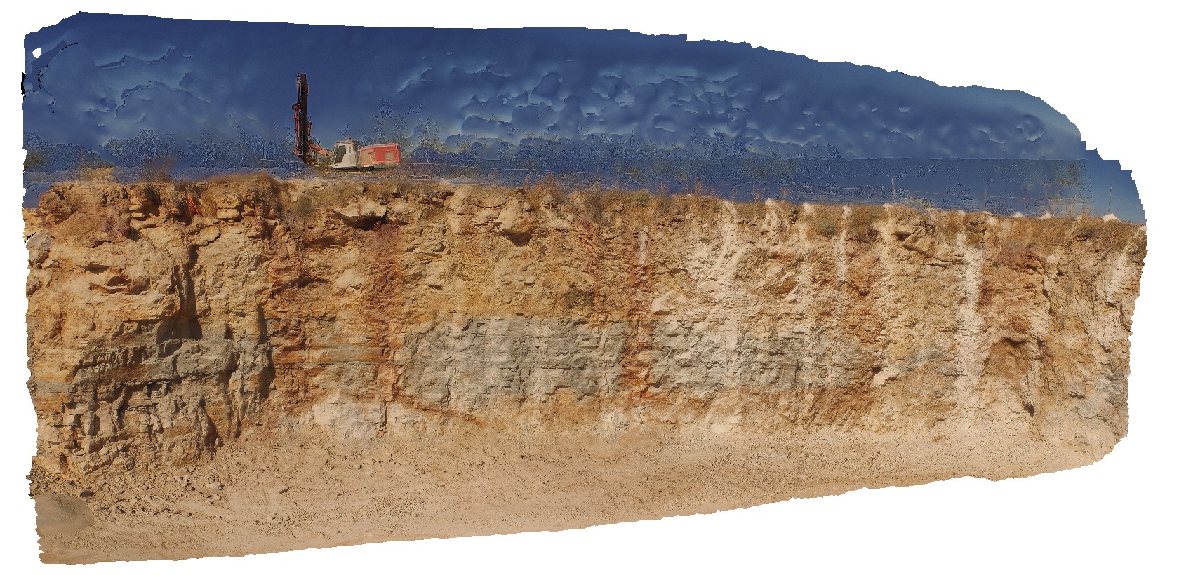
view of finely laminated limestone in quarry wall. Katherine township, N.T. |
14.00 |
-14.50562000000 |
132.33664000000 |
-9999.000 |
limestone, laminated beds |
limestone |
Katherine1 Map
 |
0 |
06/22/2016 noon |
3D terrestrial photogrammetric model |
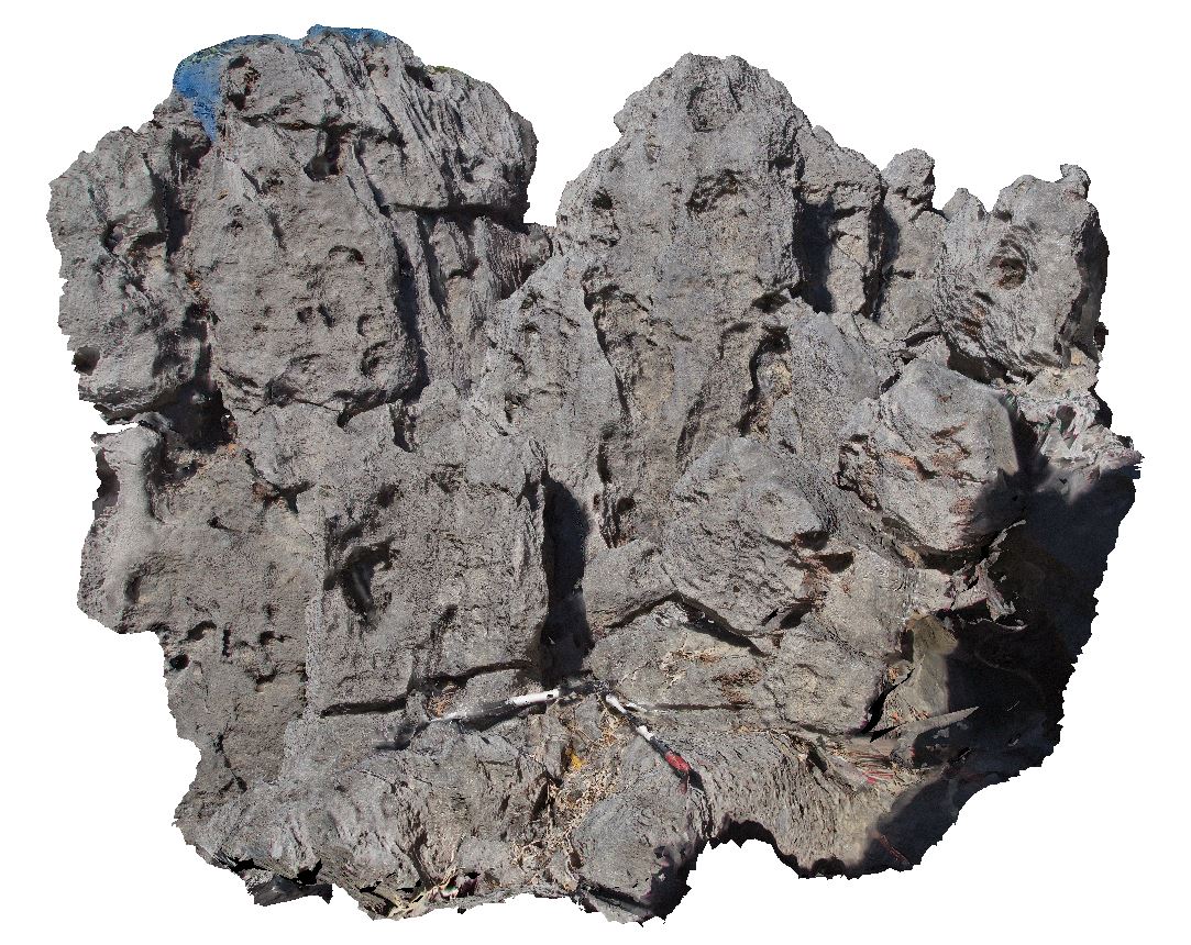
karst formations in limestone with extensive rillenkarren developed and small caves formed locally. Katherine township, N.T. |
3.20 |
-14.49961000000 |
132.33371000000 |
-9999.000 |
karst formations, rillenkarren, limestone |
limestone |
Florina7 Map
 |
0 |
06/22/2016 noon |
3D terrestrial photogrammetric model |
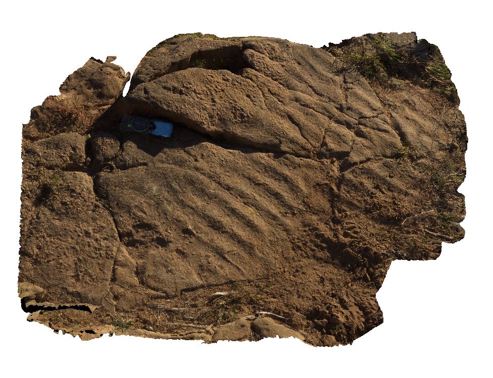
ripple marks in dolostone. Florina Homestead at Daly River, N.T. |
1.50 |
-14.49366000000 |
131.71463000000 |
-9999.000 |
dolostone, ripple marks, sedimentology |
dolostone |
KatherineUAV2 Map
 |
0 |
06/22/2016 noon |
3D UAV photogrammetric model |
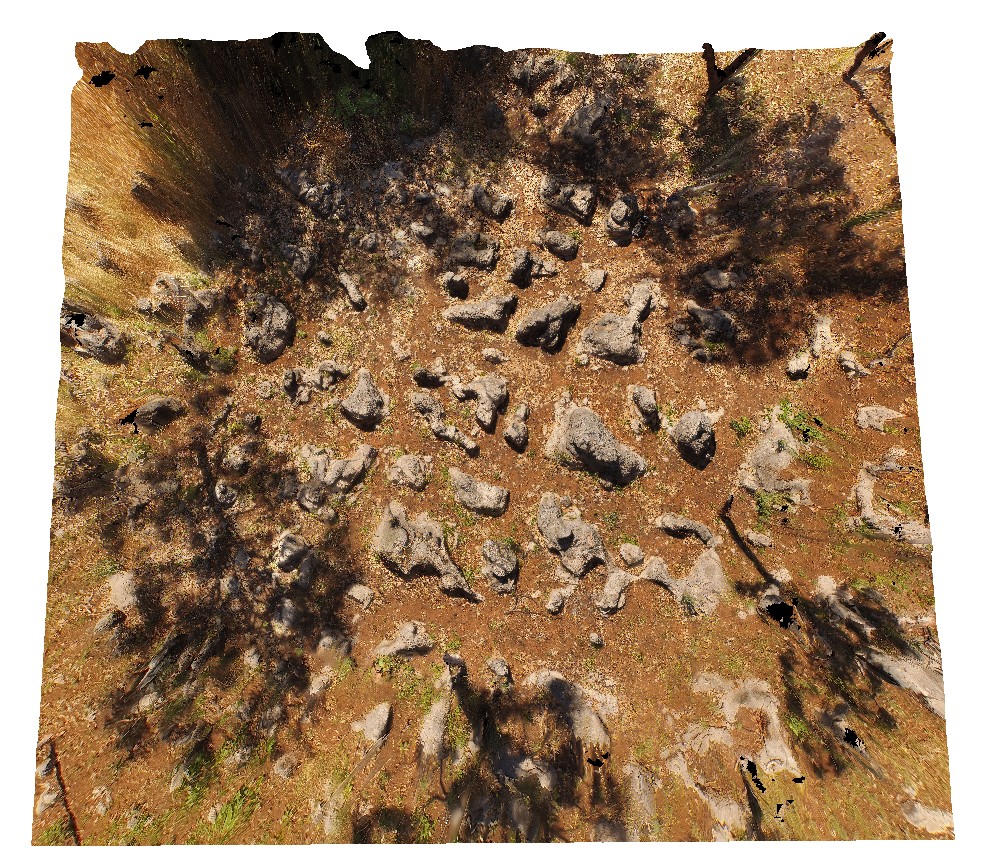
aerial view of karst towers in very thickly bedded limestone. N/W of Katherine township, N.T. |
14.00 |
-14.40787000000 |
132.19470000000 |
-9999.000 |
karst landscape, limestone, weathering feature |
limestone |
 AusGeol.org