Noosa4 Map
 |
5 |
02/23/2016 12:31 p.m. |
3D terrestrial photogrammetric model |
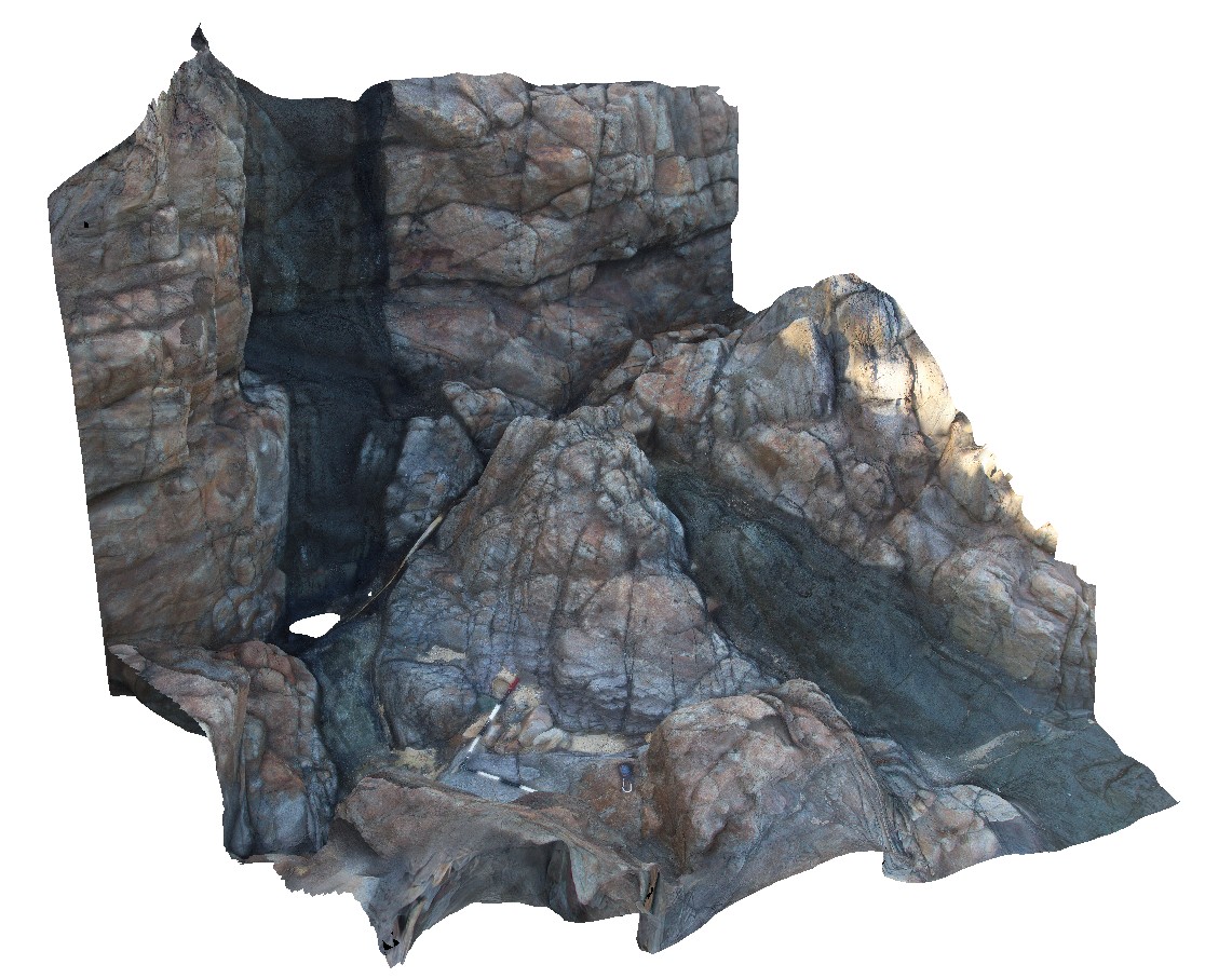
dyke step-over in mafic dyke in contact altered metasandstone. Noosa National Park. N.S.W |
8.00 |
-26.37792000000 |
153.10896000000 |
-9999.000 |
dyke, step-over, intrusive contact |
sandstone, diorite |
Noosa5 Map
 |
5 |
02/23/2016 12:32 p.m. |
3D terrestrial photogrammetric model |
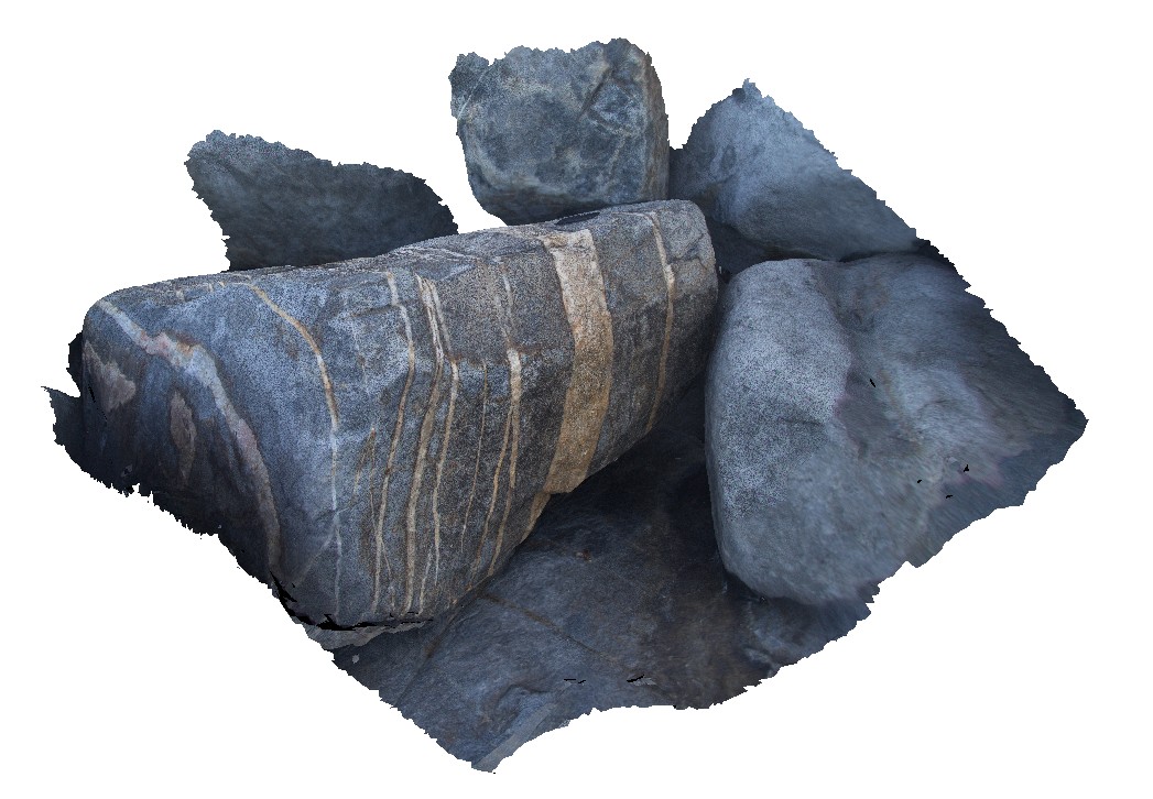
parallel aplite / magmatic hydrothermal veins in diorite. Noosa National Park. N.S.W |
0.40 |
-26.37827000000 |
153.10944000000 |
-9999.000 |
veining, diorite, dyke |
diorite |
Noosa6 Map
 |
5 |
02/23/2016 12:32 p.m. |
3D terrestrial photogrammetric model |
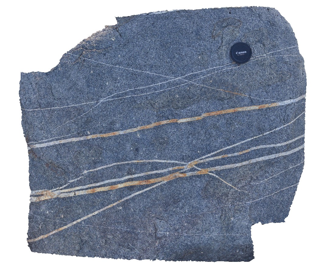
aplite dykes or veins in diorite boulder. Noosa National Park. N.S.W |
0.50 |
-26.37830000000 |
153.10950000000 |
-9999.000 |
aplite, diorite, veins, dyke |
diorite |
Noosa8 Map
 |
5 |
02/23/2016 12:33 p.m. |
3D terrestrial photogrammetric model |
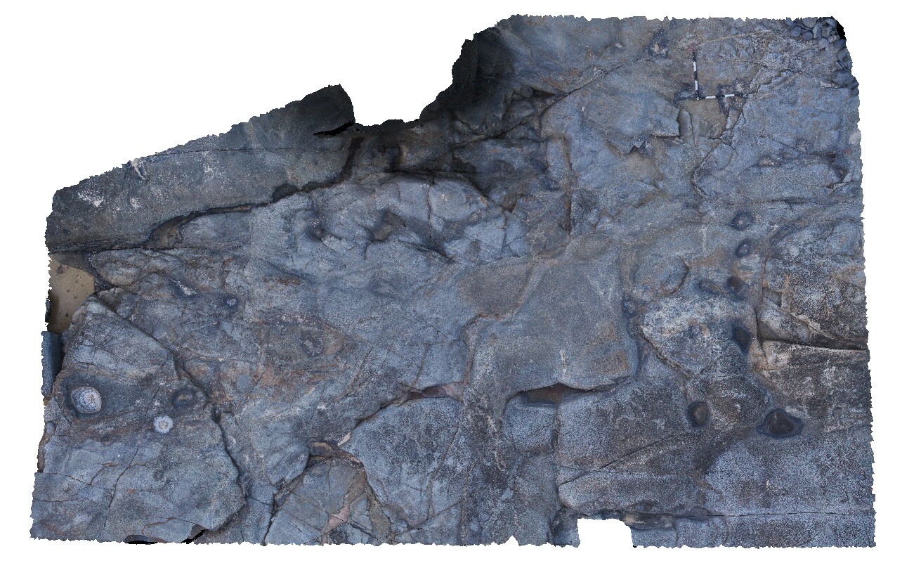
Brecciated siltstone slabs floating in quartz diorite, Noosa National Park. N.S.W |
12.00 |
-26.37903000000 |
153.11035000000 |
-9999.000 |
xenolith, wall rock, diorite, breccia |
quartz diorite, siltstone |
Noosa9 Map
 |
0 |
02/23/2016 12:34 p.m. |
3D terrestrial photogrammetric model |
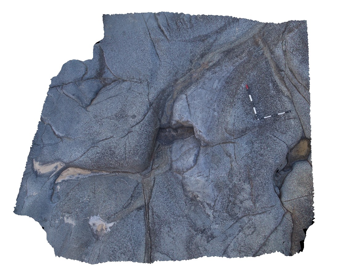
partially deformed quartzite xenolith in quartz diorite. Noosa National Park. N.S.W |
3.00 |
-26.37903000000 |
153.11041000000 |
-9999.000 |
xenolith, quartz diorite |
quartzite, quartz diorite |
NoosaUAV1 Map
 |
0 |
02/23/2016 12:34 p.m. |
3D UAV photogrammetric model |
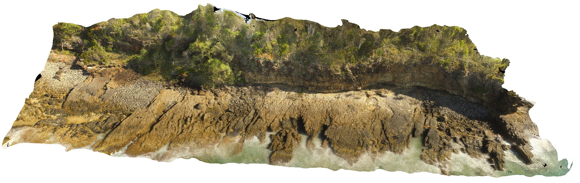
exposed shoreline platform, showing cross bedding in Jurassic aged Myrtle Creek Sandstone. Noosa National Park. N.S.W |
50.00 |
-26.37903000000 |
153.11041000000 |
-9999.000 |
cross bedding, shoreline platform |
sandstone |
Noosa7 Map
 |
5 |
02/23/2016 12:32 p.m. |
3D terrestrial photogrammetric model |
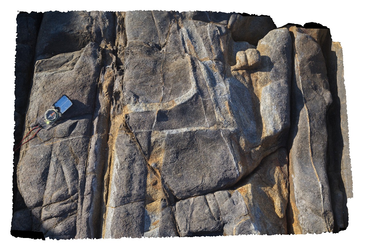
aplite dykes or veins in quartz diorite boulder. Noosa National Park. N.S.W |
1.00 |
-26.37937000000 |
153.11195000000 |
-9999.000 |
quartz diorite, intrusive contact, dyke |
quartz diorite |
Coffs2 Map
 |
1 |
07/08/2015 10:28 a.m. |
3D terrestrial photogrammetric model |
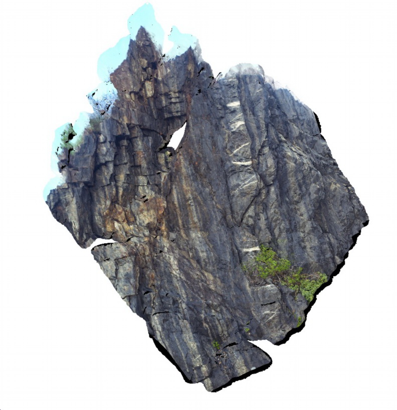
Quartz veins in steeply dipping metasediments of the Carboniferous Brooklana Beds. Coffs Harbour, N.S.W. |
9.00 |
-30.31222000000 |
153.14862000000 |
8.000 |
metasediments, quartz vein, structure |
metasediments |
Coffs1 Map
 |
5 |
07/08/2015 10:27 a.m. |
3D terrestrial photogrammetric model |
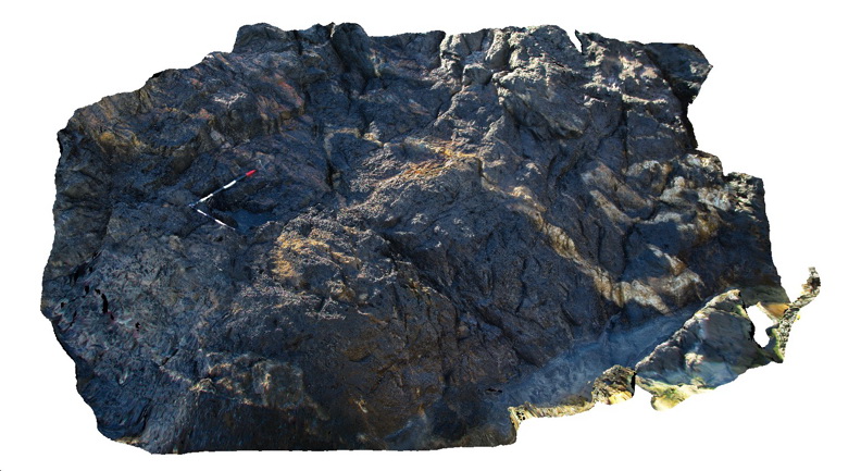
Folded and faulted metasediments - Mutton bird Island - Carboniferous Coffs Harbour Association. Coffs Harbour, N.S.W. |
4.00 |
-30.30574000000 |
153.14870000000 |
1.000 |
metasediments, folds, faults, structure |
metasediments |
YuraygirFSP1 Map
 |
5 |
06/16/2015 5:51 p.m. |
Full Spherical Panorama |
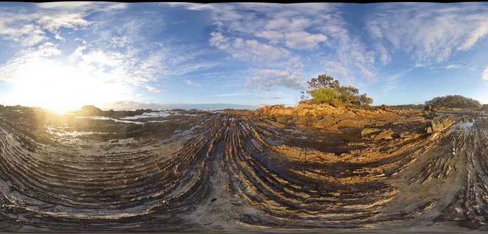
View of steeply dipping metasedimentary units (sandstone and siltstone of the Carboniferous Coramba Beds. Yuraygir, N.S.W. |
50.00 |
-29.94940000000 |
153.25934000000 |
0.000 |
bedding |
sandstone, siltstone |
Yuraygir1 Map
 |
5 |
06/16/2015 5:51 p.m. |
3D terrestrial photogrammetric model |
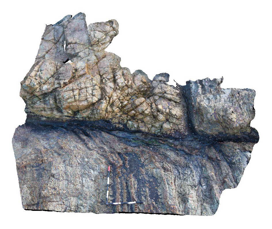
Fault in low grade metasedimentary rocks of the Carboniferous Coramba Beds showing well developed fault drag on layers. Yuraygir, N.S.W. |
2.00 |
-29.94744000000 |
153.25958000000 |
0.000 |
fault, fault drag, structure |
Mudstone |
Yamba1 Map
 |
5 |
06/16/2015 5:49 p.m. |
3D terrestrial photogrammetric model |
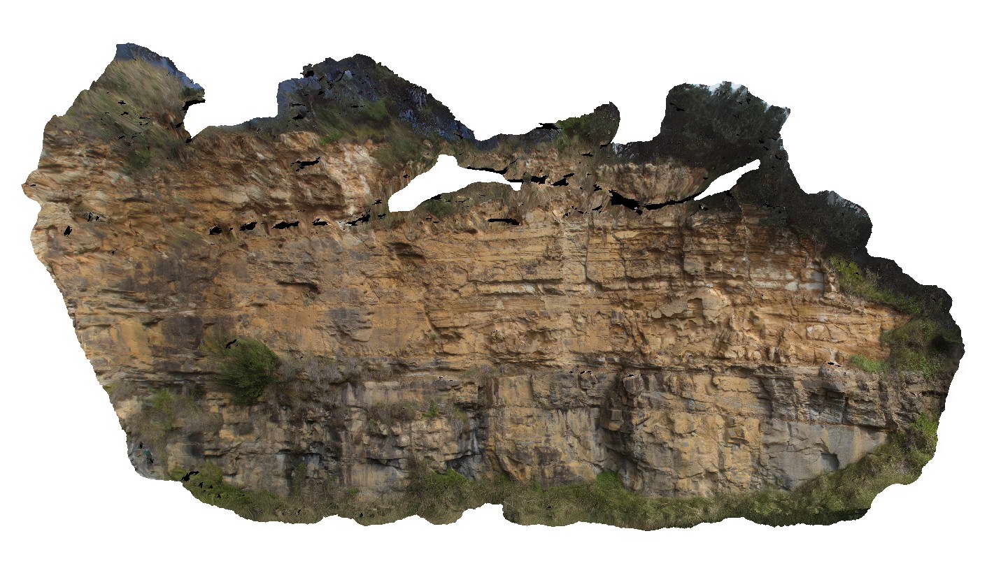
cliff face of cross bedded sandstone of the Jurassic Gatton Sandstone. Yamba, N.S.W. |
25.00 |
-29.43177000000 |
153.36409000000 |
5.000 |
cross bedding, sedimentology |
sandstone |
Yamba2 Map
 |
5 |
06/16/2015 5:49 p.m. |
3D terrestrial photogrammetric model |
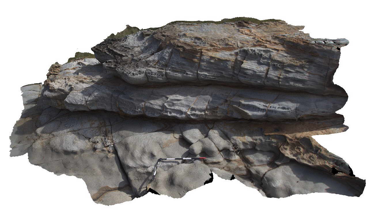
cross bedded sandstone units of the Jurassic Gatton Sandstone. Yamba, N.S.W. |
3.00 |
-29.43242000000 |
153.36531000000 |
7.000 |
cross bedding, sedimentology |
sandstone |
Minyon1 Map
 |
5 |
06/16/2015 4:36 p.m. |
3D terrestrial photogrammetric model |
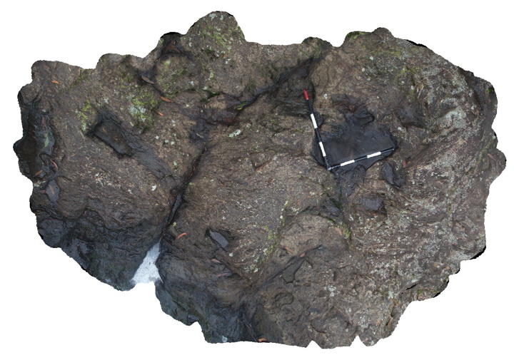
Flow banding in rhyolite, Minyon N.S.W. |
2.00 |
-28.61271000000 |
153.38986000000 |
325.000 |
flow banding, volcanology, igneous |
rhyolite |
MinyonFSP2 Map
 |
5 |
06/16/2015 4:38 p.m. |
Full Spherical Panorama |
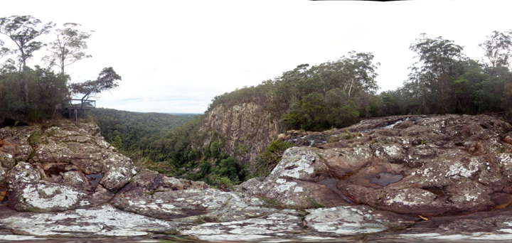
Rhyolite cliffs. Minyon N.S.W. |
50.00 |
-28.61254000000 |
153.39600000000 |
325.000 |
columnar jointing |
rhyolite |
MinyonFSP1 Map
 |
1 |
06/16/2015 4:38 p.m. |
Full Spherical Panorama |
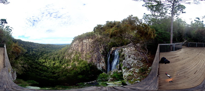
Columnar jointed rhyolite at Minyon Falls - Miocene Ninbin Rhyolite. Minyon N.S.W. |
50.00 |
-28.61254000000 |
153.39600000000 |
325.000 |
columnar jointing, igneous |
rhyolite |
Evans5 Map
 |
5 |
07/09/2015 9:16 a.m. |
3D terrestrial photogrammetric model |
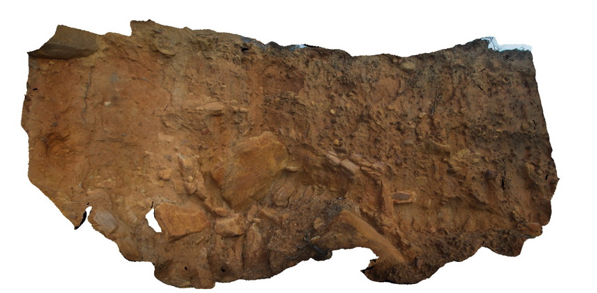
Poorly sorted landslide deposits derived from the Ipswich Coal Measures. Evens Head, N.S.W. |
10.00 |
-29.11460000000 |
153.43761000000 |
1.000 |
landslide |
landslip |
Evans4 Map
 |
5 |
07/09/2015 9:15 a.m. |
3D terrestrial photogrammetric model |
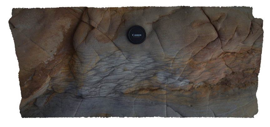
ripple marks in fine grained silty sandstone. Ipswich Coal Measures. Evens Head, N.S.W. |
1.00 |
-29.11447000000 |
153.43883000000 |
1.000 |
ripple marks, sedimentology |
sandstone |
Evans3 Map
 |
1 |
07/09/2015 9:15 a.m. |
3D terrestrial photogrammetric model |
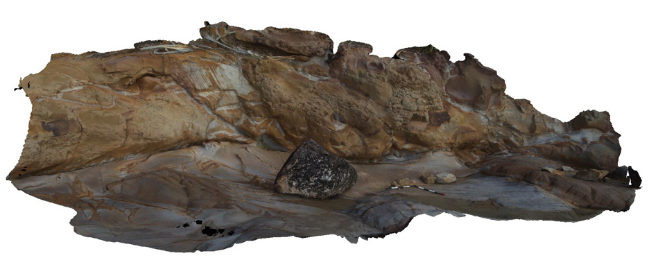
Fine grained (silty) laminated sediments overlain by medium to coarse grained quartz sandstone. The contact is irregular and erosional. Evens Head, N.S.W. |
10.00 |
-29.11441000000 |
153.43889000000 |
-9999.000 |
channel, sedimentology, erosional contact |
sandstone |
Evans2 Map
 |
5 |
07/09/2015 9:14 a.m. |
3D terrestrial photogrammetric model |
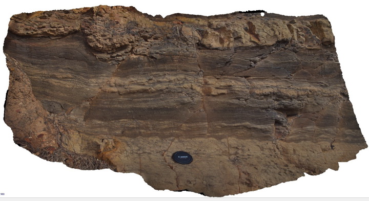
flood plain sediments consisting of laminated siltstone with ripple marks and thin fine-grained sand lenses. Triassic Ipswich Coal Measures. Evens Head, N.S.W. |
1.00 |
-29.11441000000 |
153.43919000000 |
1.000 |
ripple marks, floodplain, sedimentology |
siltstone, sandstone |
Evans1 Map
 |
5 |
07/09/2015 9:13 a.m. |
3D terrestrial photogrammetric model |
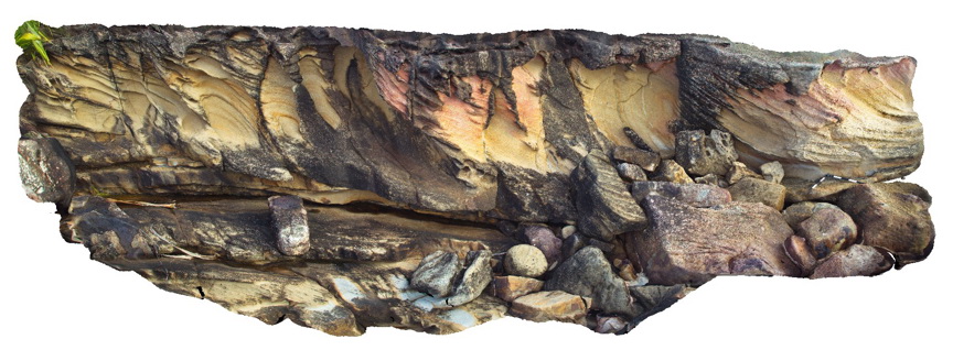
Large scale cross bedding in fluvial sandstone of the Triassic Ipswich Coal Measures. Evens Head, N.S.W. |
10.00 |
-29.11441000000 |
153.43927000000 |
1.000 |
cross bedding, fluvial, sedimentology |
sandstone |
FingalNSW2 Map
 |
5 |
01/01/9999 midnight |
3D terrestrial photogrammetric model |
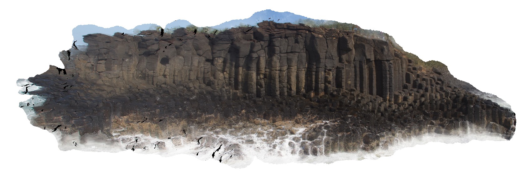
Columnar basalt exposed at Fingal Head, QLD |
30.00 |
-28.19903000000 |
153.57137000000 |
2.000 |
columnar basalt, cooling columns, cooling joints, igneous |
basalt |
FingalNSW3 Map
 |
5 |
01/01/9999 midnight |
3D terrestrial photogrammetric model |
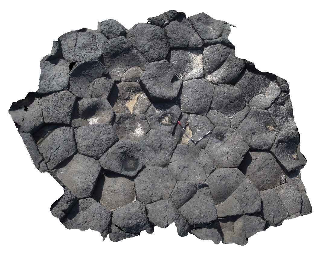
View down onto cooling columns in Tertiary Basalt at Fingal Head, QLD |
3.00 |
-28.13908000000 |
153.57141000000 |
2.000 |
cooling columns, cooling joints, igneous |
basalt |
FingalNSWUAV1 Map
 |
0 |
01/01/9999 midnight |
3D UAV photogrammetric model |
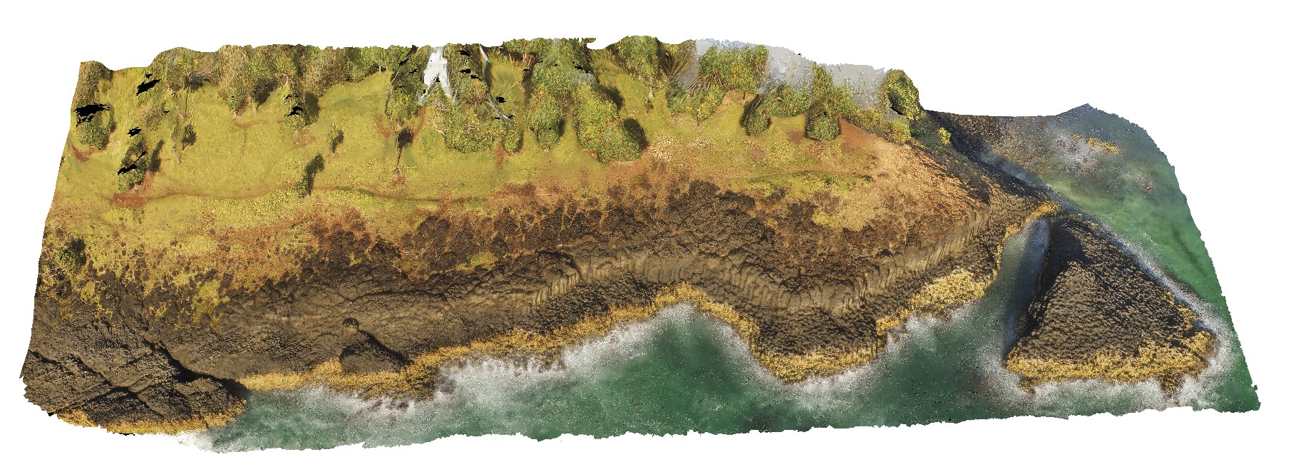
View of polygonal cooling columns in Tertiary Basalt at Fingal Head, QLD |
100.00 |
-28.13908000000 |
153.57410000000 |
-9999.000 |
columnar basalt, basalt, flow, volcanic |
basalt |
FingalNSWFSP1 Map
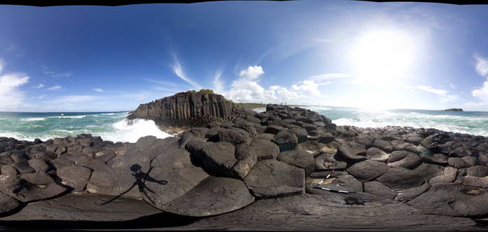 |
5 |
01/01/9999 midnight |
Full Spherical Panorama |
View of cooling columns in Tertiary Basalt at Fingal Head, QLD |
50.00 |
-28.13908000000 |
153.57410000000 |
2.000 |
cooling columns, cooling joints, igneous |
basalt |
 AusGeol.org