Merimbula11 Map
 |
20 |
01/01/9999 midnight |
3D terrestrial photogrammetric model |
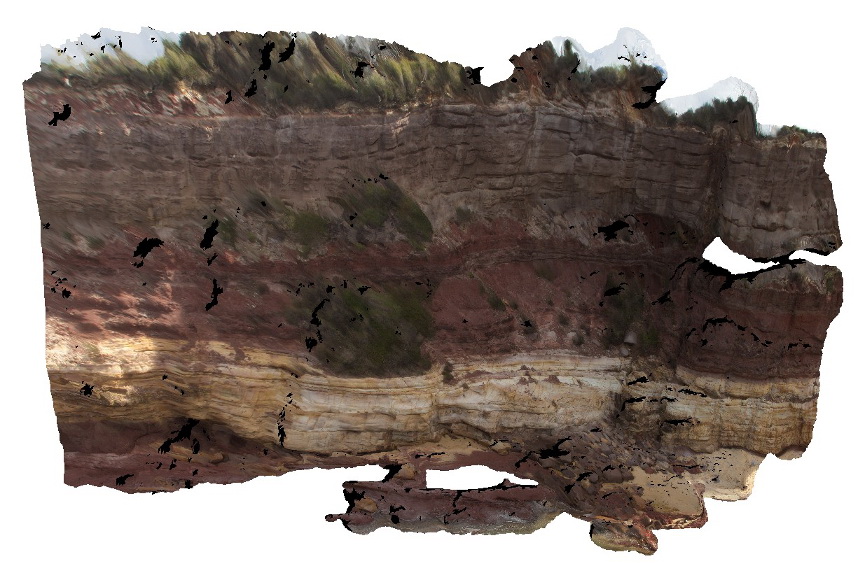
overview of large cliff face, showing layered sandstone beds. Merimbula, N.S.W. |
10.00 |
-36.89641000000 |
149.93002000000 |
2.000 |
sandstone, sedimentology, bedding |
sandstone |
PtMacquarie27 Map
 |
1 |
01/01/9999 midnight |
3D terrestrial photogrammetric model |
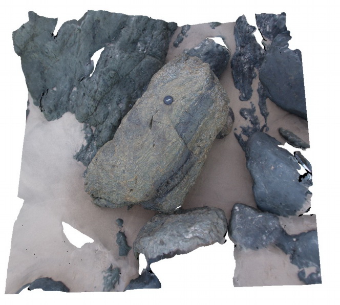
boulder of folded and faulted chert within the Cambrian Port Macquarie Serpentinite melange |
2.00 |
-31.46494000000 |
152.93452000000 |
-9999.000 |
folds, fault, structure |
chert |
PtMacquarie12 Map
 |
5 |
01/01/9999 midnight |
3D terrestrial photogrammetric model |
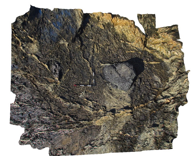
Ultramafic blocks in a matrix of totally serpentinised ultramafic material within the Cambrian Port Macquarie Serpentinite |
5.00 |
-31.43662000000 |
152.92607000000 |
1.000 |
melange, ultramafic, igneous, structure |
melange |
PtMacquarie24 Map
 |
5 |
01/01/9999 midnight |
3D terrestrial photogrammetric model |
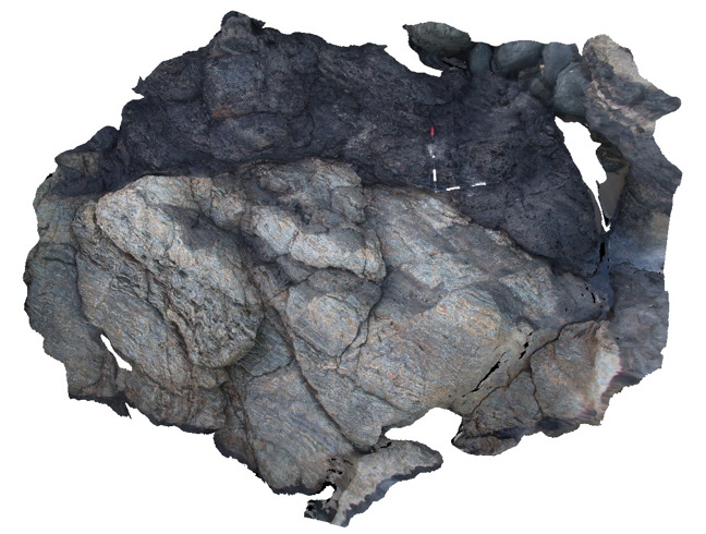
Block of folded and faulted chert in the Port Macquarie Serpentinite melange |
3.00 |
-31.46487000000 |
152.93478000000 |
1.000 |
folds, faults, melange, structure |
chert |
BingiFSP1 Map
 |
5 |
01/01/9999 midnight |
Full Spherical Panorama |
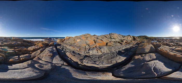
View of granodiorite with cross-cutting 'dolerite' dyke. Bingi, N.S.W. |
50.00 |
-36.01247000000 |
150.16364000000 |
2.000 |
dyke, igneous, structure |
granodiorite, dolerite |
PtMacquarieFSP13 Map
 |
5 |
01/01/9999 midnight |
Full Spherical Panorama |
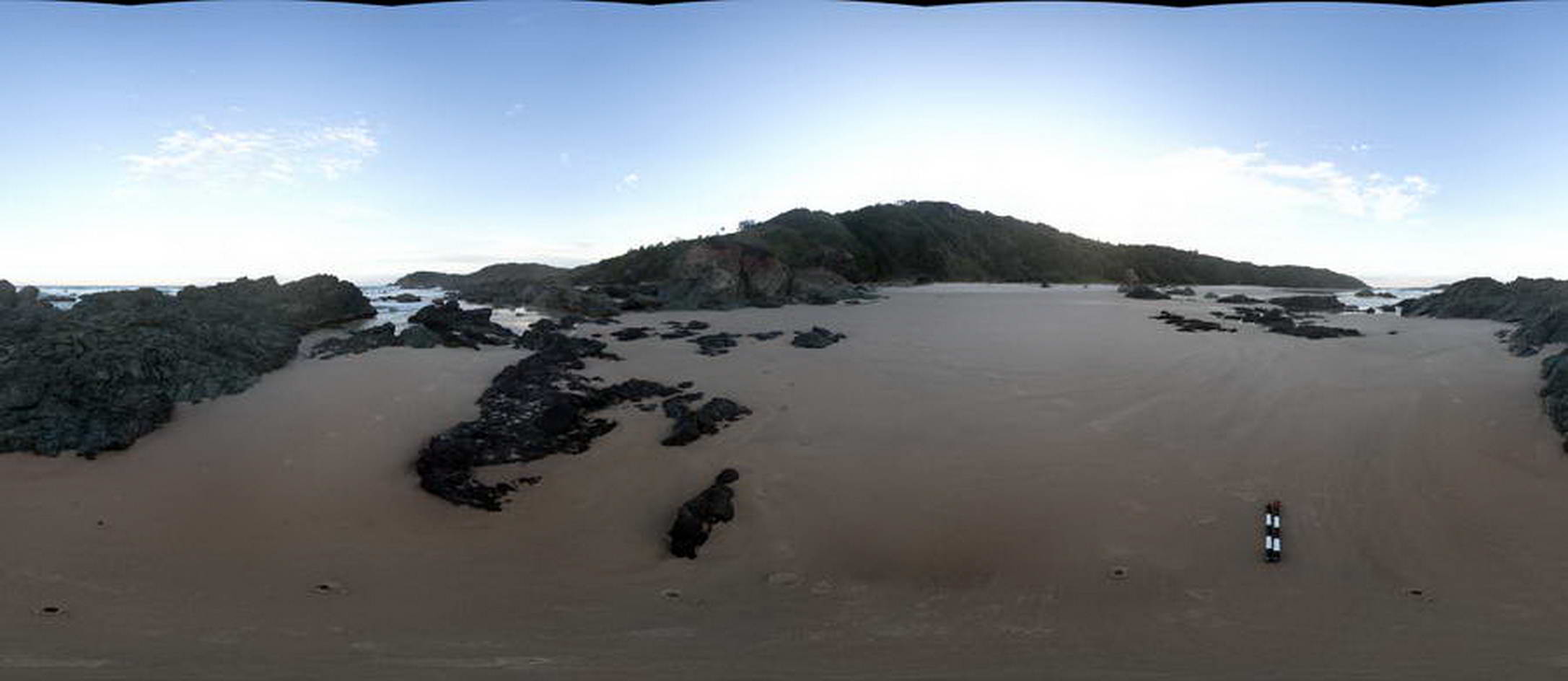
View of melange containing basalt and chert. Cambrian Port Macquarie Serpentinite melange |
50.00 |
-31.46342000000 |
152.93491000000 |
0.000 |
melange |
basalt, chert |
PtMacquarie23 Map
 |
5 |
01/01/9999 midnight |
3D terrestrial photogrammetric model |
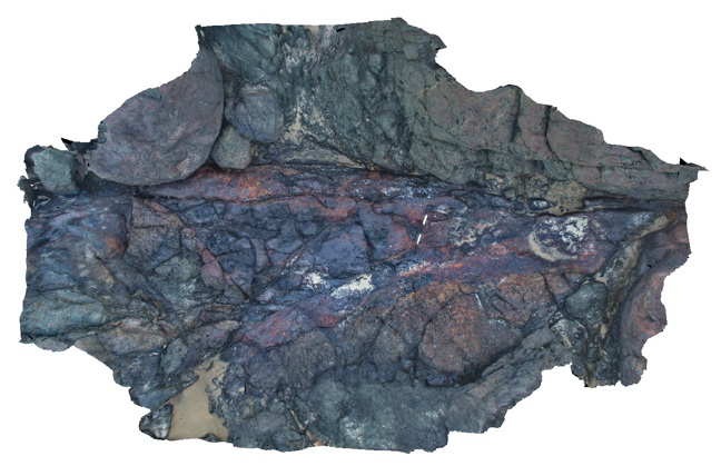
pyritic gossan within chert and altered basalt in the Cambrian Port Macquarie Serpentinite melange |
5.00 |
-31.46482000000 |
152.93486000000 |
1.000 |
gossan |
gossan |
BoatHarbour10 Map
 |
20 |
01/01/9999 midnight |
3D terrestrial photogrammetric model |
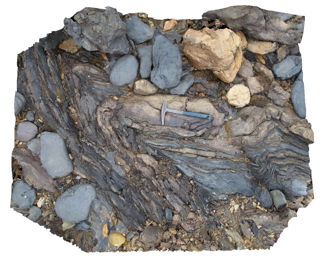
Fold hinge within Rocky Cape Group Orthoquartzite. Boat Harbour, Tas. |
2.00 |
-40.92640600000 |
145.60971200000 |
1.000 |
quartzite, fold hinge |
quartzite |
PtMacquarieFSP7 Map
 |
5 |
01/01/9999 midnight |
Full Spherical Panorama |
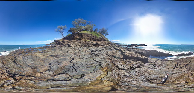
View of folded and faulted chert unit within the Cambrian Port Macquarie Serpentinite melange |
50.00 |
-31.43009000000 |
152.92384000000 |
2.000 |
fault, melange |
chert |
PtMacquarie26 Map
 |
5 |
01/01/9999 midnight |
3D terrestrial photogrammetric model |
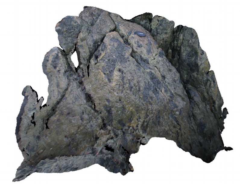
Basalt? fragments in chert within the Cambrian Port Macquarie Serpentinite melange |
1.50 |
-31.46492000000 |
152.93463000000 |
1.000 |
melange |
chert, basalt |
TheCrags5 Map
 |
20 |
01/01/9999 midnight |
3D terrestrial photogrammetric model |
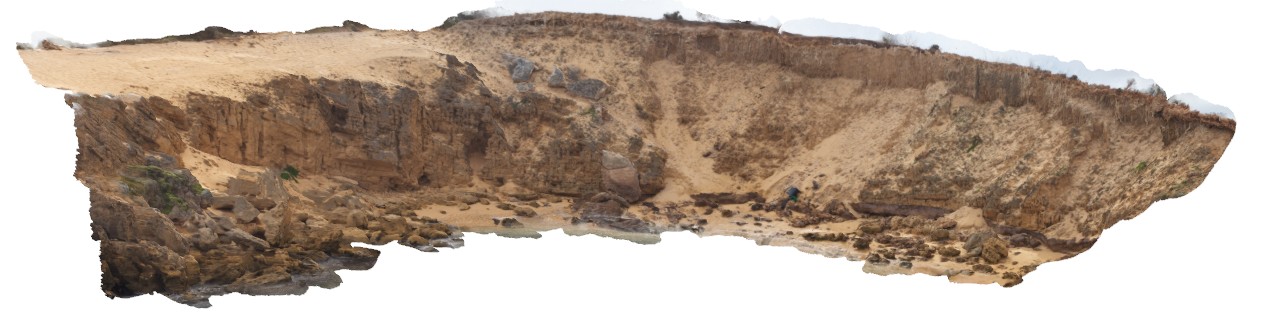
overview of aeolian calcareous sandstone overlain by brown sand with solution tubes. The Crags, Vic. |
30.00 |
-38.37184000000 |
142.11092000000 |
2.000 |
unconformity, solution tubes |
sandstone |
TowerHillGIGA1 Map
 |
10 |
01/01/9999 midnight |
Gigapixel image |
— |
0.00 |
-38.32723000000 |
142.36790000000 |
-9999.000 |
|
tuff |
FingalNSWFSP1 Map
 |
5 |
01/01/9999 midnight |
Full Spherical Panorama |
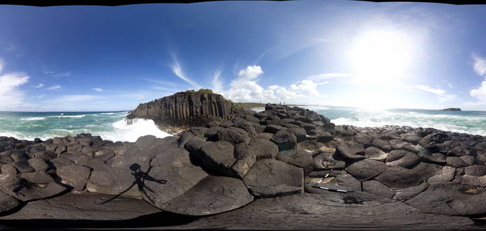
View of cooling columns in Tertiary Basalt at Fingal Head, QLD |
50.00 |
-28.13908000000 |
153.57410000000 |
2.000 |
cooling columns, cooling joints, igneous |
basalt |
BingiFSP8 Map
 |
5 |
01/01/9999 midnight |
Full Spherical Panorama |
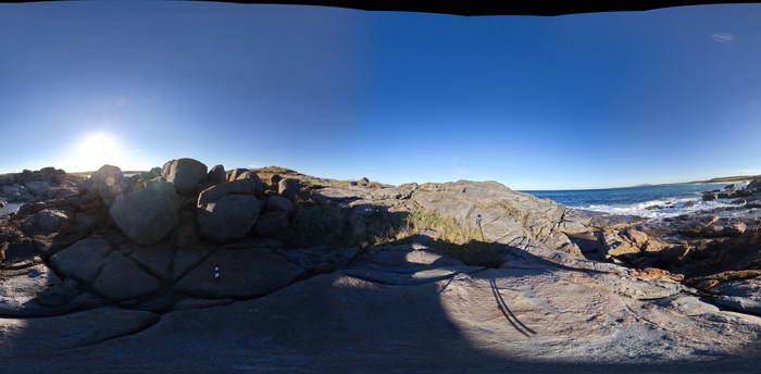
View of jointed granodiorite just east of the main zone of magma mingling. Bingi, N.S.W. |
50.00 |
-36.01313000000 |
150.16278000000 |
3.000 |
igneous, structure |
granodiorite |
Nugnug7 Map
 |
5 |
01/01/9999 midnight |
3D terrestrial photogrammetric model |
tectonic melange in Ordovician Pinnak Sandstone within the Nug Nug Shear Zone. Nugnug, Vic. |
1.00 |
-36.68078000000 |
146.67796000000 |
240.000 |
melange, mylonite, shear zone, structure |
melange |
PricesFSP2 Map
 |
20 |
01/01/9999 midnight |
Full Spherical Panorama |
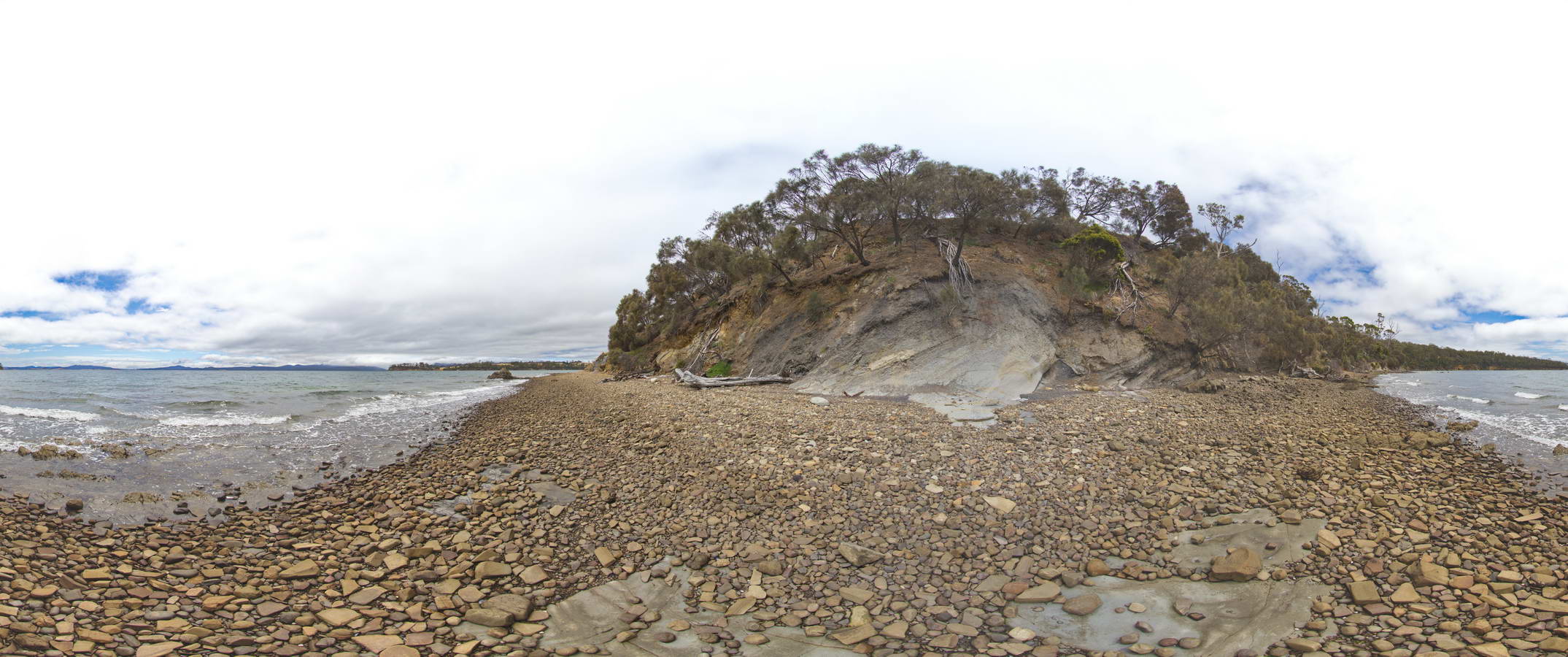
view along beach, showing normal fault offsetting a contact between Triassic sandstone and siltstone. Prices Point, Tasman Peninsula, Tasmania. |
1000.00 |
-43.03500200000 |
147.74783500000 |
0.500 |
normal fault, geological contact, structure |
sandstone, siltstone |
BoatHarbour3 Map
 |
20 |
01/01/9999 midnight |
3D terrestrial photogrammetric model |
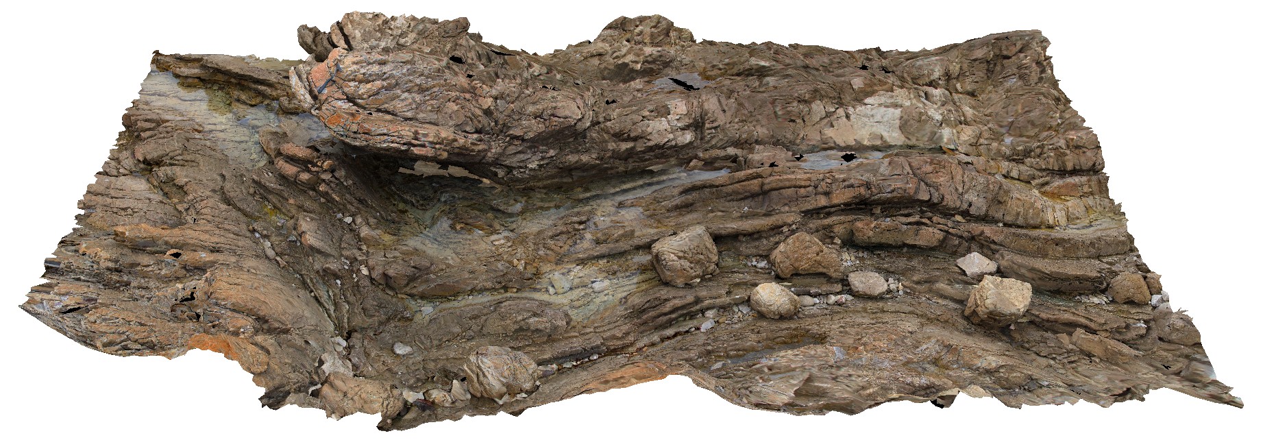
Fold hinge within Rocky Cape Group Orthoquartzite. Boat Harbour, Tas. |
8.00 |
-40.92556700000 |
145.61453900000 |
5.000 |
quartzite, bedding, fold hinge, structure |
quartzite |
Piccaninny7 Map
 |
50 |
01/01/9999 midnight |
3D terrestrial photogrammetric model |
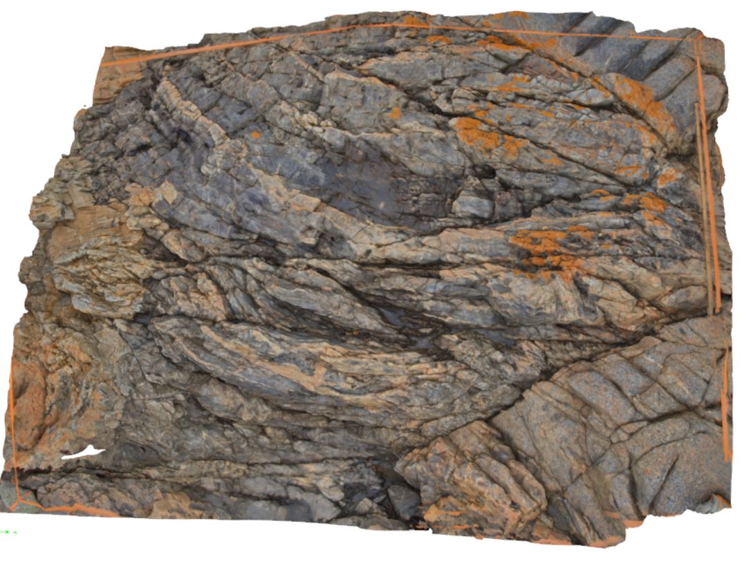
granodiorite dyke intruding folded turbidite package rocks with later offset by faulting. Some parts of the dyke appear to be bedding parallel. Piccaninny Point, eastern Tasmania. |
2.00 |
-41.69446100000 |
148.29395280000 |
2.000 |
dyke, fault, structure |
turbidite, granodiorite |
PtMacquarieFSP8 Map
 |
5 |
01/01/9999 midnight |
Full Spherical Panorama |
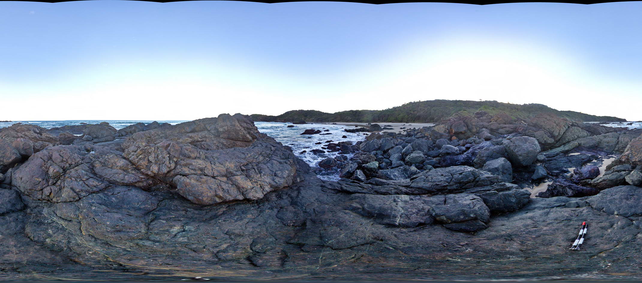
View of melange containing basalt and chert. Cambrian Port Macquarie Serpentinite melange |
50.00 |
-31.46490000000 |
152.93500000000 |
1.000 |
melange |
basalt, chert |
BingiFSP7 Map
 |
5 |
01/01/9999 midnight |
Full Spherical Panorama |
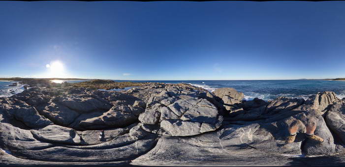
View of jointed granodiorite and diorite/gabbro. Bingi, N.S.W. |
50.00 |
-36.01328000000 |
150.16313000000 |
3.000 |
igneous, structure |
granodiorite, diorite |
BoatHarbour2 Map
 |
20 |
01/01/9999 midnight |
3D terrestrial photogrammetric model |
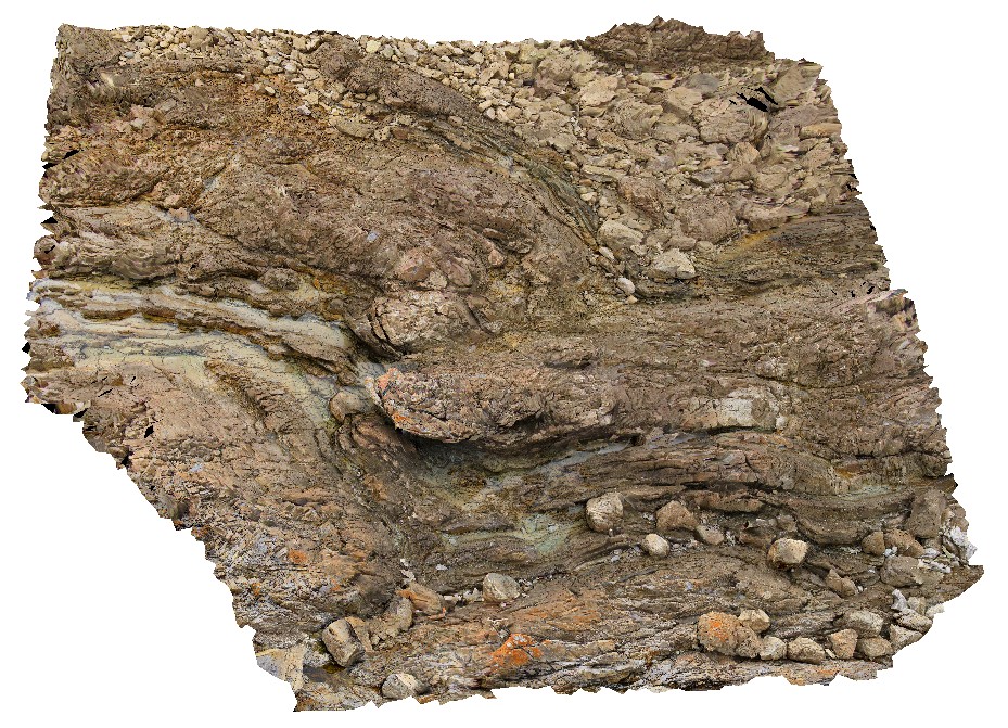
Fold hinge within Rocky Cape Group Orthoquartzite. Boat Harbour, Tas. |
6.00 |
-40.92568400000 |
145.61462700000 |
5.000 |
quartzite, fold hinge, bedding, structure |
quartzite |
PricesFSP5 Map
 |
20 |
01/01/9999 midnight |
Full Spherical Panorama |
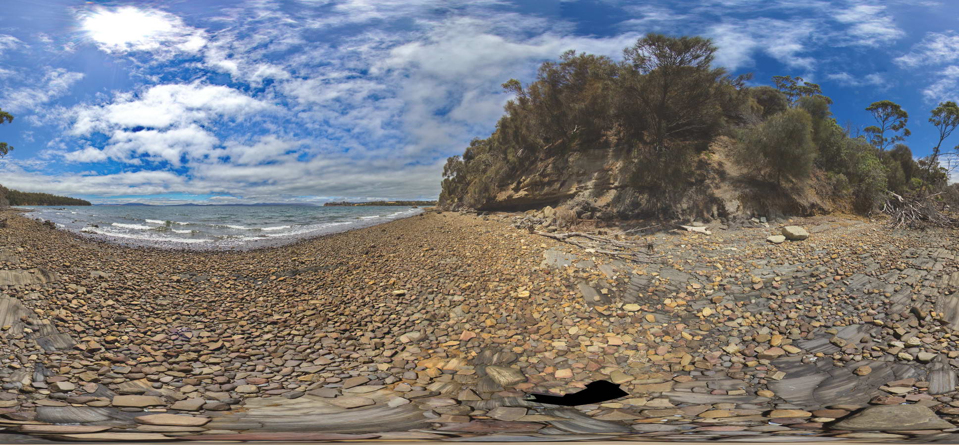
view of contact in base of cliff between underlying carbonaceous siltstone and horizontal siltstone. Prices Point, Tasman Peninsula, Tasmania. |
250.00 |
-43.03404100000 |
147.74658500000 |
0.500 |
geological contact, sedimentology |
siltstone |
BingiFSP6 Map
 |
5 |
01/01/9999 midnight |
Full Spherical Panorama |
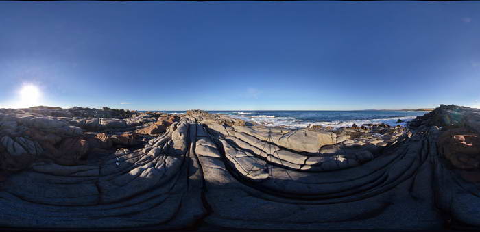
View of Jointed granodiorite cut by a 'red' mafic dyke. Bingi, N.S.W. |
50.00 |
-36.01323000000 |
150.16356000000 |
2.000 |
dyke, igneous, joints, structure |
granodiorite, dolerite |
BingiFSP9 Map
 |
5 |
01/01/9999 midnight |
Full Spherical Panorama |
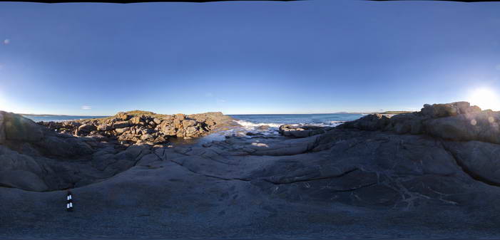
View of zone of 'magma mingling' between granodiorite and diorite/gabbro. Bingi, N.S.W. |
50.00 |
-36.01310000000 |
150.16245000000 |
3.000 |
magma mingling, igneous, enclave, xenolith |
granodiorite |
StarvationBayUAV1 Map
 |
0 |
01/01/9999 midnight |
3D UAV photogrammetric model |
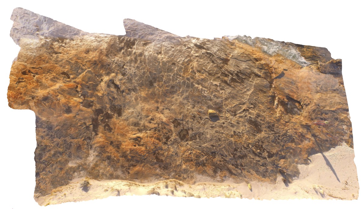
overall view of outcrop pavement, showing folded and sheared gneissic rocks. Starvation Bay, W.A. |
20.00 |
-33.92010800000 |
120.56163100000 |
5.100 |
gneiss, structure |
gneiss |
 AusGeol.org