MUDTK1 Map
 |
0 |
07/25/2016 10:11 a.m. |
3D terrestrial photogrammetric model |
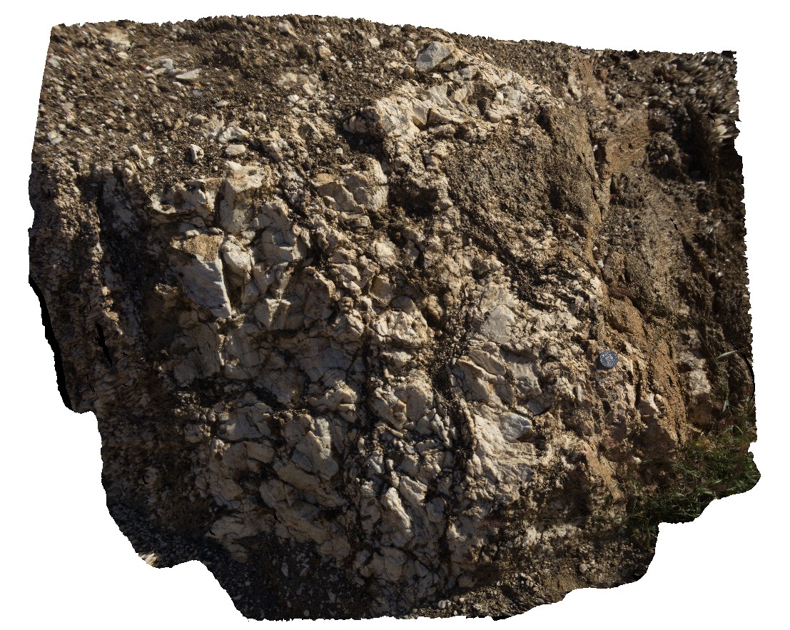
Coarse-grained feldspar-biotite schists in Mud Tank open pit. Near Plenty Highway, Zircon Field Access road, N.T. |
1.80 |
-23.01363600000 |
134.27639200000 |
658.853 |
schist, metamorphic |
schist |
ORMG6 Map
 |
5 |
08/02/2016 10:13 a.m. |
3D terrestrial photogrammetric model |
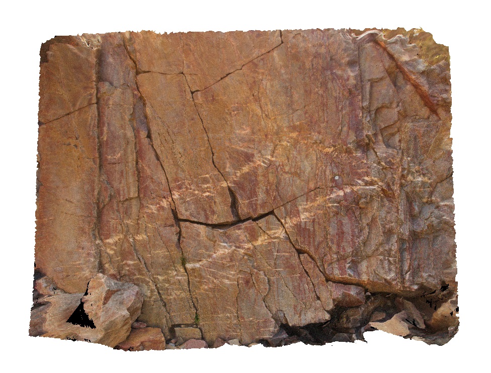
en-echelon quartz veins (dilatational?) in quartzite layers. Ormiston Gorge, N.T. |
2.00 |
-23.62691900000 |
132.72820800000 |
658.543 |
en-echelon vein, quartzite, Ormiston Gorge |
quartzite |
ORMG5 Map
 |
5 |
01/01/9999 midnight |
3D terrestrial photogrammetric model |
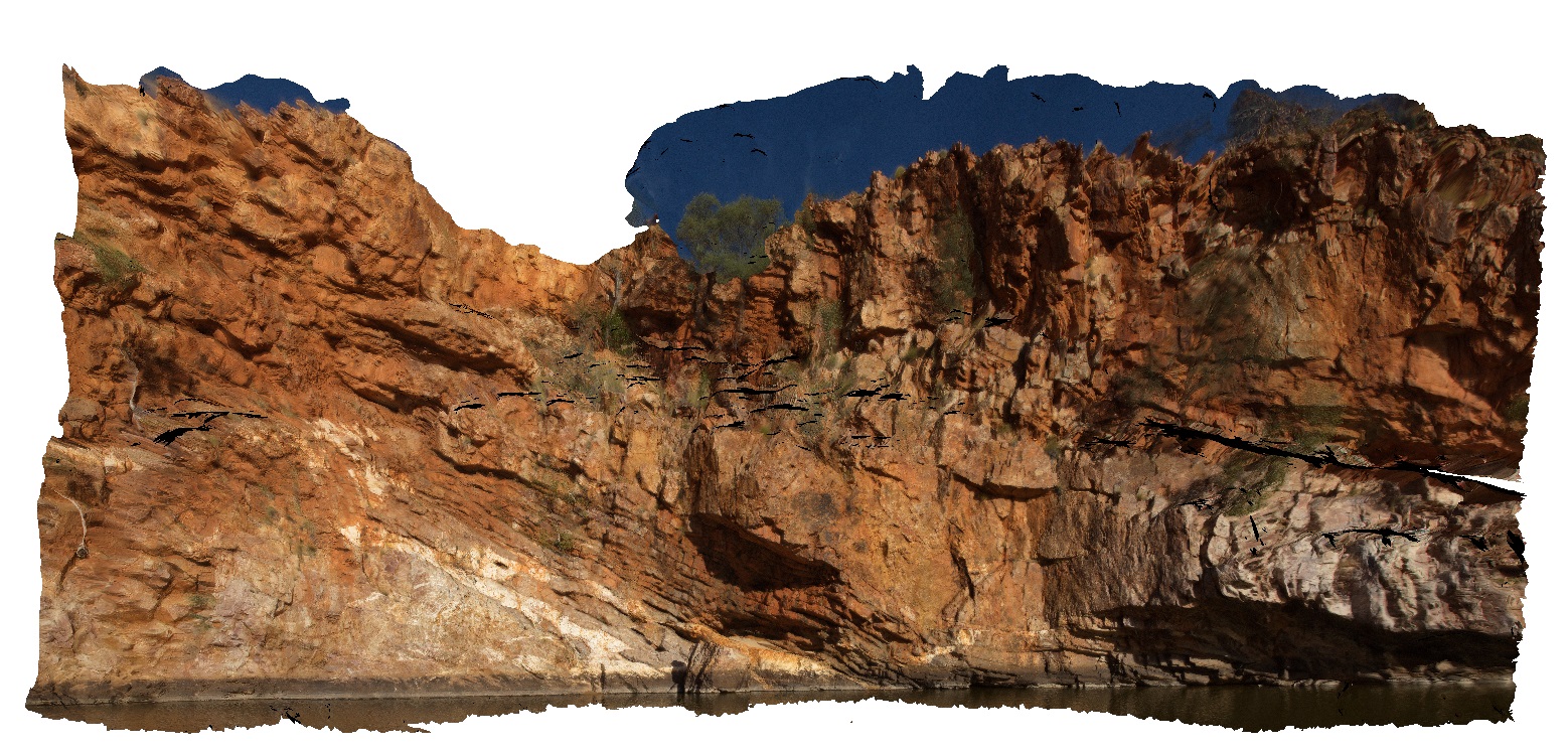
quartz veins and stacked thrusts in quartzite layers at Ormiston Gorge water hole. Ormiston Gorge, N.T. |
50.00 |
-23.62811000000 |
132.72731000000 |
651.970 |
thrust stack, fault, vein, quartz vein, quartzite, structure |
quartzite |
ORMGFSP4 Map
 |
5 |
08/02/2016 9:47 a.m. |
Full Spherical Panorama |
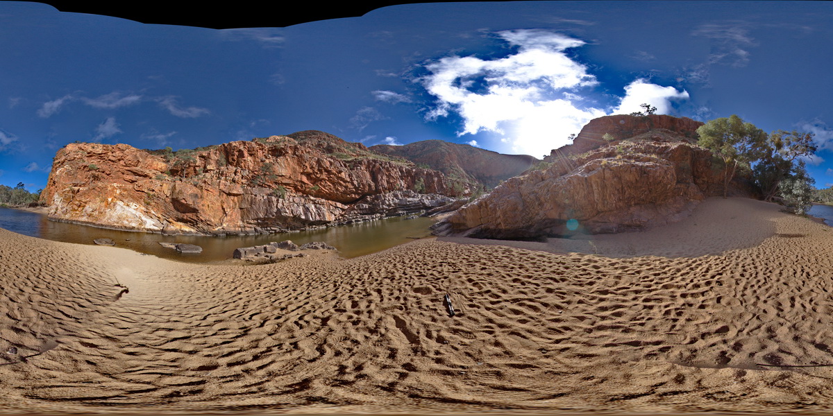
Stacked thrusts in quartzite on SW face of gorge. Faulting has offset quartz veins. Ormiston Gorge, N.T. |
500.00 |
-23.62811000000 |
132.72731000000 |
651.970 |
thrust, fault, structure, quartzite |
quartzite |
TREPH1 Map
 |
0 |
07/27/2016 4:42 p.m. |
3D terrestrial photogrammetric model |
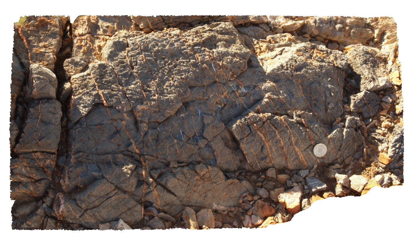
calcite vein array in dolostone. Trephina Gorge, Mordor Pound. N.T. |
1.00 |
-23.51889200000 |
134.40061900000 |
651.572 |
vein, array, dolostone, sedimentology |
dolostone |
Ninghan2 Map
 |
5 |
01/01/9999 midnight |
3D terrestrial photogrammetric model |
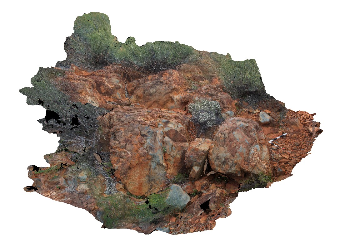
Archean meta-pillow basalts with interpillow quartz-cemented breccia. Thick unit located at the top of Mount Singleton, near Great Northern Highway, W.A. |
4.35 |
-29.37333320000 |
117.27916670000 |
650.000 |
Metabasalt, Pillow basalt, Interpillow breccia |
basalt |
ORMGFSP3 Map
 |
5 |
08/02/2016 9:37 a.m. |
Full Spherical Panorama |
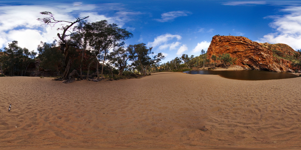
S-recumbent anticline in quartzite, in wall of Ormiston Gorge, N.T. |
500.00 |
-23.62885500000 |
132.72759000000 |
649.876 |
anticline, fold, S fold, recumbent, structure, Ormiston Gorge |
quartzite |
ORMG1 Map
 |
5 |
08/01/2016 2:28 p.m. |
3D terrestrial photogrammetric model |
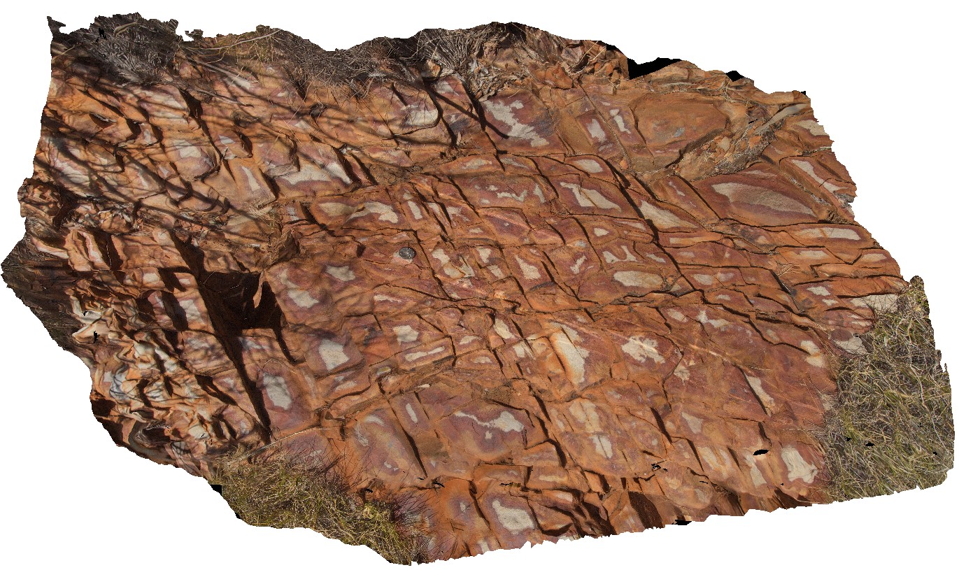
weathering pattern on joints in quartzite with late quartz veins. Pound walk, Ormiston Gorge, N.T. |
1.00 |
-23.63449900000 |
132.73310600000 |
646.864 |
joint, weathering, quartzite |
quartzite |
HARTS5 Map
 |
5 |
07/26/2016 1:20 p.m. |
3D terrestrial photogrammetric model |
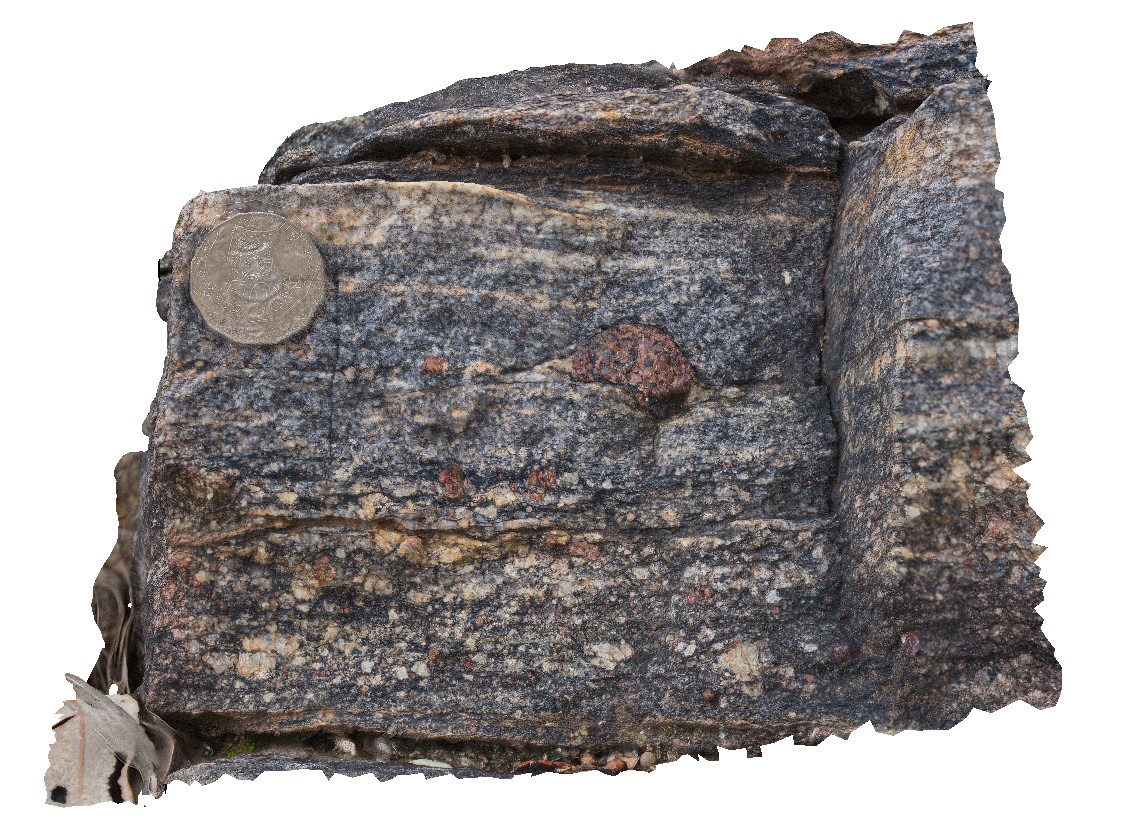
view of cross section of small garnet porphyroblast in bi-gt gneiss. Harts Range, N.T. |
0.20 |
-23.27660300000 |
135.03500500000 |
646.190 |
Harts Range Metamorphic Complex, metamorphic, gneiss |
gneiss |
OLGA1 Map
 |
0 |
07/30/2016 10:18 a.m. |
3D terrestrial photogrammetric model |
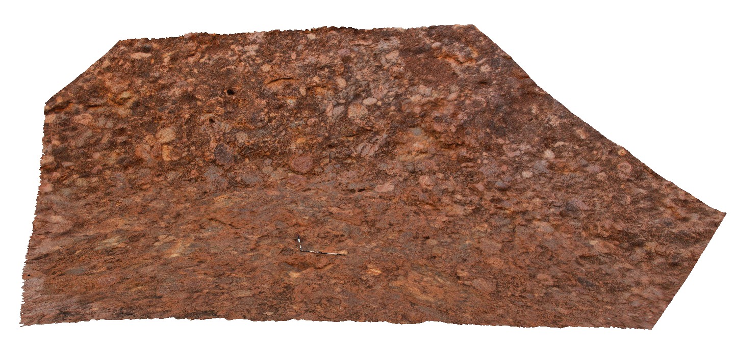
view of conglomerate at Kata Tjuta (The Olgas), showing poor sorting and rounding of cobbles. Kata Tjuta National Park. N.T. |
8.00 |
-25.30090900000 |
130.73502000000 |
645.453 |
conglomerate, Kata Tjuta, sedimentology |
conglomerate |
TREPHFSP1 Map
 |
0 |
07/27/2016 4:26 p.m. |
Full Spherical Panorama |
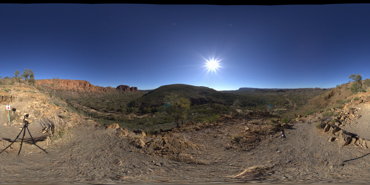
view of 'The Bluff', with tight folding. Trephina Gorge, Mordor Pound. N.T. |
1000.00 |
-23.51895600000 |
134.39911100000 |
642.214 |
tight folds, folds, structure, sedimentology, Trephina Gorge |
sandstone |
TREPHFSP2 Map
 |
0 |
07/27/2016 4:53 p.m. |
Full Spherical Panorama |
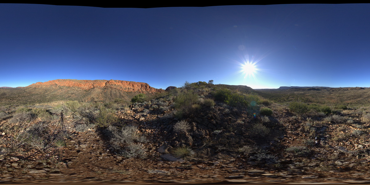
view toward Mordor igneous Complex (north) and dipping sandstone red beds. Trephina Gorge, Mordor Pound. N.T. |
1000.00 |
-23.51885700000 |
134.40191500000 |
636.194 |
sandstone, Trephina Gorge, structure |
dolostone |
HARTS1 Map
 |
5 |
07/25/2016 3:02 p.m. |
3D terrestrial photogrammetric model |
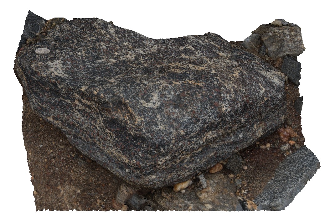
view of coarse-grained bi-gt gneiss boulder. Harts Range, N.T. |
0.50 |
-23.13541900000 |
135.06157000000 |
633.891 |
bi-gt-gneiss, gneiss, metamorphic, Harts range metamorphics |
gneiss |
HARTS3 Map
 |
5 |
07/25/2016 3:09 p.m. |
3D terrestrial photogrammetric model |
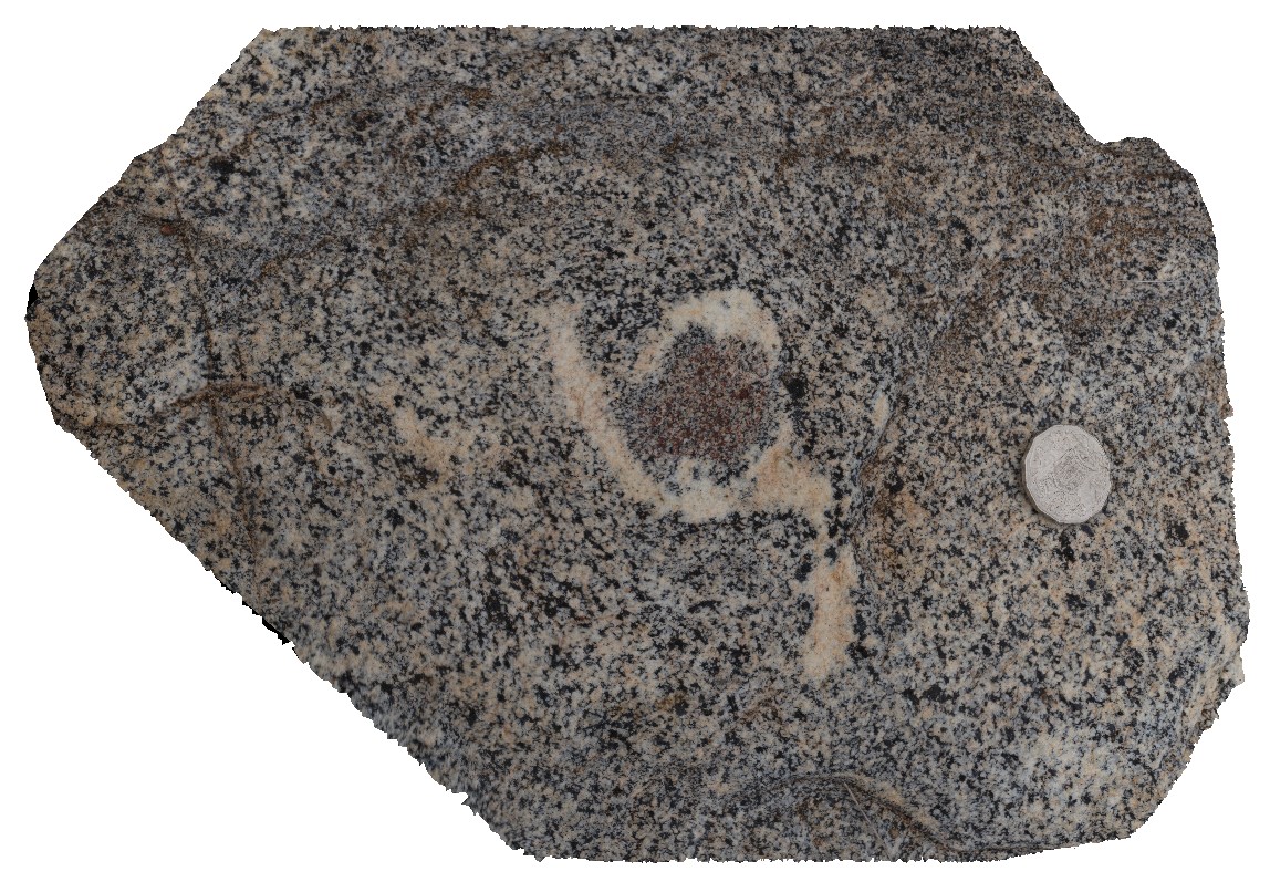
view of 2-3cm wide garnet porphyroblast in bt-gneiss. Harts Range, N.T. |
0.30 |
-23.13526300000 |
135.06147100000 |
633.312 |
porphyroblast, biotite gneiss, harts range, metamorphic |
gneiss |
HARTS2 Map
 |
5 |
07/25/2016 3:07 p.m. |
3D terrestrial photogrammetric model |
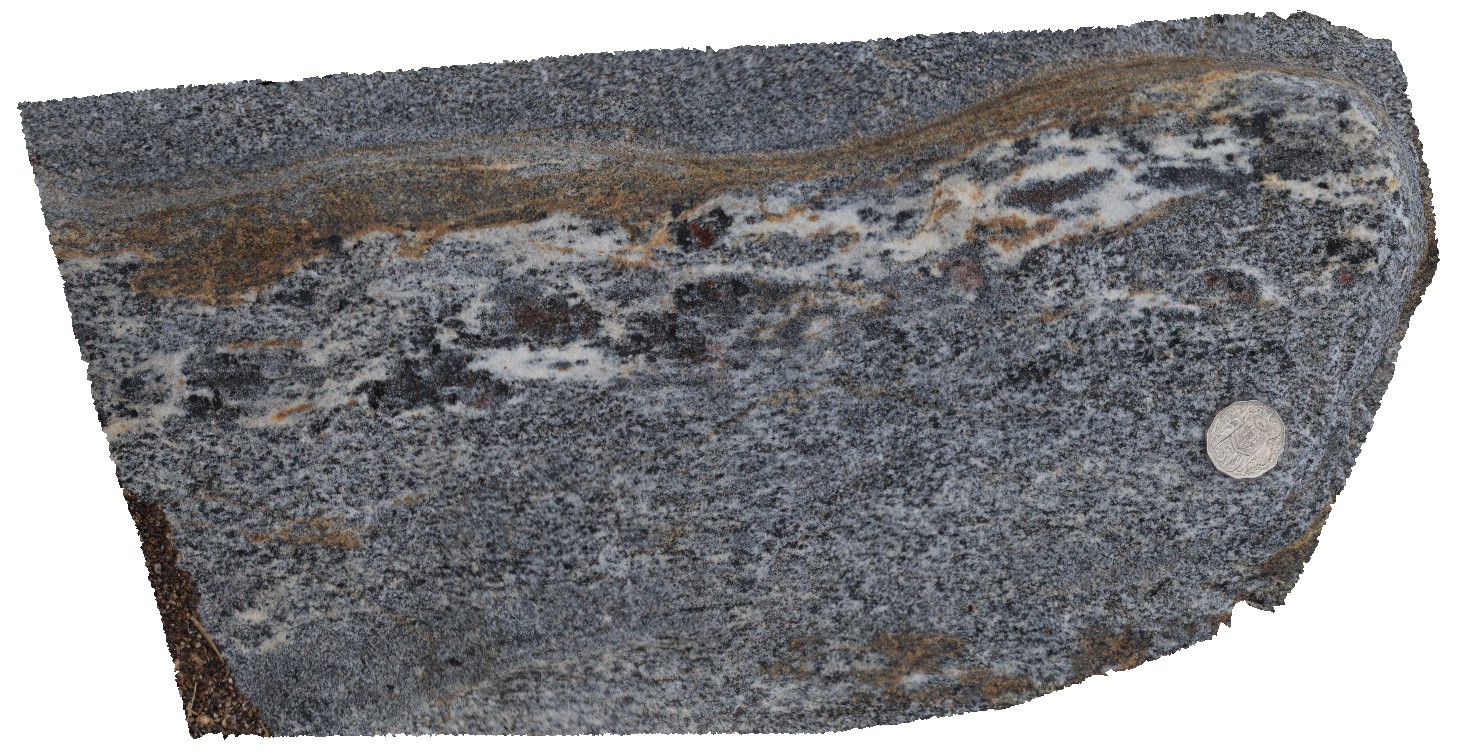
garnet gneiss in leucocratic layer of bt-gneiss. Harts Range, N.T. |
0.40 |
-23.13530700000 |
135.06145700000 |
633.085 |
gneiss, harts range metamorphics, metamorphic |
gneiss |
OLGAFSP1 Map
 |
5 |
07/30/2016 10:04 a.m. |
Full Spherical Panorama |
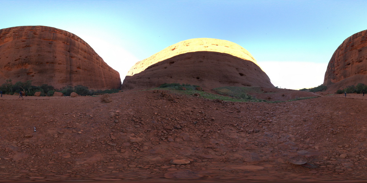
view of Kata Tjuta (The Olgas), showing conglomerate layers. Kata Tjuta National Park. N.T. |
100.00 |
-25.29999200000 |
130.73189500000 |
632.614 |
Kata Tjuta, conglomerate, sedimentology |
conglomerate |
OLGA2 Map
 |
0 |
07/30/2016 10:38 a.m. |
3D terrestrial photogrammetric model |
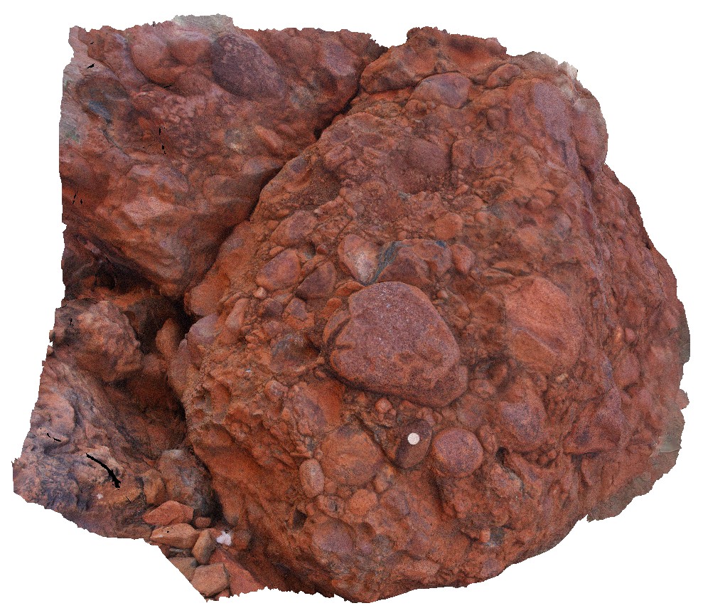
detailed view of polymict clasts in Mt Currie conglomerate at Kata Tjuta (The Olgas). Clasts are sub rounded, poorly sorted and matrix supported. Kata Tjuta National Park. N.T. |
1.00 |
-25.30027200000 |
130.72979700000 |
620.020 |
conglomerate, Kata Tjuta, Mt Currie conglomerate, sedimentology |
conglomerate |
AMADFSP1 Map
 |
5 |
07/27/2016 10:04 a.m. |
Full Spherical Panorama |
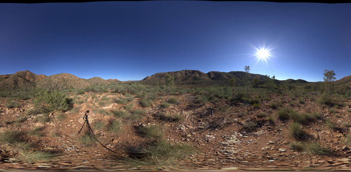
view of folded sediments from the Bitter Springs Group. Bitter Springs Gorge, N.T. |
1000.00 |
-23.54177100000 |
134.50347000000 |
617.659 |
sediments, sedimentology, fold, structure |
sediments |
HARTS6 Map
 |
5 |
07/26/2016 2:05 p.m. |
3D terrestrial photogrammetric model |
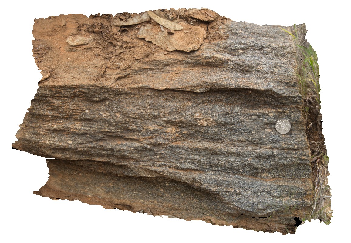
foliated biotite gneiss, containing mus-qtz porphyroblasts with pressure shadows. Harts Range, N.T. |
0.50 |
-23.27949400000 |
134.98622000000 |
614.991 |
pressure shadow, metamorphic, structure, foliation, gneiss, porphyroblast |
gneiss |
Kiewa3 Map
 |
5 |
06/17/2015 10:18 a.m. |
3D terrestrial photogrammetric model |
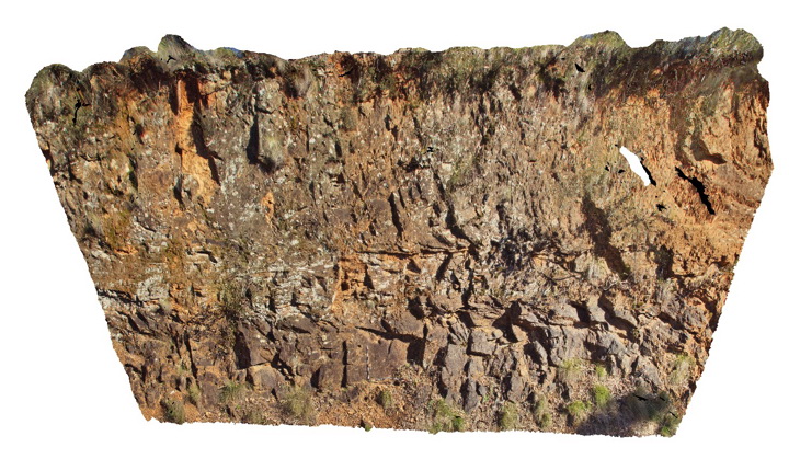
Horizontal high temperature shear zone in gneissic rocks of the Silurian Omeo Metamorphic Complex. Kiewa, Vic. |
15.00 |
-36.72313706000 |
147.13280305000 |
611.000 |
shear zone, structure |
gneiss |
ENTIA3 Map
 |
5 |
07/25/2016 4:10 p.m. |
3D terrestrial photogrammetric model |
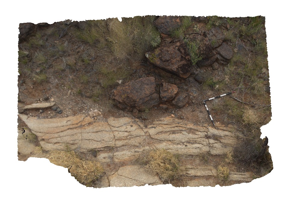
contact between overlying Gabbro and the underlying Entia Gneiss Complex. Harts Range, N.T. |
3.70 |
-23.09488300000 |
135.15850500000 |
609.429 |
contact, gabbro, gneiss, structure, metamorphic |
gabbro, gneiss |
HARTS7 Map
 |
5 |
07/26/2016 2:36 p.m. |
3D terrestrial photogrammetric model |
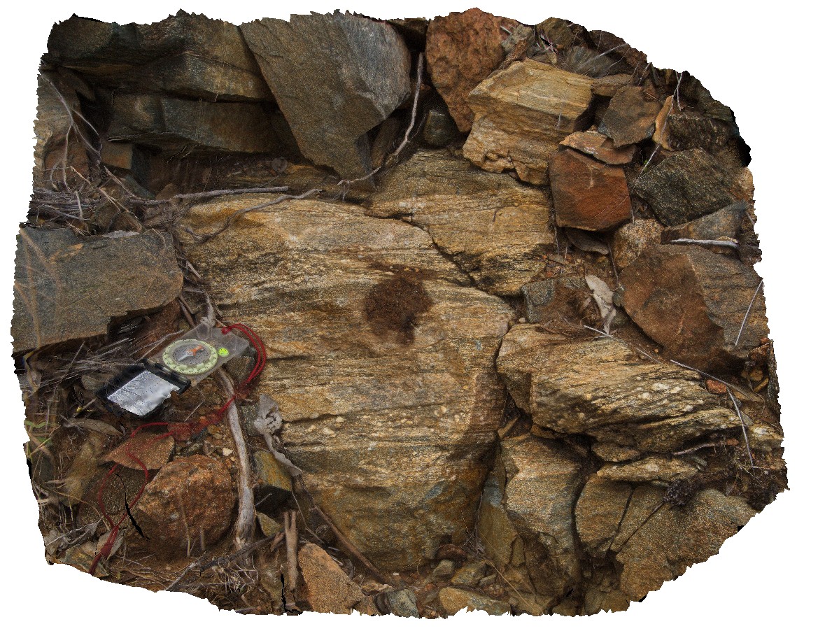
quarts and feldspar augen in finely laminated amphibolite. Harts Range, N.T. |
0.80 |
-23.26729200000 |
134.88561700000 |
603.098 |
amphibolite, augen, structure, laminated, metamorphic |
amphibolite |
ENTIAFSP1 Map
 |
0 |
07/25/2016 4:26 p.m. |
Full Spherical Panorama |
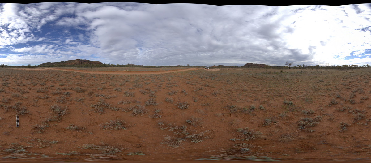
view of central west Entia Dome. Harts Range, N.T. |
1000.00 |
-23.09634100000 |
135.17949400000 |
601.106 |
Entia Dome, Harts Range, metamorphic, gneiss |
gneiss |
ENTIA4 Map
 |
5 |
07/25/2016 5:14 p.m. |
3D terrestrial photogrammetric model |
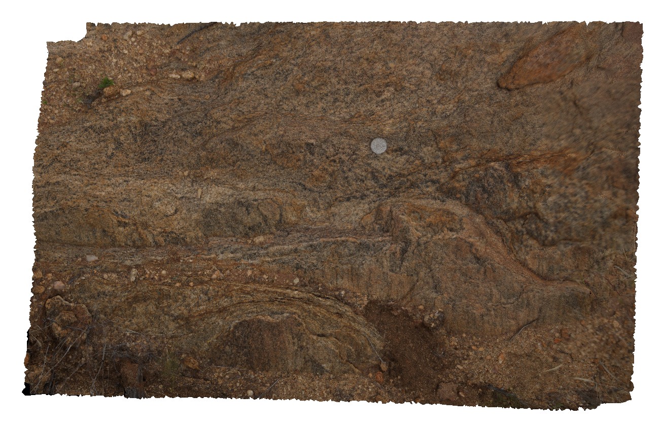
view of foliated minerals in orthogneiss of the Entia Gneiss Complex. Entia Dome. Harts Range, N.T. |
1.00 |
-23.03333900000 |
135.22426300000 |
597.140 |
orthogneiss, Entia Dome, metamorphic, Harts Range, foliation, structure |
gneiss |
ENTIA6 Map
 |
5 |
07/25/2016 5:30 p.m. |
3D terrestrial photogrammetric model |
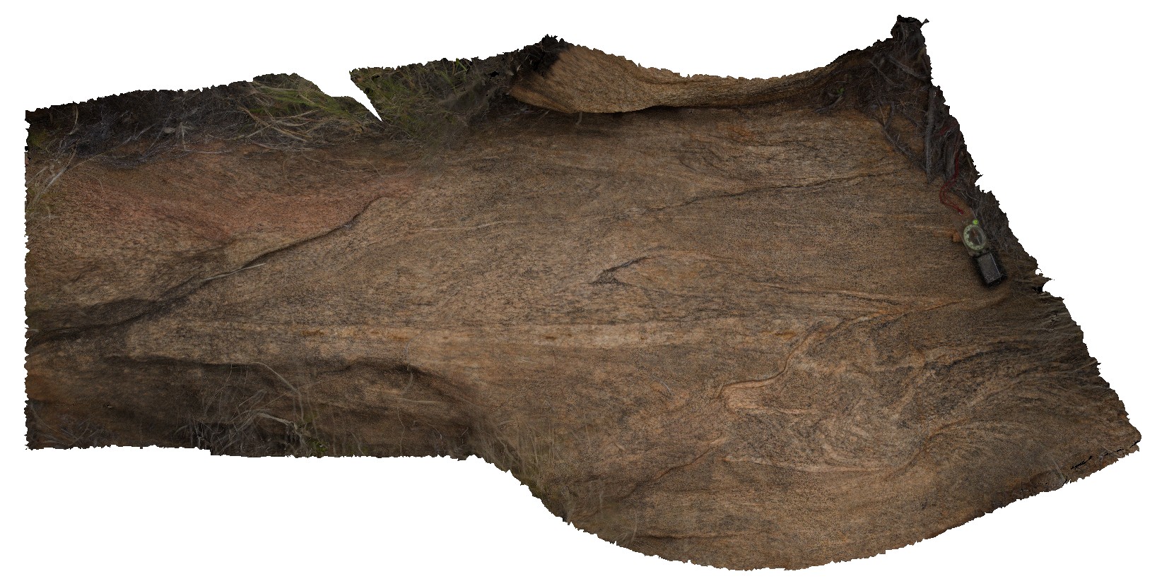
small-scale isoclinal folds in orthogneiss of the Entia Gneiss Complex. Entia Dome. Harts Range, N.T. |
2.00 |
-23.03303200000 |
135.22423100000 |
594.750 |
Entia Gneiss Complex, gneiss, metamorphic, harts range, isoclinal fold, fold, structure |
gneiss |
 AusGeol.org