GibbRiverFSP4 Map
 |
0 |
06/06/2016 noon |
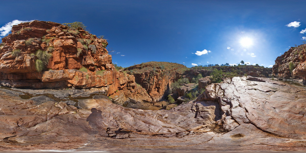
Full Spherical Panorama |
view along and into Lennard Gorge in the O'Donnell Formation sandstone. Lennard Gorge Road, W.A. |
500.00 |
-17.17694000000 |
125.19958000000 |
-9999.000 |
O'Donnell Formation, sandstone, gorge, sedimentology |
sandstone |
DixonRange15 Map
 |
0 |
06/14/2016 noon |
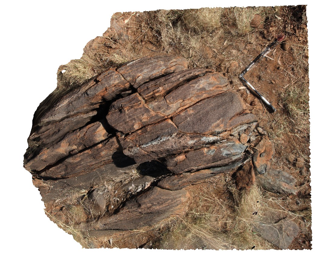
3D terrestrial photogrammetric model |
biotite schist with layers of coarse-grained quartz and biotite. Dixon Range road, W.A. |
3.00 |
-17.17705000000 |
128.24669000000 |
-9999.000 |
biotite schist, metamorphic, structure |
schist |
DixonRangeUAV1 Map
 |
0 |
06/14/2016 noon |
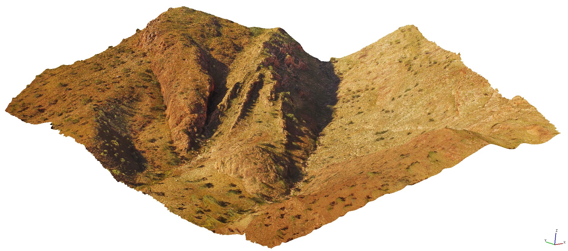
3D UAV photogrammetric model |
aerial view of steep faults in metasediments. Road to Dixon Range, W.A. |
50.00 |
-17.17800000000 |
128.25186000000 |
-9999.000 |
steep fault, metasediments, structure |
metasediments |
DixonRangeFSP1 Map
 |
0 |
06/14/2016 noon |
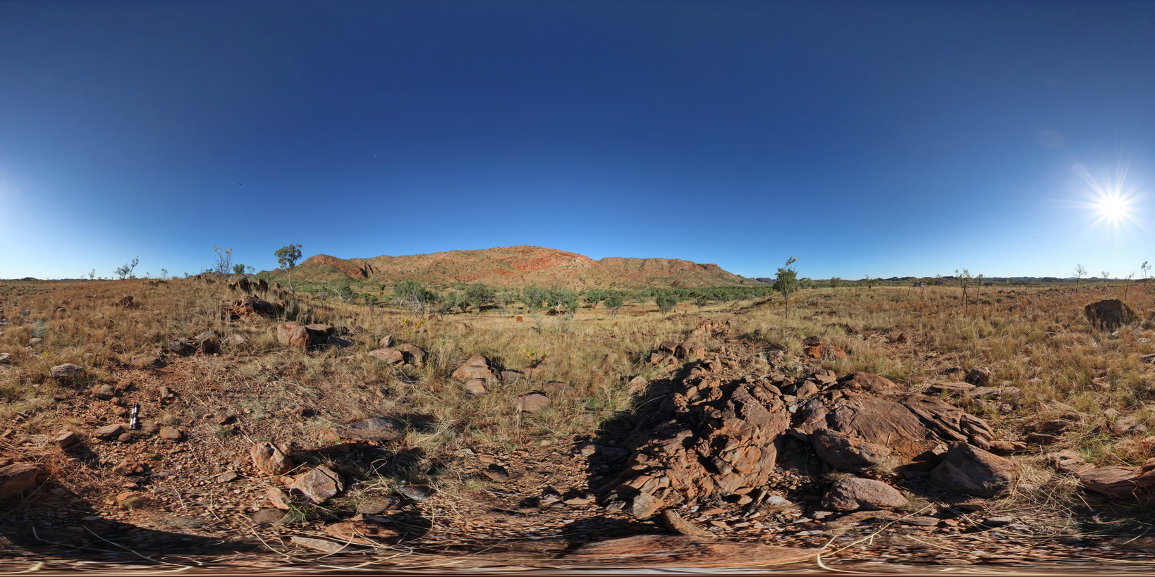
Full Spherical Panorama |
view of steep faults in metasediments / fault block terrane. Road Dixon Range, W.A. |
2000.00 |
-17.17853000000 |
128.24756000000 |
-9999.000 |
fault terrane, steep fault, metasediment, structure |
metasediment |
DixonRange1 Map
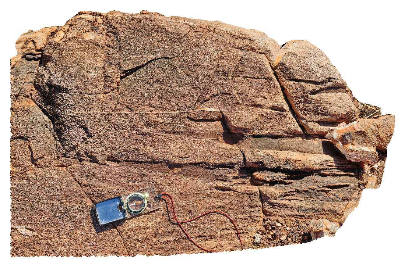 |
0 |
06/13/2016 noon |
3D terrestrial photogrammetric model |
schist with small mafic dykes and quartz veins with tight folds. Road to Dixon Range, W.A. |
1.00 |
-17.17853000000 |
128.24756000000 |
-9999.000 |
schist, tight fold, structure, mafic dyke |
schist |
DixonRangeGIGa1 Map
 |
0 |
06/13/2016 noon |
Gigapixel image |
steep fault in metasediments. Dixon Range, north W.A. |
0.00 |
-17.17853000000 |
128.24756000000 |
-9999.000 |
|
|
GibbRiver19 Map
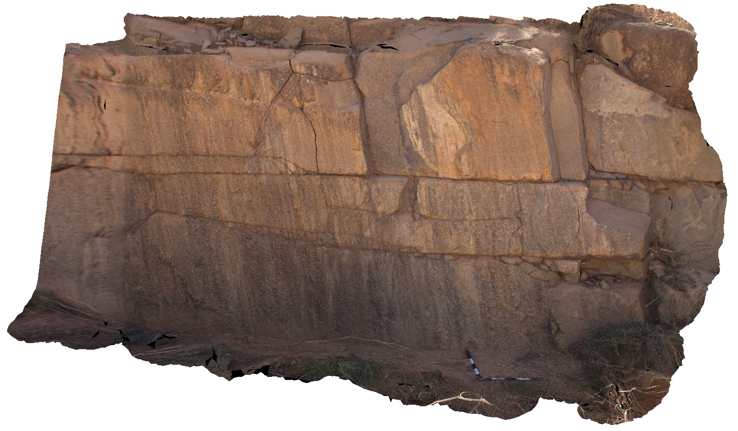 |
0 |
06/06/2016 noon |
3D terrestrial photogrammetric model |
steeply plunging lineations on foliation / fault surface in mylonitised granite. Gibb River Road, W.A. |
5.00 |
-17.18072000000 |
124.92310000000 |
-9999.000 |
lineation, foliation, mylonite, granite, structure |
granite |
GibbRiver20 Map
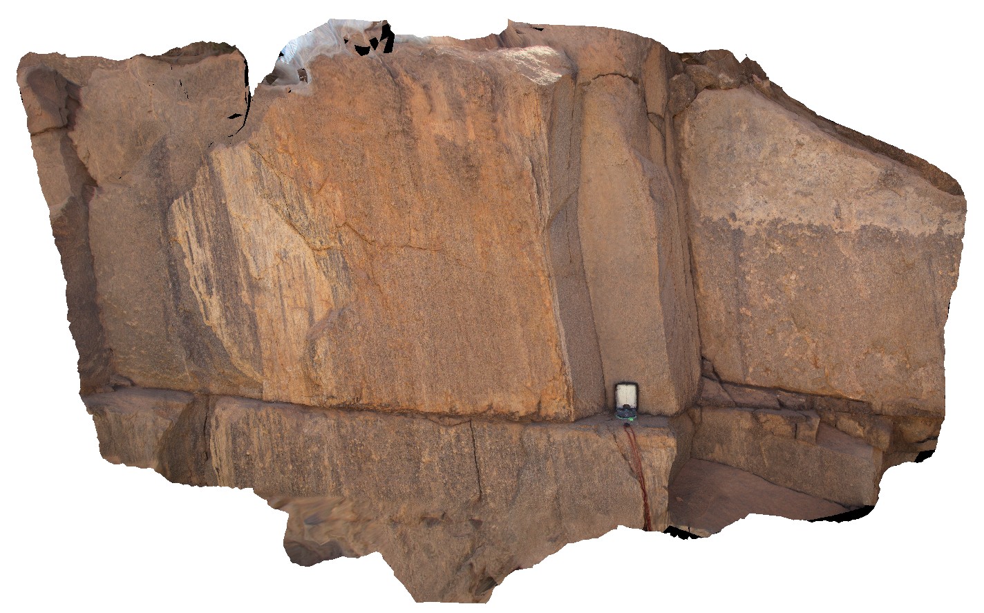 |
0 |
06/06/2016 noon |
3D terrestrial photogrammetric model |
detail of steeply plunging lineations on foliation / fault surface in mylonitised granite. Gibb River Road, W.A. |
1.00 |
-17.18072000000 |
124.92310000000 |
-9999.000 |
mylonite, structure, lineation, foliation |
mylonite |
DixonRangeFSP2 Map
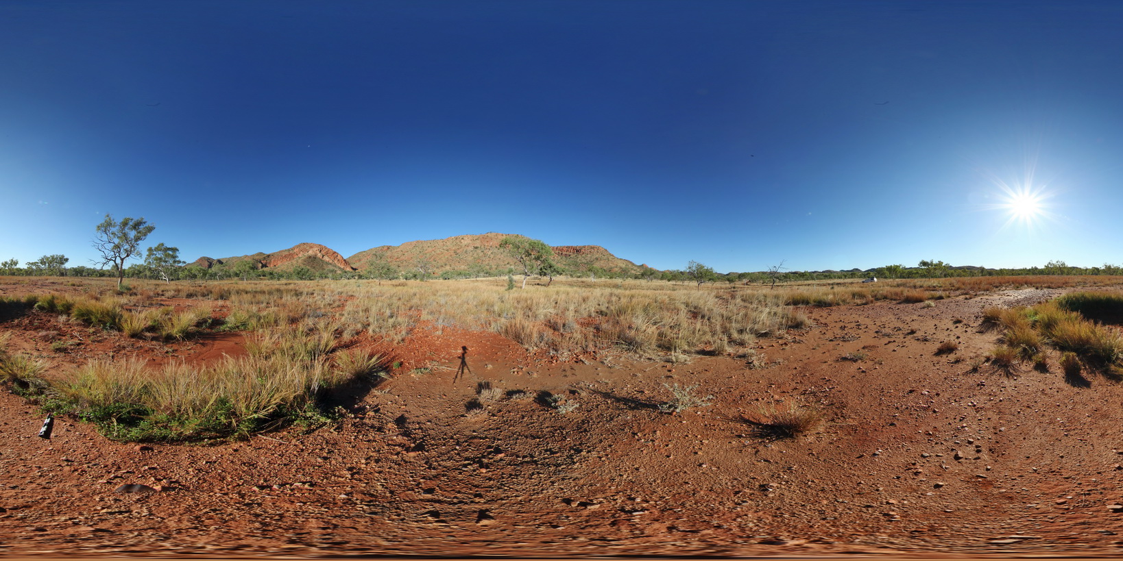 |
0 |
06/14/2016 noon |
Full Spherical Panorama |
view of fault-block terrane showing blocks of metasediment. Dixon Range road. Dixon Range, W.A. |
2000.00 |
-17.18634000000 |
128.24443000000 |
-9999.000 |
fault terrane, structure, fault, metasediment |
metasediment |
DixonRangeFSP3 Map
 |
0 |
06/14/2016 noon |
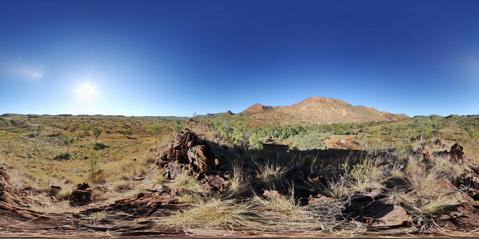
Full Spherical Panorama |
view of fault-block terrane showing blocks of metasediment. Dixon Range road. Dixon Range, W.A. |
2000.00 |
-17.19481000000 |
128.24078000000 |
-9999.000 |
metasediments, fault block terrane, structure, fault |
metasediment |
DixonRange14 Map
 |
0 |
06/14/2016 noon |
3D terrestrial photogrammetric model |
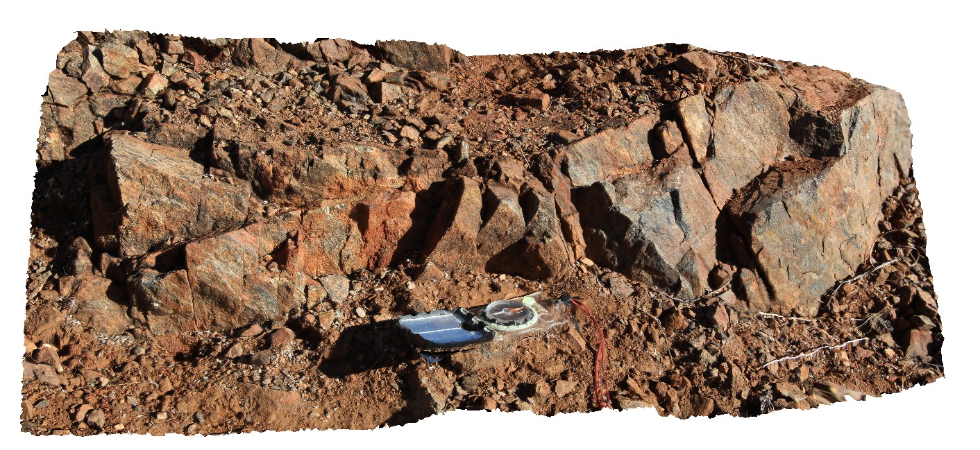
low-lying amphibolite outcrop with apparent cleavage parallel to adjacent road. Road to Dixon Range, North W.A. |
0.90 |
-17.19775000000 |
128.24126000000 |
-9999.000 |
amphibolite, apparent cleavage, metamorphics |
amphibolite |
DixonRange12 Map
 |
0 |
06/14/2016 noon |
3D terrestrial photogrammetric model |
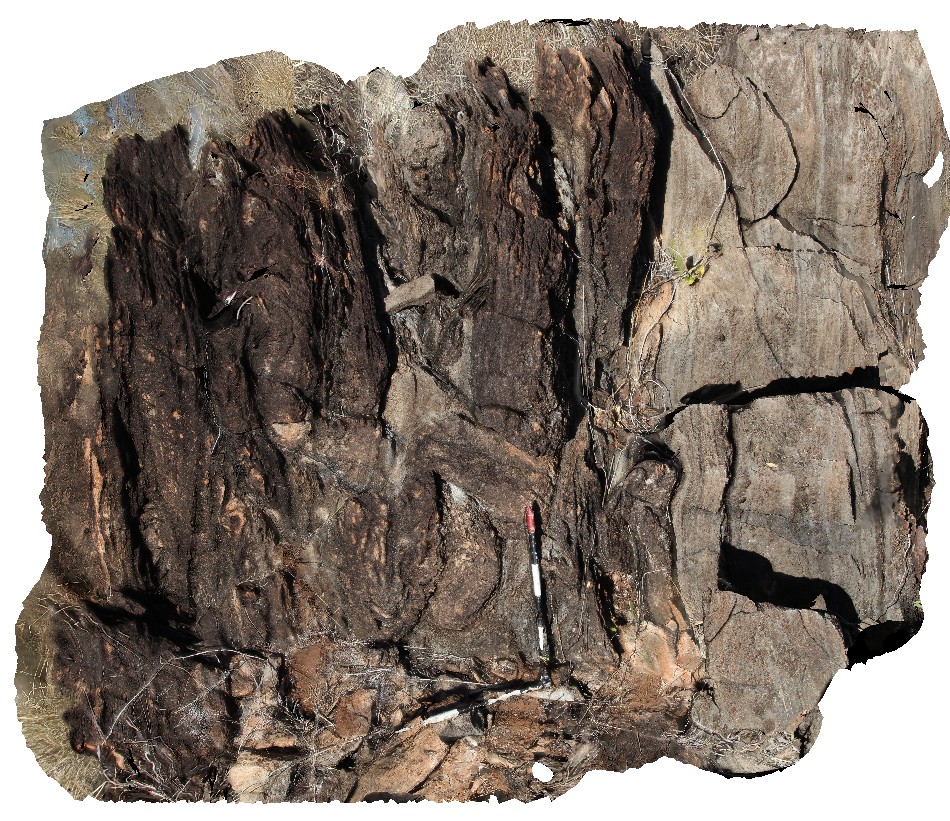
steeply dipping carbonates near road to Dixon Range, North W.A. |
2.50 |
-17.19787000000 |
128.24109000000 |
-9999.000 |
carbonate, metamorphics, dip |
carbonate |
DixonRange13 Map
 |
0 |
06/14/2016 noon |
3D terrestrial photogrammetric model |
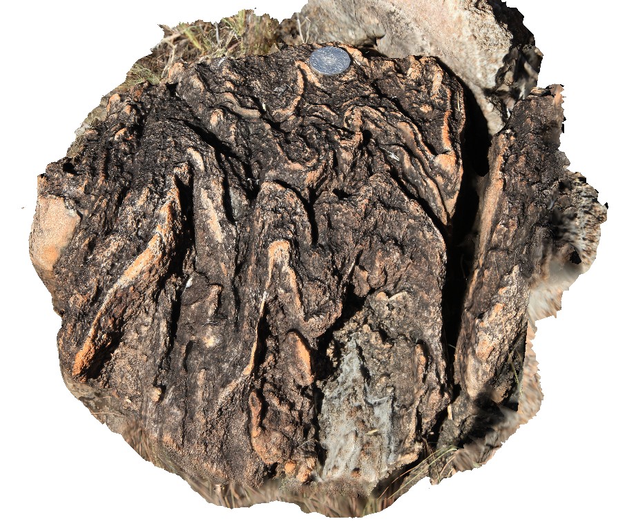
tightly folded carbonate float near road to Dixon Range, North W.A. |
0.35 |
-17.19787000000 |
128.24109000000 |
-9999.000 |
fold, structure, carbonate |
carbonate |
GibbRiverFSP1 Map
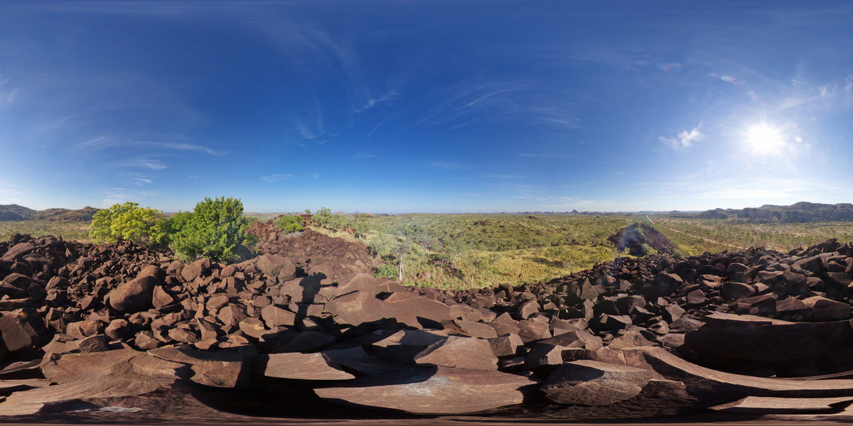 |
0 |
06/06/2016 noon |
Full Spherical Panorama |
view from gabbroic knoll of surrounding granite country. Gibb River Road, near Mount Amy. W.A. |
5000.00 |
-17.20575000000 |
124.91619000000 |
-9999.000 |
gabbro, granite |
gabbro |
GibbRiver9 Map
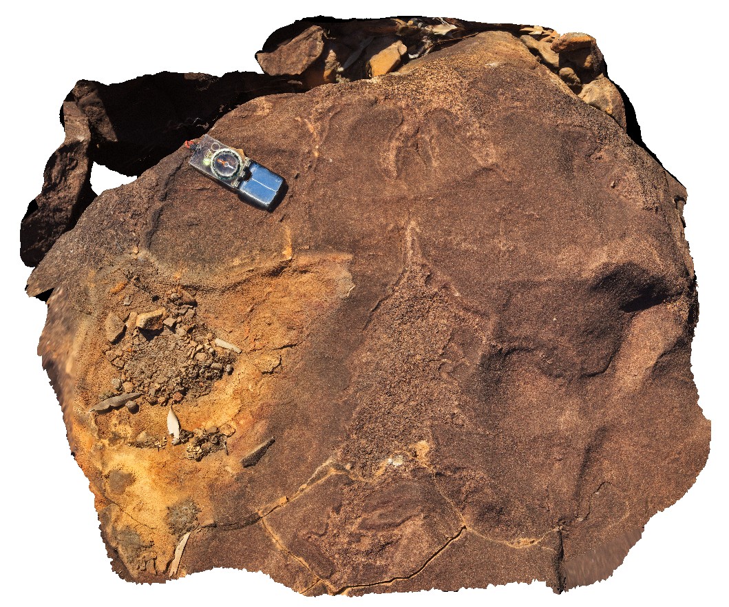 |
0 |
06/06/2016 noon |
3D terrestrial photogrammetric model |
Irregular felsic / granophyric segregations in gabbro. Gibb River Road, near Mount Amy. W.A. |
1.00 |
-17.20631000000 |
124.91576000000 |
-9999.000 |
igneous segregations, gabbro |
gabbro |
GibbRiverFSP2 Map
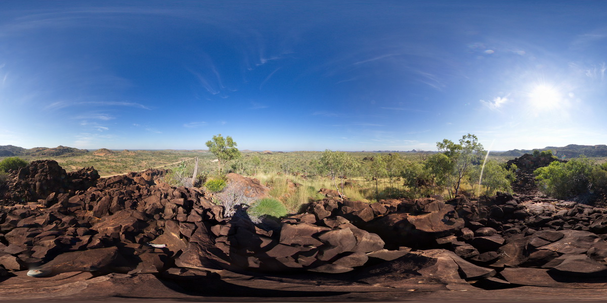 |
0 |
06/06/2016 noon |
Full Spherical Panorama |
view from gabbroic knoll of surrounding granite country. Gibb River Road, near Mount Amy. W.A. |
5000.00 |
-17.20631000000 |
124.91576000000 |
-9999.000 |
gabbro, granite |
gabbro |
GibbRiver10 Map
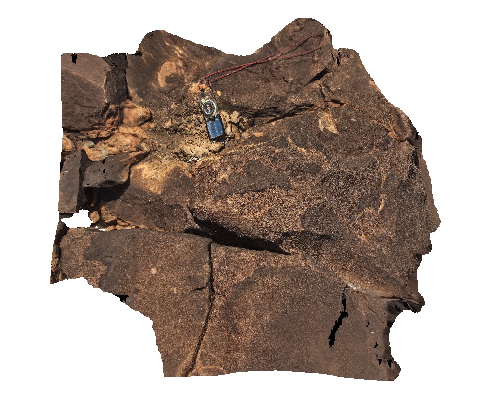 |
0 |
06/06/2016 noon |
3D terrestrial photogrammetric model |
Irregular felsic / granophyric segregations in gabbro. Gibb River Road, near Mount Amy. W.A. |
1.00 |
-17.20634000000 |
124.91590000000 |
-9999.000 |
granophyric segregations, gabbro |
gabbro |
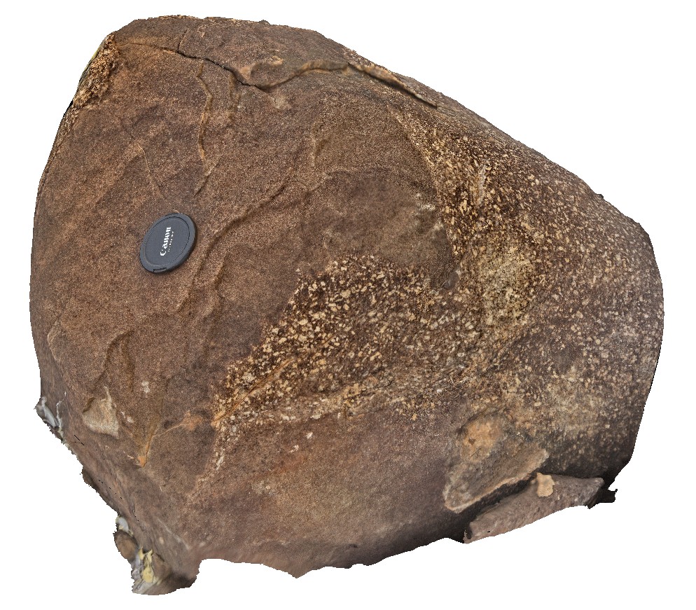
GibbRiver11 Map
 |
0 |
06/06/2016 noon |
3D terrestrial photogrammetric model |
coarse graded, feldspar phyric granodiorite segregations in medium to fine-grained gabbro. Gibb River Road, near Mount Amy. W.A. |
0.80 |
-17.20640000000 |
124.91614000000 |
-9999.000 |
segregations in gabbro |
gabbro |
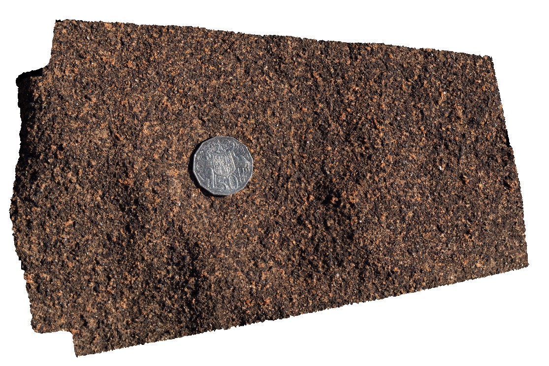
GibbRiver12 Map
 |
0 |
06/06/2016 noon |
3D terrestrial photogrammetric model |
detail of typical weathering surface of medium to fine-grained gabbro. Gibb River Road, near Mount Amy. W.A. |
0.20 |
-17.20654000000 |
124.91680000000 |
-9999.000 |
gabbro, weathering surface |
gabbro |
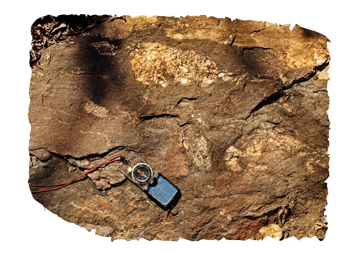
GibbRiver13 Map
 |
0 |
06/06/2016 noon |
3D terrestrial photogrammetric model |
xenolith / boudin of porphyritic granite in foliated gabbro. Gibb River Road, near Mount Amy. W.A. |
0.80 |
-17.20688000000 |
124.91716000000 |
-9999.000 |
xenolith, gabbro |
gabbro |
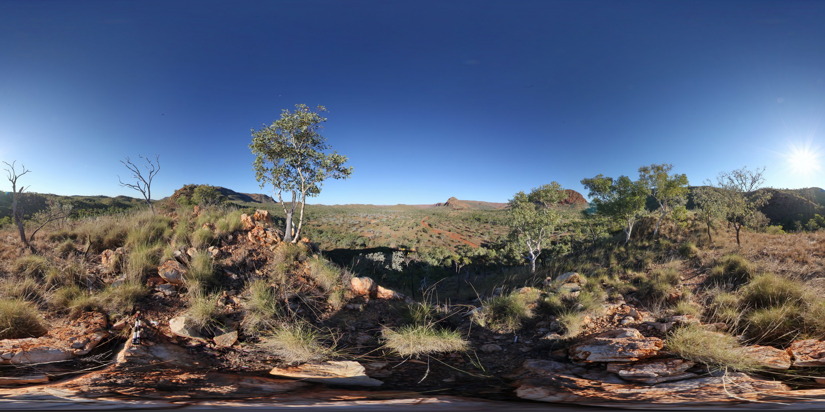
DixonRangeFSP4 Map
 |
0 |
06/14/2016 noon |
Full Spherical Panorama |
360 degree view of fault block terrane, showing hills and ridges of metasediments and flat, recessed plane of metamorphics below. Road to Dixon Range, north W.A. |
2000.00 |
-17.21462000000 |
128.23607000000 |
-9999.000 |
fault block terrane, fault, metasediments, structure, weathering landscape |
metasediments, metasediment |
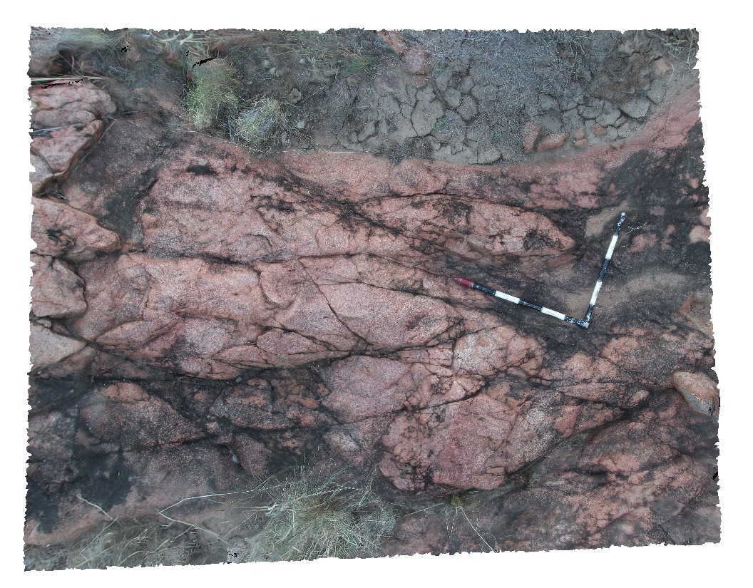
DixonRange2 Map
 |
0 |
06/14/2016 noon |
3D terrestrial photogrammetric model |
medium-grained red granite. Dixon Range road. Dixon Range, W.A. |
2.50 |
-17.21555500000 |
128.23648000000 |
-9999.000 |
granite |
granite |
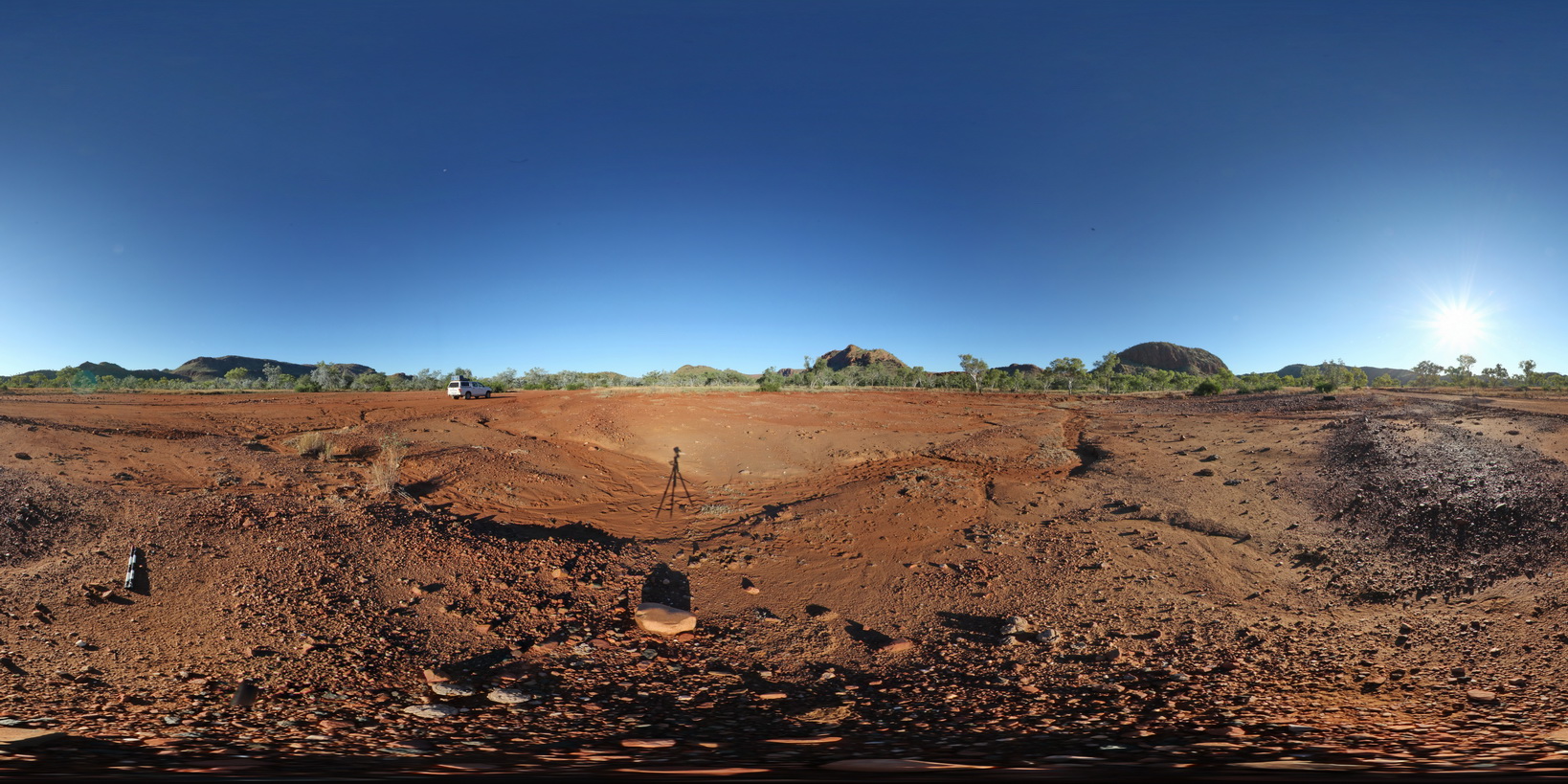
DixonRangeFSP5 Map
 |
0 |
06/14/2016 noon |
Full Spherical Panorama |
360 degree view of surrounding metasediment hills of the Red Rock Formation. Road to Dixon Range, north W.A. |
2000.00 |
-17.21930000000 |
128.24271000000 |
-9999.000 |
metasediment, fault terrane, metamorphic, fault, structure |
metasediment |
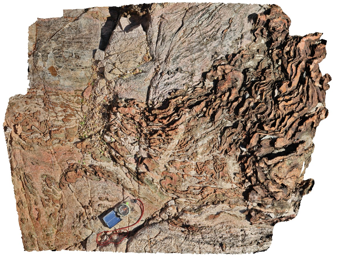
DixonRange11 Map
 |
0 |
06/14/2016 noon |
3D terrestrial photogrammetric model |
folded calc-silicate and marble outcrop. Hill above road to Dixon Range, north W.A. |
120.00 |
-17.22520000000 |
128.25299000000 |
-9999.000 |
calc-silicate, marble, metamorphic, structure |
calc-silicate |
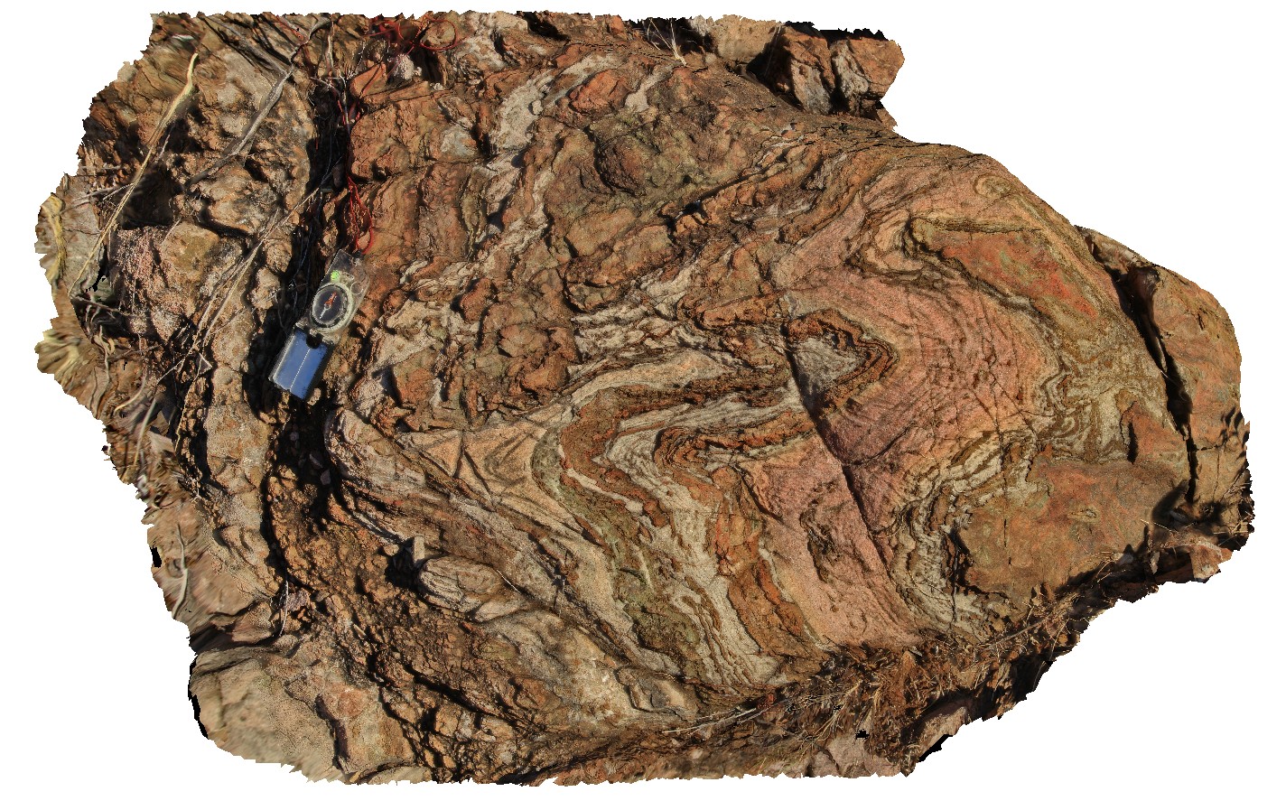
DixonRange3 Map
 |
0 |
06/14/2016 noon |
3D terrestrial photogrammetric model |
tightly folded, finely layered marble and calc-silicate rocks, near road to Dixon Range, north W.A. |
1.10 |
-17.22526000000 |
128.22598000000 |
-9999.000 |
marble, calc-silicate, tight fold, fold, structure, metamorphic |
calc-silicate |
 AusGeol.org