Jourama1 Map
 |
20 |
04/28/2016 2:59 p.m. |
3D terrestrial photogrammetric model |
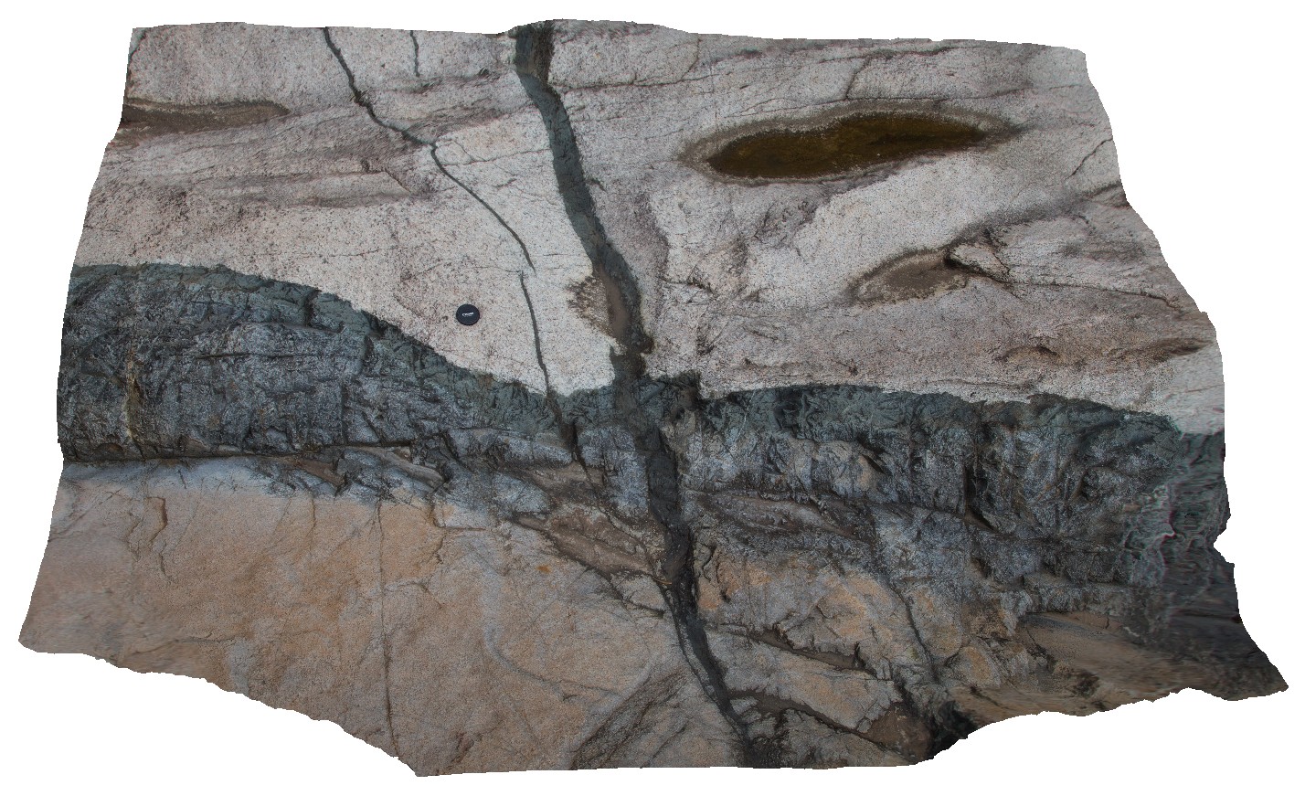
dolerite dykes intruding granite. Clear examples of small scale intrusive structures. Jourama Falls, QLD. |
4.00 |
-18.86587200000 |
146.12700700000 |
125.000 |
Granite, dolerite dyke swarm, cross cutting relationships, igneous |
granite, dolerite |
BH2014n12 Map
 |
20 |
03/18/2015 3:58 p.m. |
3D terrestrial photogrammetric model |
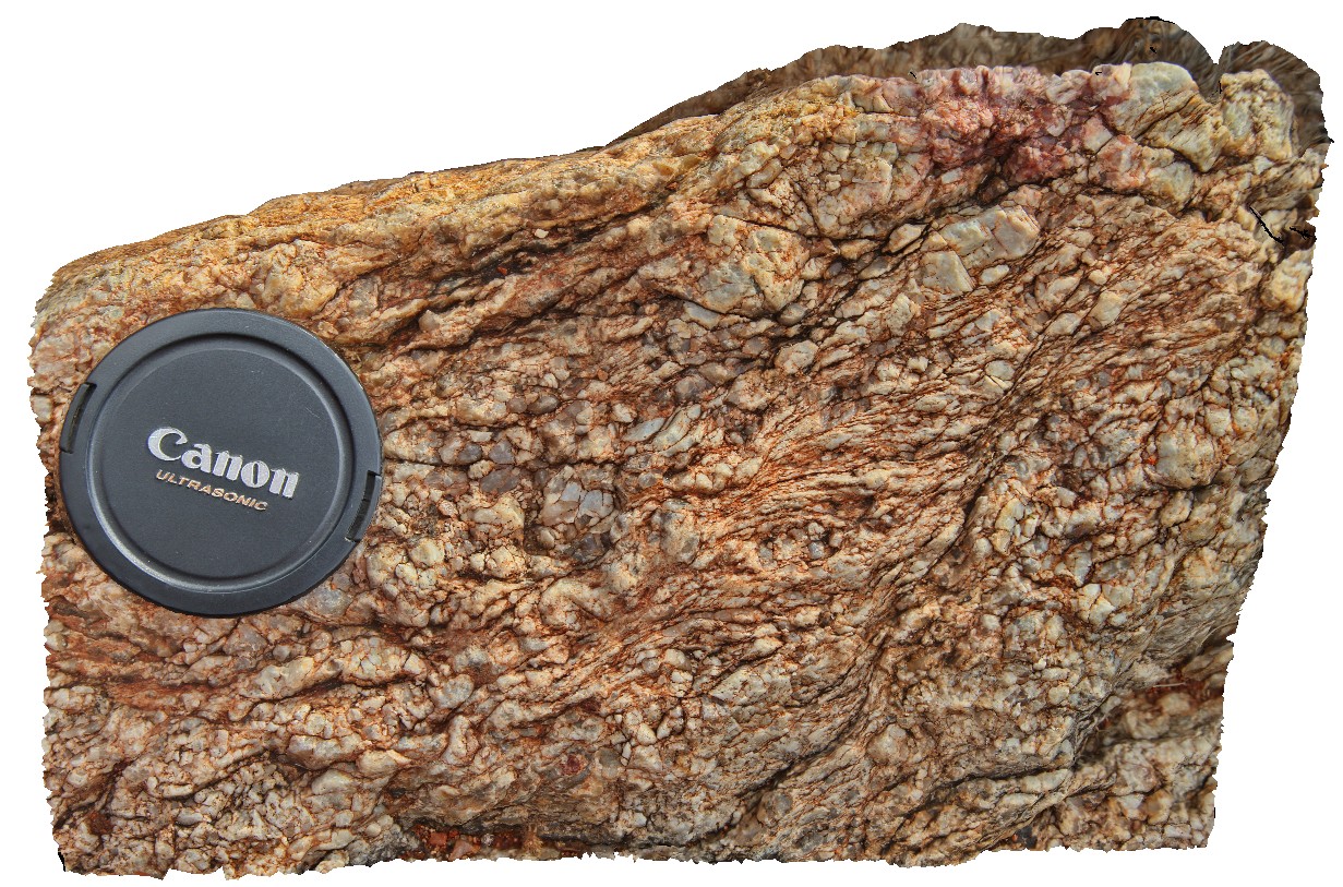
detail of S-C fabric developed in quartz pegmatite. Broken Hill, N.S.W. |
0.20 |
-31.61758375000 |
141.49437432000 |
-9999.000 |
pegmatite, S-C fabric, structure |
pegmatite |
BH2014n13 Map
 |
20 |
03/17/2015 11:29 a.m. |
3D terrestrial photogrammetric model |
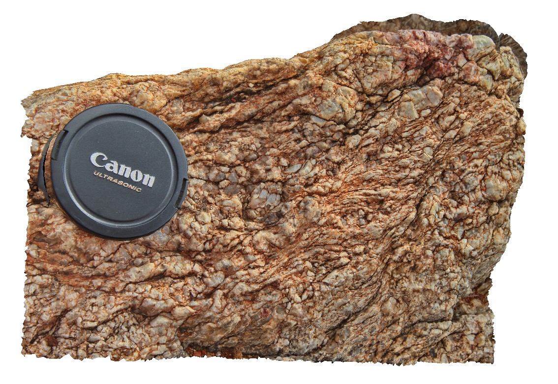
S-C fabric developed in quartz pegmatite. Broken Hill, N.S.W. |
0.20 |
-31.61759888000 |
141.49437438000 |
-9999.000 |
S-C fabric, quartz pegmatite |
pegmatite |
DaisyBanksPit11 Map
 |
20 |
03/23/2015 11:25 a.m. |
3D terrestrial photogrammetric model |
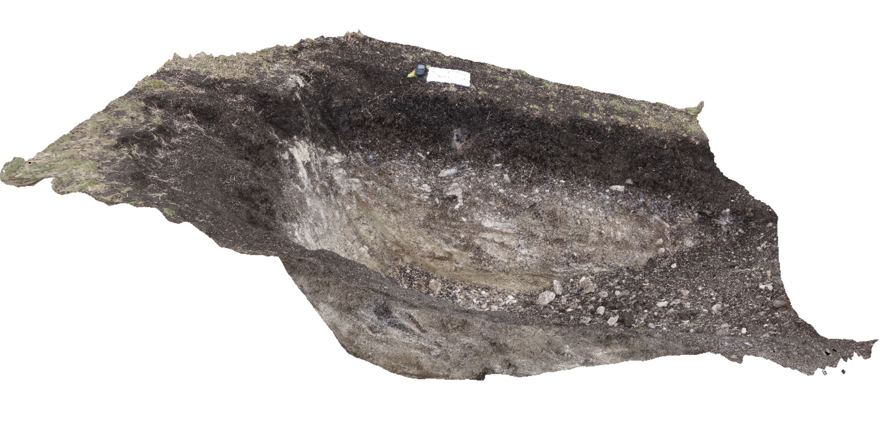
~80cm pit into dark grey sandy soils and white-brown sandy clay overlying Triassic interbedded micaceous brown, red-purple, green and grey carbonaceous siltstone, shale, mudstone and sandstone. Richmond, Tas. |
2.00 |
-42.72936200000 |
147.42457600000 |
-9999.000 |
clay, regolith |
clay |
Prices7 Map
 |
20 |
03/13/2015 9:13 a.m. |
3D terrestrial photogrammetric model |
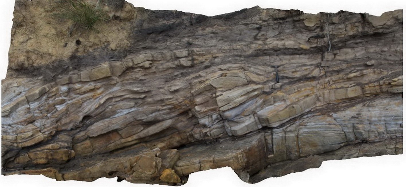
Cross beds and channels in Triassic fluvial sediments. Prices Point, Tasman Peninsula, Tasmania. |
10.00 |
-43.03379200000 |
147.74610800000 |
0.500 |
sandstone, cross beds, fluvial, channel, sedimentology |
sandstone |
DaisyBanksPit1 Map
 |
20 |
03/17/2015 1:18 p.m. |
3D terrestrial photogrammetric model |
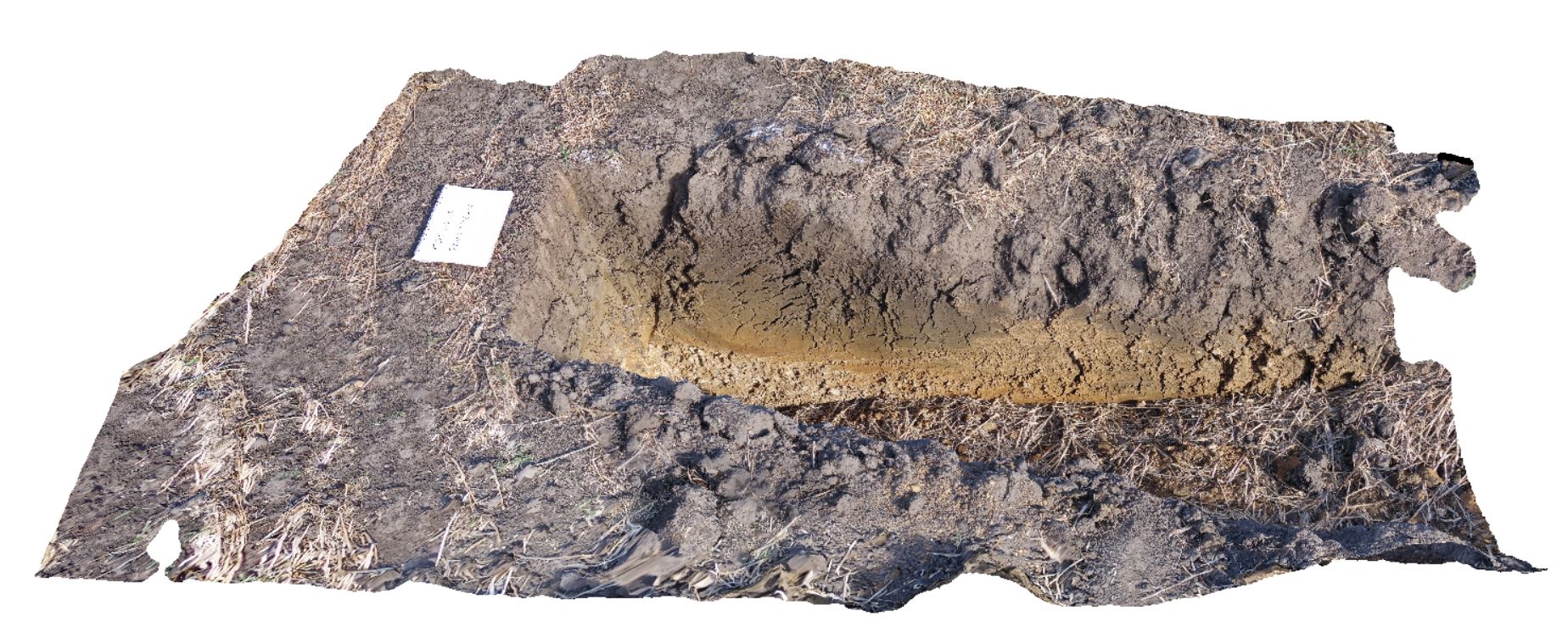
Undifferentiated alluvial soils and clays developed on Quaternary alluvial terrace gravel deposits predominantly derived from Parmeener and Palaeogene-Neogene units with clasts commonly of basalt and in places dolerite. Richmond, Tas. |
2.00 |
-42.73095300000 |
147.43018100000 |
-9999.000 |
clay, alluvium, regolith |
clay |
Jourama6 Map
 |
20 |
04/28/2016 3:48 p.m. |
3D terrestrial photogrammetric model |
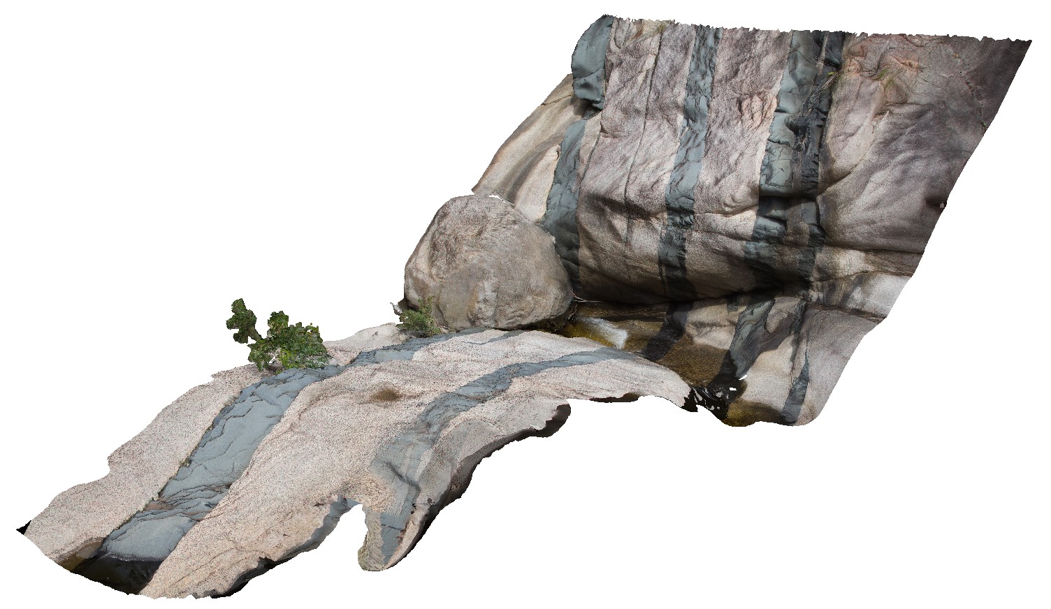
Dolerite dykes intruding granite. Clear examples of small scale intrusive structures. Jourama Falls, QLD. |
5.00 |
-18.86577200000 |
146.12731000000 |
119.000 |
Granite, mafic dyke swarm, cross cutting relationships, igneous |
granite, dolerite |
DaisyBanksPit12 Map
 |
20 |
03/23/2015 12:11 p.m. |
3D terrestrial photogrammetric model |
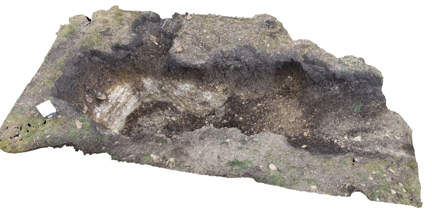
~80cm pit into dark grey sandy soils and white-brown sandy clay overlying Jurassic Dolerite. Richmond, Tas. |
2.00 |
-42.72939600000 |
147.42269500000 |
-9999.000 |
clay, Jurassic Dolerite, regolith |
clay |
Jourama10 Map
 |
20 |
04/28/2016 4:10 p.m. |
3D terrestrial photogrammetric model |
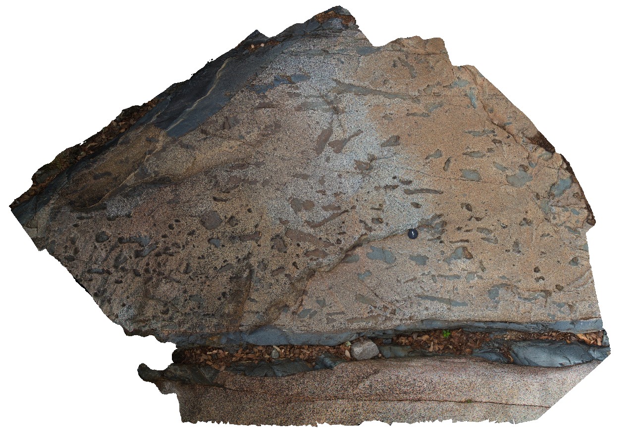
Dolerite dykes intruding granite with aplite veins. Concentration of mafic xenoliths (or cognate inclusions) within the granite. Clear examples of small scale intrusive structures. Jourama Falls, QLD. |
4.00 |
-18.86534800000 |
146.12760700000 |
104.000 |
Granite, mafic dyke swarm, cross cutting relationships, igneous |
granite, dolerite |
BoatHarbour2 Map
 |
20 |
01/01/9999 midnight |
3D terrestrial photogrammetric model |
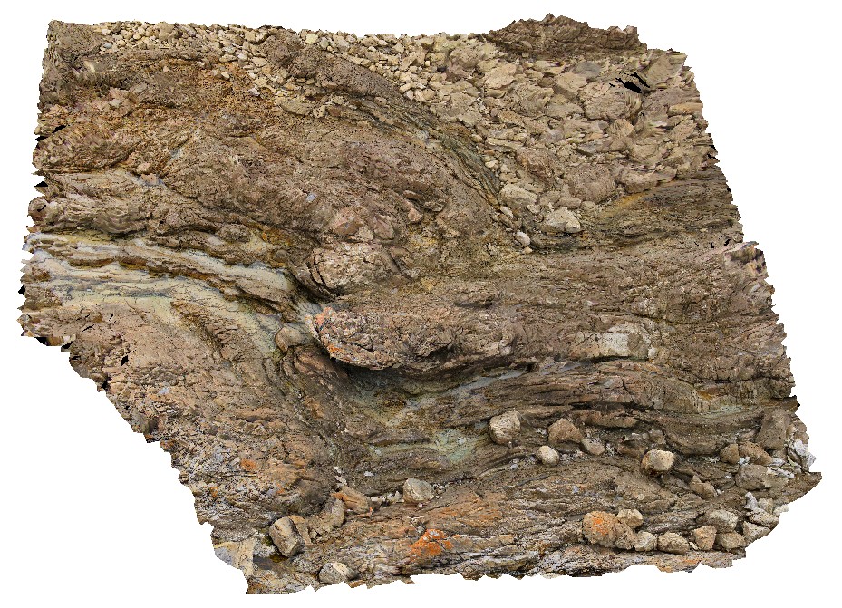
Fold hinge within Rocky Cape Group Orthoquartzite. Boat Harbour, Tas. |
6.00 |
-40.92568400000 |
145.61462700000 |
5.000 |
quartzite, fold hinge, bedding, structure |
quartzite |
BoatHarbour3 Map
 |
20 |
01/01/9999 midnight |
3D terrestrial photogrammetric model |
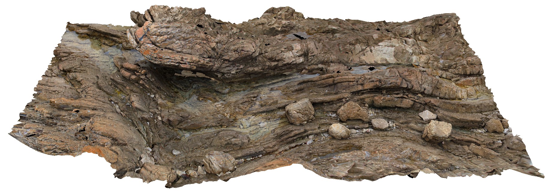
Fold hinge within Rocky Cape Group Orthoquartzite. Boat Harbour, Tas. |
8.00 |
-40.92556700000 |
145.61453900000 |
5.000 |
quartzite, bedding, fold hinge, structure |
quartzite |
DaisyBanksPit13 Map
 |
20 |
03/23/2015 12:07 p.m. |
3D terrestrial photogrammetric model |
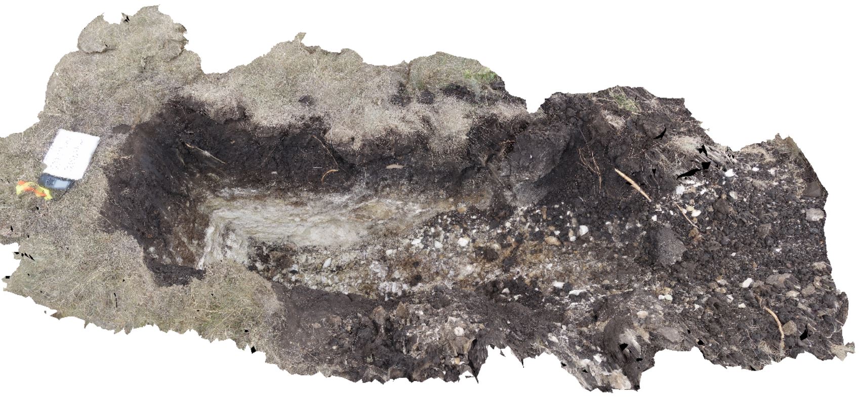
~80cm pit into dark grey sandy soils and white-brown sandy clay overlying Jurassic Dolerite. Richmond, Tas. |
2.00 |
-42.72961200000 |
147.42258600000 |
-9999.000 |
clay, Jurassic Dolerite, regolith |
clay |
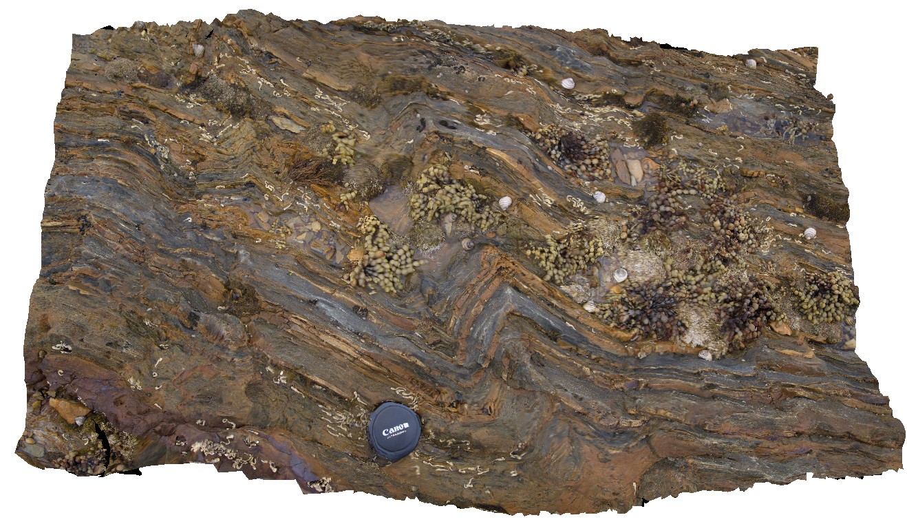
BoatHarbour7 Map
 |
20 |
01/01/9999 midnight |
3D terrestrial photogrammetric model |
Folded Rocky Cape Group quartzite and siltstone. Boat Harbour, Tas. |
1.00 |
-40.92636100000 |
145.61004200000 |
1.000 |
quartzite, bedding, folded, structure |
quartzite, siltstone |
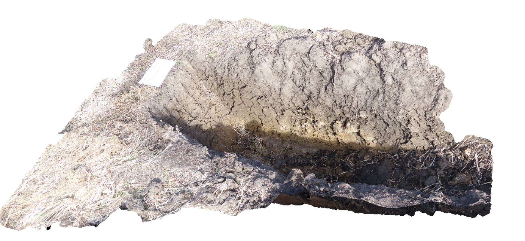
DaisyBanksPit2 Map
 |
20 |
03/17/2015 1:33 p.m. |
3D terrestrial photogrammetric model |
~80cm deep pit into soil and clays overlying quaternary alluvial deposits. Richmond, Tas. |
2.00 |
-42.73141700000 |
147.43138200000 |
-9999.000 |
clay, alluvium, regolith |
clay |
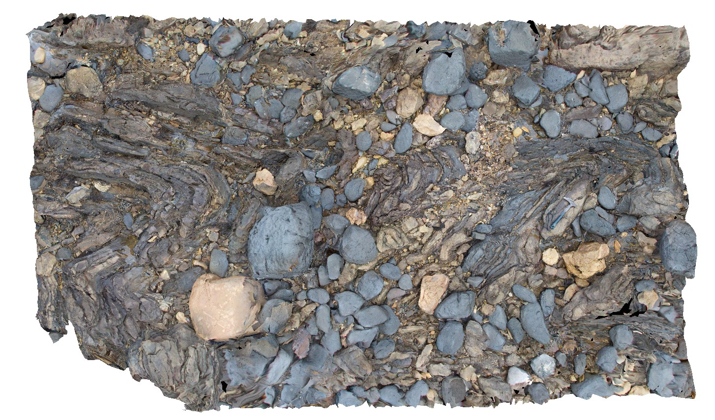
BoatHarbour9 Map
 |
20 |
01/01/9999 midnight |
3D terrestrial photogrammetric model |
Fold hinge within Rocky Cape Group Orthoquartzite. Boat Harbour, Tas. |
3.00 |
-40.92637600000 |
145.60981500000 |
1.000 |
quartzite, fold hinge |
quartzite |
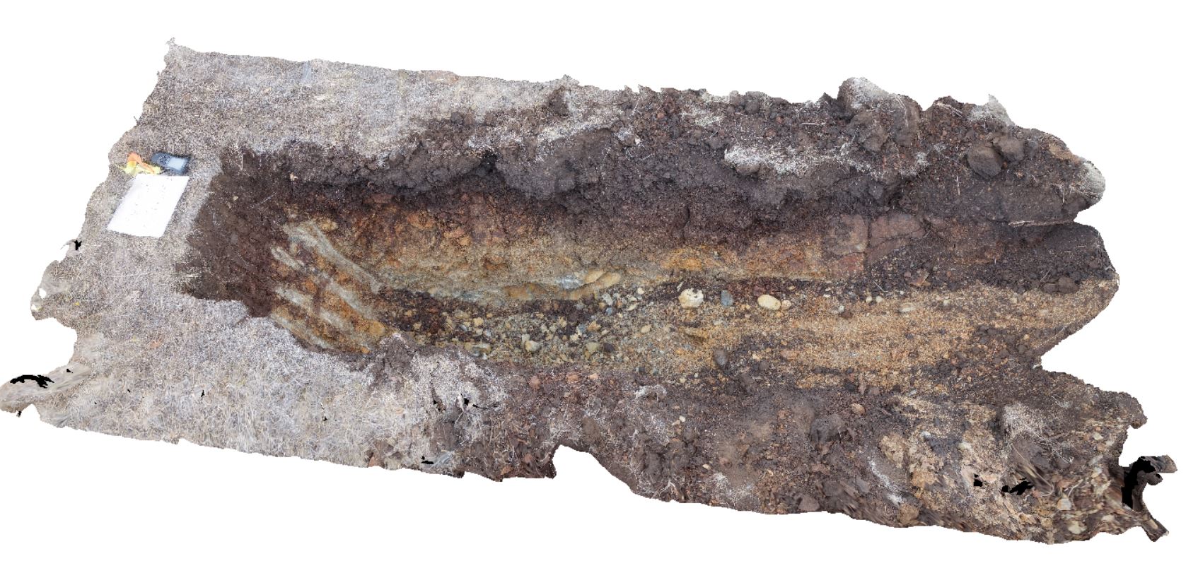
DaisyBanksPit14 Map
 |
20 |
03/24/2015 10:06 a.m. |
3D terrestrial photogrammetric model |
~80cm pit into dark grey sandy soils and white-brown sandy clay overlying Jurassic Dolerite. Richmond, Tas. |
2.00 |
-42.73006300000 |
147.42246700000 |
-9999.000 |
Clay, Jurassic Dolerite, regolith |
Clay |
Piccaninny21 Map
 |
20 |
03/13/2015 9:05 a.m. |
3D terrestrial photogrammetric model |
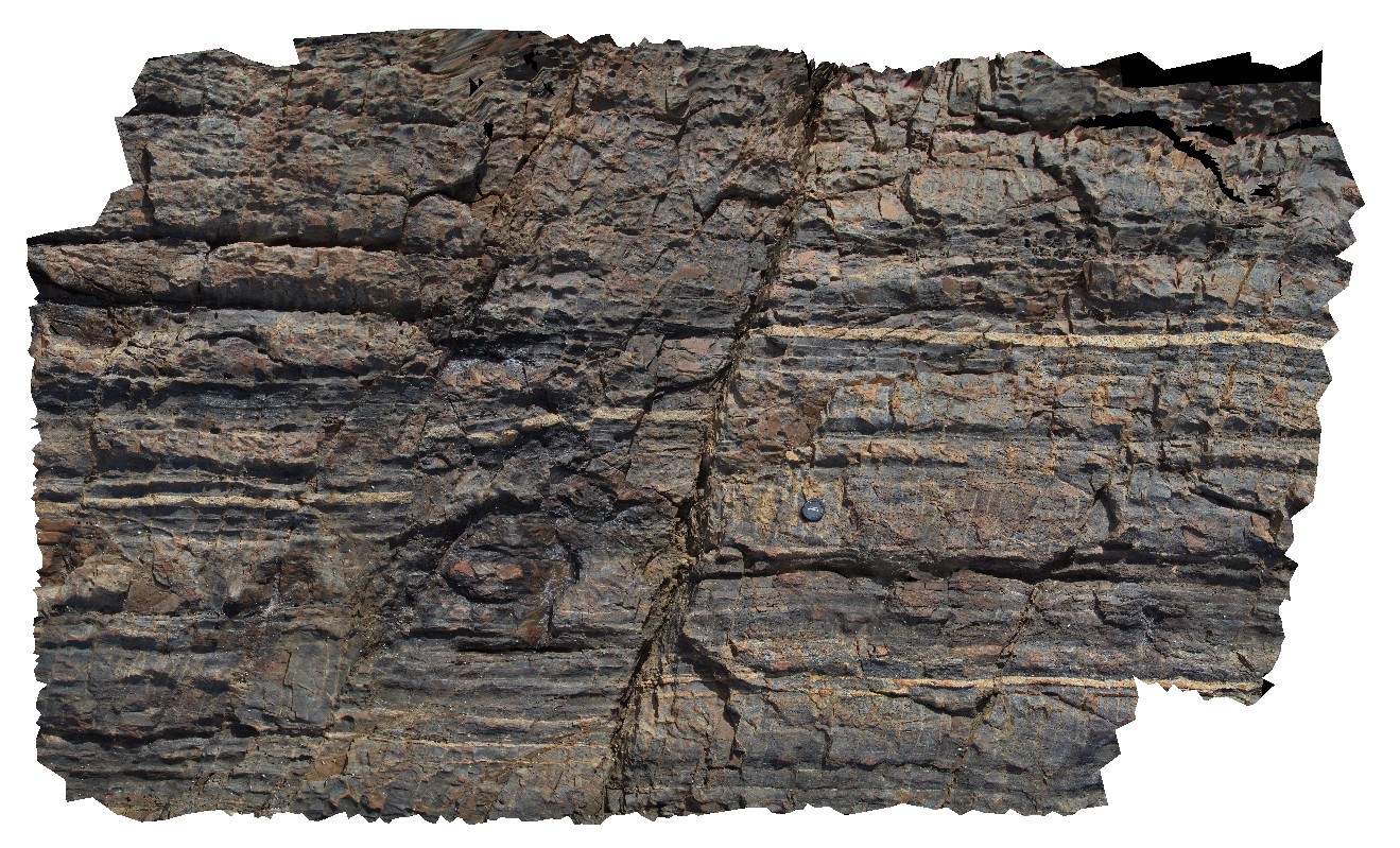
Major left lateral fault through hornfelsed well bedded, pervasively microfaulted Mathinna Supergroup. Piccaninny Point, eastern Tasmania. |
5.00 |
-41.69572100000 |
148.29369900000 |
2.000 |
Mathinna Supergroup, Fault, Hornfels, structure |
Turbidite, Granodiorite |
Piccaninny23 Map
 |
20 |
03/13/2015 9:06 a.m. |
3D terrestrial photogrammetric model |
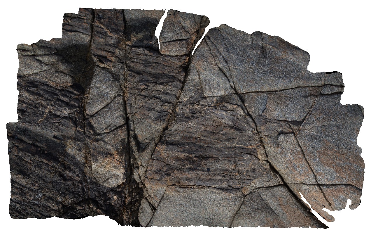
well defined conjugate faults within Long Point Granodiorite and semi assimilated xenolith of Mathinna Supergroup. Piccaninny Point, eastern Tasmania. |
8.00 |
-41.69552000000 |
148.29365700000 |
3.000 |
igneous, structure, conjugate fault, assimilated |
Turbidite, Granodiorite |
Piccaninny24 Map
 |
20 |
03/13/2015 9:06 a.m. |
3D terrestrial photogrammetric model |
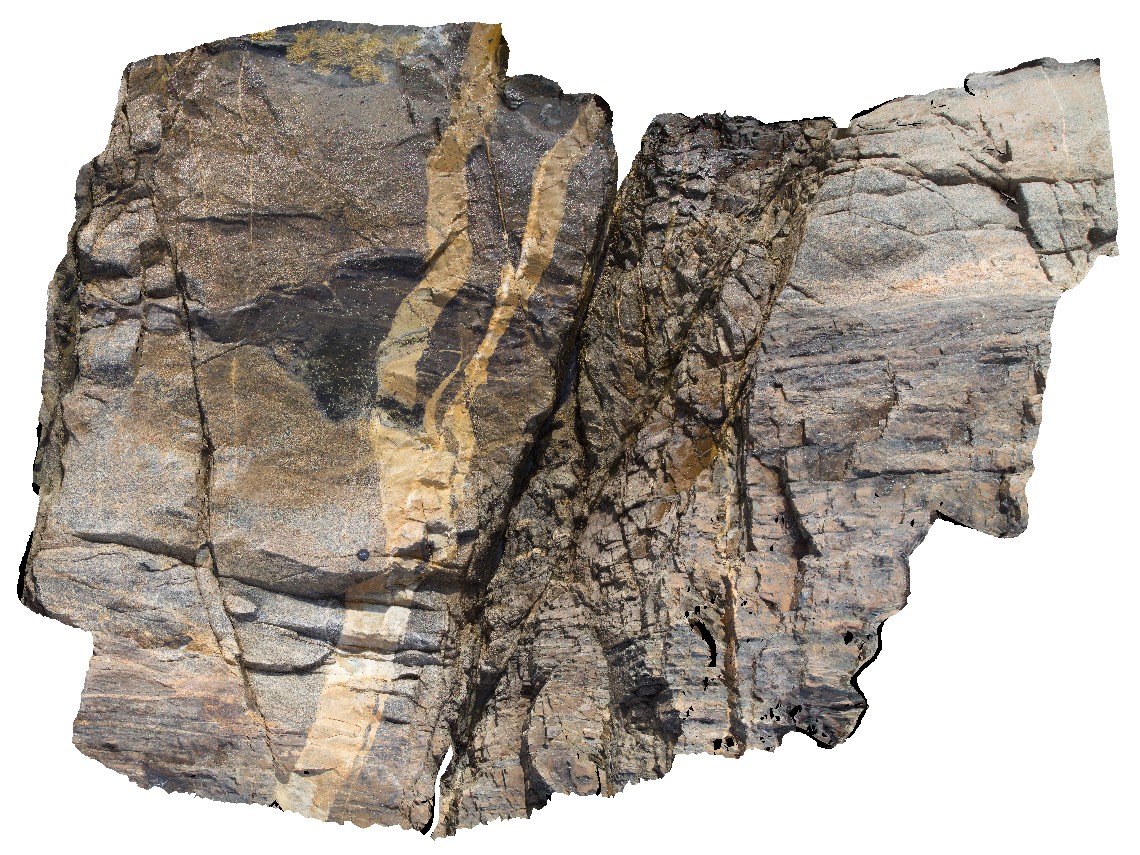
Long Point Granodiorite intruding into and assimilating well bedded Mathinna Supergroup. Multiple fault generations well displayed; 20cm aplite dyke offset by qz-filled fault, 1m wide fault zone with drag folding, all offset by secondary conjugate faults. |
5.00 |
-41.69546700000 |
148.29358800000 |
3.000 |
igneous, structure, assimilation, conjugate fault, fault zone, dyke |
Turbidite, Granodiorite |
BH2014n1 Map
 |
20 |
03/16/2015 3:03 p.m. |
3D terrestrial photogrammetric model |
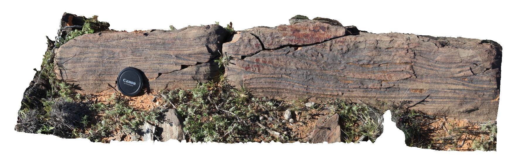
well preserved small cross beds in sandstone. Broken Hill, N.S.W. |
1.00 |
-31.61947252000 |
141.56534702000 |
-9999.000 |
cross bedding, sedimentology |
sandstone |
Prices5 Map
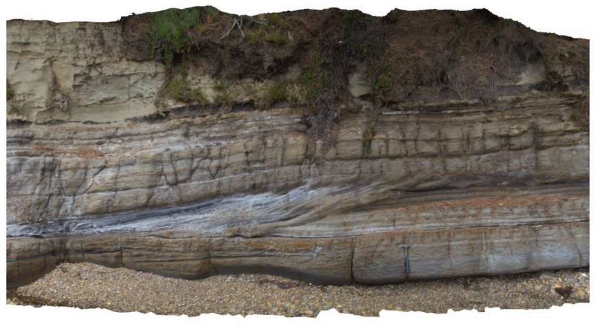 |
20 |
03/13/2015 9:13 a.m. |
3D terrestrial photogrammetric model |
Cross bedded 'prograding' Triassic sandstone unit with clear erosional truncation. Prices Point, Tasman Peninsula, Tasmania. |
8.00 |
-43.03478900000 |
147.74734900000 |
0.500 |
cross bedding, sandstone, fluvial, sedimentology |
sandstone |
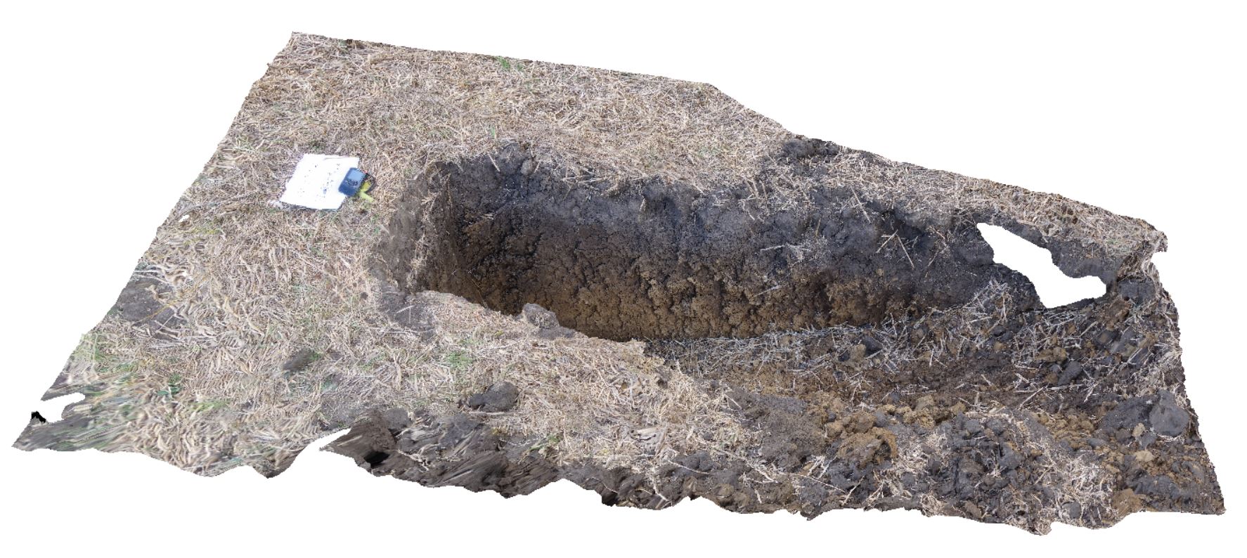
DaisyBanksPit3 Map
 |
20 |
03/17/2015 1:37 p.m. |
3D terrestrial photogrammetric model |
~80cm deep pit into soil and clays overlying Quaternary alluvial and marsh deposits of modern flood plains; of gravel, sand, silt and clay. Richmond, Tas. |
2.00 |
-42.73071600000 |
147.42842100000 |
-9999.000 |
clay, alluvium, regolith |
Clay |
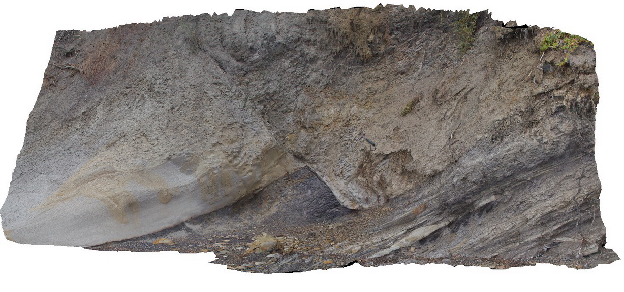
Prices2 Map
 |
20 |
03/13/2015 9:12 a.m. |
3D terrestrial photogrammetric model |
normal fault offsetting a contact between Triassic sandstone and siltstone. Prices Point, Tasman Peninsula, Tasmania. |
10.00 |
-43.03500200000 |
147.74783500000 |
0.500 |
normal fault, sandstone, siltstone, structure, sedimentology |
sandstone, siltstone |
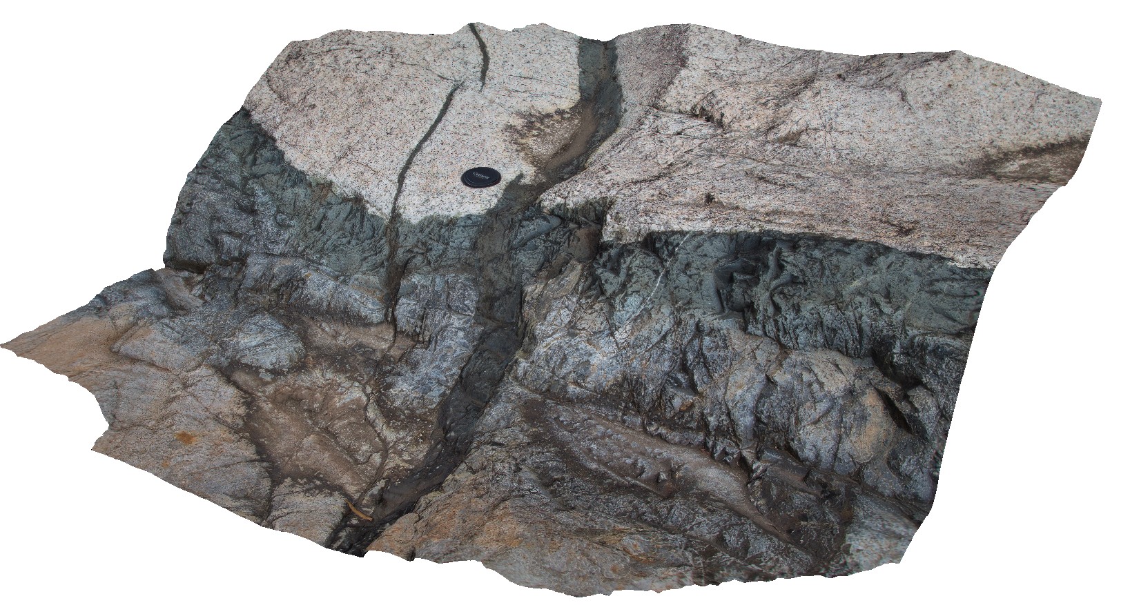
Jourama2 Map
 |
20 |
04/28/2016 3:04 p.m. |
3D terrestrial photogrammetric model |
Dolerite dykes intruding granite. Clear examples of small scale intrusive structures. Jourama Falls, QLD. |
2.00 |
-18.86578800000 |
146.12699200000 |
122.000 |
Granite, dolerite dyke swarm, cross cutting relationships, igneous |
granite, dolerite |
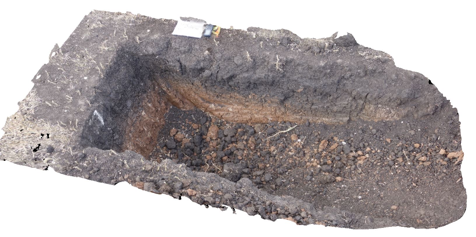
DaisyBanksPit9 Map
 |
20 |
03/17/2015 12:49 p.m. |
3D terrestrial photogrammetric model |
~80cm deep pit into soil and clays overlying late Cenozoic alluvial terrace deposits. Richmond, Tas. |
2.00 |
-42.72983600000 |
147.42554400000 |
-9999.000 |
clay, alluvial, regolith |
Clay |
 AusGeol.org