DaisyBanksPit4 Map
 |
20 |
03/17/2015 1:45 p.m. |
3D terrestrial photogrammetric model |
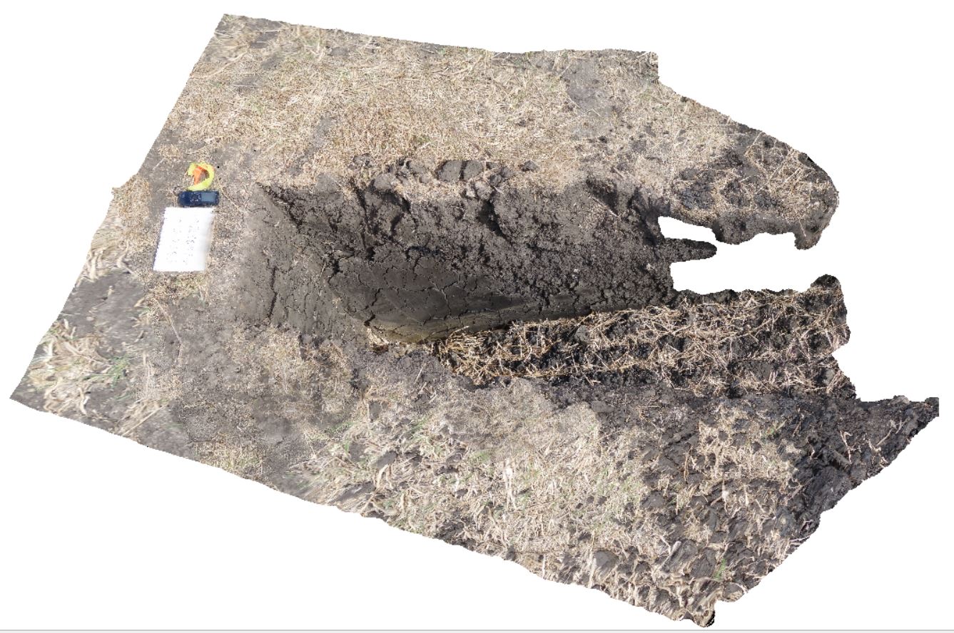
~80cm deep pit into soil and clays overlying Quaternary alluvial and marsh deposits of modern flood plains; of gravel, sand, silt and clay. Richmond, Tas. |
2.00 |
-42.73176200000 |
147.42817100000 |
-9999.000 |
Clay, alluvium, regolith |
Clay |
Trigelow1 Map
 |
0 |
06/05/2016 10:47 a.m. |
3D terrestrial photogrammetric model |
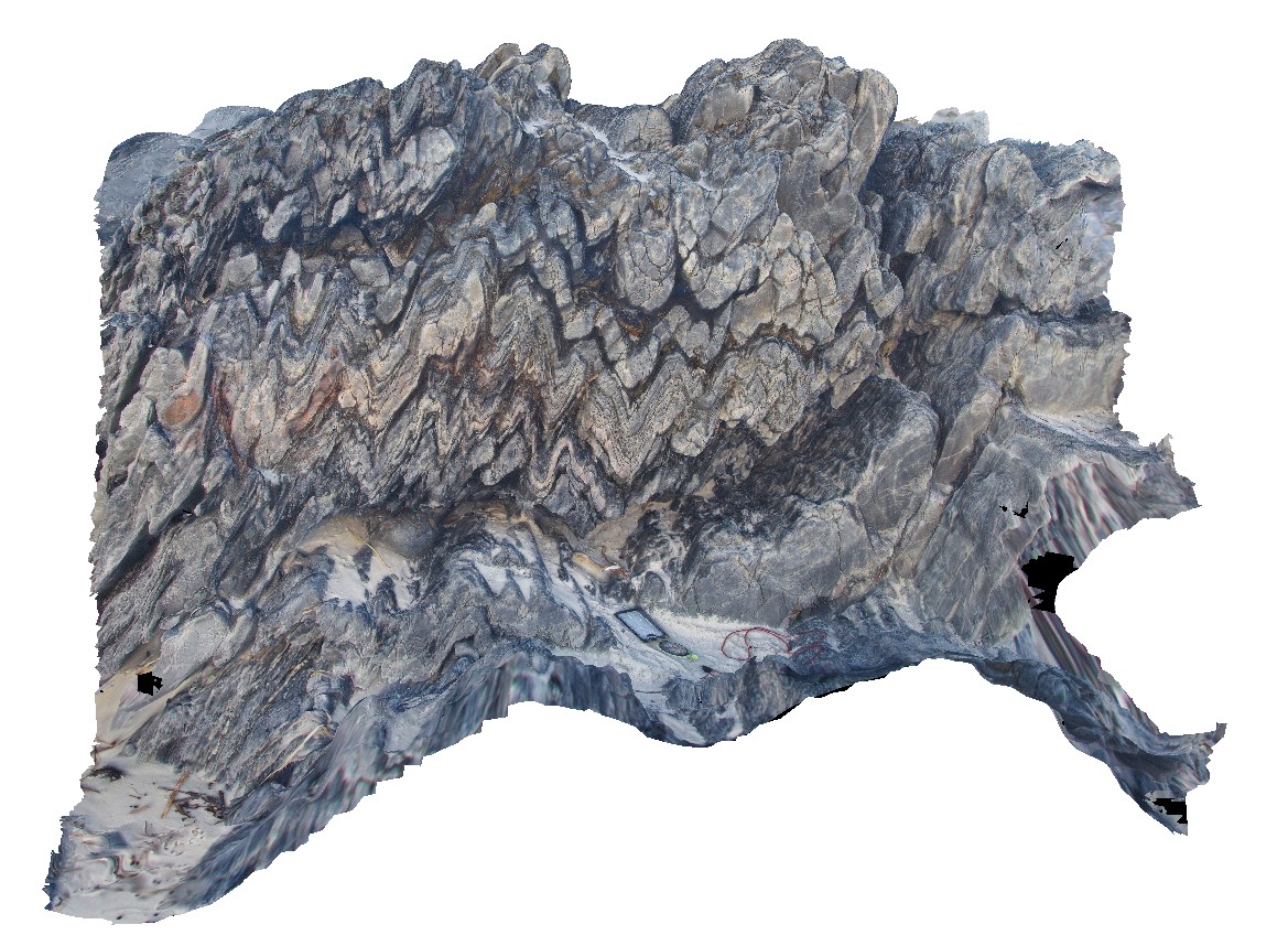
gently plunging, open folds in psammite / quartzite, Point Ann, W.A. |
1.50 |
-34.19865000000 |
119.55386000000 |
-9999.000 |
gently plunging fold, open fold, metasediments, structure |
quartzite |
WestBeach1 Map
 |
0 |
06/05/2016 10:47 a.m. |
3D terrestrial photogrammetric model |
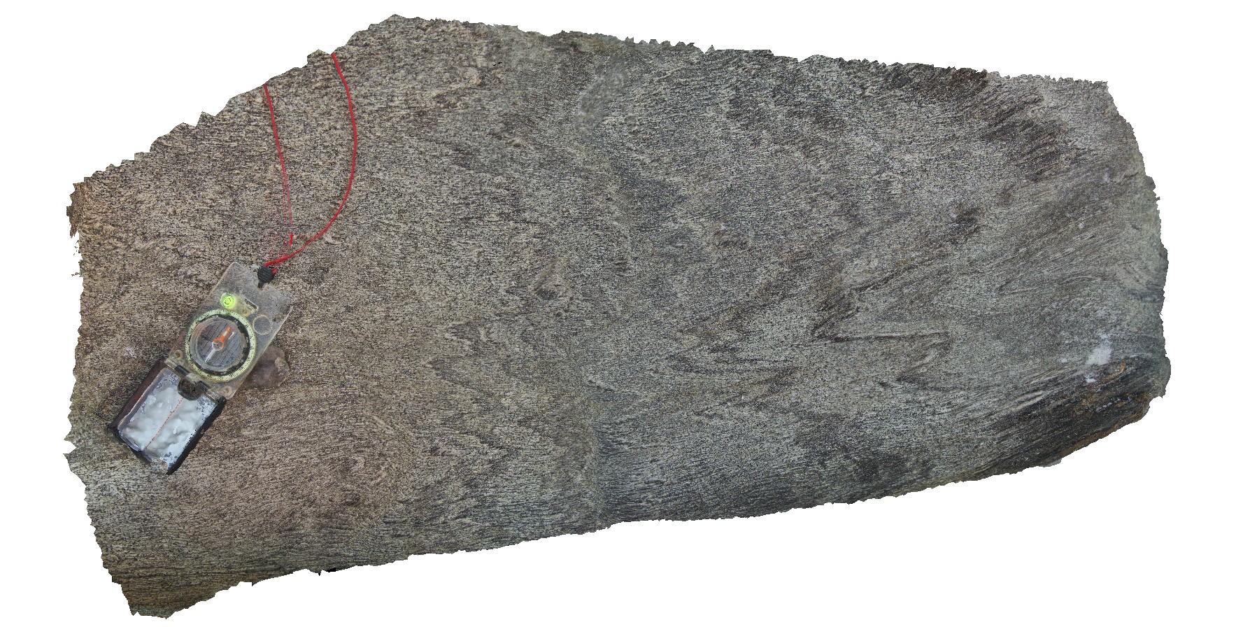
M geometry folds with penetrative cleavage in garnet schist. West Beach, W.A. |
1.00 |
-33.95337000000 |
119.97512000000 |
-9999.000 |
penetrative cleavage, M folding, garnet schist |
garnet schist |
Trigelow2 Map
 |
0 |
06/05/2016 10:47 a.m. |
3D terrestrial photogrammetric model |
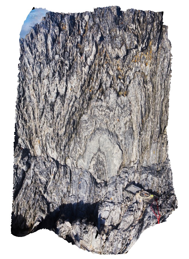
gently plunging, open to tight folds in psammite / quartzite. Point Ann, W.A. |
0.60 |
-34.19875000000 |
119.55394000000 |
-9999.000 |
fold plunge, fold, quartzite |
quartzite |
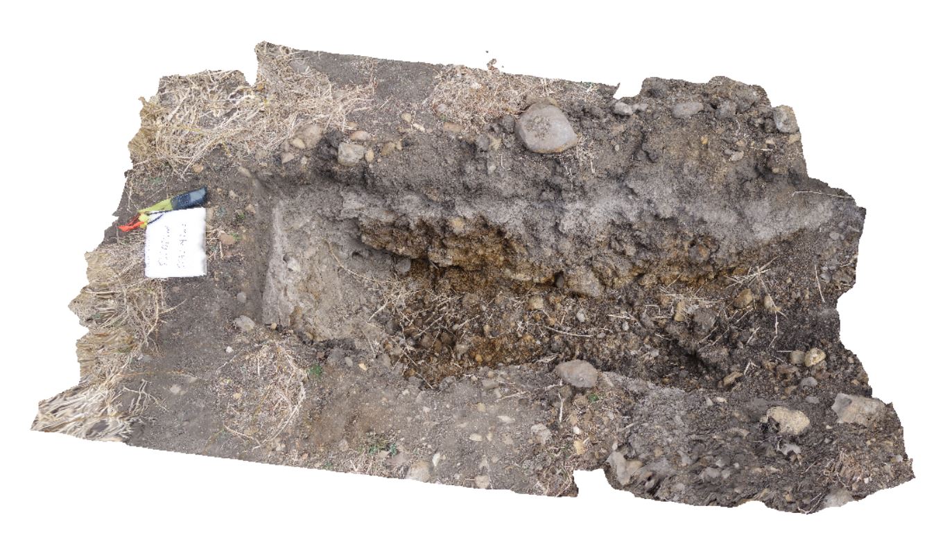
DaisyBanksPit5 Map
 |
20 |
03/17/2015 1:50 p.m. |
3D terrestrial photogrammetric model |
~80cm wide pit into recent sediments overlying Quaternary alluvial and marsh deposits of modern flood plains; of gravel, sand, silt and clay. Richmond, Tas. |
2.00 |
-42.73253700000 |
147.42790800000 |
-9999.000 |
palaeochannel, alluvial, regolith |
Gravel |
WestBeach3 Map
 |
0 |
06/05/2016 10:50 a.m. |
3D terrestrial photogrammetric model |
detailed view of 'M' folding in garnet schist from site WestBeach1. West Beach, W.A. |
0.30 |
-33.95340000000 |
119.97511000000 |
-9999.000 |
M fold geometry, folding, structure |
garnet schist |
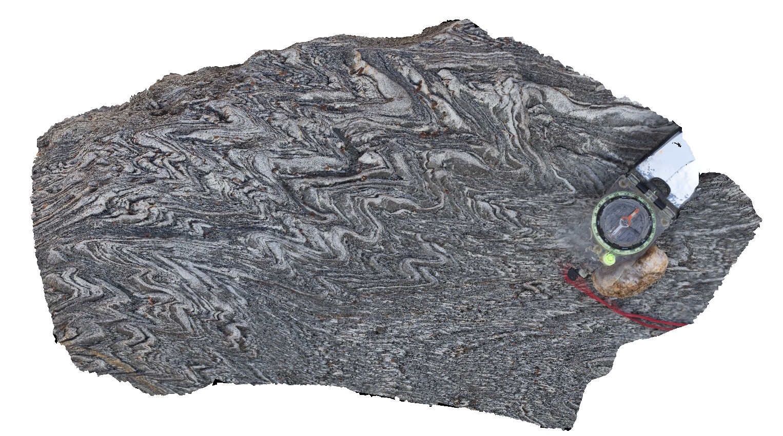
WestBeach6 Map
 |
0 |
06/05/2016 10:42 a.m. |
3D terrestrial photogrammetric model |
steeply plunging, tight to open folds in finely laminated schist. West Beach, W.A. |
0.50 |
-33.95350000000 |
119.97487000000 |
-9999.000 |
folding, schist, structure |
schist |
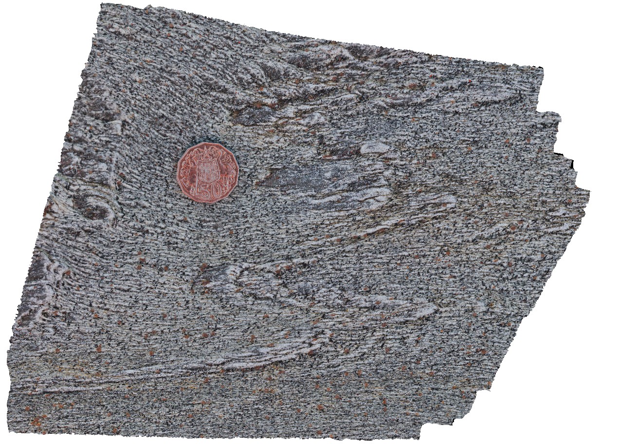
WestBeach5 Map
 |
0 |
06/05/2016 10:50 a.m. |
3D terrestrial photogrammetric model |
'M' folding in garnet schist, West Beach, W.A. |
0.00 |
-33.95352000000 |
119.97489000000 |
-9999.000 |
M folds, structure, garnet schist |
garnet schist |
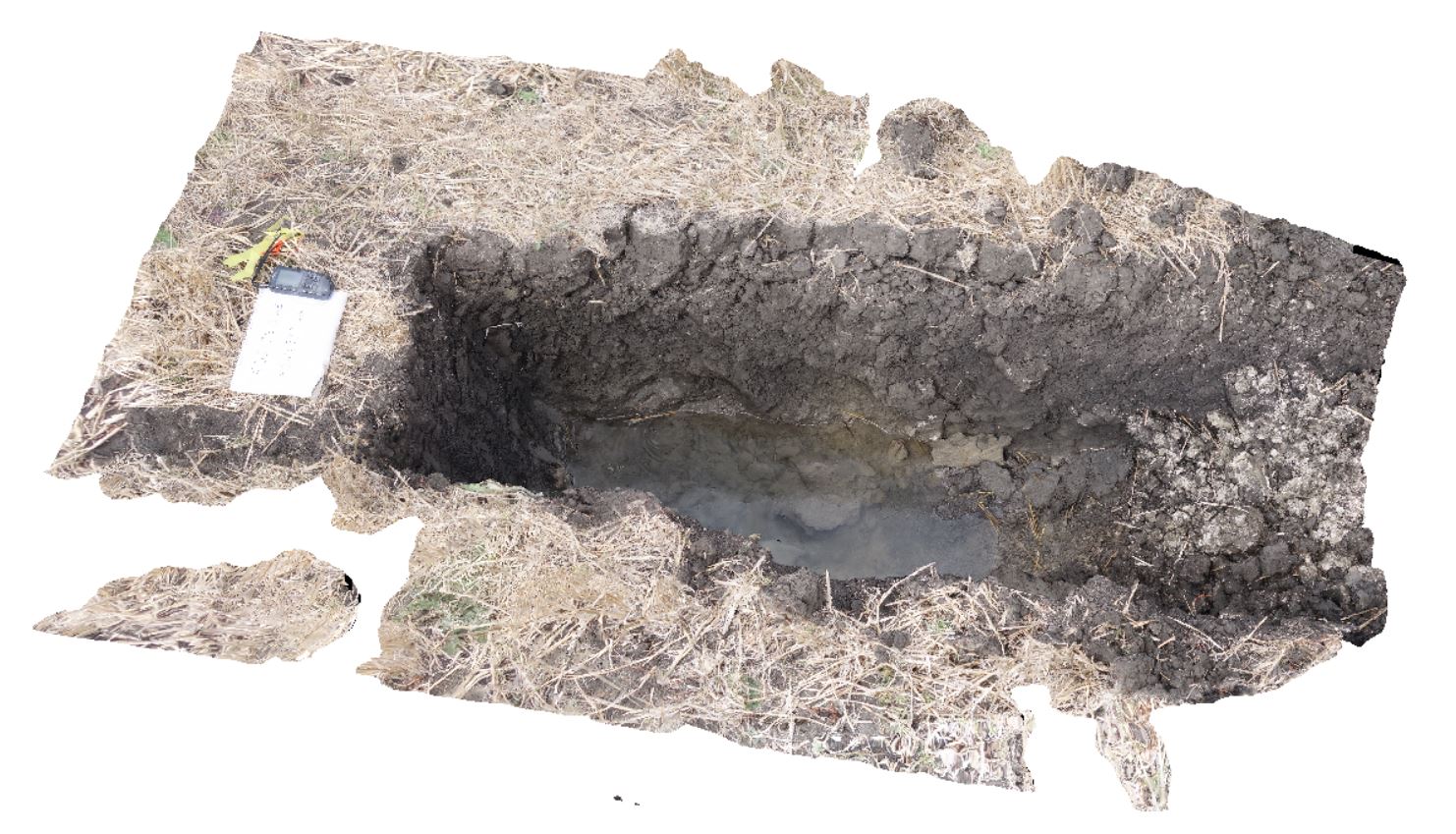
DaisyBanksPit6 Map
 |
20 |
03/17/2015 1:54 p.m. |
3D terrestrial photogrammetric model |
~80cm deep pit into soil and clays overlying Quaternary alluvial and marsh deposits of modern flood plains; of gravel, sand, silt and clay. Richmond, Tas. |
2.00 |
-42.73310300000 |
147.43077000000 |
-9999.000 |
clay, alluvial, regolith |
clay |
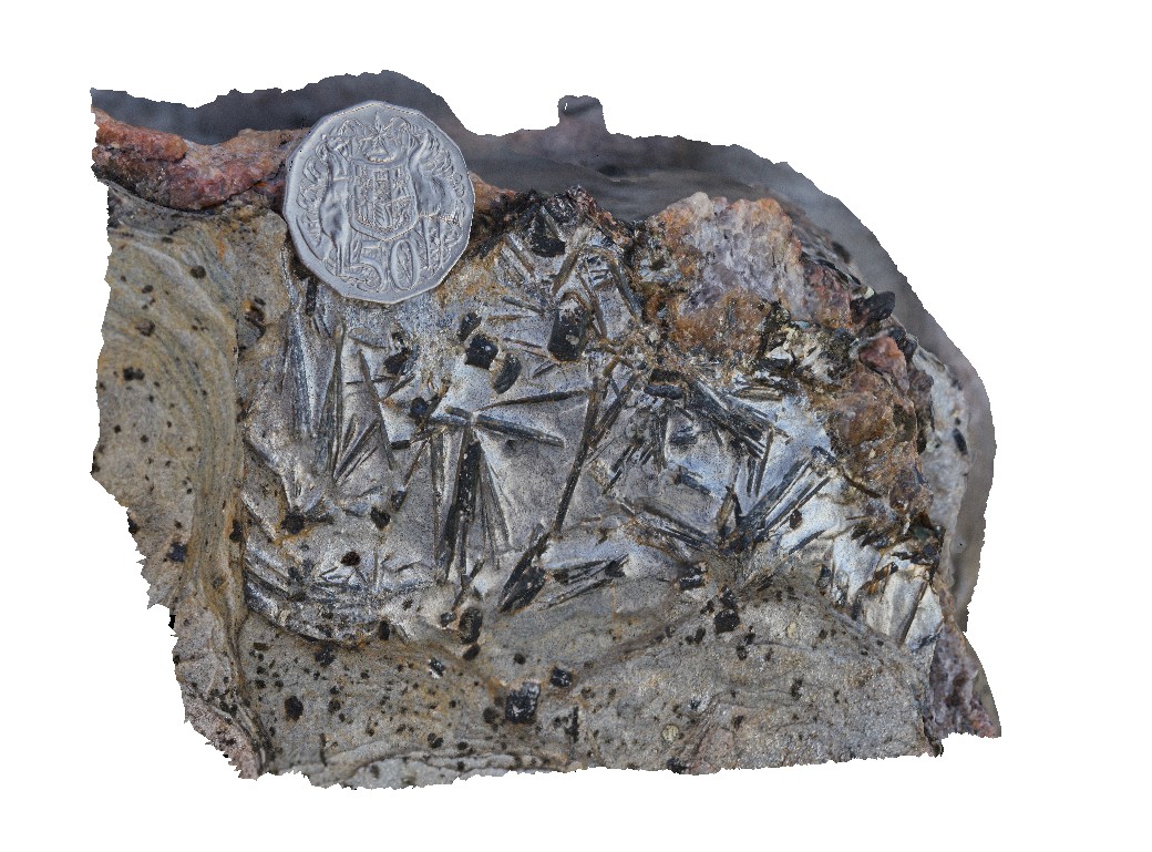
WestBeach8 Map
 |
0 |
06/05/2016 10:35 a.m. |
3D terrestrial photogrammetric model |
radiating needles of kyanite in schist. West Beach, W.A. |
0.10 |
-33.95360000000 |
119.97449000000 |
-9999.000 |
kyanite, schist, metamorphic |
kyanite schist |
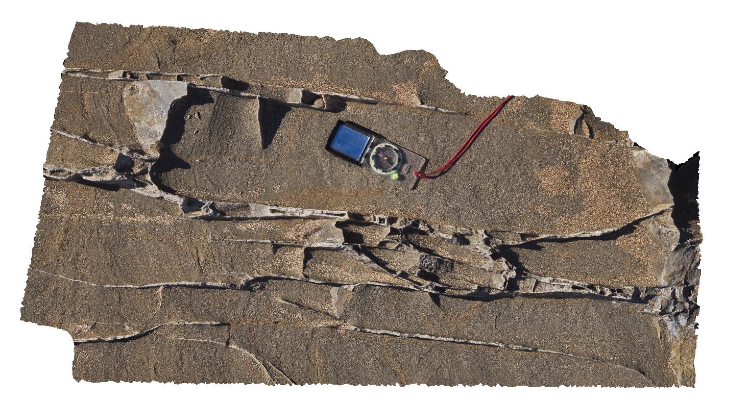
WreckBeach1 Map
 |
0 |
06/14/2016 2:13 p.m. |
3D terrestrial photogrammetric model |
shore platform exposure of multiple carbonate veins in well sorted sandstone. Wreck Beach, Vic. |
1.20 |
-38.75579000000 |
143.21394000000 |
-9999.000 |
sandstone, carbonate vein |
sandstone |
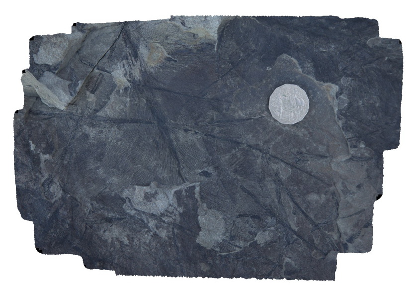
Dudley6 Map
 |
1 |
09/09/2015 8:35 a.m. |
3D terrestrial photogrammetric model |
leaf fossils in fine grained sandstone. Dudley Beach, N.S.W. |
0.30 |
-32.96874000000 |
151.73665000000 |
-9999.000 |
leaf, fossil, palaeontology |
sandstone |
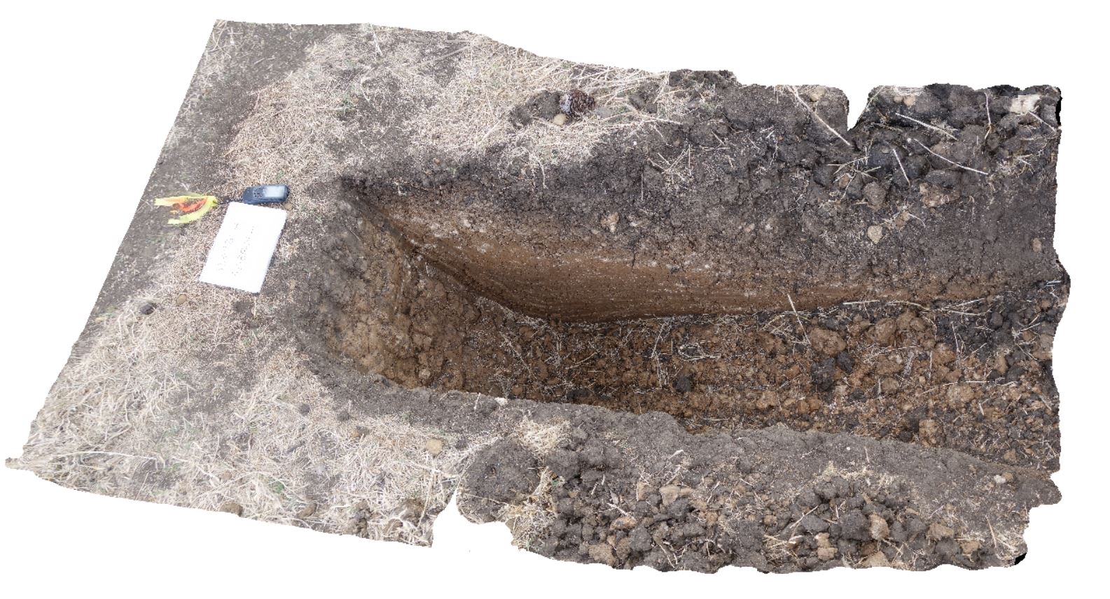
DaisyBanksPit7 Map
 |
20 |
03/17/2015 2 p.m. |
3D terrestrial photogrammetric model |
Undifferentiated alluvial soils and clays developed on Quaternary alluvial terrace gravel deposits predominantly derived from Parmeener and Palaeogene-Neogene units with clasts commonly of basalt and in places dolerite. Richmond, Tas. |
2.00 |
-42.73247900000 |
147.42657600000 |
-9999.000 |
clay, alluvial, regolith |
clay |
Conran4 Map
 |
5 |
07/18/2015 3:10 p.m. |
3D terrestrial photogrammetric model |
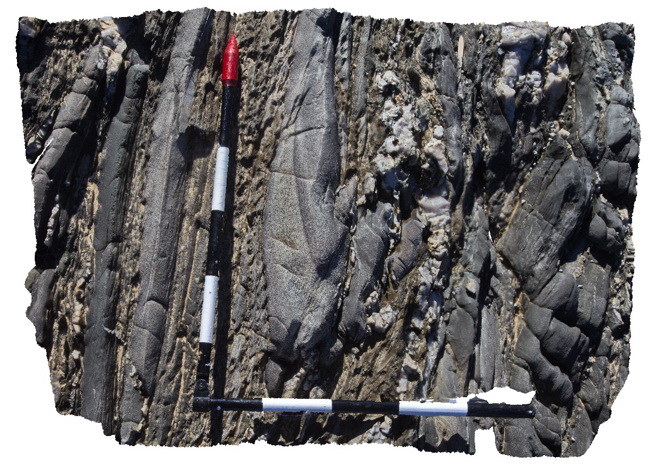
Disrupted isoclinal fold hinge in turbiditic metasediments of the Ordovician Pinnak Sandstone. Axial planar cleavage is well developed in the hinge of the fold. Cape Conran, Vic. |
0.90 |
-37.80046000000 |
148.74255000000 |
-9999.000 |
turbidite, isoclinal fold, cleavage, structure |
turbidite |
TowerHill1 Map
 |
10 |
06/05/2016 10:42 a.m. |
3D terrestrial photogrammetric model |
over view of finely layered tuffaceous rocks on rim of Tower Hill. Tower Hill, Vic. |
16.00 |
-38.32485000000 |
142.37242000000 |
-9999.000 |
tuffaceous sediments, volcano |
tuff |
Tambo1 Map
 |
5 |
05/18/2015 2:16 p.m. |
3D terrestrial photogrammetric model |
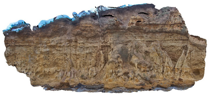
Sandstone of the Pliocene Seaspray Group disconformably overlain by Quaternary gravel. Metung, Vic. |
15.00 |
-37.88462000000 |
147.82196000000 |
-9999.000 |
sandstone, gravel, disconformity, unconformity, sedimentology |
sandstone, gravel |
Buchan1 Map
 |
5 |
07/21/2015 12:36 p.m. |
3D terrestrial photogrammetric model |
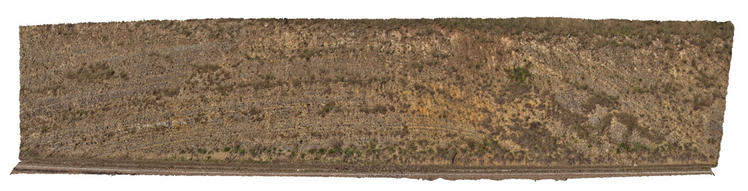
Open anticline in layered carbonate sediments of the Taravale Marlstone. Buchan, VIC. |
25.00 |
-37.49040000000 |
148.17535000000 |
-9999.000 |
marl, anticline, fold, structure |
marl |
Buchan2 Map
 |
10 |
07/21/2015 2 p.m. |
3D terrestrial photogrammetric model |
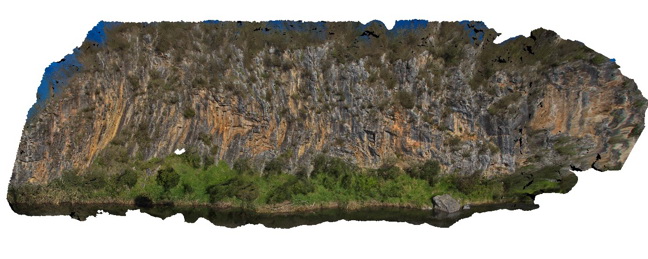
Large outcrop of steeply dipping Buchan Caves Limestone with gentle folds. Buchan, VIC. |
80.00 |
-37.49072000000 |
148.16913000000 |
-9999.000 |
limestone, folds, structure |
Limestone |
Buchan3 Map
 |
10 |
07/21/2015 3:20 p.m. |
3D terrestrial photogrammetric model |
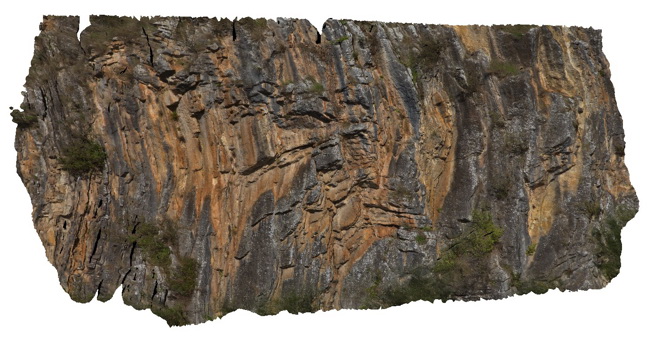
Detail of parasitic fold in Buchan Caves Limestone as depicted in Buchan2. Buchan, VIC. |
20.00 |
-37.49072000000 |
148.16913000000 |
-9999.000 |
limestone, fold, structure |
limestone |
Buchan4 Map
 |
10 |
07/18/2015 2:58 p.m. |
3D terrestrial photogrammetric model |
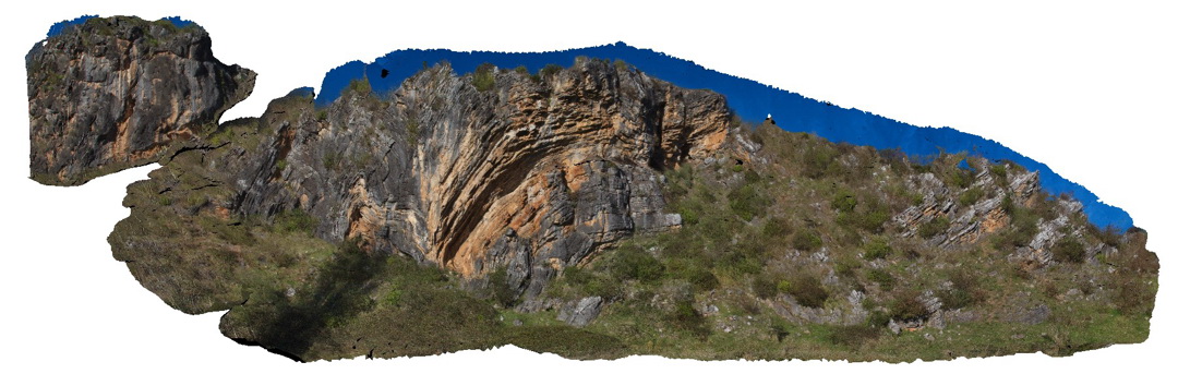
Buchan thrust fault -Folding in the hanging wall in Buchan Caves Limestone. Buchan, VIC. |
100.00 |
-37.50776000000 |
148.21648000000 |
-9999.000 |
limestone, thrust fault, structure |
limestone |
DaisyBanksPit9 Map
 |
20 |
03/17/2015 12:49 p.m. |
3D terrestrial photogrammetric model |
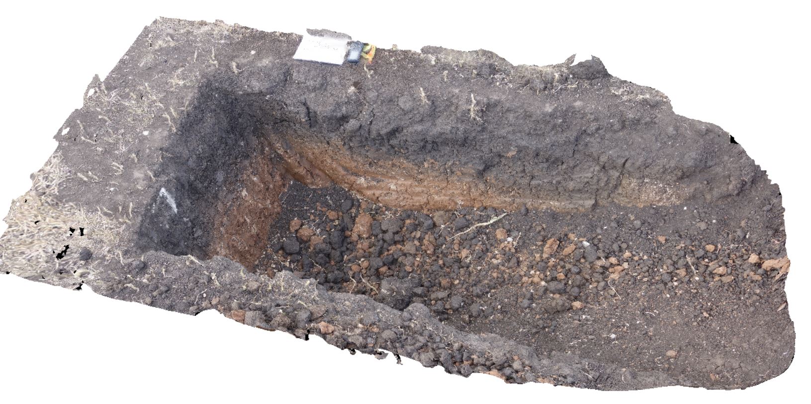
~80cm deep pit into soil and clays overlying late Cenozoic alluvial terrace deposits. Richmond, Tas. |
2.00 |
-42.72983600000 |
147.42554400000 |
-9999.000 |
clay, alluvial, regolith |
Clay |
TowerHill12 Map
 |
10 |
06/05/2016 10:44 a.m. |
3D terrestrial photogrammetric model |
detail of cross bedding in thinly layered, fine-grained tuffaceous deposits. Tower Hill, Vic. |
3.20 |
-38.32697000000 |
142.36827000000 |
-9999.000 |
tuff, cross bedding |
tuff |
SBay1 Map
 |
20 |
03/13/2015 9:17 a.m. |
3D terrestrial photogrammetric model |
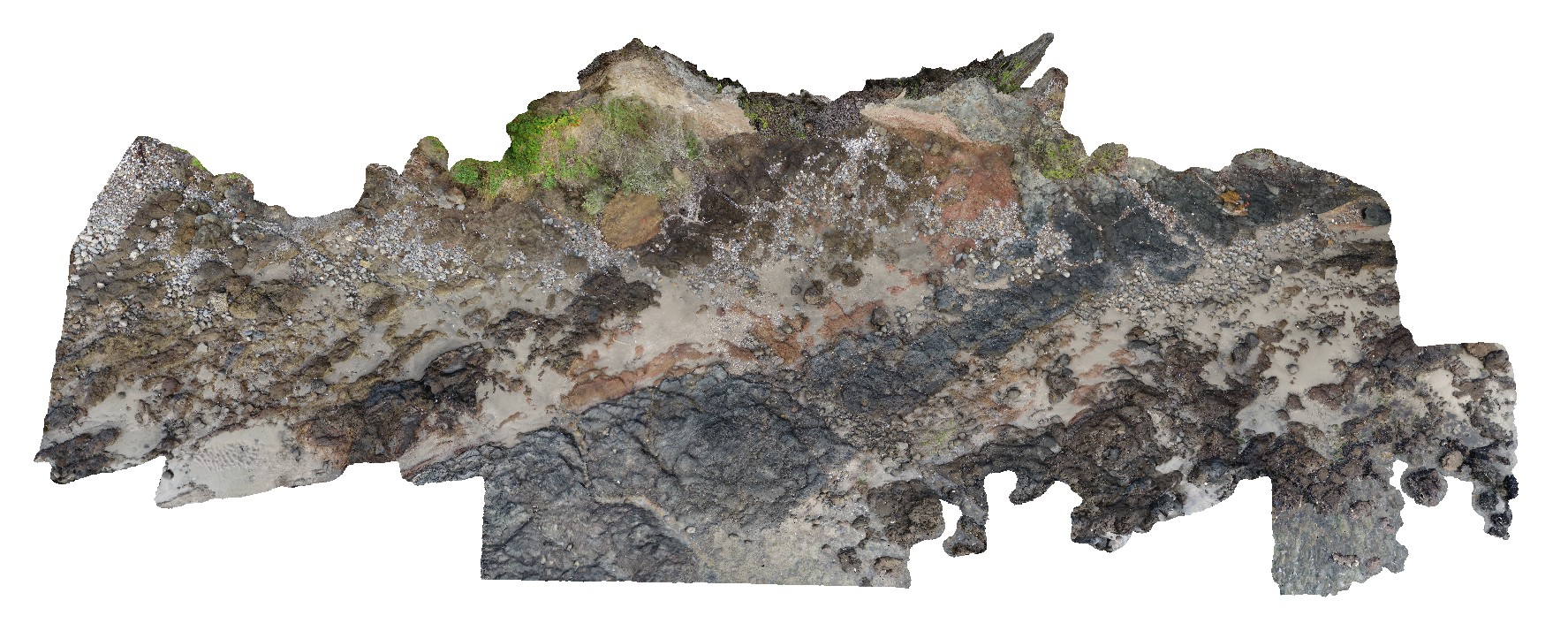
Pole photography of the Charles Darwin Cliff at Sandy Bay. Tertiary basaltic lava flows and pyroclastic material deposited from a small volcanic vent approximately 200m to the west |
25.00 |
-42.91649600000 |
147.36026000000 |
-9999.000 |
basalt, tuff, agglomerate, volcanology, igneous |
basalt, tuff |
TowerHill13 Map
 |
10 |
06/05/2016 10:44 a.m. |
3D terrestrial photogrammetric model |
detailed view of wavy pebble layer in tuff deposits. Tower Hill, Vic. |
0.50 |
-38.32708000000 |
142.36807000000 |
-9999.000 |
tuff, volcanics |
tuff |
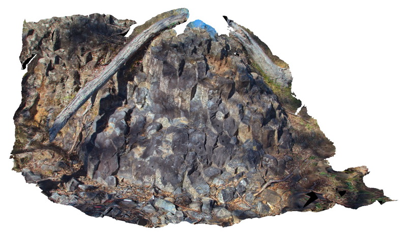
Armidale1 Map
 |
5 |
10/06/2015 11:03 a.m. |
3D terrestrial photogrammetric model |
Tertiary columnar basalt with mantle xenoliths. Armidale, N.S.W |
5.00 |
-30.48196000000 |
151.63914000000 |
-9999.000 |
basalt, columnar jointing, igneous |
basalt |
 AusGeol.org